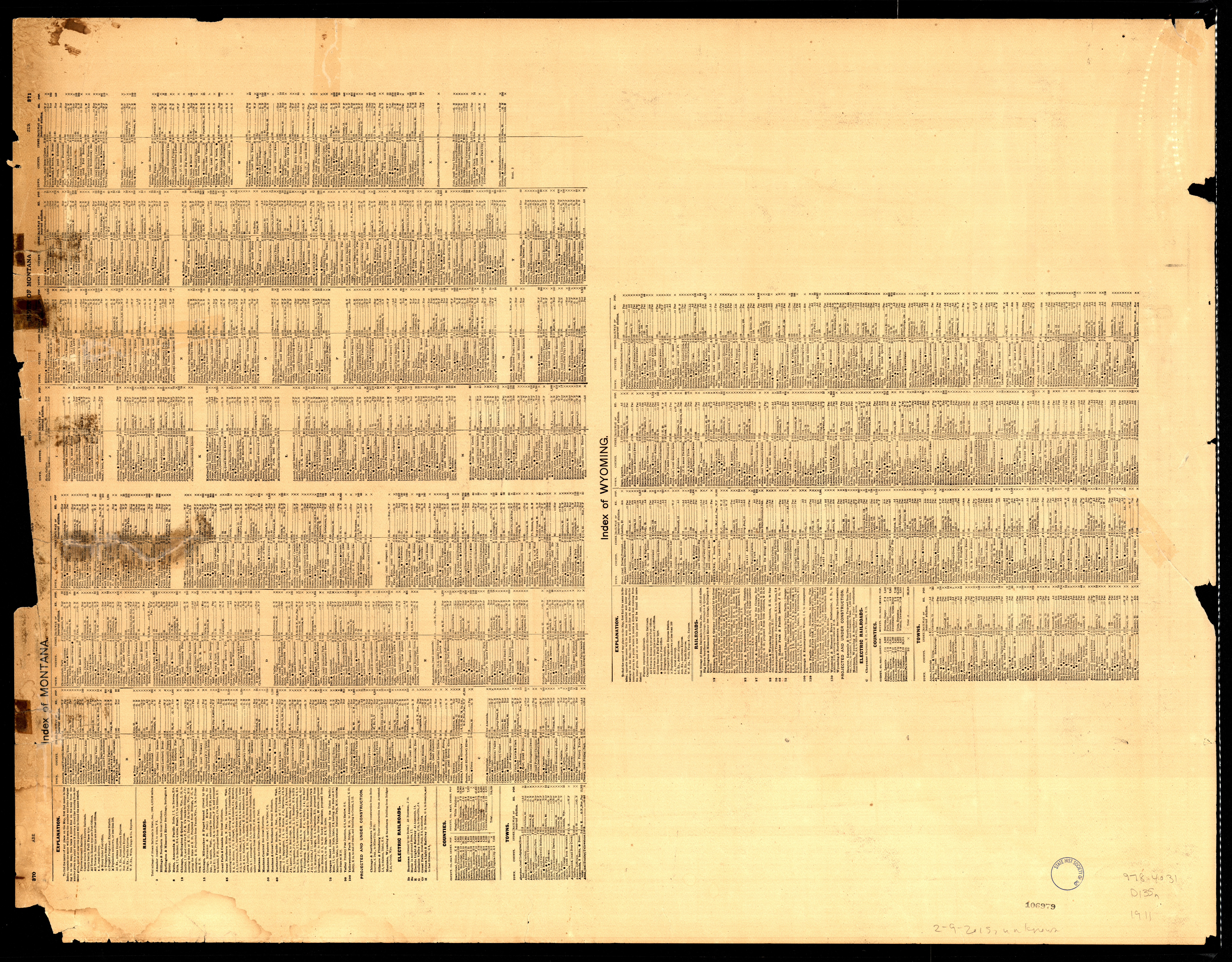
Collection: 978.4031 D135n 1911 - North Dakota, South Dakota
Folder: Library
Item: 978.4031 D135n 1911
Date: 1911
Title: North Dakota, South Dakota
Collection: 977 U5813p 1877 - Progress chart of the Survey of the Northern & North Western Lakes, July 1st, 1877 : __primary triangulation, telegraphic longitudes, shore line, topography and hydrography, &c. / __engraved in the Office of the Chief of Engineers
Folder: Library
Item: 977 U5813p 1877
Date: 1877
Creator: United States.--Army.--Office of the Chief of Engineers
Title: Progress chart of the Survey of the Northern & North Western Lakes, July 1st, 1877 : __primary triangulation, telegraphic longitudes, shore line, topography and hydrography, &c. / __engraved in the Office of the Chief of Engineers
Collection: 959.9031 M2782 1899 - Manila & vicinity
Folder: Library
Item: 959.9031 M2782 1899
Date: 1899
Title: Manila & vicinity
Collection: 971.202 C212mp 1875 - Map of part of the North West Territory including the province of Manitoba : __exhibiting the several tracts of country ceded by the Indian Treaties 1, 2, 3 and 4 : to accompany report of the Honble. the Minister of the Interior, dated 20th January, 1875 / __J. Johnston, chief draftsman
Folder: Library
Item: 971.202 C212mp 1875
Date: 1875
Creator: Canada.--Department of the Interior.--Dominion Lands Branch
Title: Map of part of the North West Territory including the province of Manitoba : __exhibiting the several tracts of country ceded by the Indian Treaties 1, 2, 3 and 4 : to accompany report of the Honble. the Minister of the Interior, dated 20th January, 1875 / __J. Johnston, chief draftsman
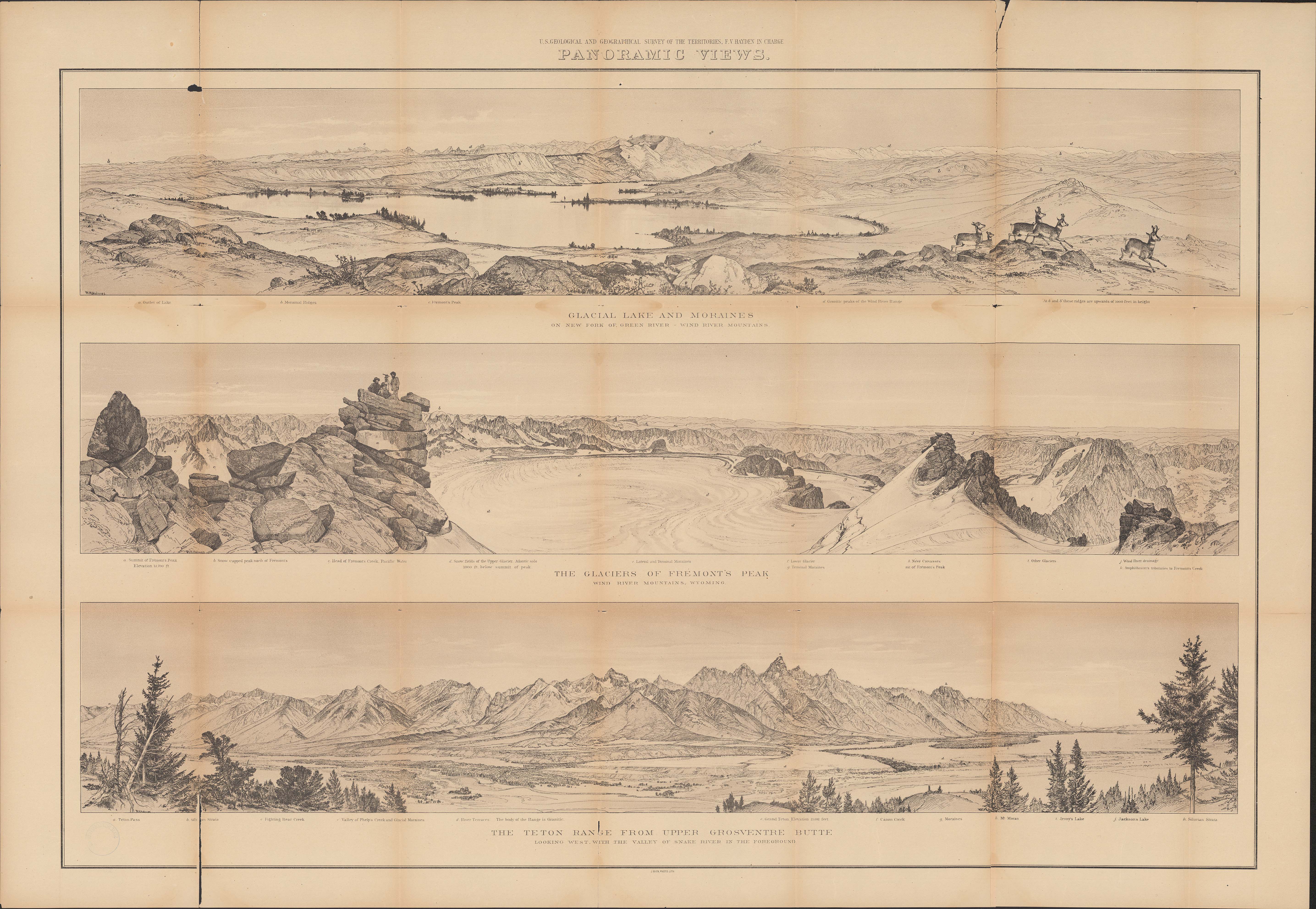
Collection: 978.702 G3454p 1878 - Panoramic views : __[Wyoming] / __W.H. Holmes ; U.S. Geological and Geographical Survey of the Territories ; F.V. Hayden in charge
Folder: Library
Item: 978.702 G3454p 1878
Date: 1878
Creator: Geological and Geographical Survey of the Territories (U.S.)
Title: Panoramic views : __[Wyoming] / __W.H. Holmes ; U.S. Geological and Geographical Survey of the Territories ; F.V. Hayden in charge
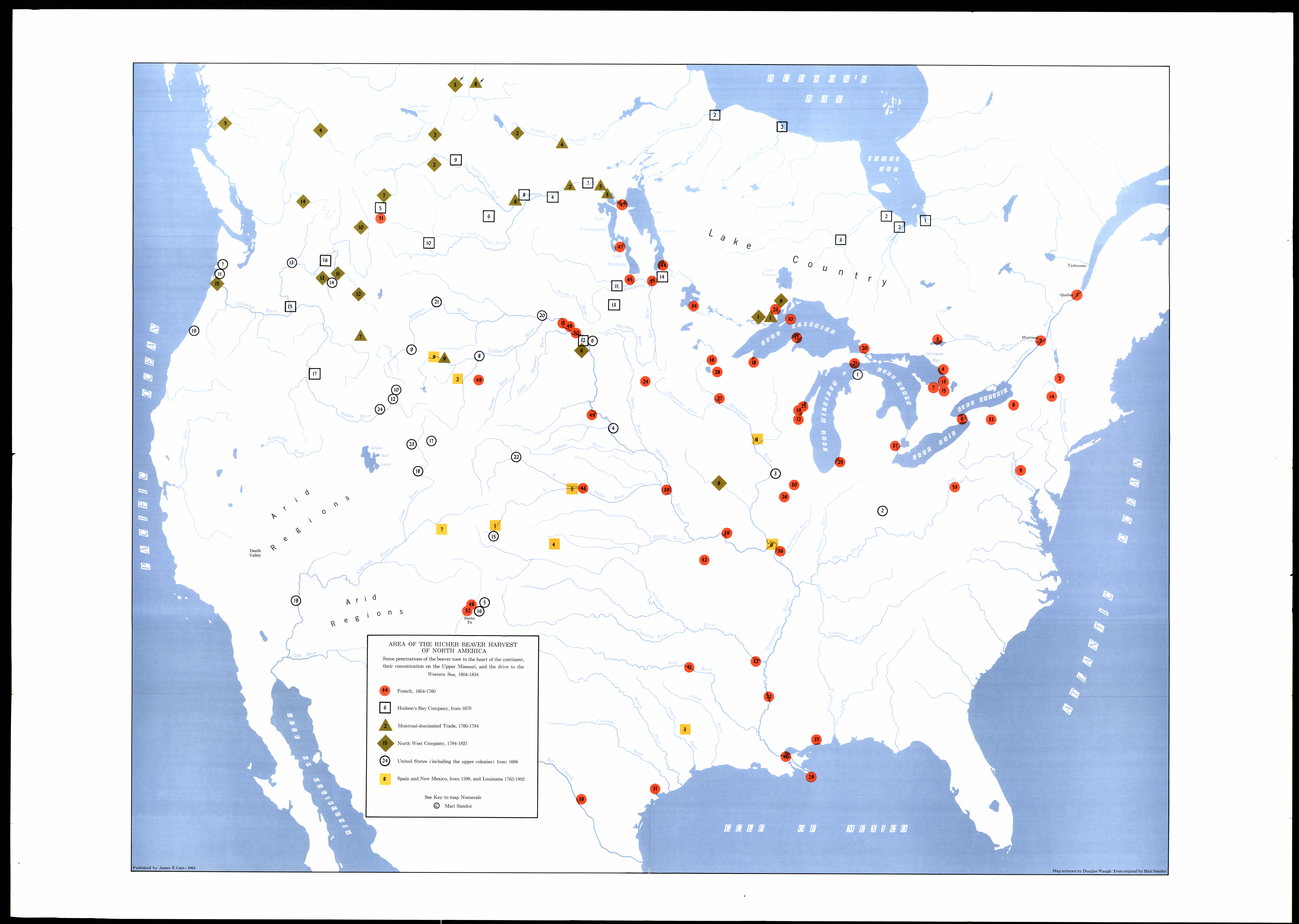
Collection: 978 Sa57b 1964 - Area of the richer beaver harvest of North America : __some penetrations of the beaver men to the heart of the continent, their concentration on the upper Missouri and the drive to the Western Sea, 1604-1834 / __map redrawn by Douglas Waugh from original by Mari Sandoz
Folder: Library
Item: 978 Sa57b 1964
Date: 1964
Creator: Sandoz, Mari,--1896-1966
Title: Area of the richer beaver harvest of North America : __some penetrations of the beaver men to the heart of the continent, their concentration on the upper Missouri and the drive to the Western Sea, 1604-1834 / __map redrawn by Douglas Waugh from original by Mari Sandoz
Collection: 973.82 R828m 1871 - Map of a reconnoisance [sic] from the Missouri R. to the Yellowstone R. via Heart R. and Glendive Cr. / __ __surveyed by T.L. Rosser, accompanied by military escort com'd by J.N.G. Whistler, Sept. & Oct. 1871
Folder: Library
Item: 973.82 R828m 1871
Date: 1871
Creator: Rosser, Thomas Lafayette,--1836-1910
Title: Map of a reconnoisance [sic] from the Missouri R. to the Yellowstone R. via Heart R. and Glendive Cr. / __ __surveyed by T.L. Rosser, accompanied by military escort com'd by J.N.G. Whistler, Sept. & Oct. 1871
Collection: 978.477 S6278 - Sketch plan of Mandan & Bismarck parks
Folder: Library
Item: 978.477 S6278
Date: ca. 1935
Title: Sketch plan of Mandan & Bismarck parks
Collection: 266.08997 P6978 - Places and dates of baptismal rites performed by Father Christian Hoecken in 1840
Folder: Library
Item: 266.08997 P6978
Date: ca. 1935
Title: Places and dates of baptismal rites performed by Father Christian Hoecken in 1840
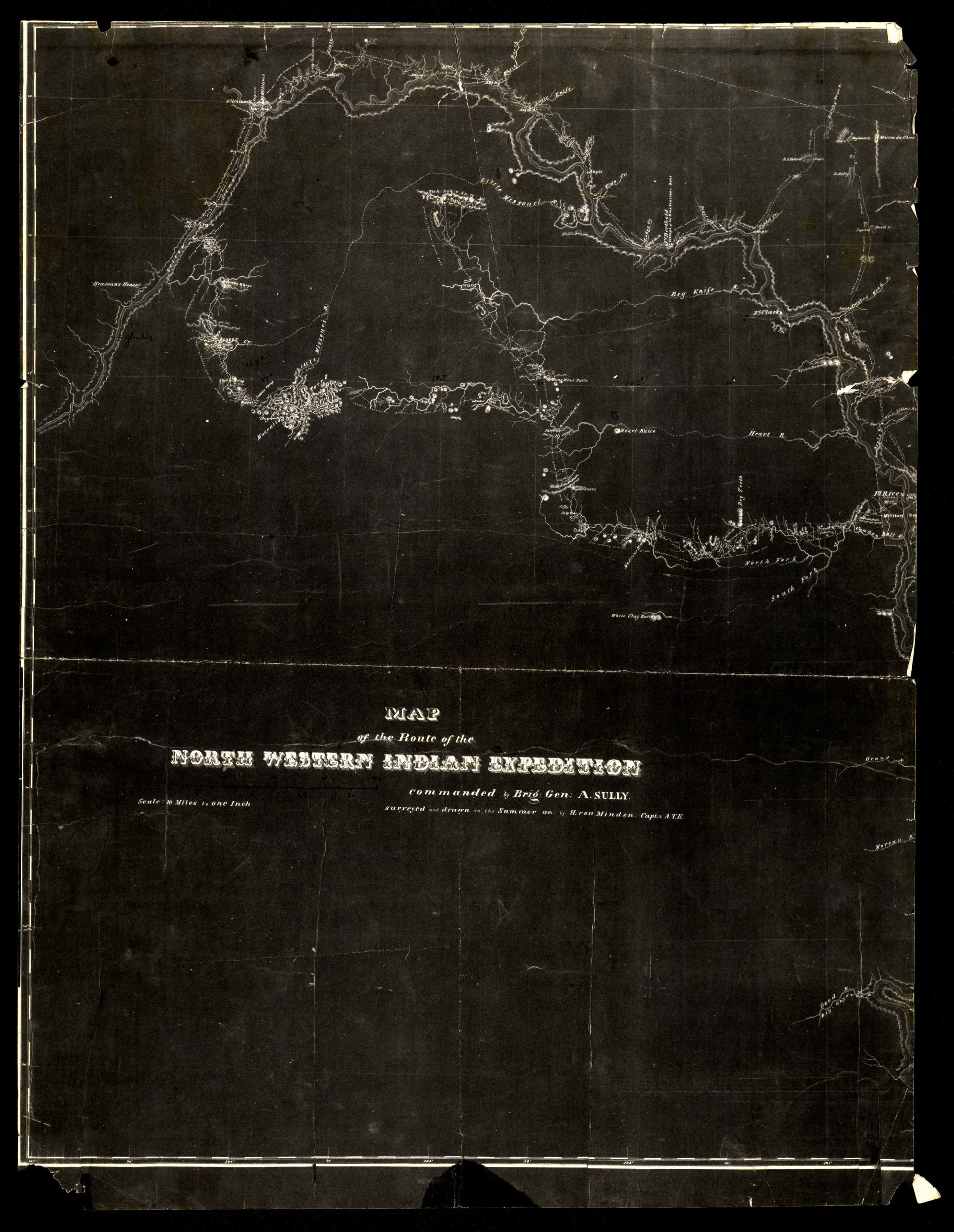
Collection: 973.82 V947m 1864 - Map of the route of the North Western Indian Expedition : __commanded by Brig. Gen. A. Sully / __surveyed & drawn in the summer 1864 by H. von Minden, Capt. A.T.E
Folder: Library
Item: 973.82 V947m 1864
Date: 1864
Creator: Von Minden, H.--(Henning)
Title: Map of the route of the North Western Indian Expedition : __commanded by Brig. Gen. A. Sully / __surveyed & drawn in the summer 1864 by H. von Minden, Capt. A.T.E
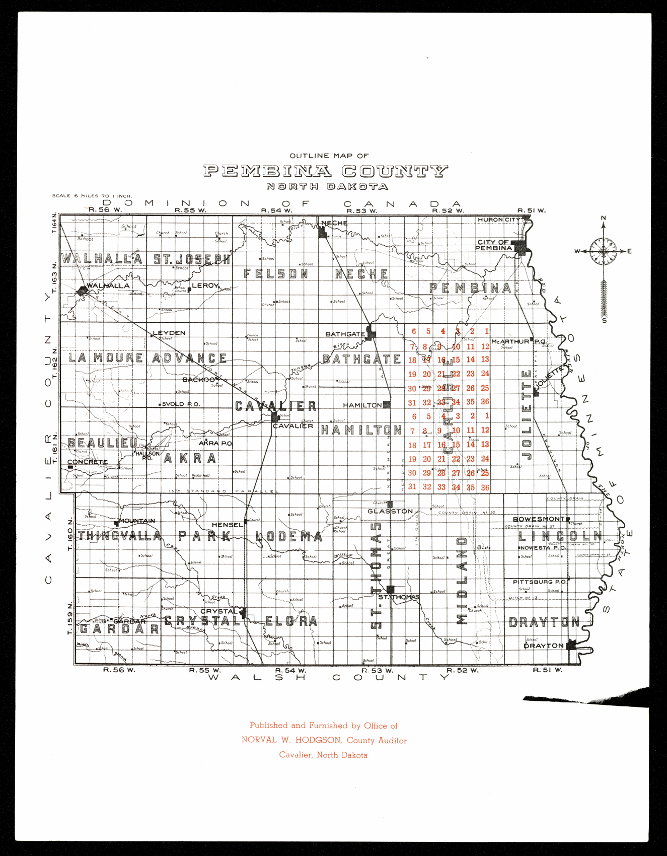
Collection: 978.419 O946 - Outline map of Pembina County, North Dakota
Folder: Library
Item: 978.419 O946
Date: ca. 1935
Title: Outline map of Pembina County, North Dakota
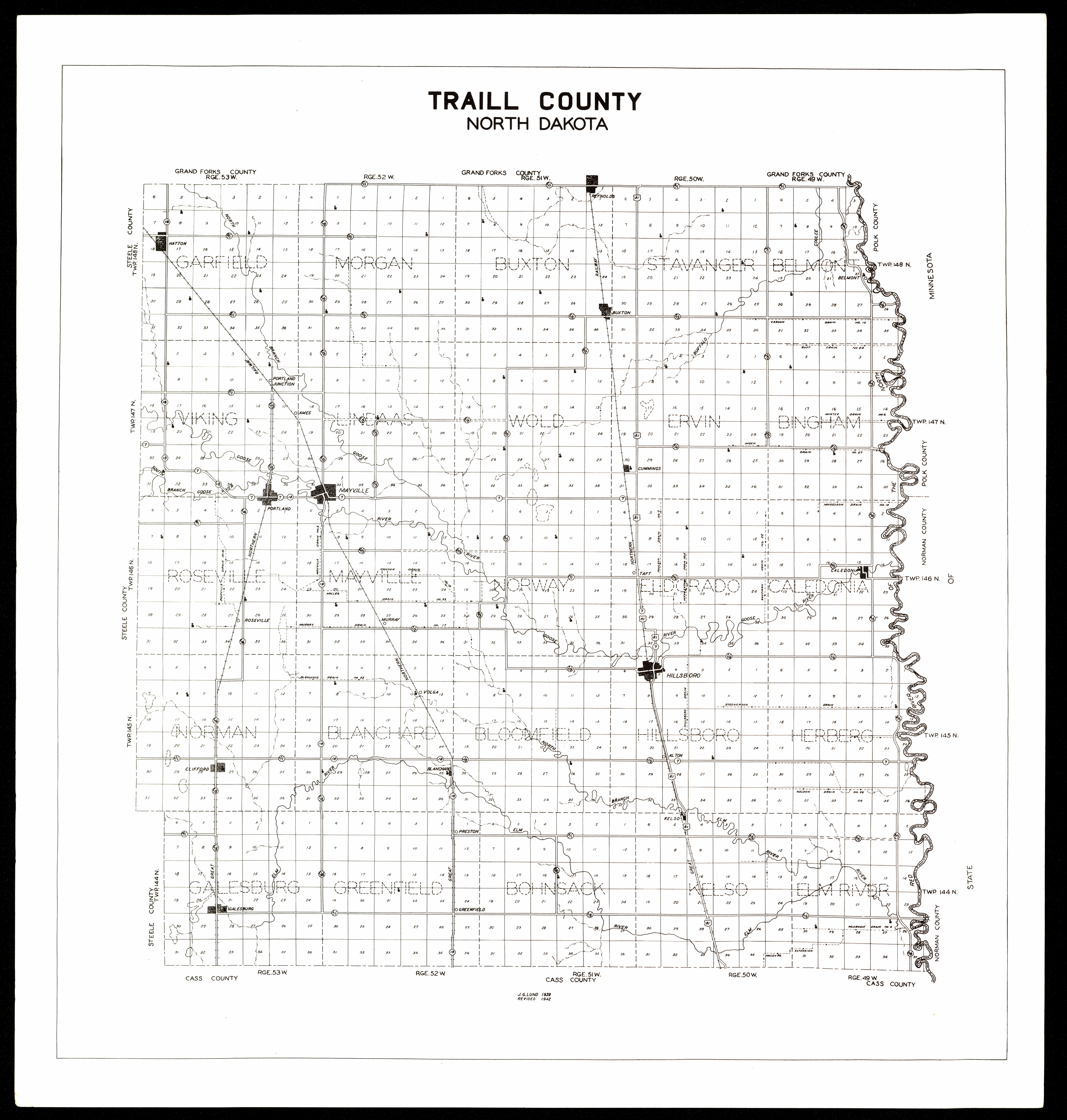
Collection: 978.414 L962t 1942 - Traill County, North Dakota / __ __J.G. Lund
Folder: Library
Item: 978.414 L962t 1942
Date: 1942
Creator: Lund, J. G
Title: Traill County, North Dakota / __ __J.G. Lund
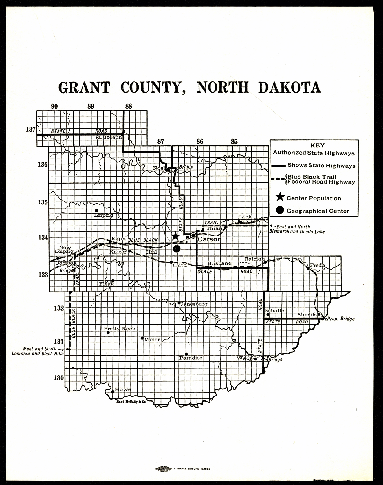
Collection: 978.487 R186g - Grant County, North Dakota
Folder: Library
Item: 978.487 R186g
Date: ca. 1935
Creator: Rand McNally and Company
Title: Grant County, North Dakota
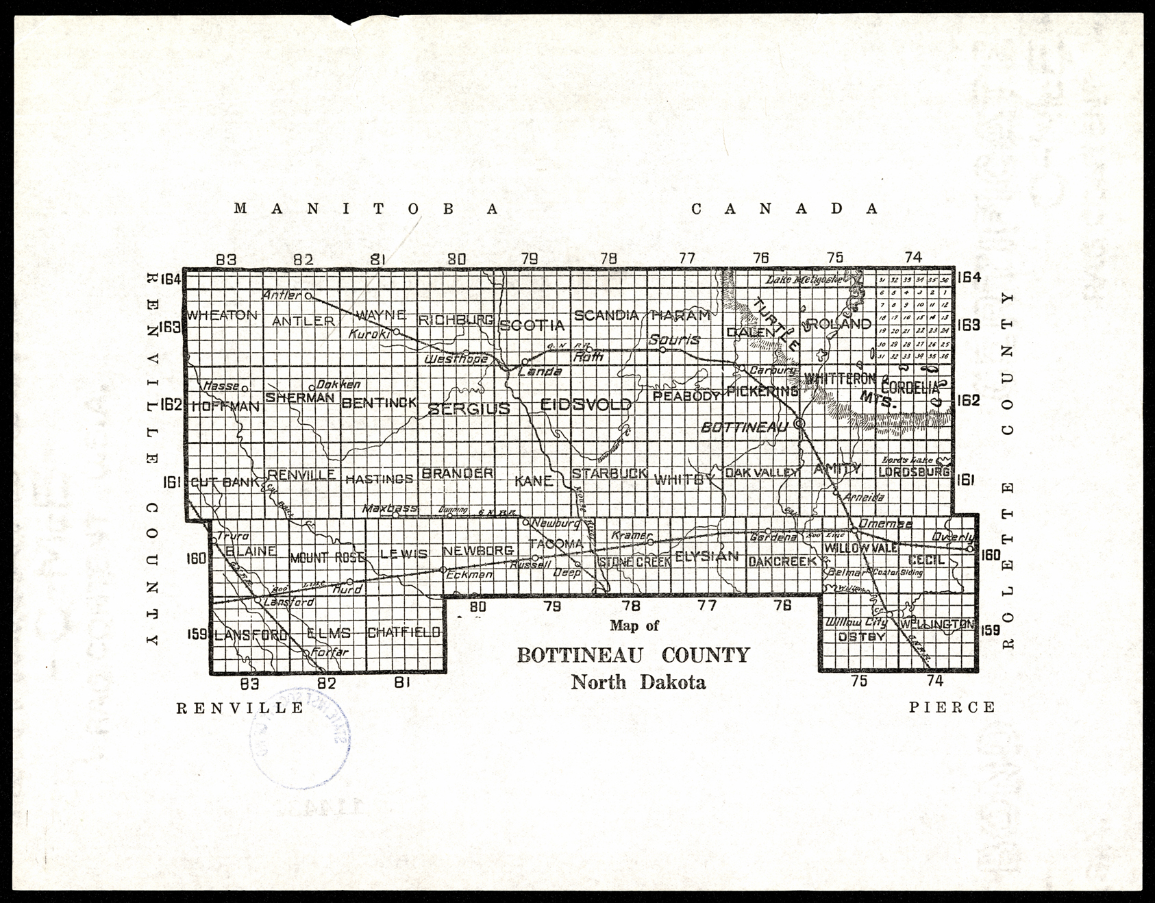
Collection: 978.461 M297 - Map of Bottineau County, North Dakota
Folder: Library
Item: 978.461 M297
Date: ca. 1950
Title: Map of Bottineau County, North Dakota
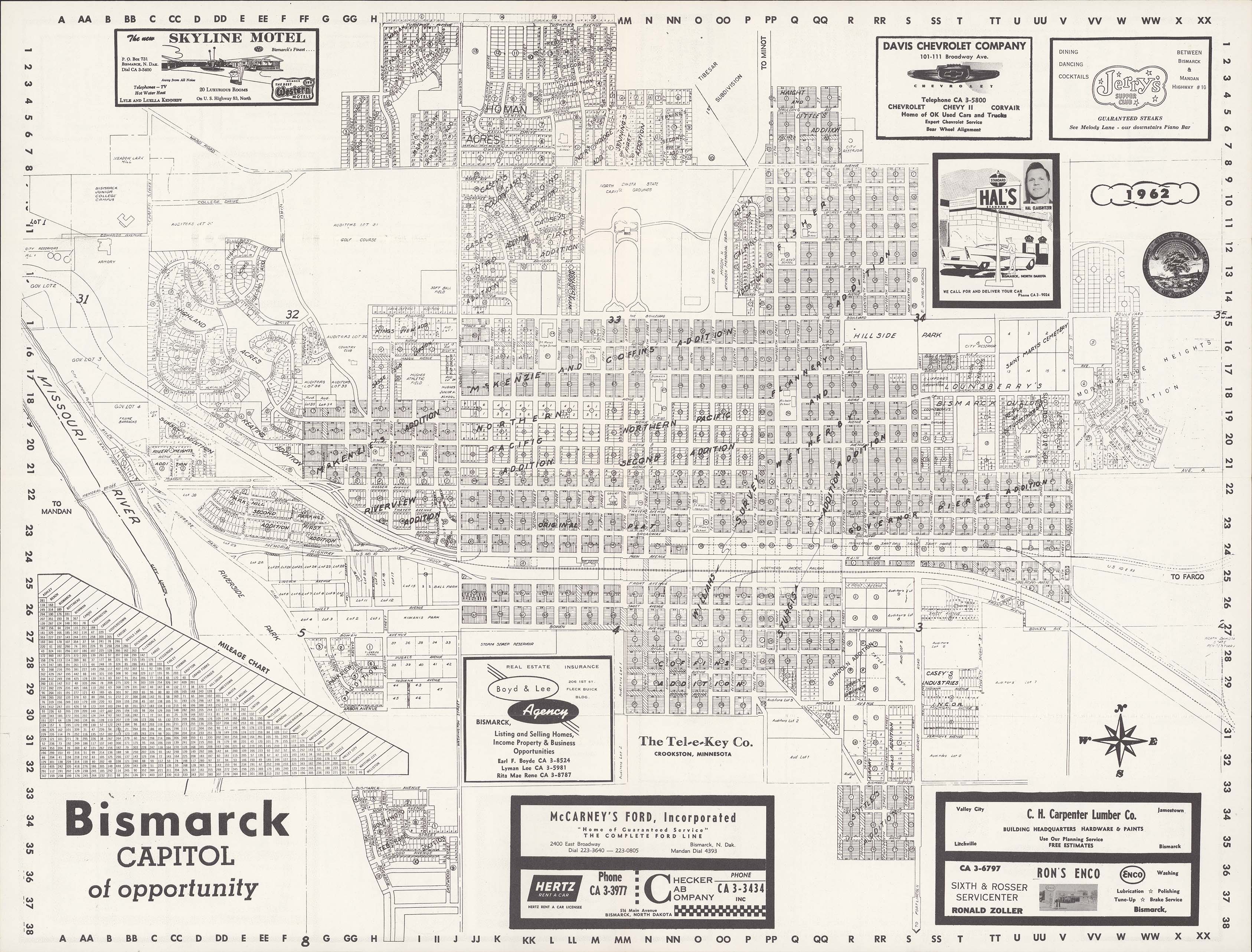
Collection: 978.477 T2679b 1962 - Bismarck, capitol of opportunity
Folder: Library
Item: 978.477 T2679b 1962
Date: 1962
Creator: Tel-E-Key Company
Title: Bismarck, capitol of opportunity
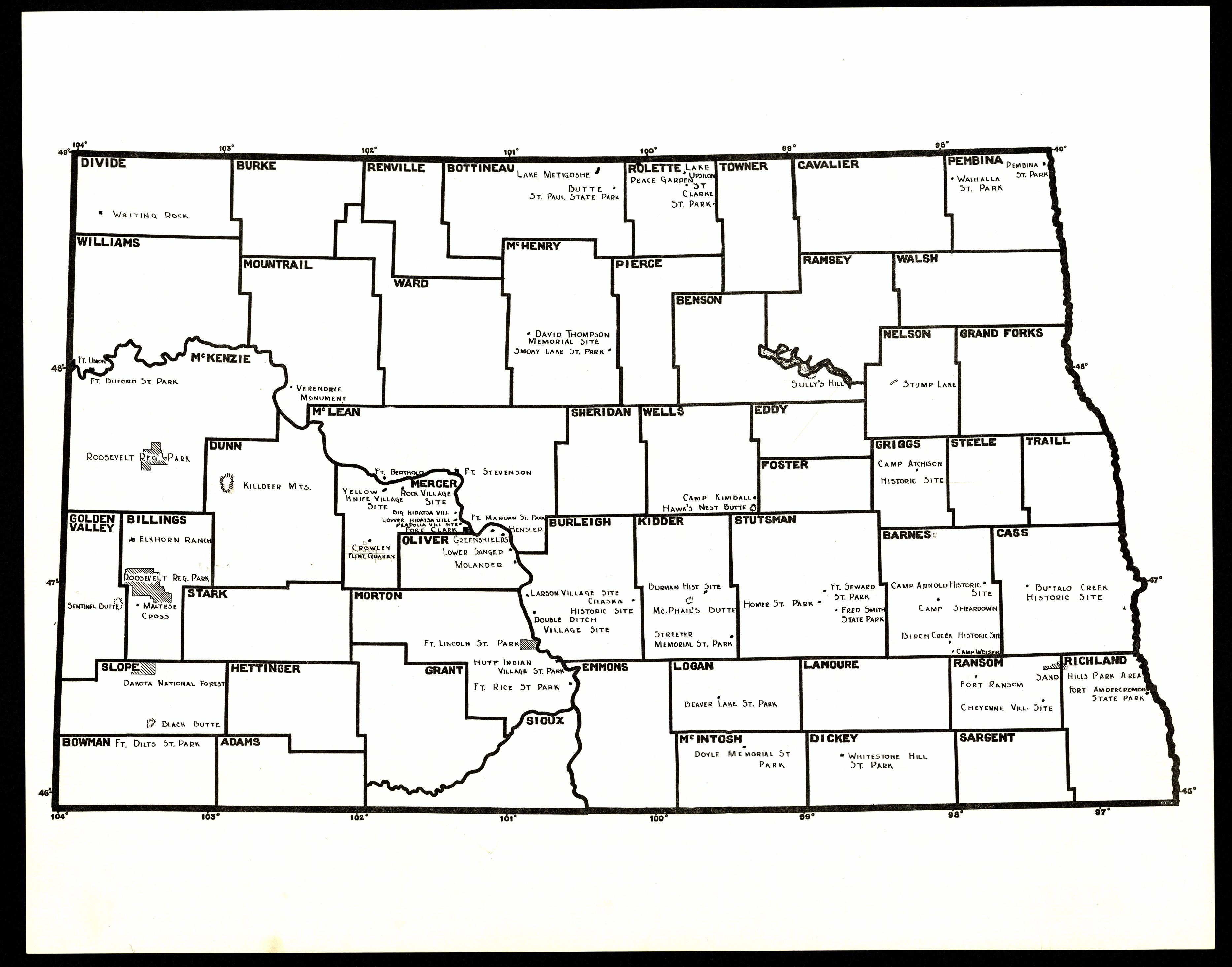
Collection: 978.4 M297 - [Map of North Dakota state parks and historic sites]
Folder: Library
Item: 978.4 M297
Date: 1920 - 1933
Title: [Map of North Dakota state parks and historic sites]
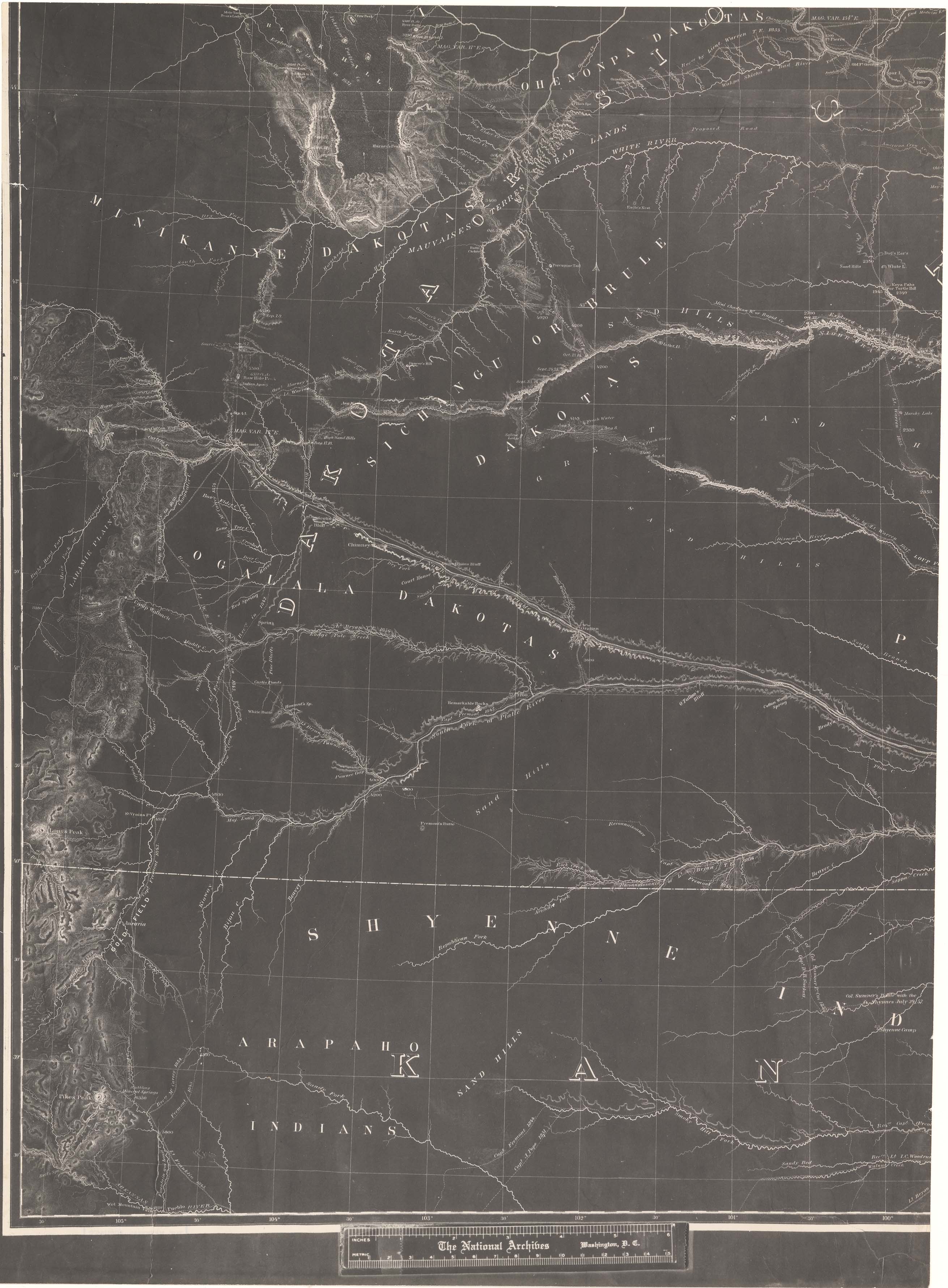
Collection: 978.02 W286m 1858 - Military map of Nebraska and Dakota / __ __by Lieut. G.K. Warren from the explorations made by him in 1855 & while attached to the staff of Brev. Brig. Gen. W.S. Harney, commg. Sioux Expedn. and in 1857 under the direction of the Office Explns. and Surveys, Capt. A.A. Humphreys in charge ; exhibiting also routes reconnoitred & surveyed by Capts. Lewis & Clark, U.S.A. ... [et al.]
Folder: Library
Item: 978.02 W286m 1858
Date: 1858
Creator: Warren, G. K.--(Gouverneur Kemble),--1830-1882
Title: Military map of Nebraska and Dakota / __ __by Lieut. G.K. Warren from the explorations made by him in 1855 & while attached to the staff of Brev. Brig. Gen. W.S. Harney, commg. Sioux Expedn. and in 1857 under the direction of the Office Explns. and Surveys, Capt. A.A. Humphreys in charge ; exhibiting also routes reconnoitred & surveyed by Capts. Lewis & Clark, U.S.A. ... [et al.]
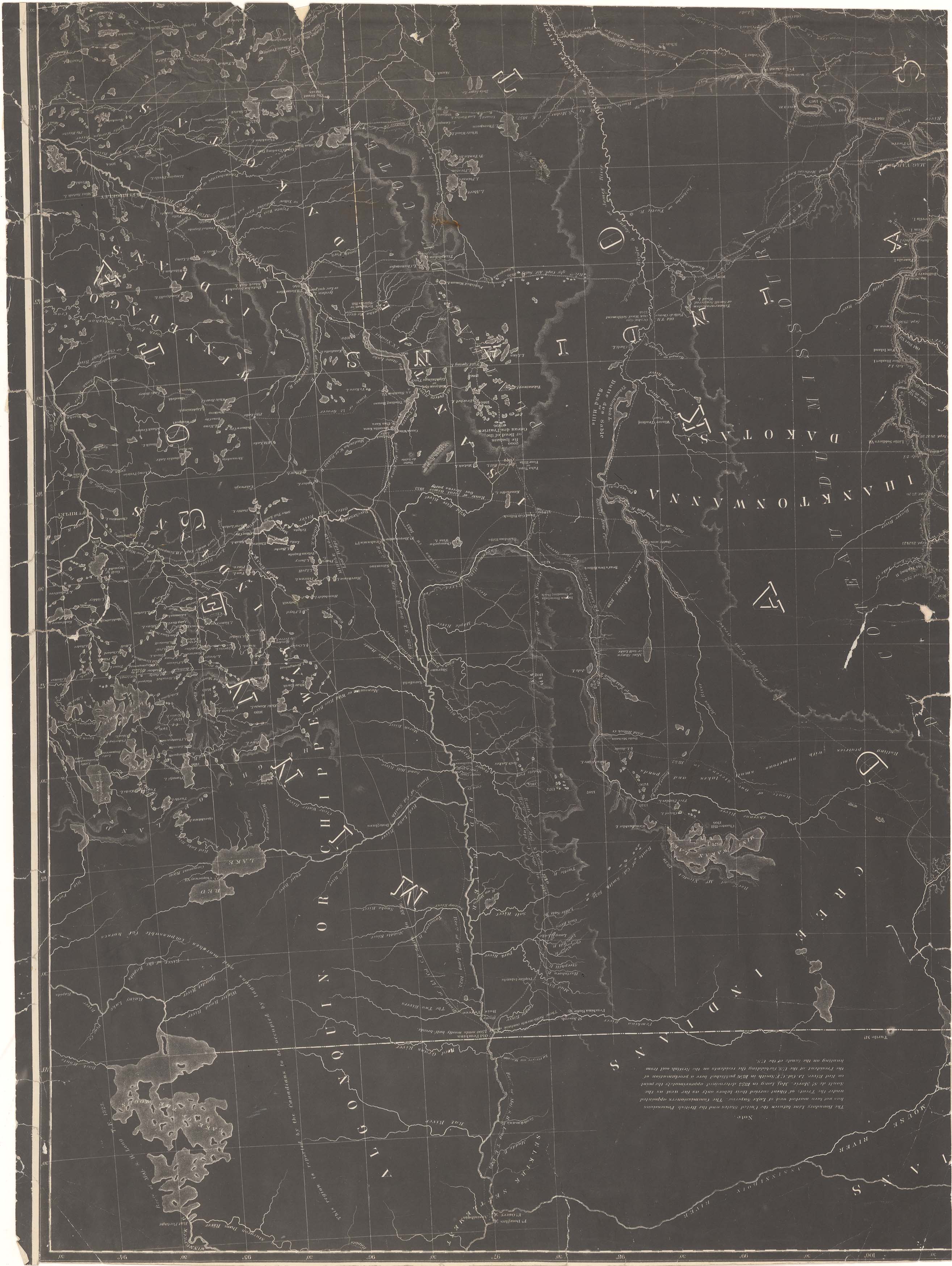
Collection: 978.02 W286m 1858 - Military map of Nebraska and Dakota / __ __by Lieut. G.K. Warren from the explorations made by him in 1855 & while attached to the staff of Brev. Brig. Gen. W.S. Harney, commg. Sioux Expedn. and in 1857 under the direction of the Office Explns. and Surveys, Capt. A.A. Humphreys in charge ; exhibiting also routes reconnoitred & surveyed by Capts. Lewis & Clark, U.S.A. ... [et al.]
Folder: Library
Item: 978.02 W286m 1858
Date: 1858
Creator: Warren, G. K.--(Gouverneur Kemble),--1830-1882
Title: Military map of Nebraska and Dakota / __ __by Lieut. G.K. Warren from the explorations made by him in 1855 & while attached to the staff of Brev. Brig. Gen. W.S. Harney, commg. Sioux Expedn. and in 1857 under the direction of the Office Explns. and Surveys, Capt. A.A. Humphreys in charge ; exhibiting also routes reconnoitred & surveyed by Capts. Lewis & Clark, U.S.A. ... [et al.]
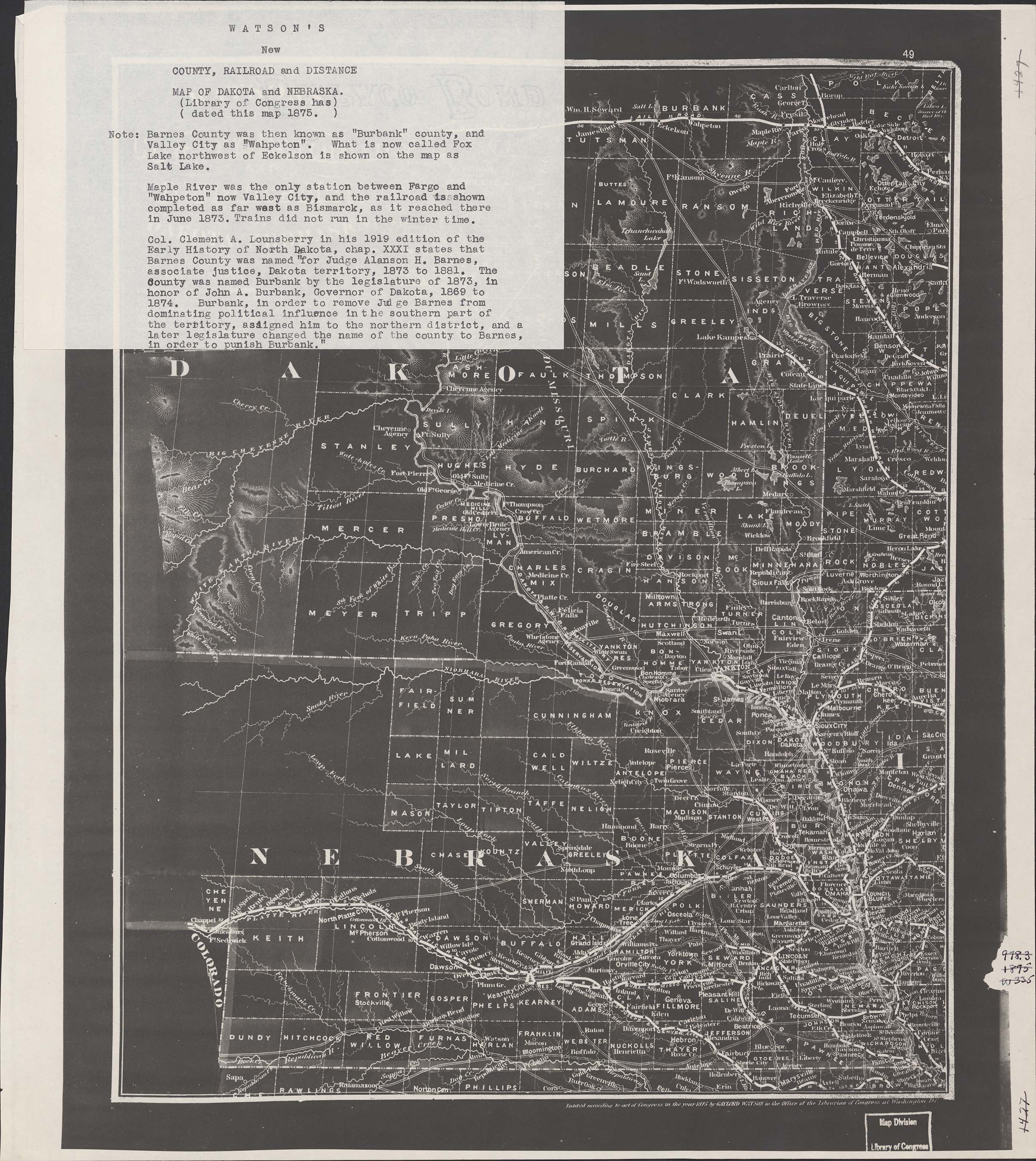
Collection: 978.02 W337w 1875 - Watson's new county, railroad and distance map of Dakota and Nebraska / __ __Gaylord Watson
Folder: Library
Item: 978.02 W337w 1875
Date: 1875
Creator: Watson, Gaylord
Title: Watson's new county, railroad and distance map of Dakota and Nebraska / __ __Gaylord Watson
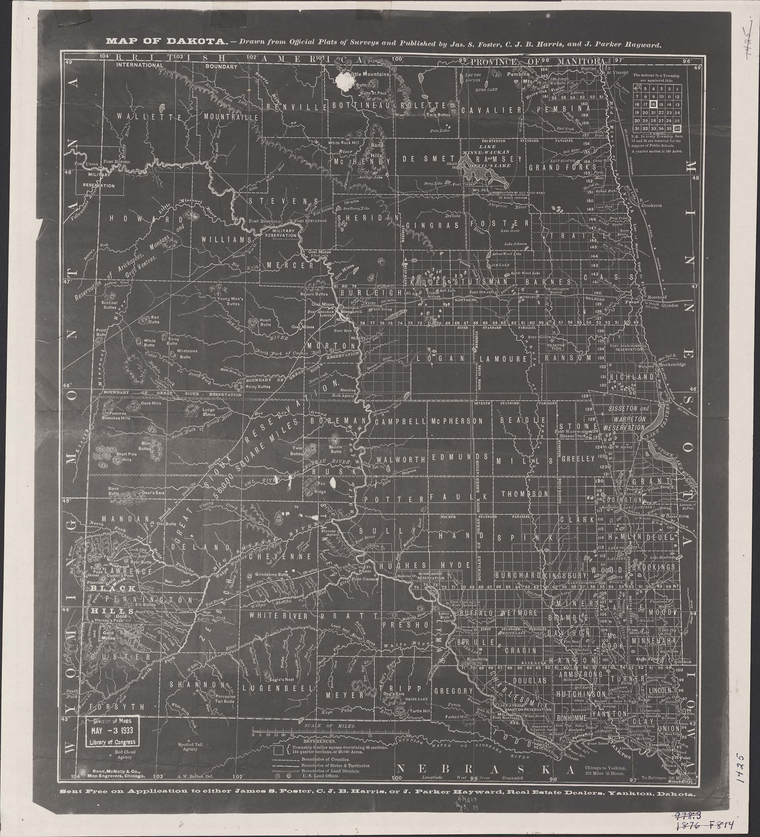
Collection: 978.402 F814m 1876 - Map of Dakota / __ __drawn from official plats of surveys and published by Jas. S. Foster, C.J.B. Harris, and J. Parker Hayward
Folder: Library
Item: 978.402 F814m 1876
Date: 1876
Creator: Foster, James S.,--1828-1890
Title: Map of Dakota / __ __drawn from official plats of surveys and published by Jas. S. Foster, C.J.B. Harris, and J. Parker Hayward
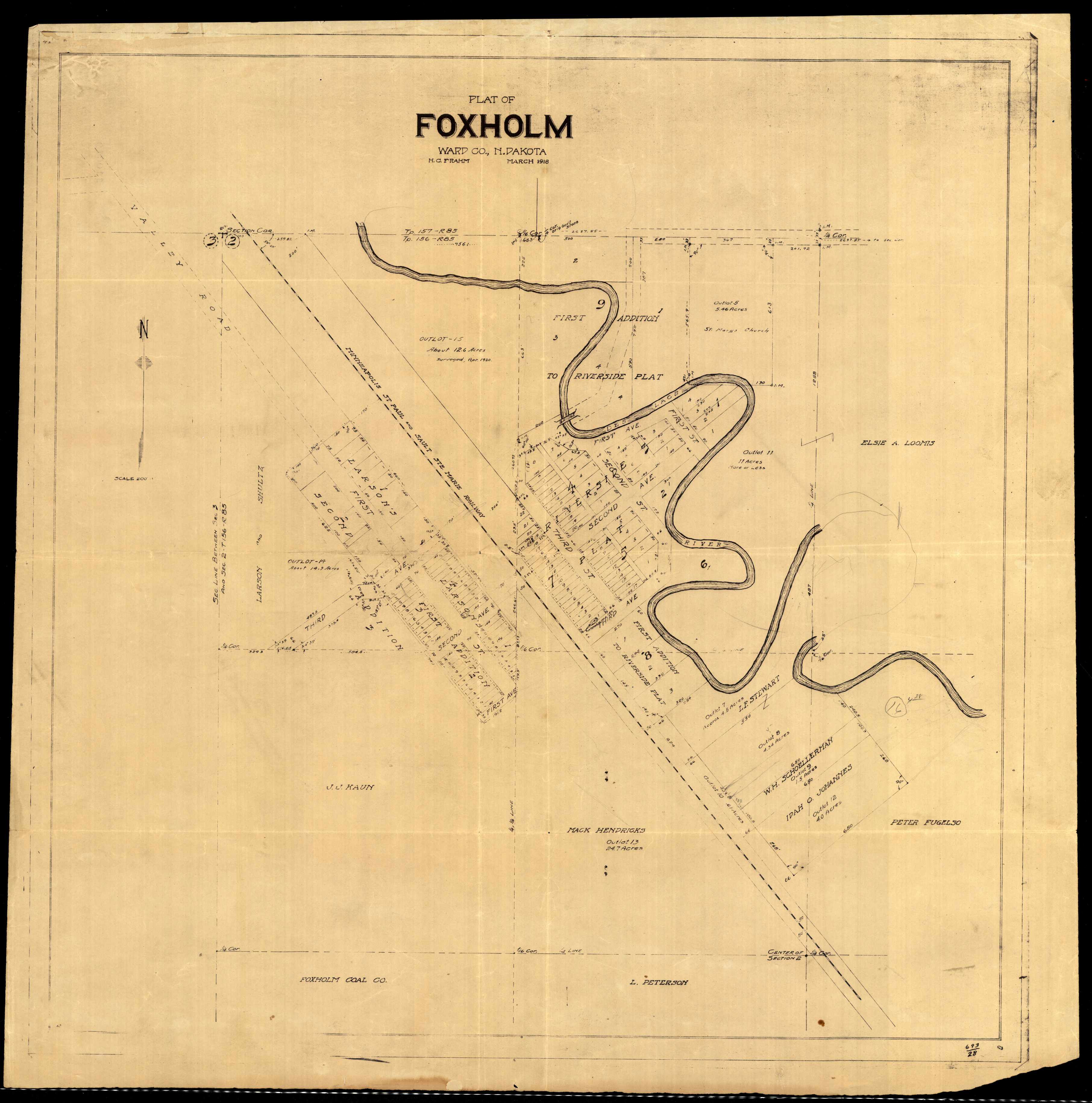
Collection: 978.463 F8p 1918 - Plat of Foxholm, Ward Co., N. Dakota / __ __H.C. Frahm
Folder: Library
Item: 978.463 F8p 1918
Date: 1918
Creator: Frahm, H. C
Title: Plat of Foxholm, Ward Co., N. Dakota / __ __H.C. Frahm
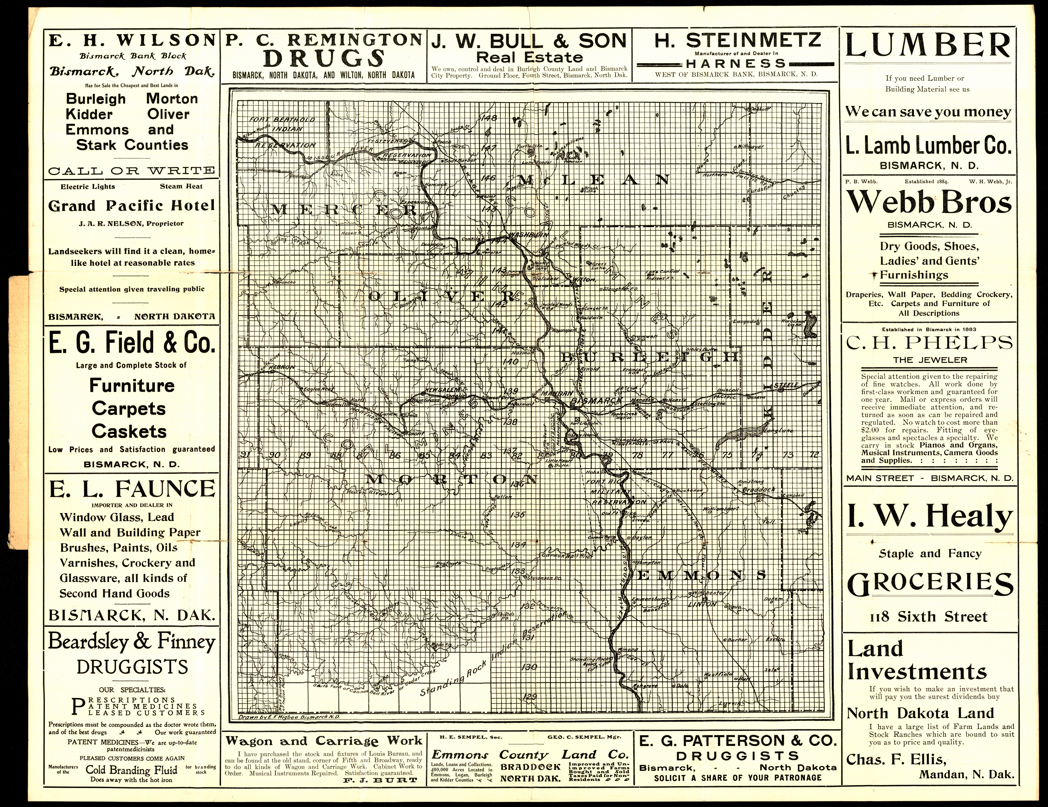
Collection: 978.48 H634r - Real estate : __North Dakota farm and ranch land for sale on easy terms / __drawn by E.F. Higbee
Folder: Library
Item: 978.48 H634r
Date: 1902 - 1914
Creator: Higbee, E. F
Title: Real estate : __North Dakota farm and ranch land for sale on easy terms / __drawn by E.F. Higbee
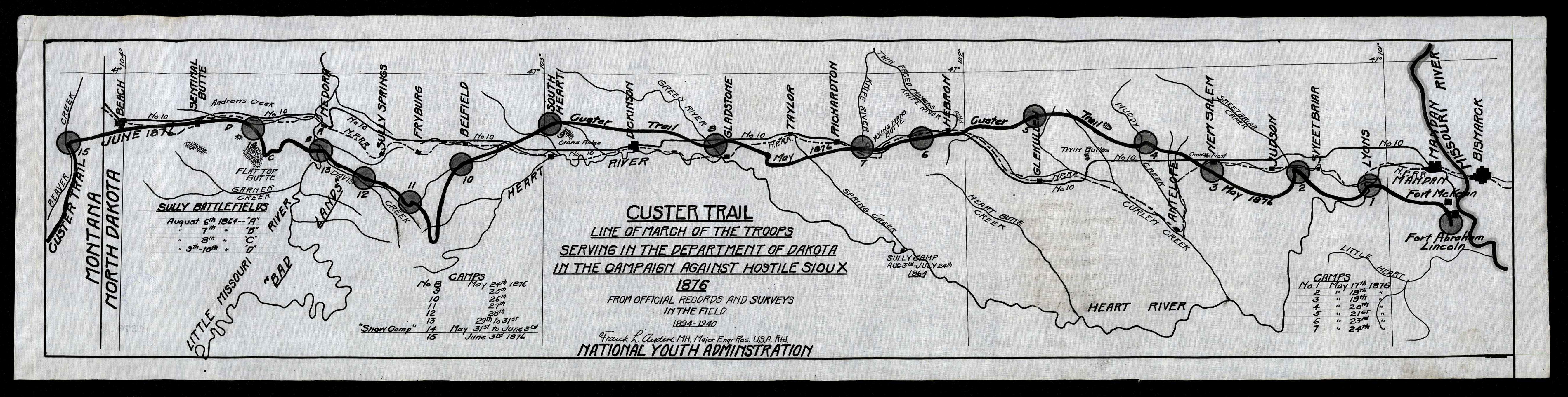
Collection: 973.82 A544c - Custer trail : __line of march of the troops serving in the Department of Dakota in the campaign against hostile Sioux, 1876 from official records and surveys in the field, 1894-1940 / __Frank L. Anders
Folder: Library
Item: 973.82 A544c
Date: 1935 - 1939
Creator: Anders, Frank L.,--1875-1966
Title: Custer trail : __line of march of the troops serving in the Department of Dakota in the campaign against hostile Sioux, 1876 from official records and surveys in the field, 1894-1940 / __Frank L. Anders
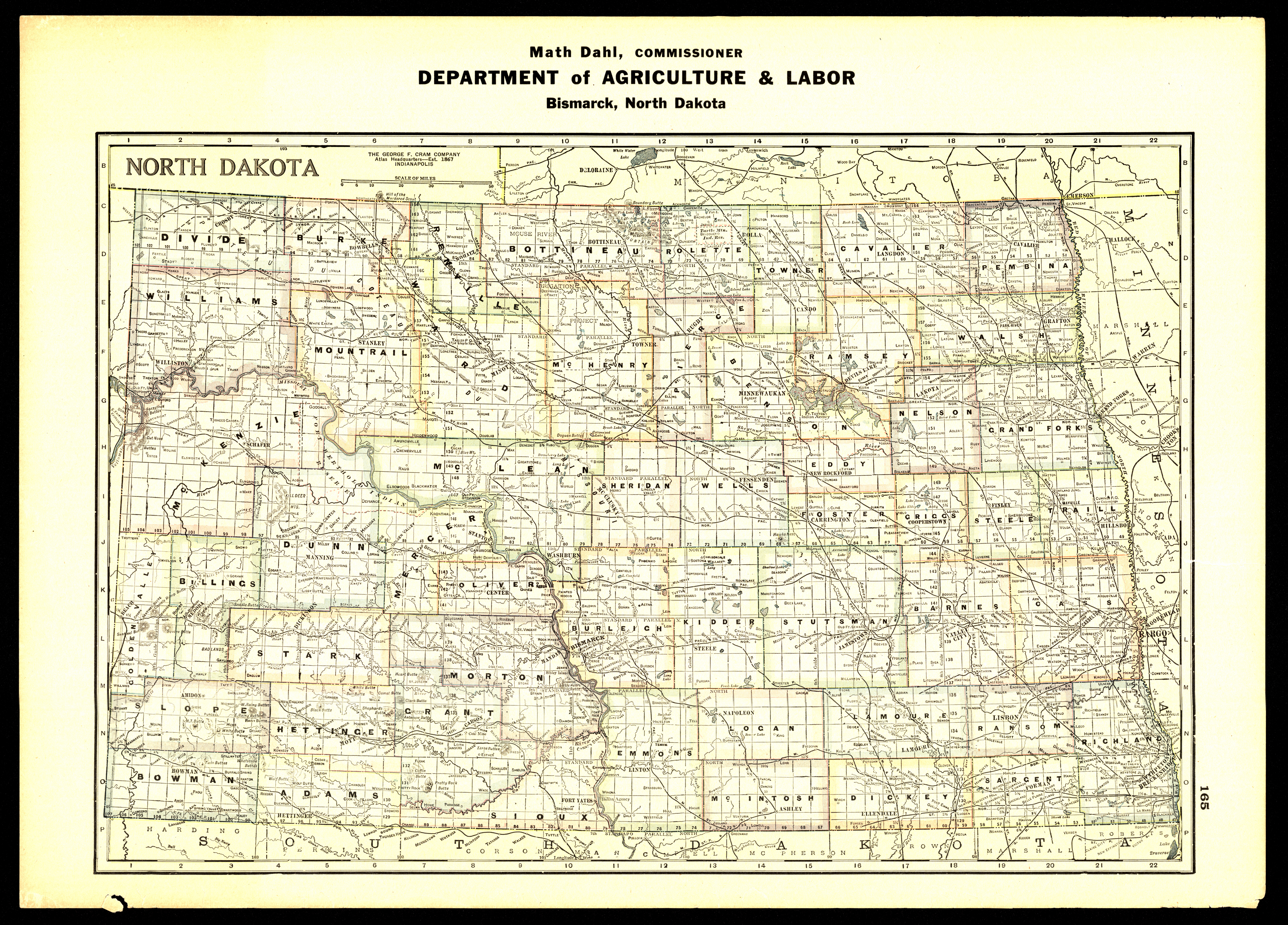
Collection: 978.4032 N864 - North Dakota / __ __Math Dahl, Commissioner, Department of Agriculture and Labor
Folder: Library
Item: 978.4032 N864
Date: 1939 - 1945
Creator: North Dakota.--Department of Agriculture and Labor
Title: North Dakota / __ __Math Dahl, Commissioner, Department of Agriculture and Labor
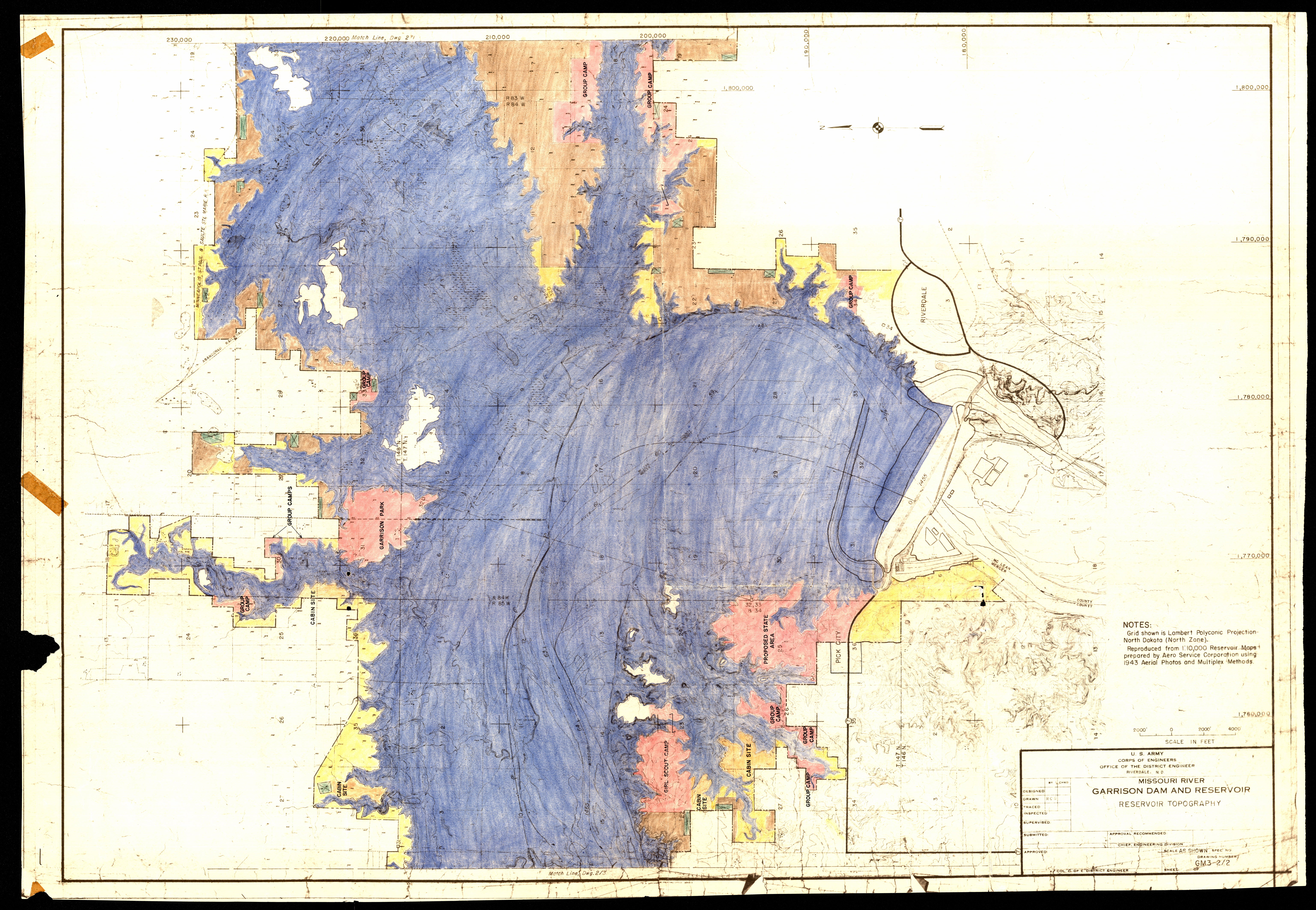
Collection: 333.91 U5813m - Missouri River, Garrison Dam and Reservoir : __reservoir topography / __U.S. Army, Corps of Engineers, Office of the District Engineer
Folder: Library
Item: 333.91 U5813m
Date: ca. 1955
Creator: United States.--Army.--Corps of Engineers
Title: Missouri River, Garrison Dam and Reservoir : __reservoir topography / __U.S. Army, Corps of Engineers, Office of the District Engineer