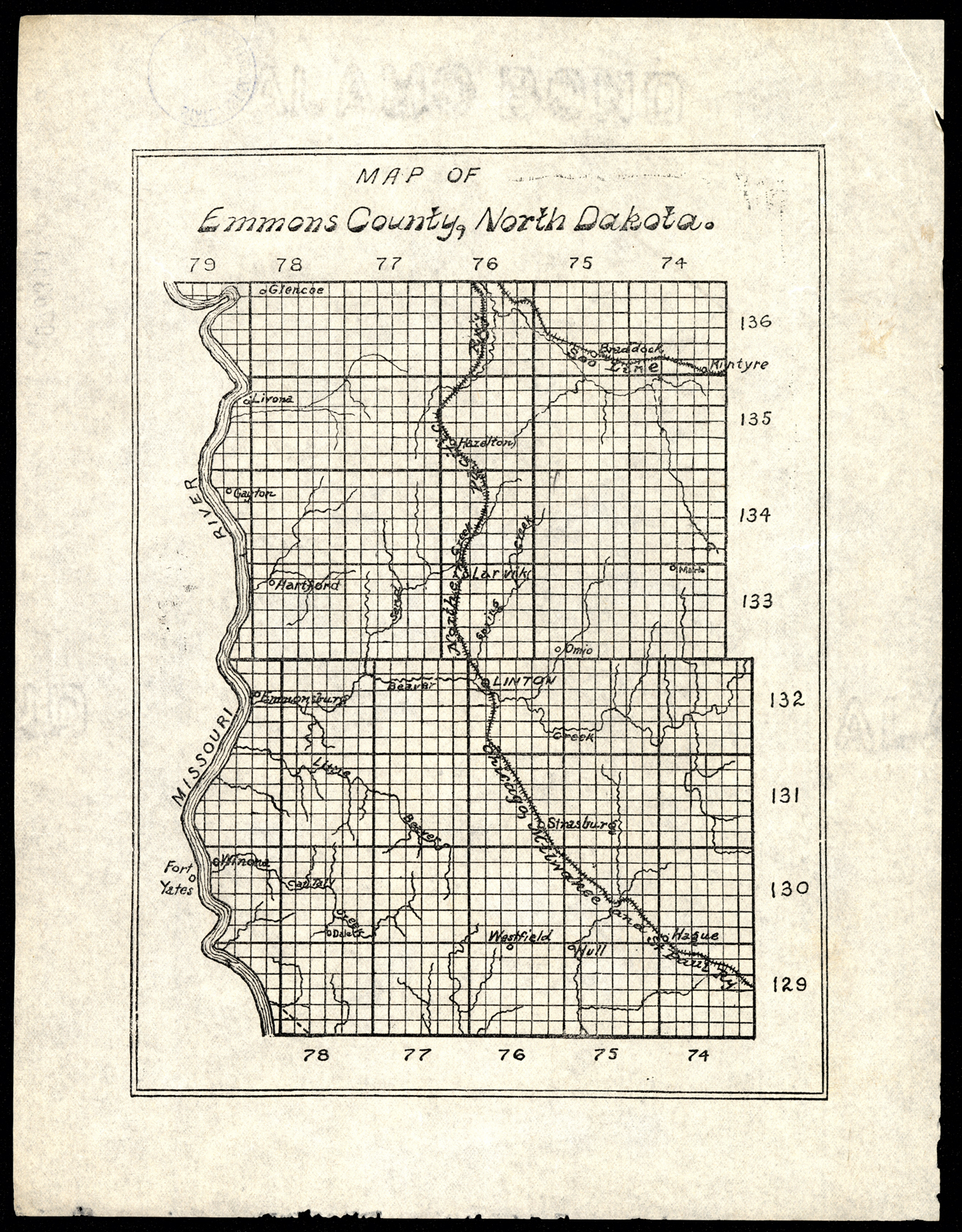
Collection: 978.478 M297 - Map of Emmons County, North Dakota
Folder:
Library
Item:
978.478 M297
Date:
ca. 1905
Creator:
Title:
Map of Emmons County, North Dakota
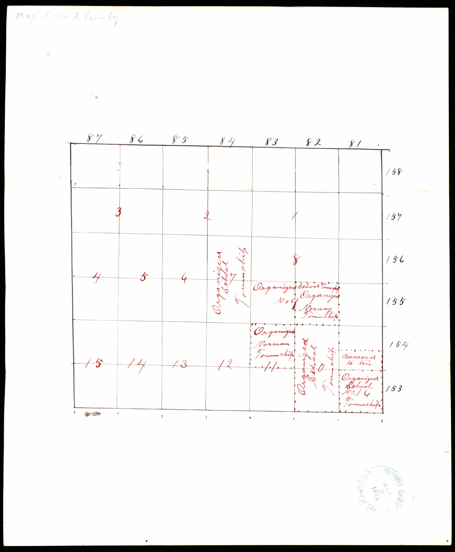
Collection: 978.463 M297 1888 - [Map of Ward County, Dakota]
Folder:
Library
Item:
978.463 M297 1888
Date:
1888
Creator:
Title:
[Map of Ward County, Dakota]
Collection: 978.439 M297 - Map of Benson County
Folder:
Library
Item:
978.439 M297
Date:
ca. 1920
Creator:
Title:
Map of Benson County
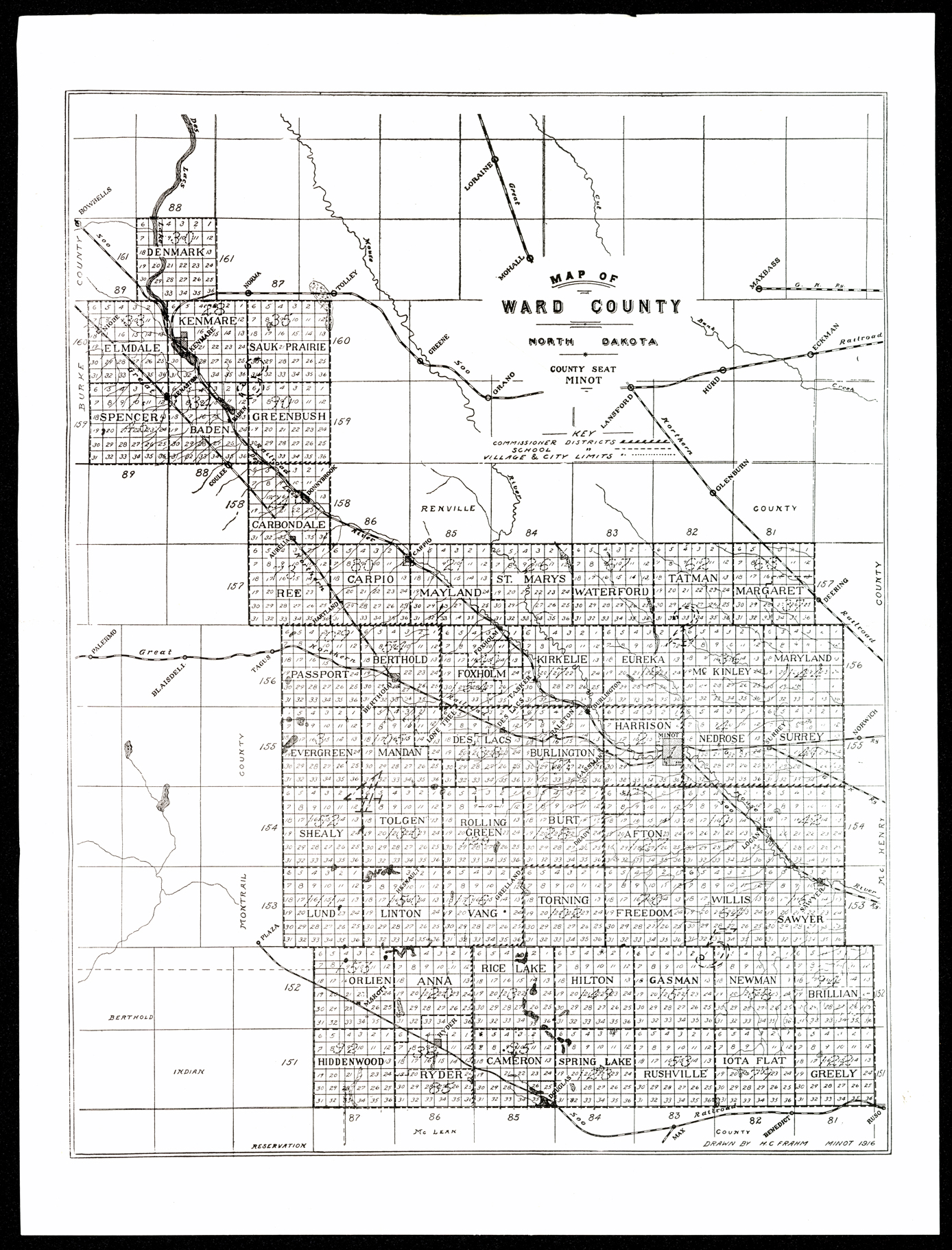
Collection: 978.463 F8m 1916 - Map of Ward County, North Dakota / __ __drawn by H.C. Frahm
Folder:
Library
Item:
978.463 F8m 1916
Date:
1916
Creator:
Frahm, H. C
Title:
Map of Ward County, North Dakota / __ __drawn by H.C. Frahm
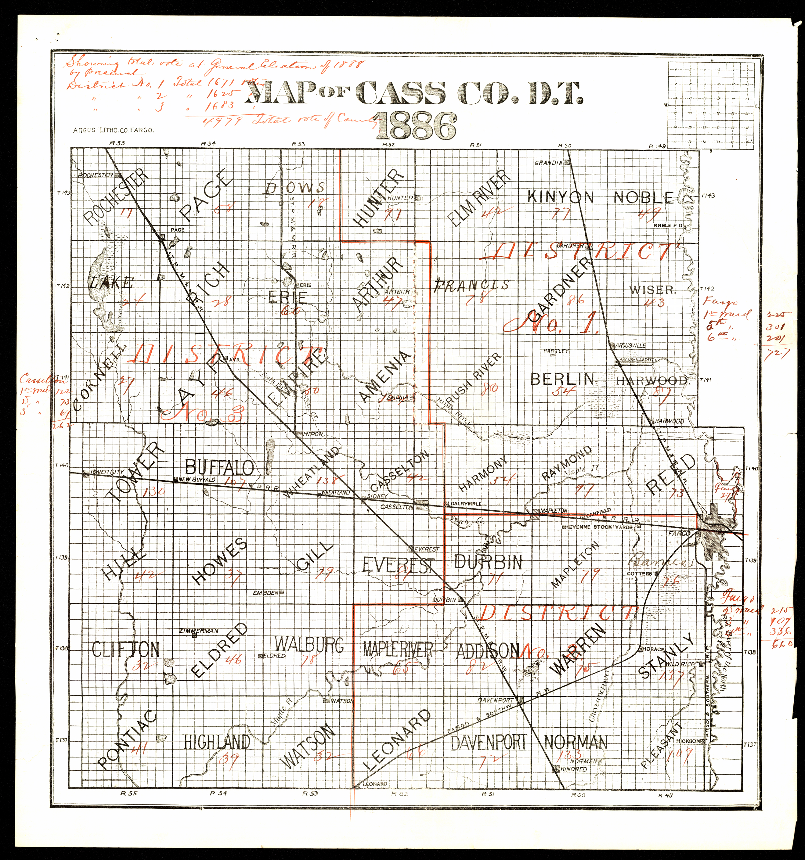
Collection: 978.413 M297 1886 - Map of Cass Co., D.T
Folder:
Library
Item:
978.413 M297 1886
Date:
1886
Creator:
Title:
Map of Cass Co., D.T
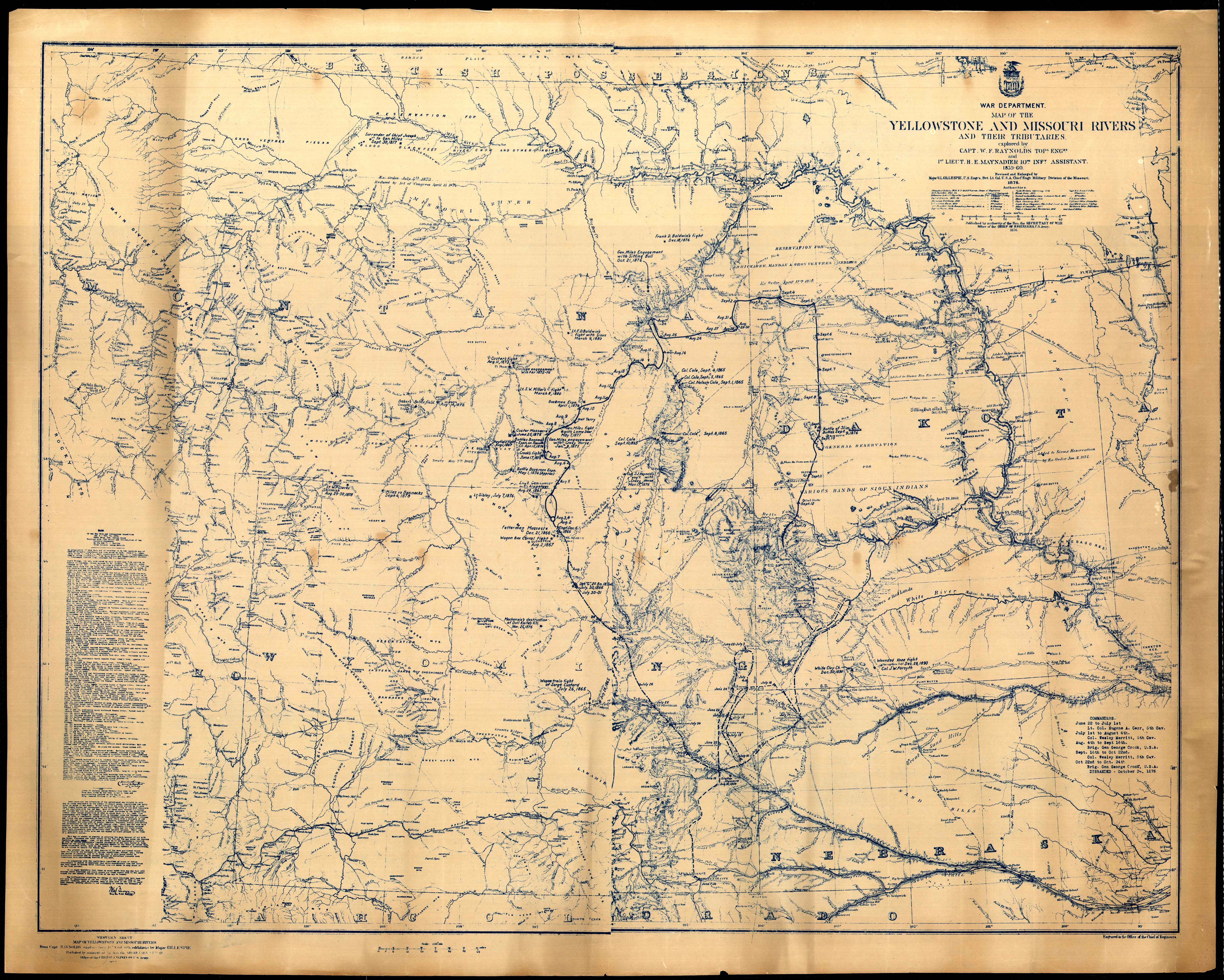
Collection: 978 Un4 1876 - Map of the Yellowstone and Missouri Rivers and their tributaries / __ __explored by W.F. Raynolds and H.E. Maynadier, 1859-60 ; engraved in the Office of the Chief of Engineers
Folder:
Library
Item:
978 Un4 1876
Date:
1876 - 1877
Creator:
United States.--Army.--Office of the Chief of Engineers
Title:
Map of the Yellowstone and Missouri Rivers and their tributaries / __ __explored by W.F. Raynolds and H.E. Maynadier, 1859-60 ; engraved in the Office of the Chief of Engineers
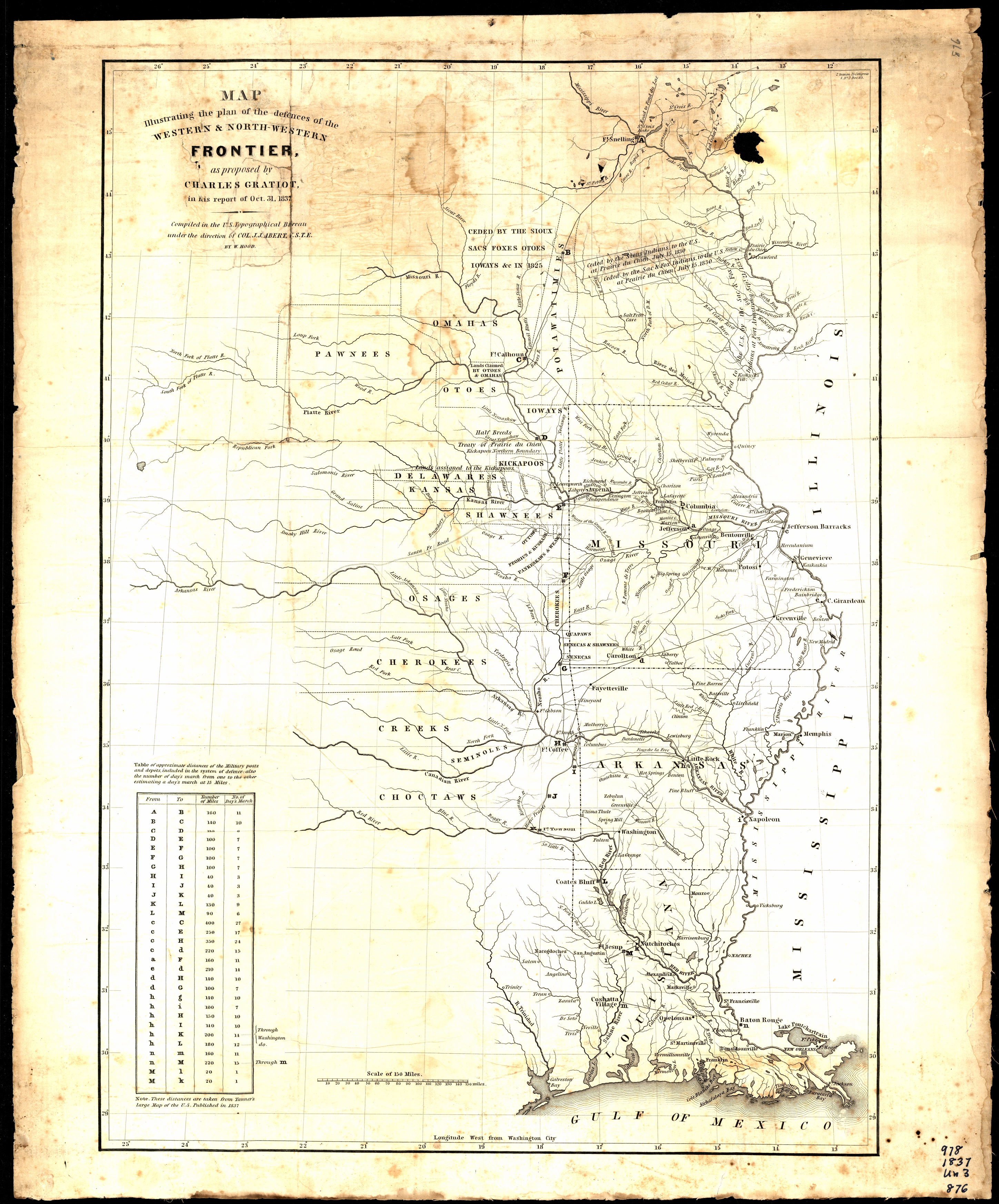
Collection: 978.02 H776m 1837 - Map illustrating the plan of the defences of the western & north-western frontier : __as proposed by Charles Gratiot in his report of Oct. 31, 1837 / __compiled in the U.S. Topographical Bureau under the direction of Col. J.J. Abert, U.S.T.E., by W. Hood
Folder:
Library
Item:
978.02 H776m 1837
Date:
1837
Creator:
Hood, Washington
Title:
Map illustrating the plan of the defences of the western & north-western frontier : __as proposed by Charles Gratiot in his report of Oct. 31, 1837 / __compiled in the U.S. Topographical Bureau under the direction of Col. J.J. Abert, U.S.T.E., by W. Hood
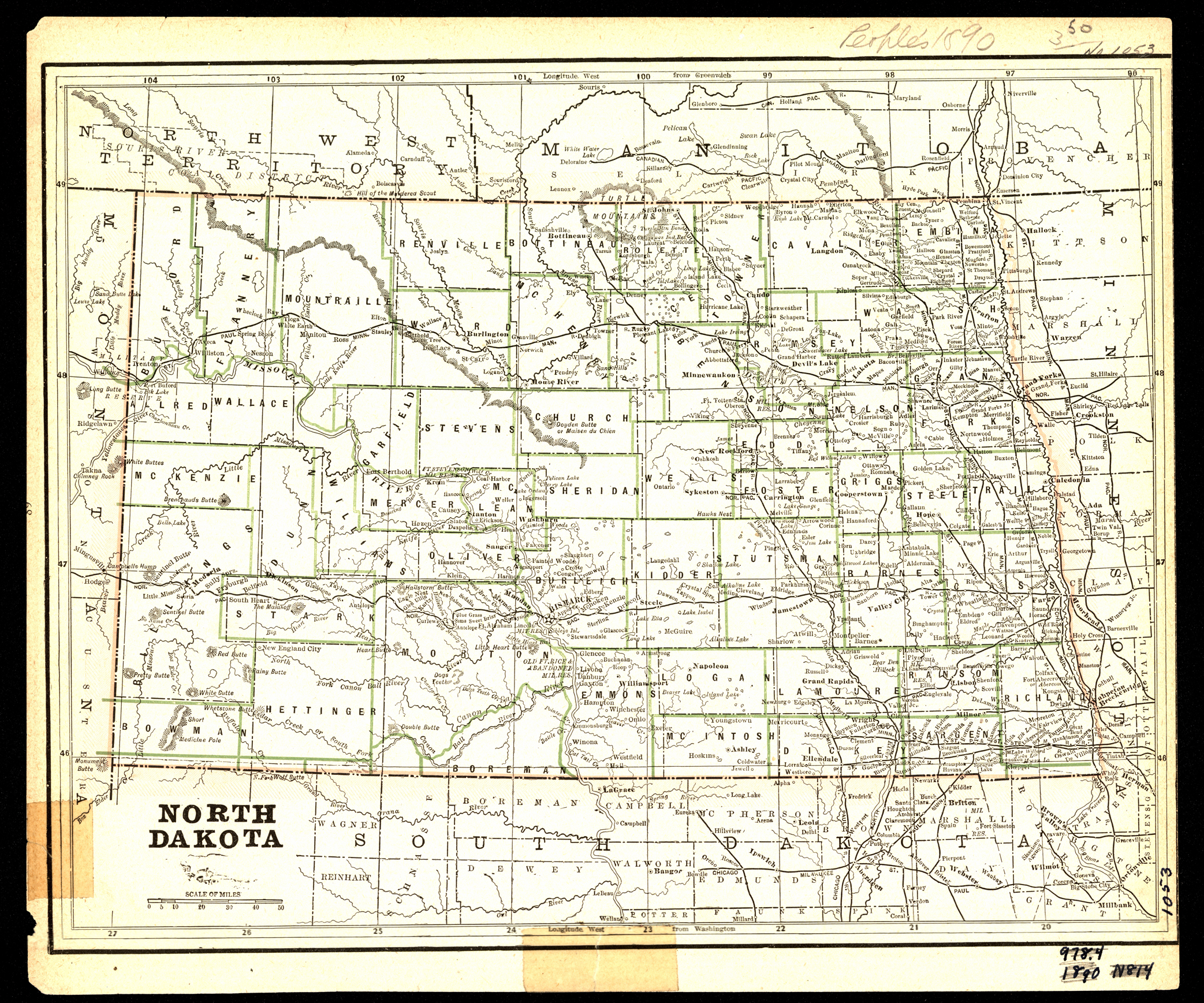
Collection: 978.4031 P4197d 1890 - North Dakota ; __Minnesota / __engraved for the People's Publishing Co
Folder:
Library
Item:
978.4031 P4197d 1890
Date:
1890
Creator:
People's Publishing Co
Title:
North Dakota ; __Minnesota / __engraved for the People's Publishing Co
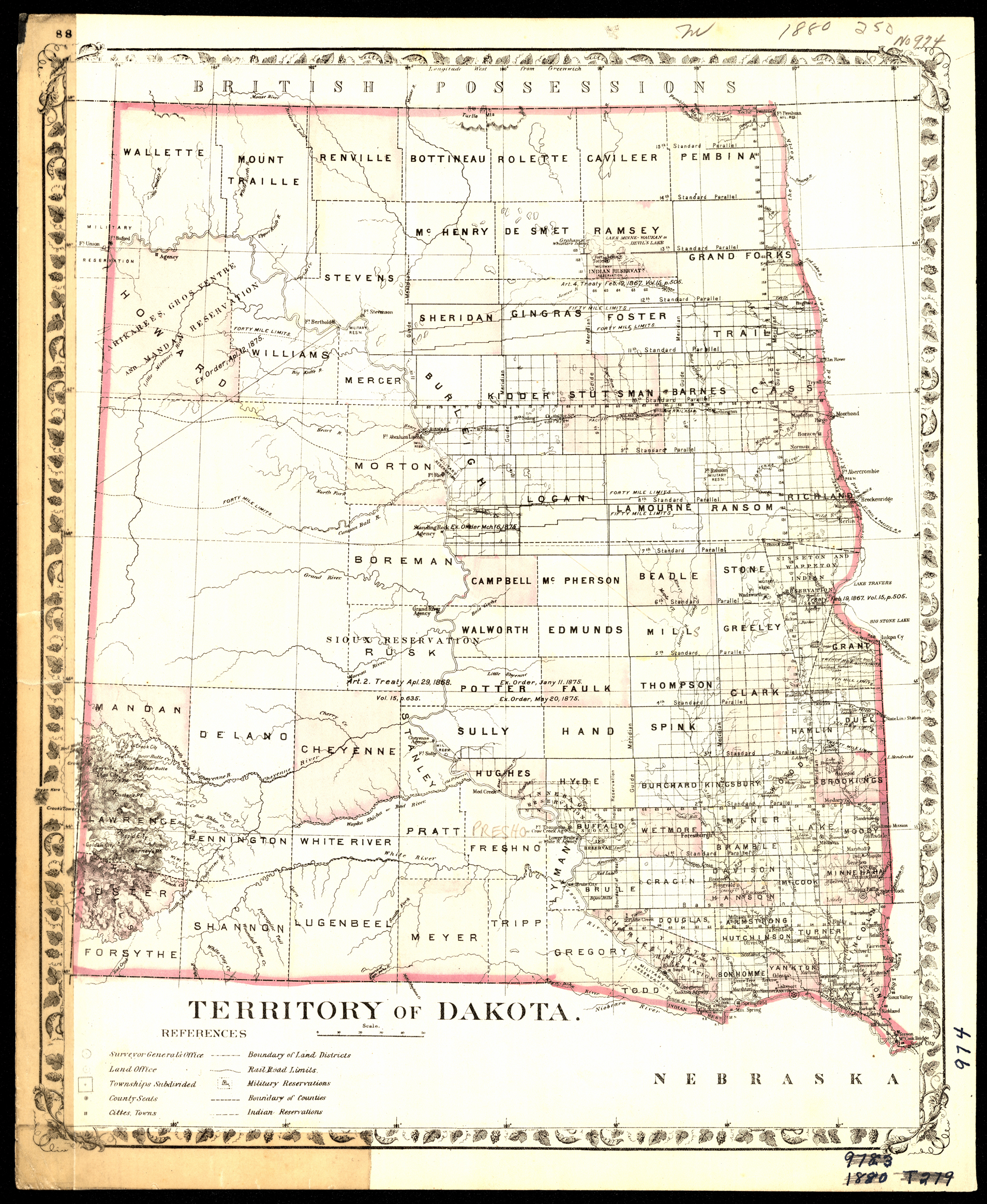
Collection: 978.402 M68t 1879 - Territory of Dakota
Folder:
Library
Item:
978.402 M68t 1879
Date:
1879
Creator:
Mitchell, S. Augustus--(Samuel Augustus),--Jr
Title:
Territory of Dakota
Collection: 385 N864r 1935 - Railroad Commissioners' map of North Dakota
Folder:
Library
Item:
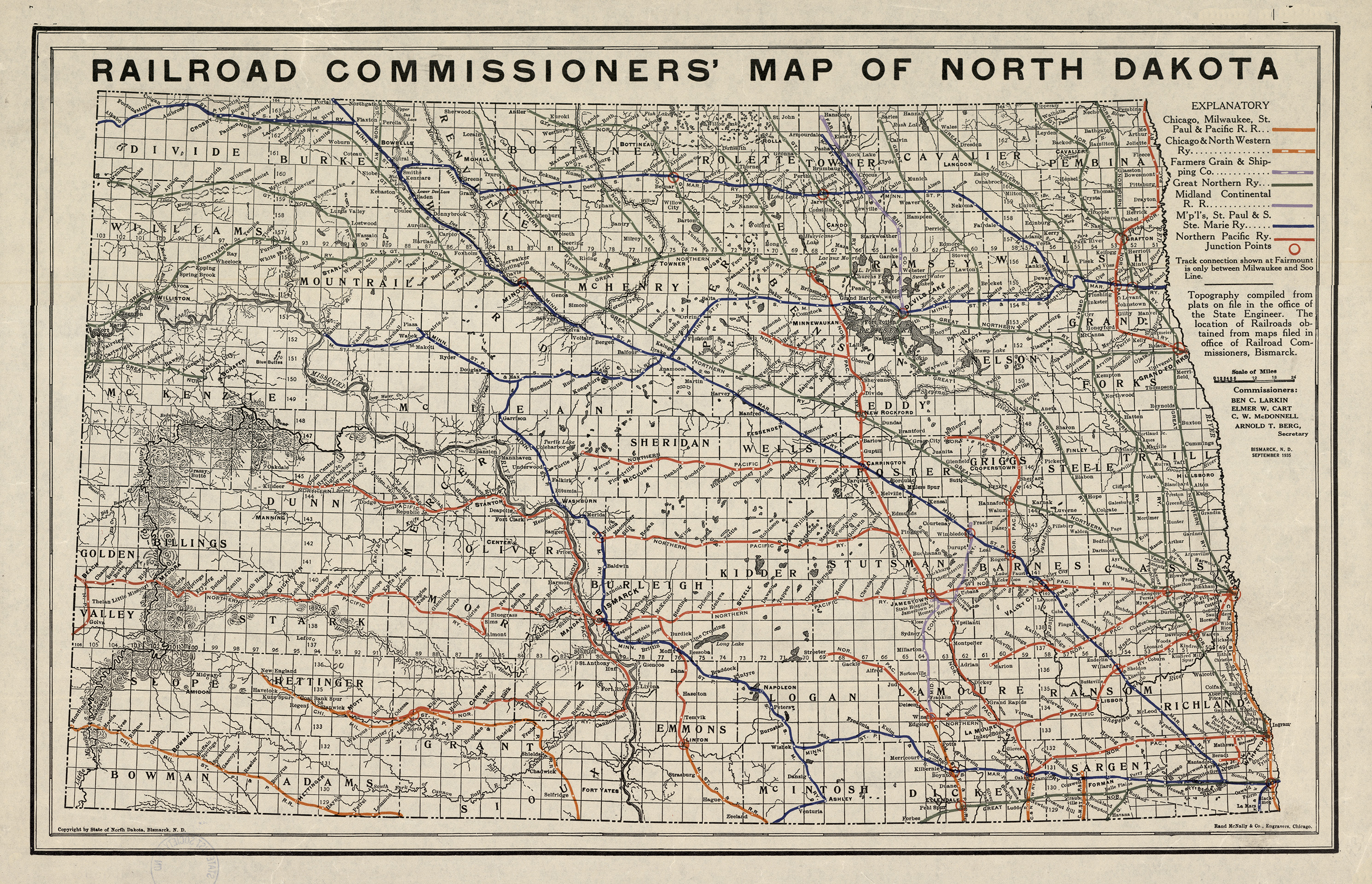
385 N864r 1935
Date:
1935
Creator:
North Dakota.--Board of Railroad Commissioners
Title:
Railroad Commissioners' map of North Dakota
Collection: 385 N864r 1913 - Railroad Commissioners' map of North Dakota / __ __map prepared by State Engineer's Office
Folder:
Library
Item:
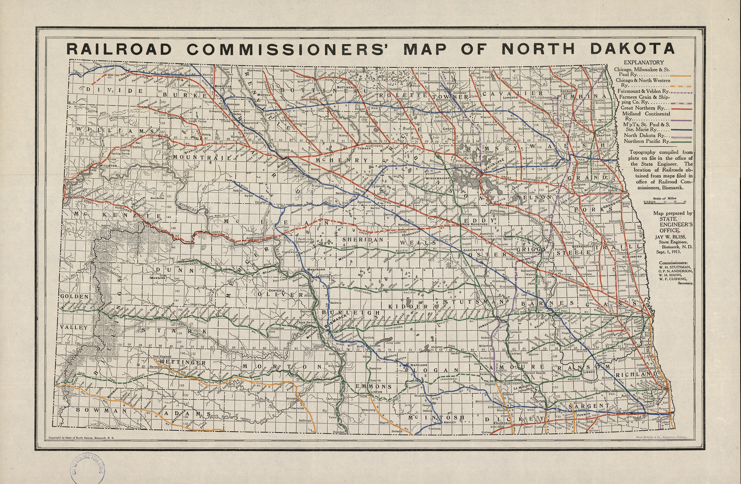
385 N864r 1913
Date:
1913
Creator:
North Dakota.--Board of Railroad Commissioners
Title:
Railroad Commissioners' map of North Dakota / __ __map prepared by State Engineer's Office
Collection: 978.473 M297b - Map of Williams County, North Dakota
Folder:
Library
Item:
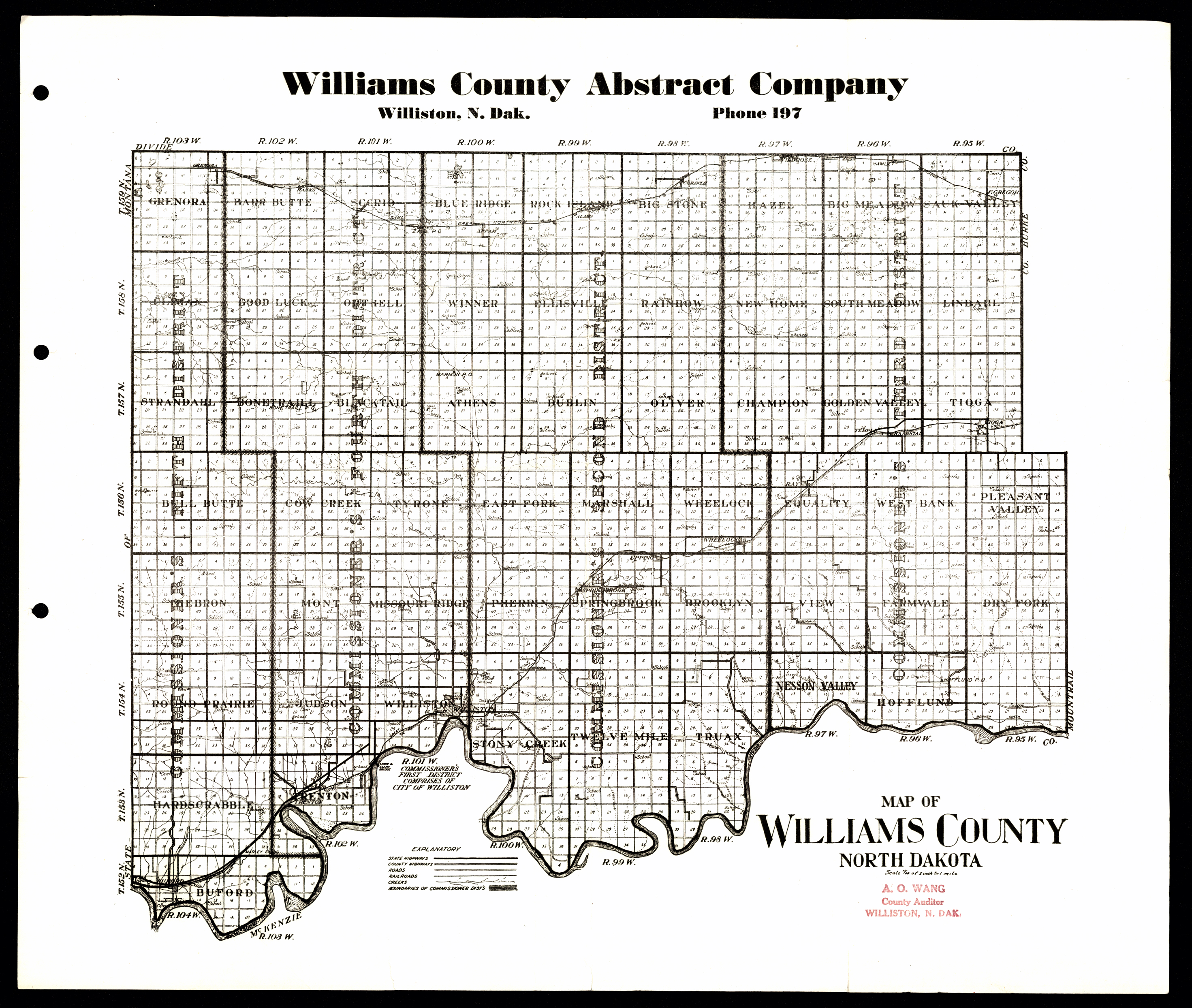
978.473 M297b
Date:
ca. 1955
Creator:
Title:
Map of Williams County, North Dakota
Collection: 978.493 M297 - Map of Slope County, state of North Dakota
Folder:
Library
Item:
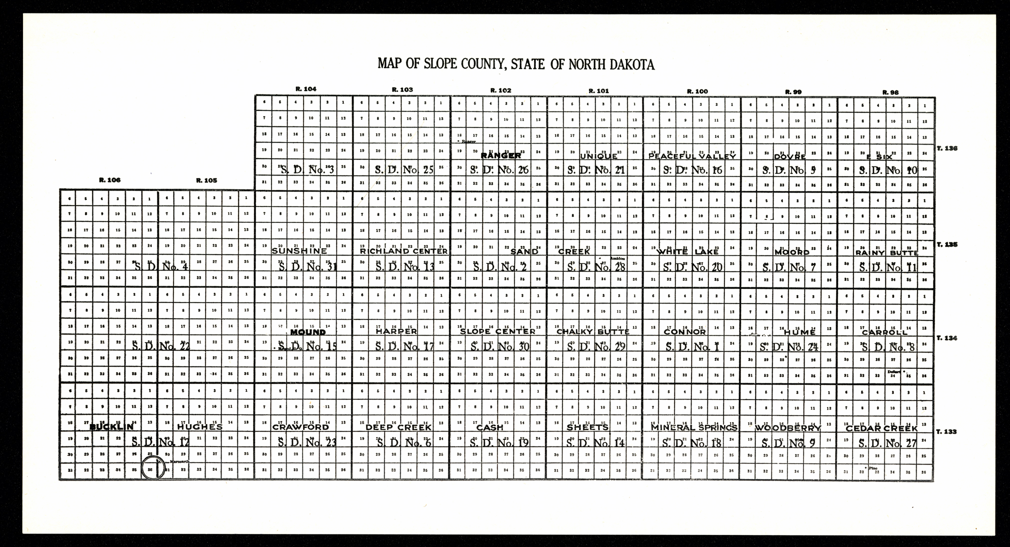
978.493 M297
Date:
ca. 1935
Creator:
Title:
Map of Slope County, state of North Dakota
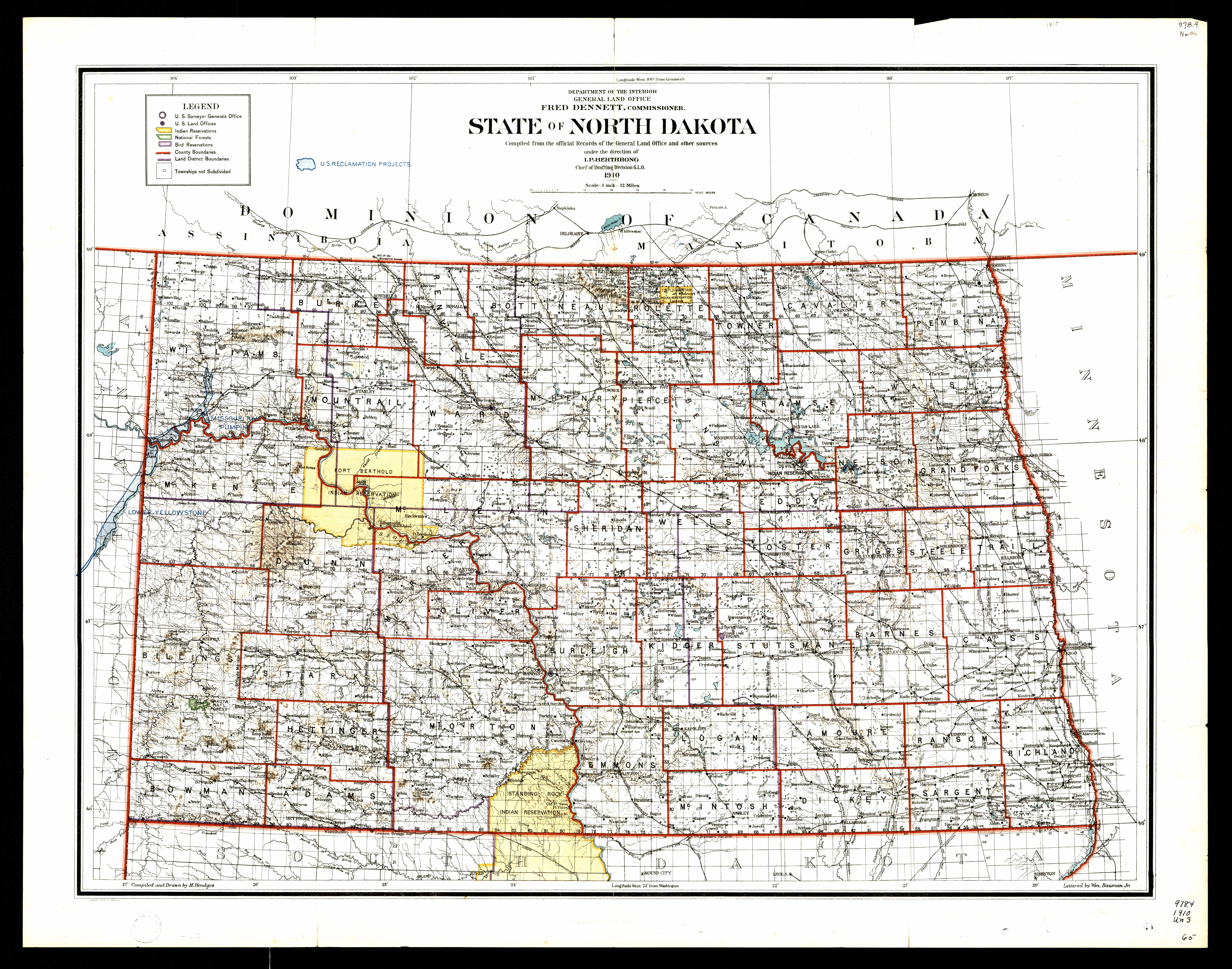
Collection: 978.4031 U5813s 1910 - State of North Dakota / __ __compiled from the official records of the General Land Office and other sources under the direction of I.P. Berthrong ; compiled and drawn by M. Hendges ; lettered by Wm. Bauman, Jr
Folder:
Library
Item:
978.4031 U5813s 1910
Date:
1910
Creator:
United States.--General Land Office
Title:
State of North Dakota / __ __compiled from the official records of the General Land Office and other sources under the direction of I.P. Berthrong ; compiled and drawn by M. Hendges ; lettered by Wm. Bauman, Jr
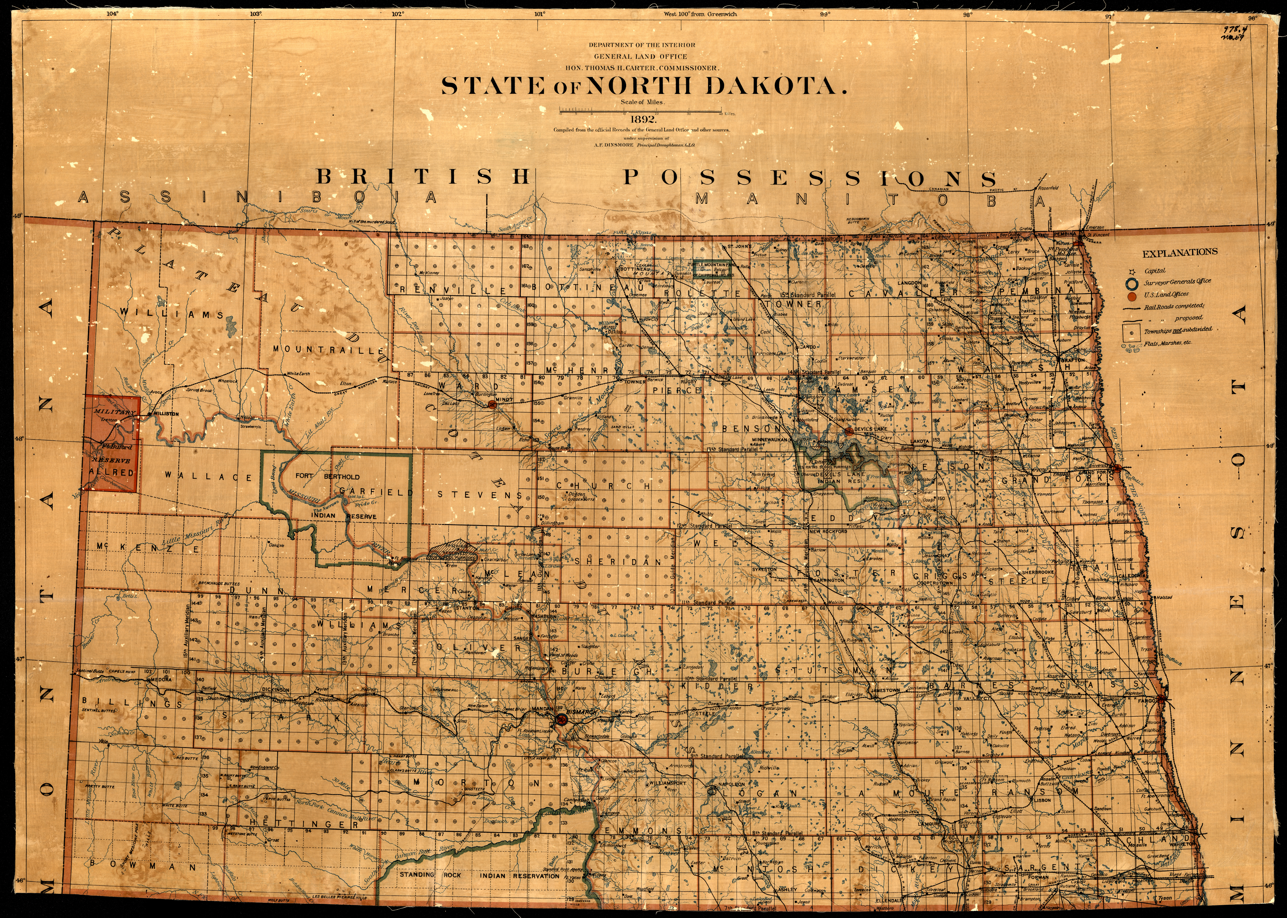
Collection: 978.4031 U5813s 1892 - State of North Dakota / __ __compiled from the official records of the General Land Office and other sources ; compiled and drawn by A.F. Dinsmore ; traced and lettered by M. Hendges
Folder:
Library
Item:
978.4031 U5813s 1892
Date:
1892
Creator:
United States.--General Land Office
Title:
State of North Dakota / __ __compiled from the official records of the General Land Office and other sources ; compiled and drawn by A.F. Dinsmore ; traced and lettered by M. Hendges
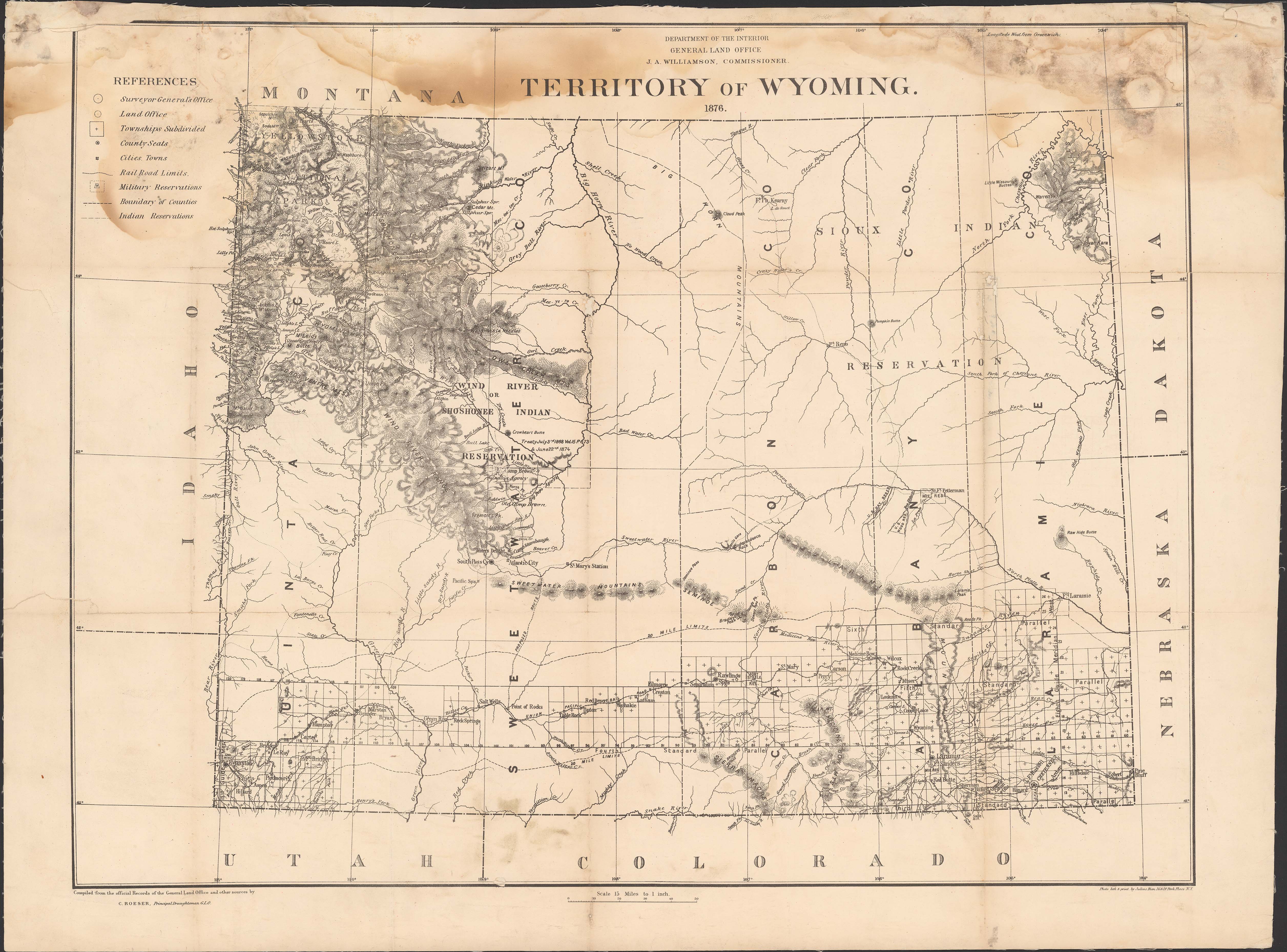
Collection: 978.702 U5813t 1876 - Territory of Wyoming / __ __compiled from the official records of the General Land Office and other sources by C. Roeser, Principal Draughtsman, G.L.O
Folder:
Library
Item:
978.702 U5813t 1876
Date:
1876
Creator:
United States.--General Land Office
Title:
Territory of Wyoming / __ __compiled from the official records of the General Land Office and other sources by C. Roeser, Principal Draughtsman, G.L.O
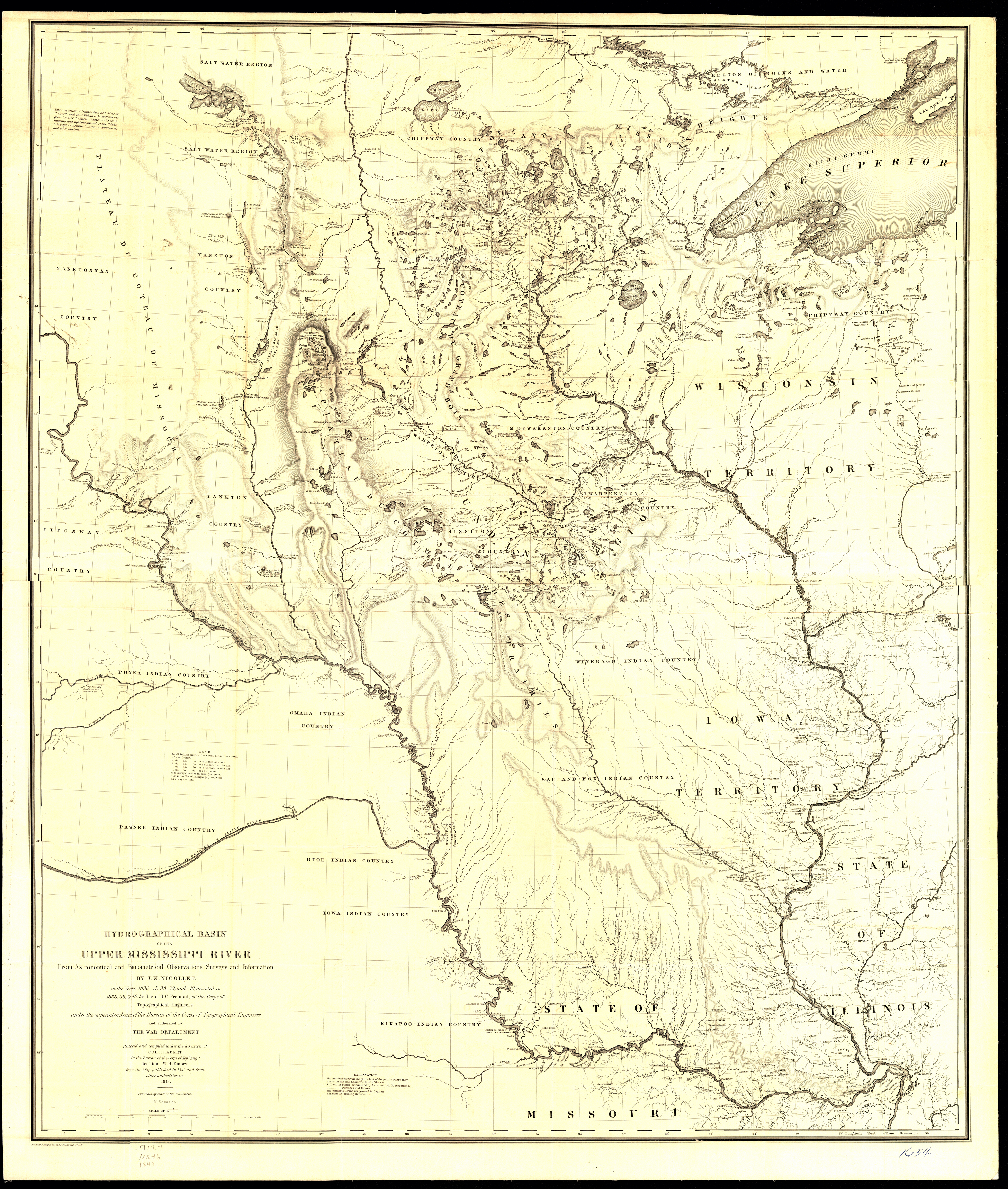
Collection: 917.7 N546 1843 map - Hydrographical basin of the upper Mississippi River __from astronomical and barometrical observations, surveys, and information / __by J. N. Nicollet, in the years 1836, 37, 38, 39, and 40 ; assisted in 1838, 39, & 40, by Lieut. J. C. Fremont, of the Corps of Topographical Engineers under the superintendence of the Bureau of the Corps of Topographical Engineers and authorized by the War Department
Folder:
Library
Item:
917.7 N546 1843 map
Date:
1843
Creator:
Nicollet, J. N.--(Joseph Nicolas),--1786-1843
Title:
Hydrographical basin of the upper Mississippi River __from astronomical and barometrical observations, surveys, and information / __by J. N. Nicollet, in the years 1836, 37, 38, 39, and 40 ; assisted in 1838, 39, & 40, by Lieut. J. C. Fremont, of the Corps of Topographical Engineers under the superintendence of the Bureau of the Corps of Topographical Engineers and authorized by the War Department
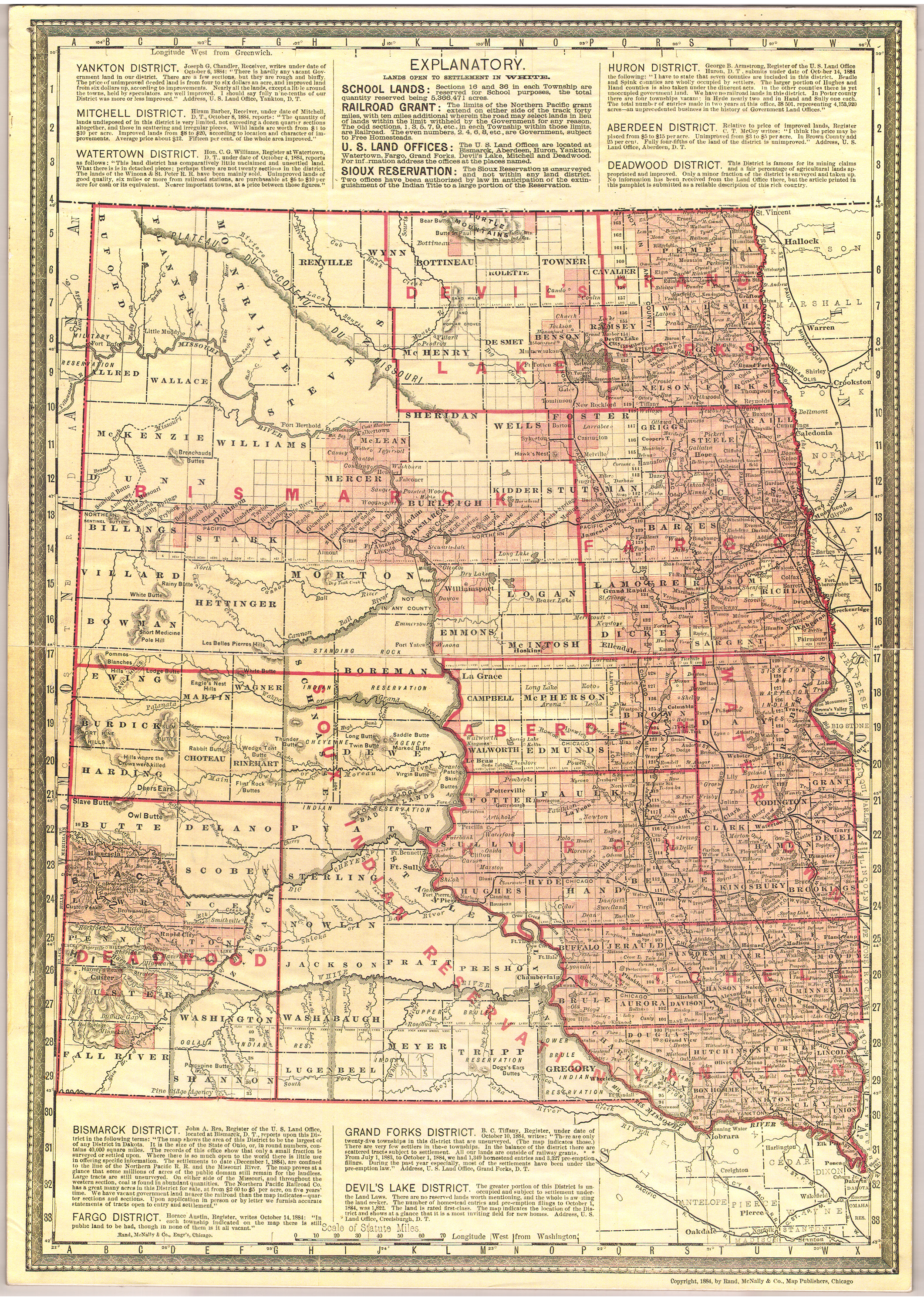
Collection: 978.402 R186m 1884 - [Map of Dakota Territory, by district]
Folder:
Library
Item:
978.402 R186m 1884
Date:
Copyright 1884
Creator:
Rand McNally and Company
Title:
[Map of Dakota Territory, by district]
Collection: 973.00497 U5813m 1885 - Map showing the location of the Indian reservations within the limits of the United States and territories / __ __compiled from official and other authentic sources, under the direction of John D.C. Atkins, Commissioner of Indian Affairs ; Paul Brodie, draughtsman
Folder:
Library
Item:
973.00497 U5813m 1885
Date:
1885
Creator:
United States.--Office of Indian Affairs
Title:
Map showing the location of the Indian reservations within the limits of the United States and territories / __ __compiled from official and other authentic sources, under the direction of John D.C. Atkins, Commissioner of Indian Affairs ; Paul Brodie, draughtsman
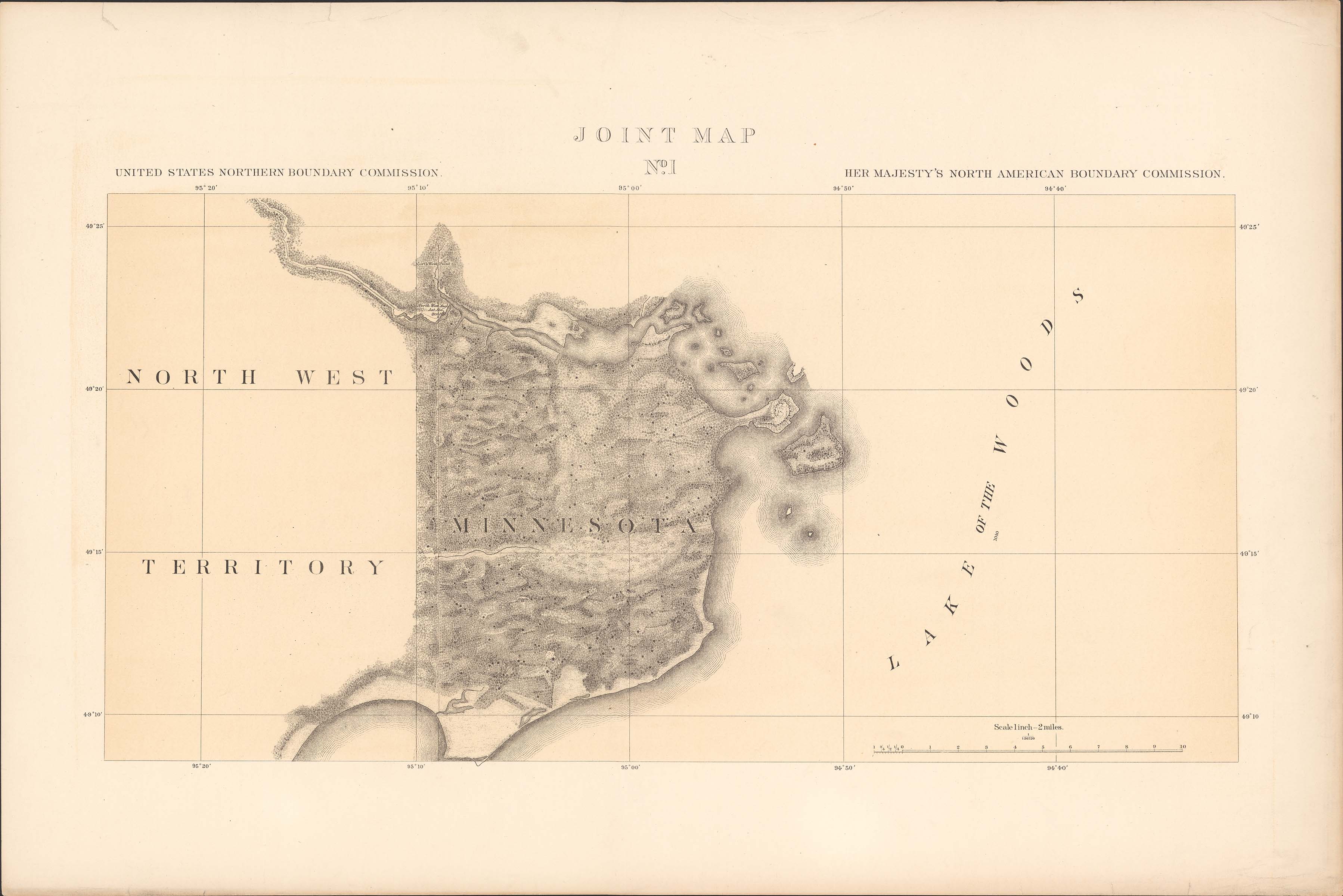
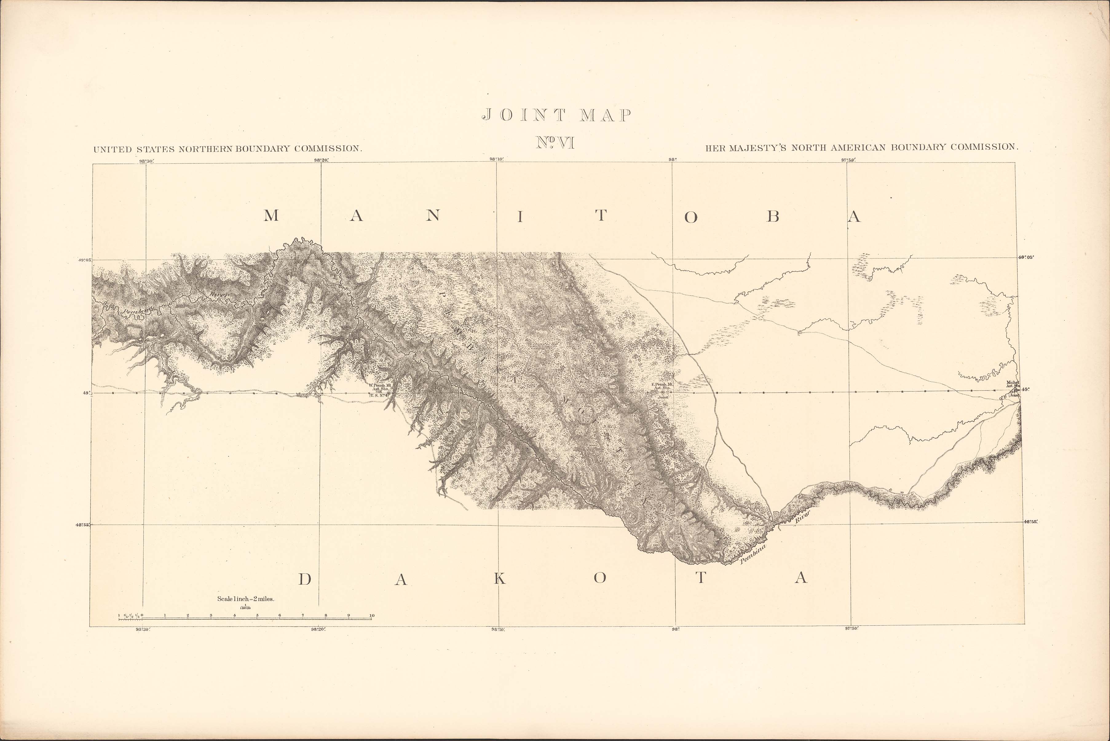
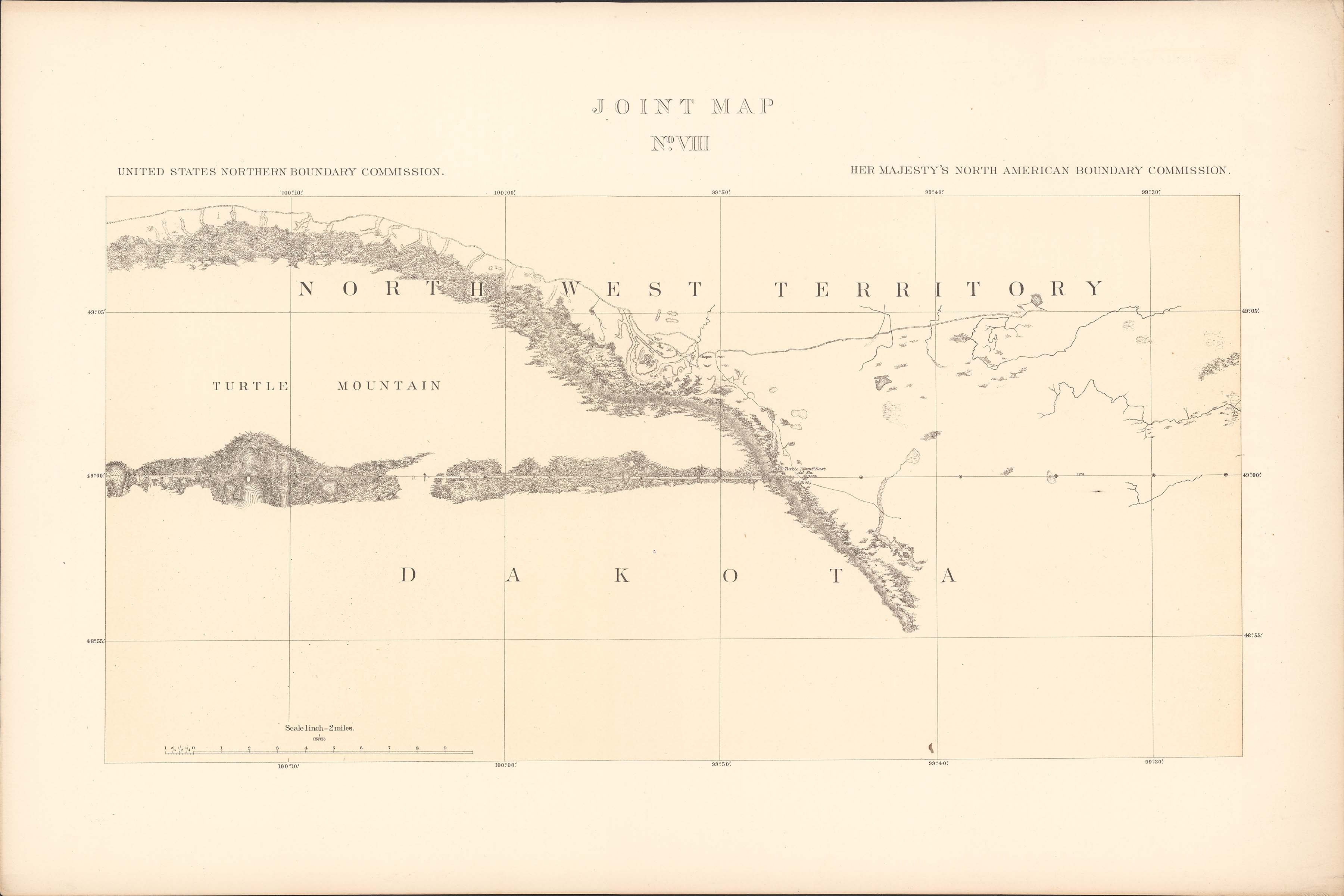
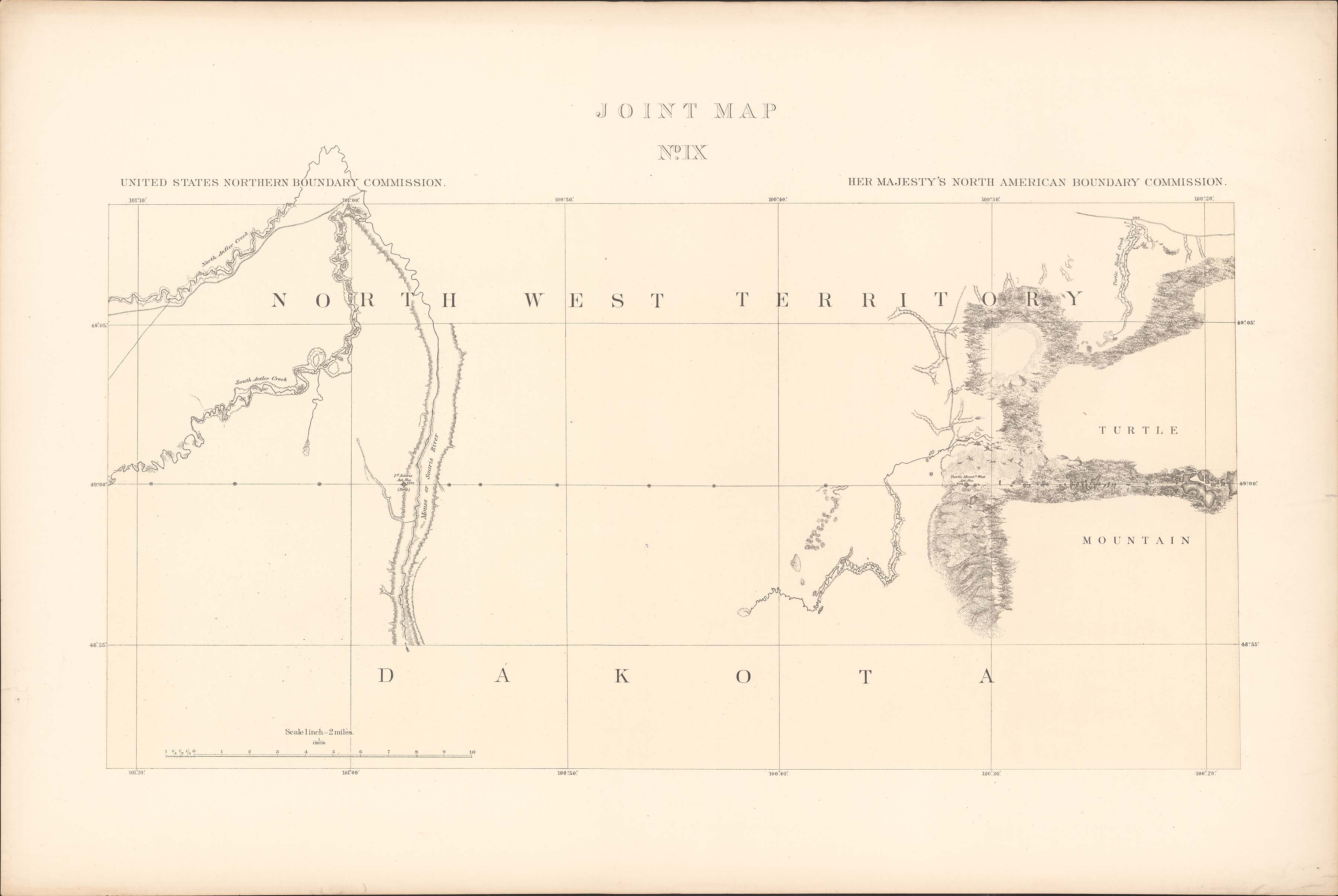
Collection: 917.98 In8 1878 - Joint maps of the Northern Boundary of the United States from the Lake of the Woods to the summit of the Rocky Mountains / __ __United States Northern Boundary Commission ; Archibald Campbell, commissioner ; W.J. Twining, chief astronomer ; Her Majesty's North American Boundary Commission ; D.R. Cameron, commissioner ; S. Anderson, chief astronomer
Folder:
Library
Item:
917.98 In8 1878
Date:
1878
Creator:
North American Boundary Commission
Title:
Joint maps of the Northern Boundary of the United States from the Lake of the Woods to the summit of the Rocky Mountains / __ __United States Northern Boundary Commission ; Archibald Campbell, commissioner ; W.J. Twining, chief astronomer ; Her Majesty's North American Boundary Commission ; D.R. Cameron, commissioner ; S. Anderson, chief astronomer
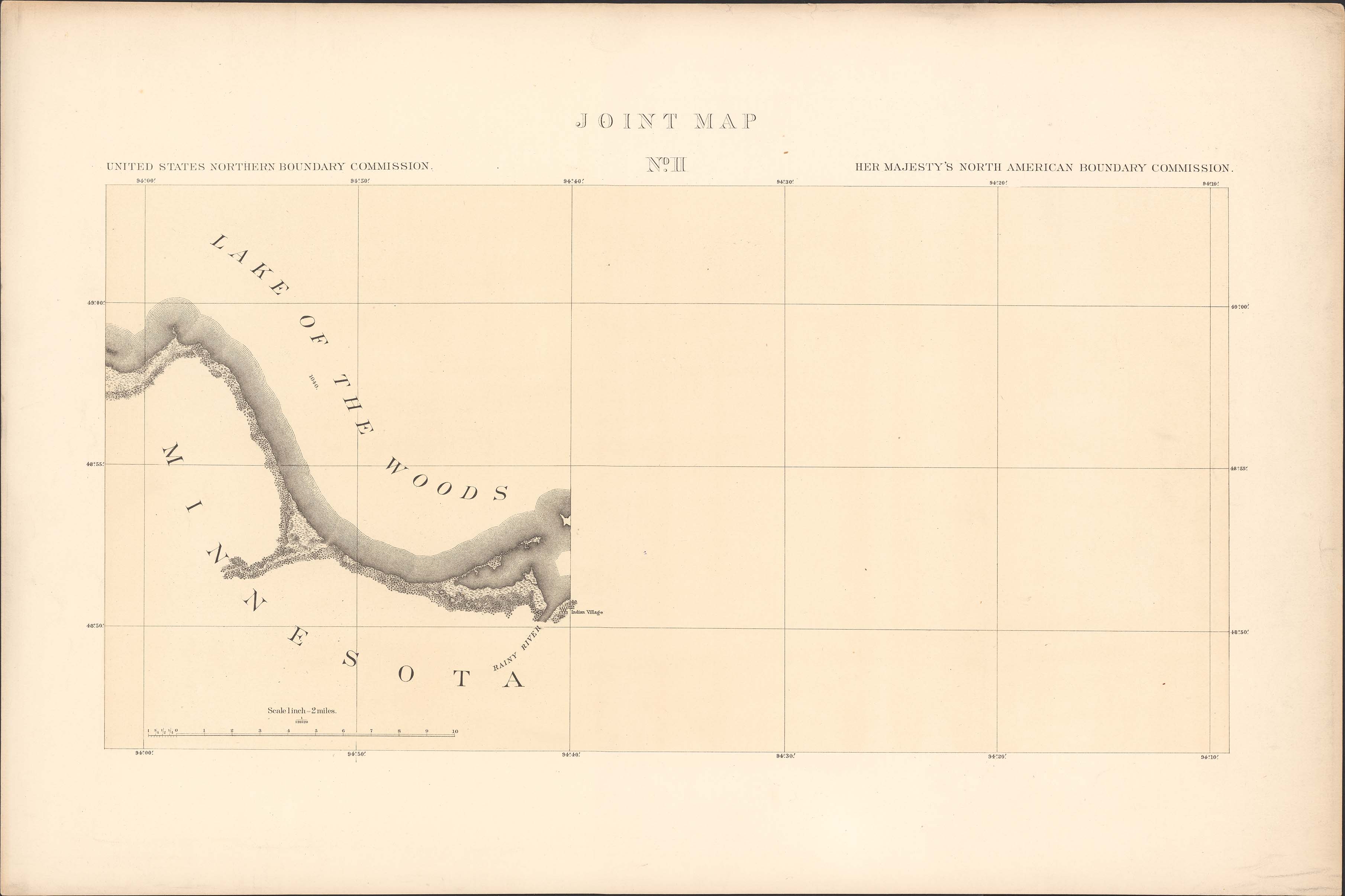
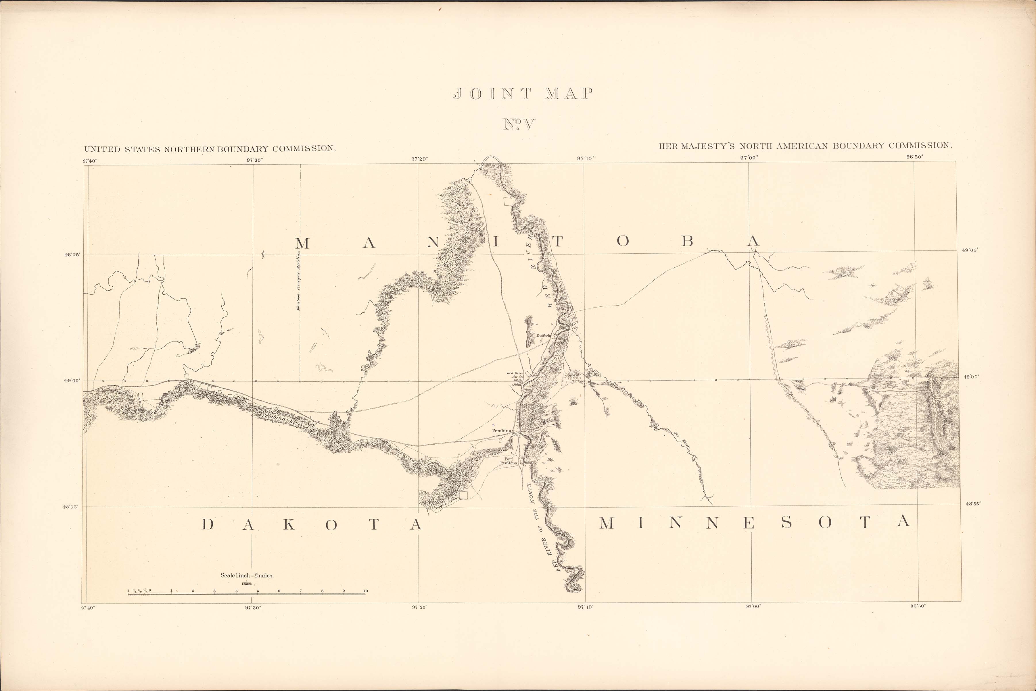