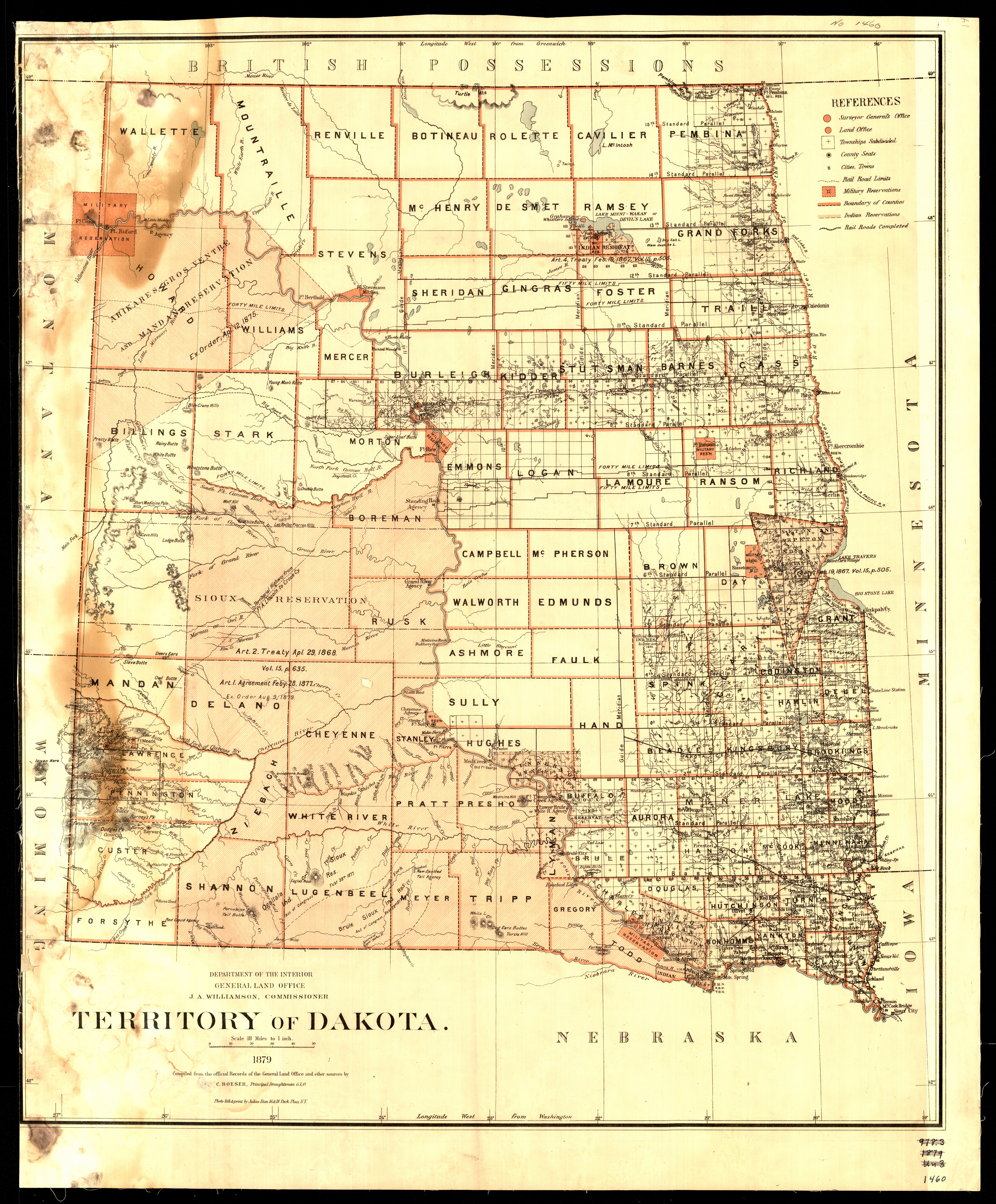
Collection: 978.402 U5813t 1879 - Territory of Dakota / __ __compiled from the official records of the General Land Office and other sources by C. Roeser
Folder:
Library
Item:
978.402 U5813t 1879
Date:
1879
Creator:
United States.--General Land Office
Title:
Territory of Dakota / __ __compiled from the official records of the General Land Office and other sources by C. Roeser
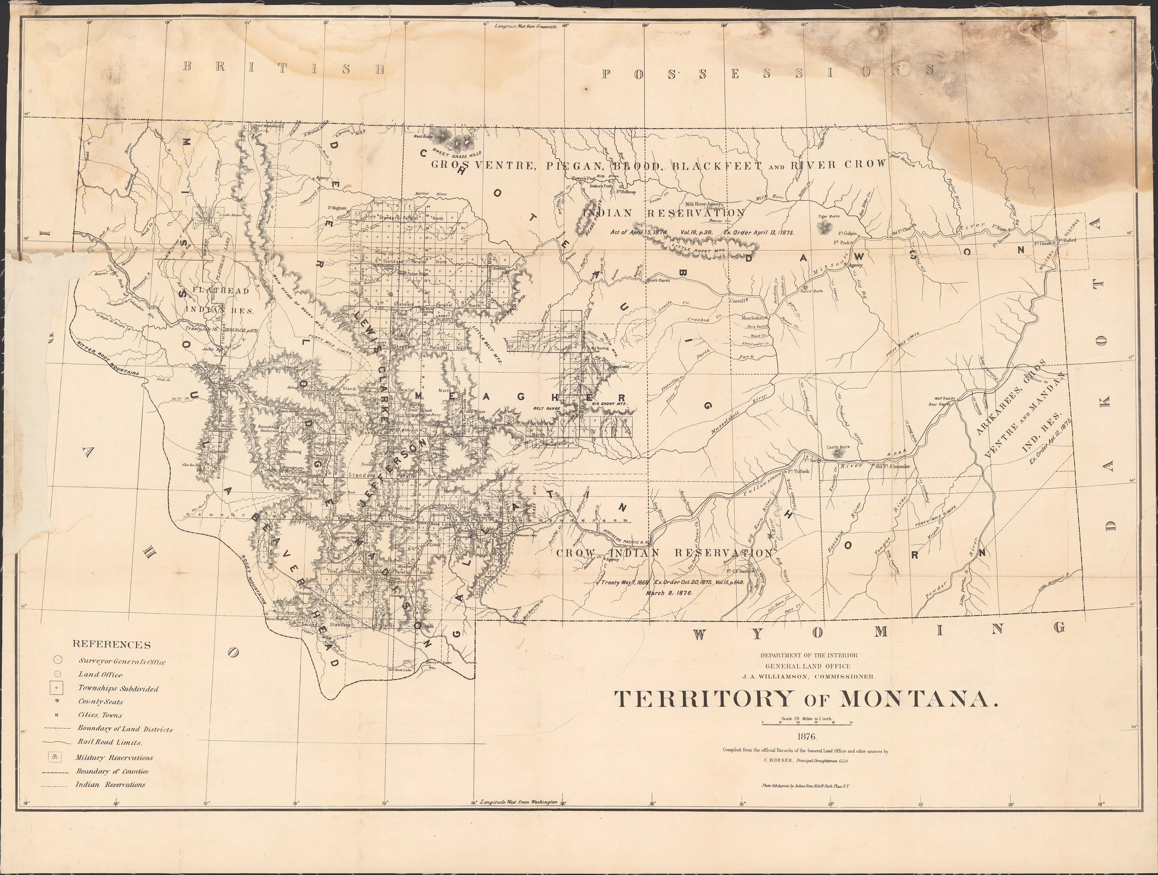
Collection: 978.602 U5813t 1876 - Territory of Montana / __ __compiled from the official records of the General Land Office and other sources by C. Roeser
Folder:
Library
Item:
978.602 U5813t 1876
Date:
1876
Creator:
United States.--General Land Office
Title:
Territory of Montana / __ __compiled from the official records of the General Land Office and other sources by C. Roeser
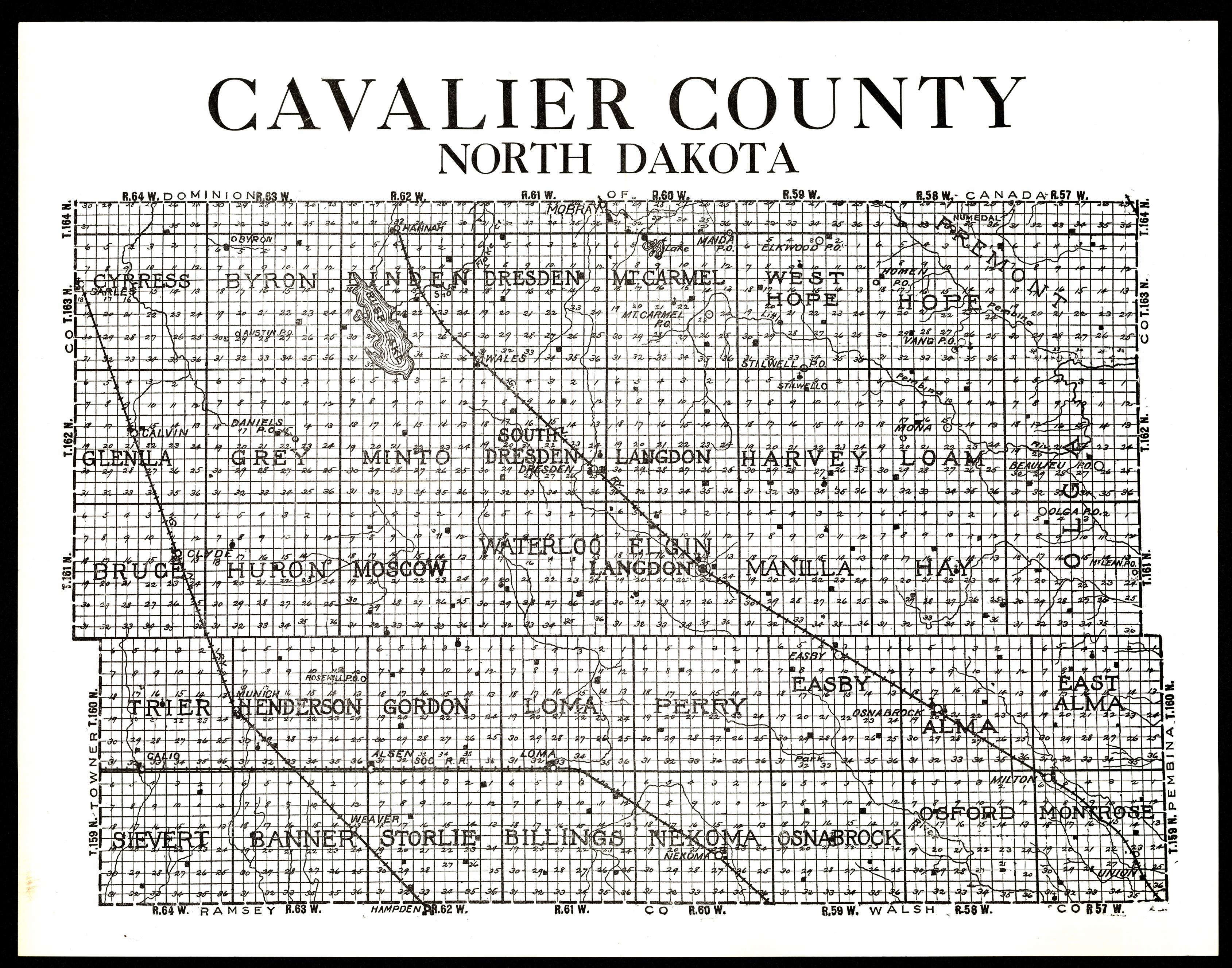
Collection: 978.437 C376 - Cavalier County, North Dakota
Folder:
Library
Item:
978.437 C376
Date:
ca. 1905
Creator:
Title:
Cavalier County, North Dakota
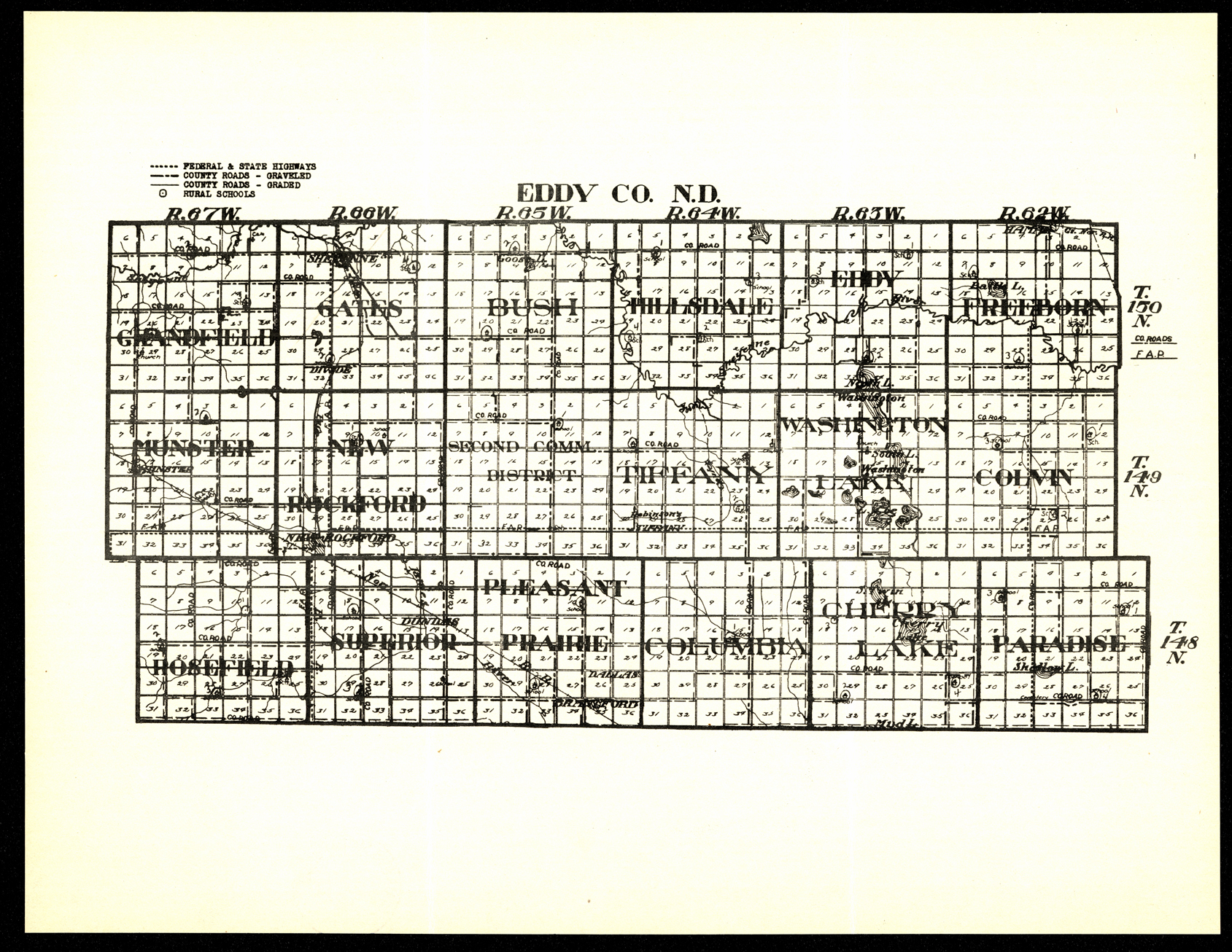
Collection: 978.4512 E213 - Eddy Co., N.D
Folder:
Library
Item:
978.4512 E213
Date:
ca. 1935
Creator:
Title:
Eddy Co., N.D
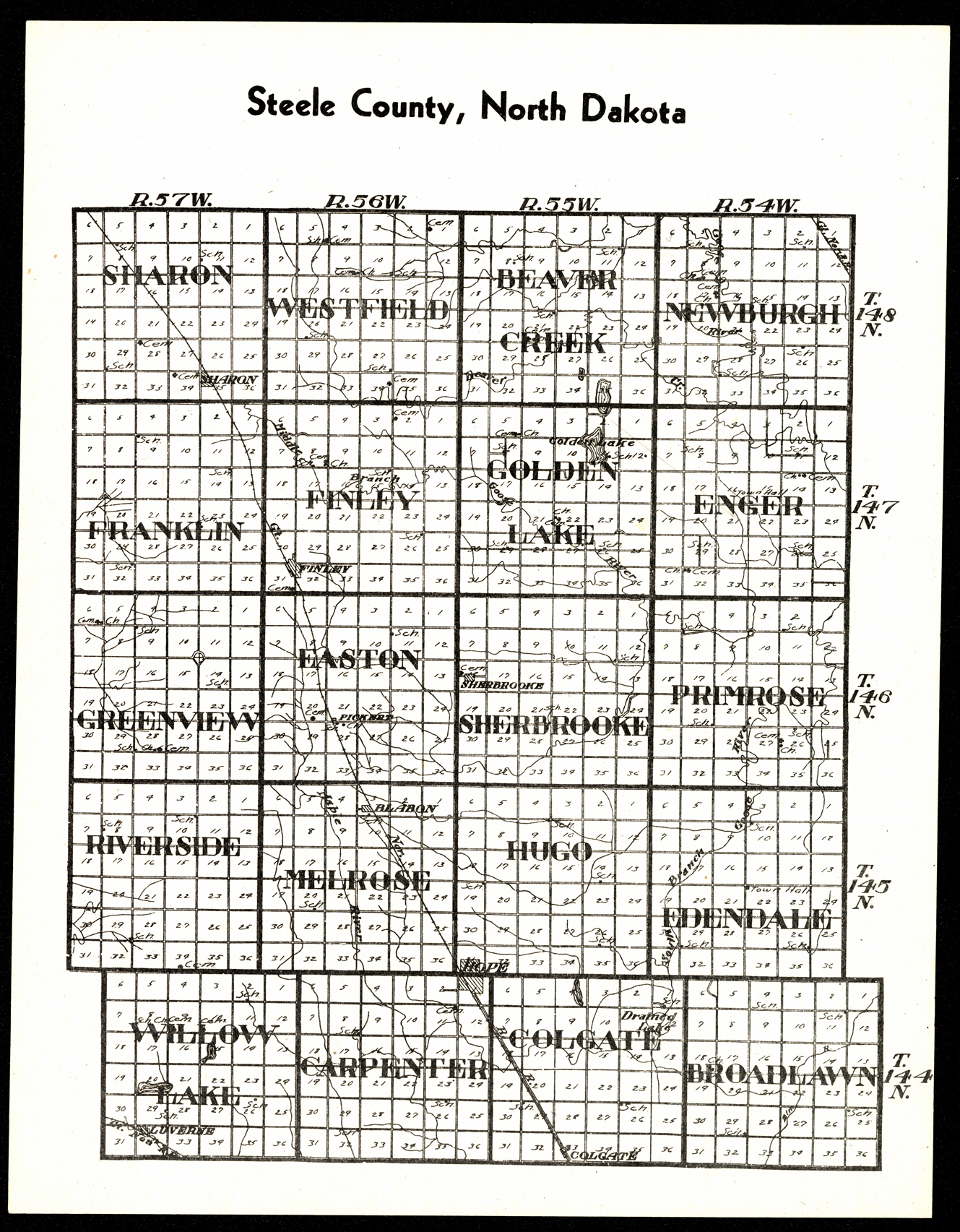
Collection: 978.433 W1117s 1916 - Steele County, North Dakota
Folder:
Library
Item:
978.433 W1117s 1916
Date:
Creator:
W.W. Hixson & Co
Title:
Steele County, North Dakota
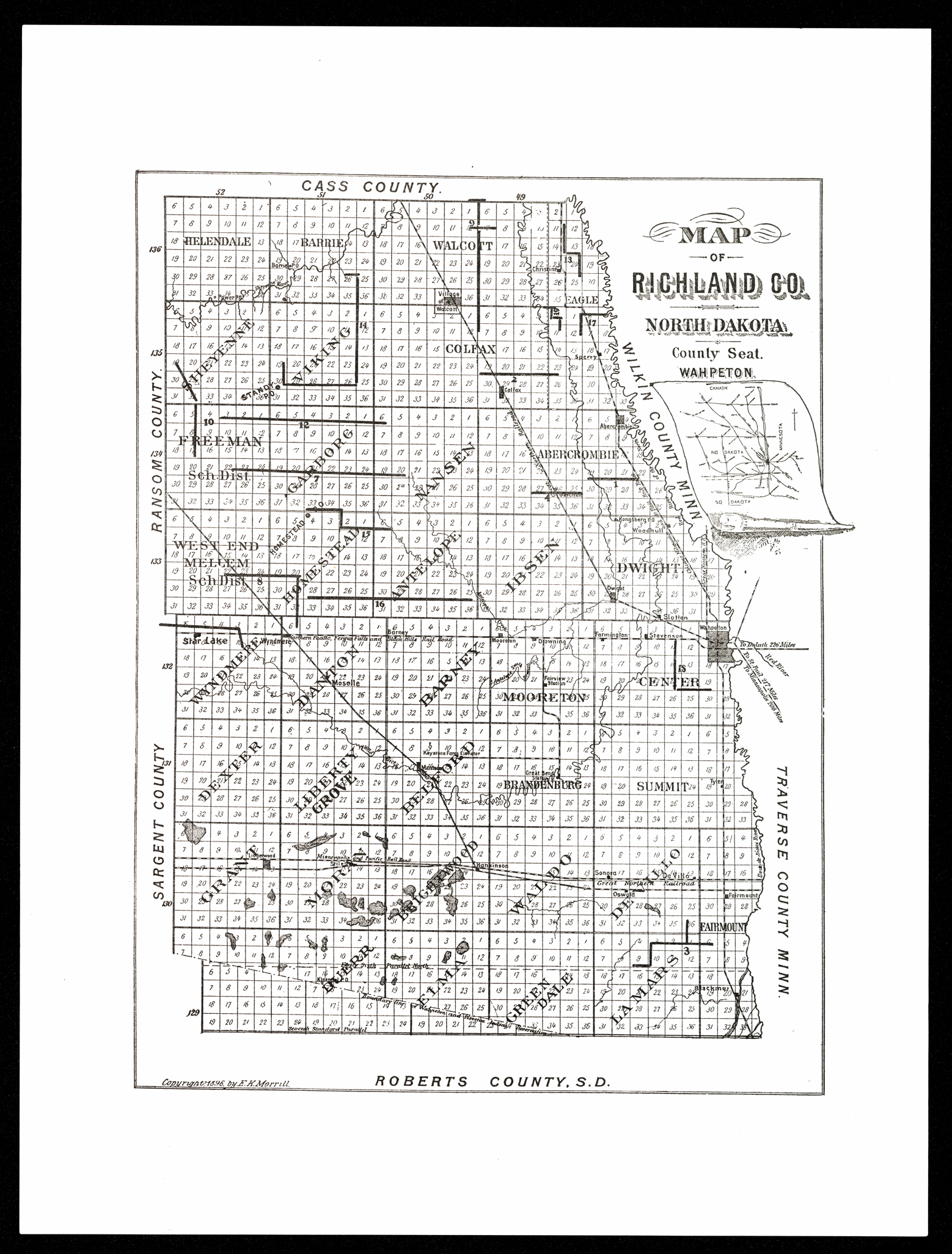
Collection: 978.412 M874m 1896 - Map of Richland Co., North Dakota / __ __E.K. Morrill
Folder:
Library
Item:
978.412 M874m 1896
Date:
Creator:
Morrill, E. K
Title:
Map of Richland Co., North Dakota / __ __E.K. Morrill
Collection: 978.464 T754 1941 - Township, village and city officers of Renville County, North Dakota, 1941
Folder:
Library
Item:
978.464 T754 1941
Date:
Creator:
Title:
Township, village and city officers of Renville County, North Dakota, 1941
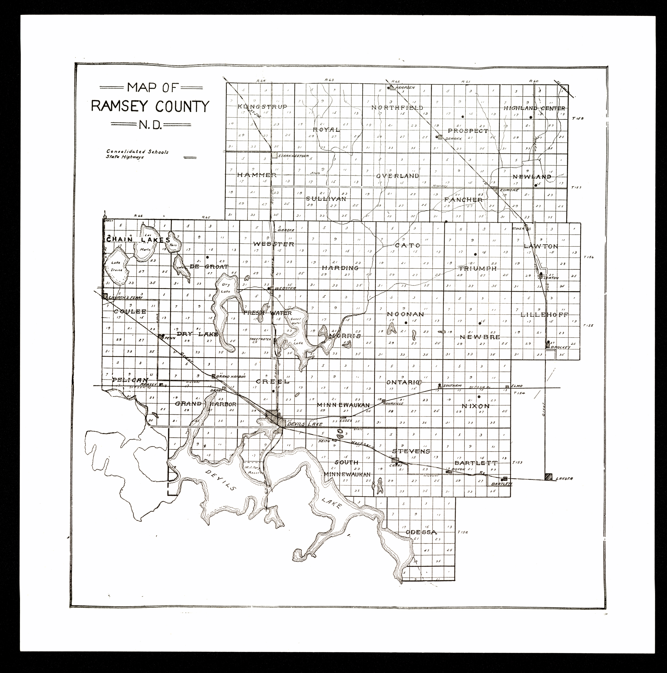
Collection: 978.436 M297 1920 - Map of Ramsey County, N.D
Folder:
Library
Item:
978.436 M297 1920
Date:
1920
Creator:
Title:
Map of Ramsey County, N.D
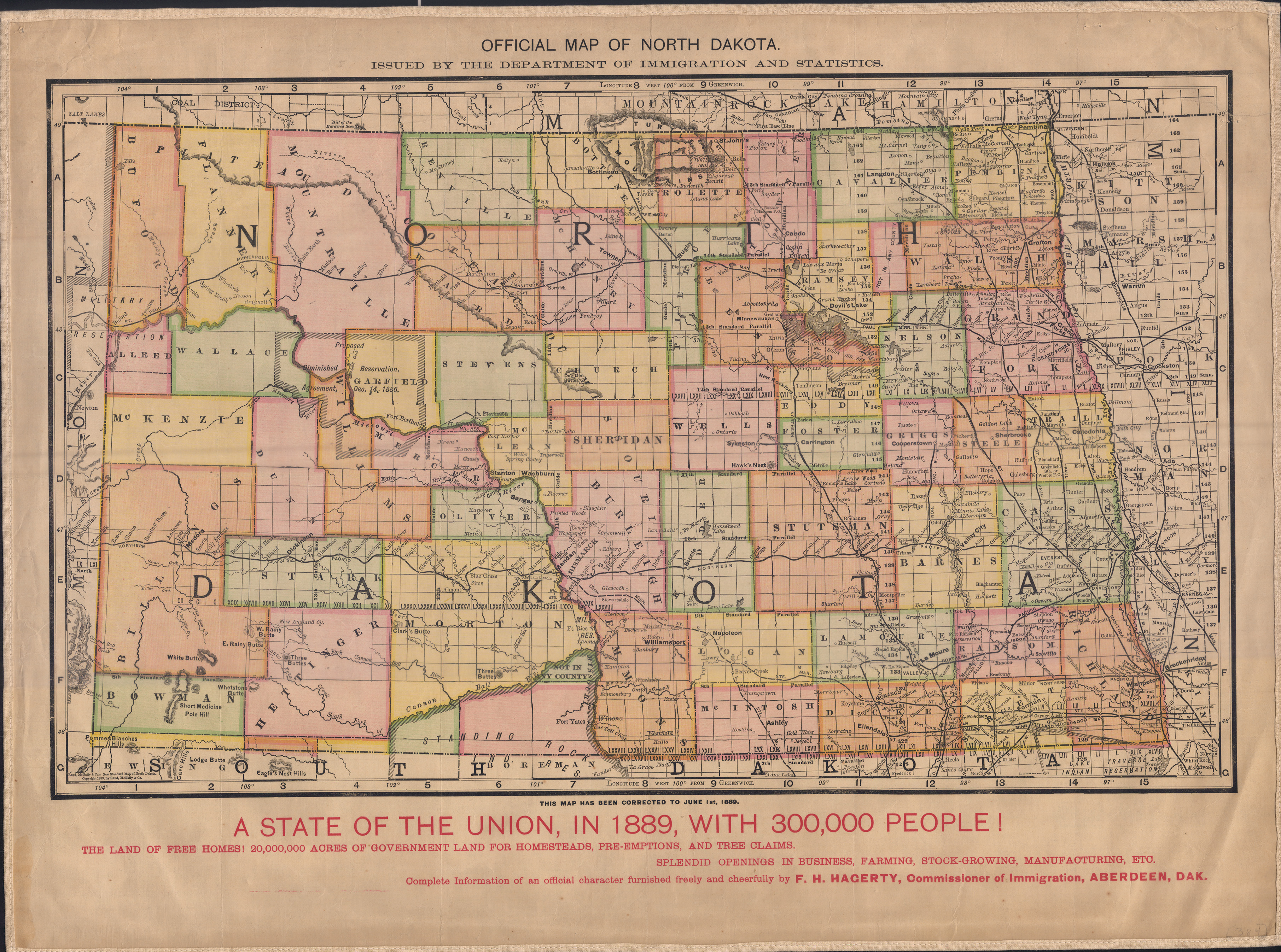
Collection: 978.4031 N864o 1889 - Official map of North Dakota __ __/ issued by the Department of Immigration and Statistics
Folder:
Library
Item:
978.4031 N864o 1889
Date:
1889
Creator:
Dakota Territory.--Department of Immigration and Statistics
Title:
Official map of North Dakota __ __/ issued by the Department of Immigration and Statistics
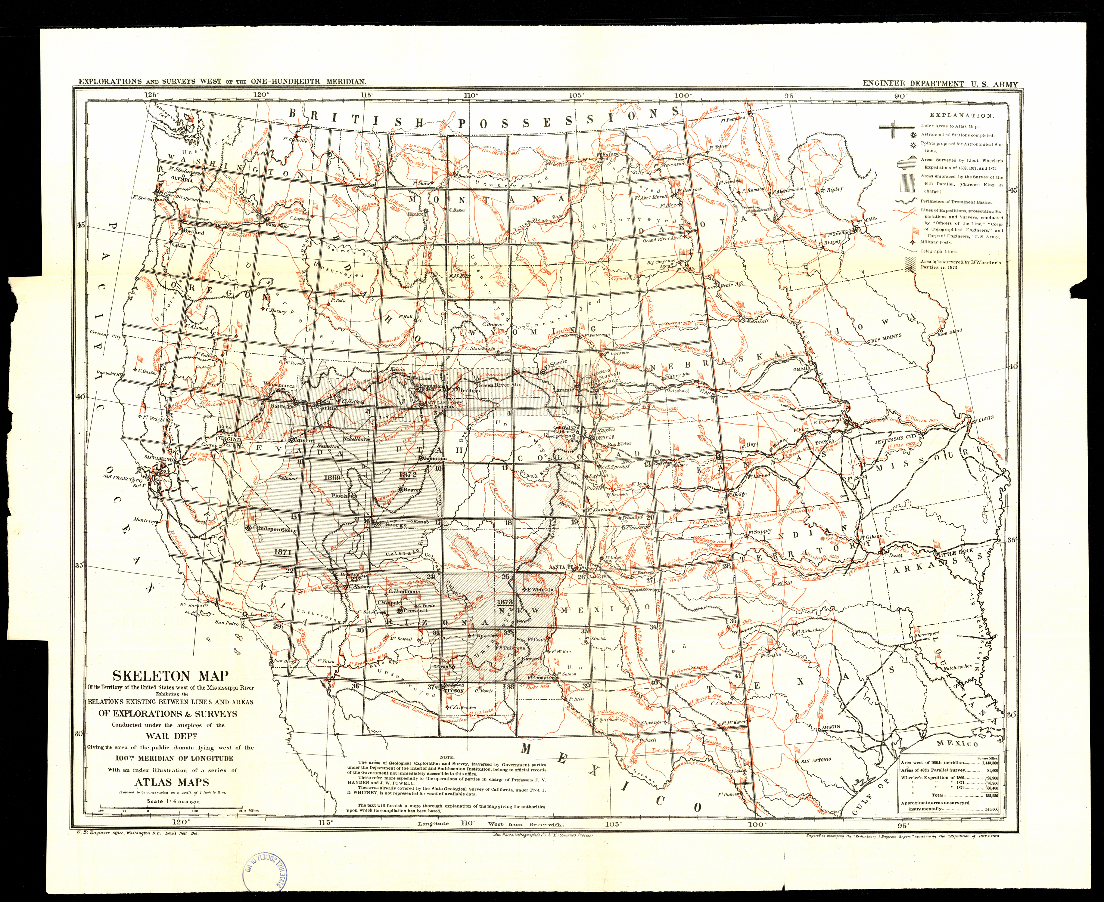
Collection: 978.02 G3452s 1873 - Skeleton map of the territory of the United States west of the Mississippi River : __exhibiting the relations existing between lines and areas of explorations & surveys conducted under the auspices of the War Dept., giving the area of the public domain lying west of the 100th meridian of longitude, with an index illustration of a series of atlas maps proposed to be constructed on a scale of 1 inch to 8 mi
Folder:
Library
Item:
978.02 G3452s 1873
Date:
1873
Creator:
Geographical Surveys West of the 100th Meridian (U.S.)
Title:
Skeleton map of the territory of the United States west of the Mississippi River : __exhibiting the relations existing between lines and areas of explorations & surveys conducted under the auspices of the War Dept., giving the area of the public domain lying west of the 100th meridian of longitude, with an index illustration of a series of atlas maps proposed to be constructed on a scale of 1 inch to 8 mi
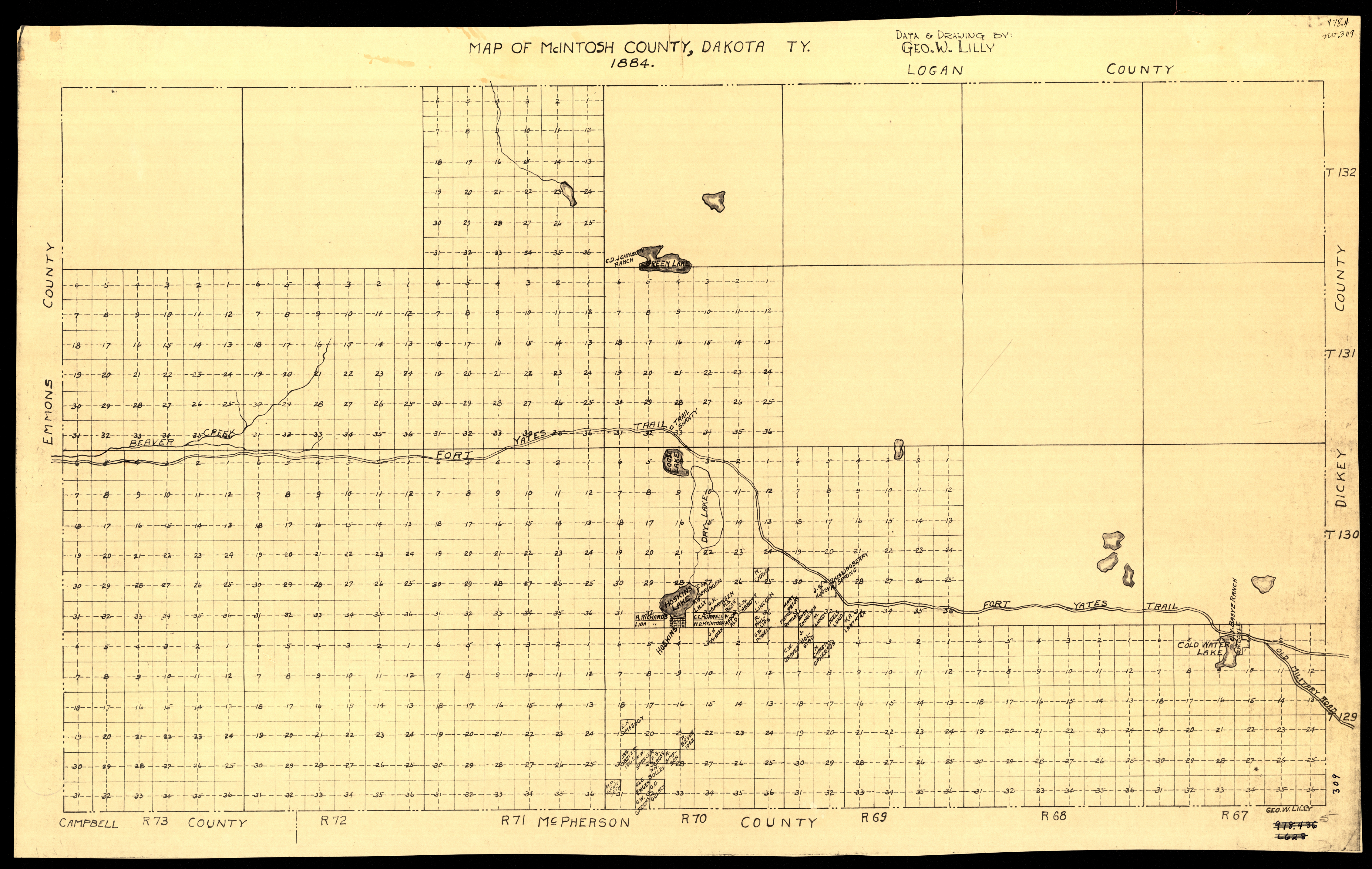
Collection: 978.455 L7297m 1884 - Map of McIntosh County, Dakota Ty. / __ __data & drawing by Geo. W. Lilly
Folder:
Library
Item:
978.455 L7297m 1884
Date:
1884
Creator:
Lilly, George W
Title:
Map of McIntosh County, Dakota Ty. / __ __data & drawing by Geo. W. Lilly
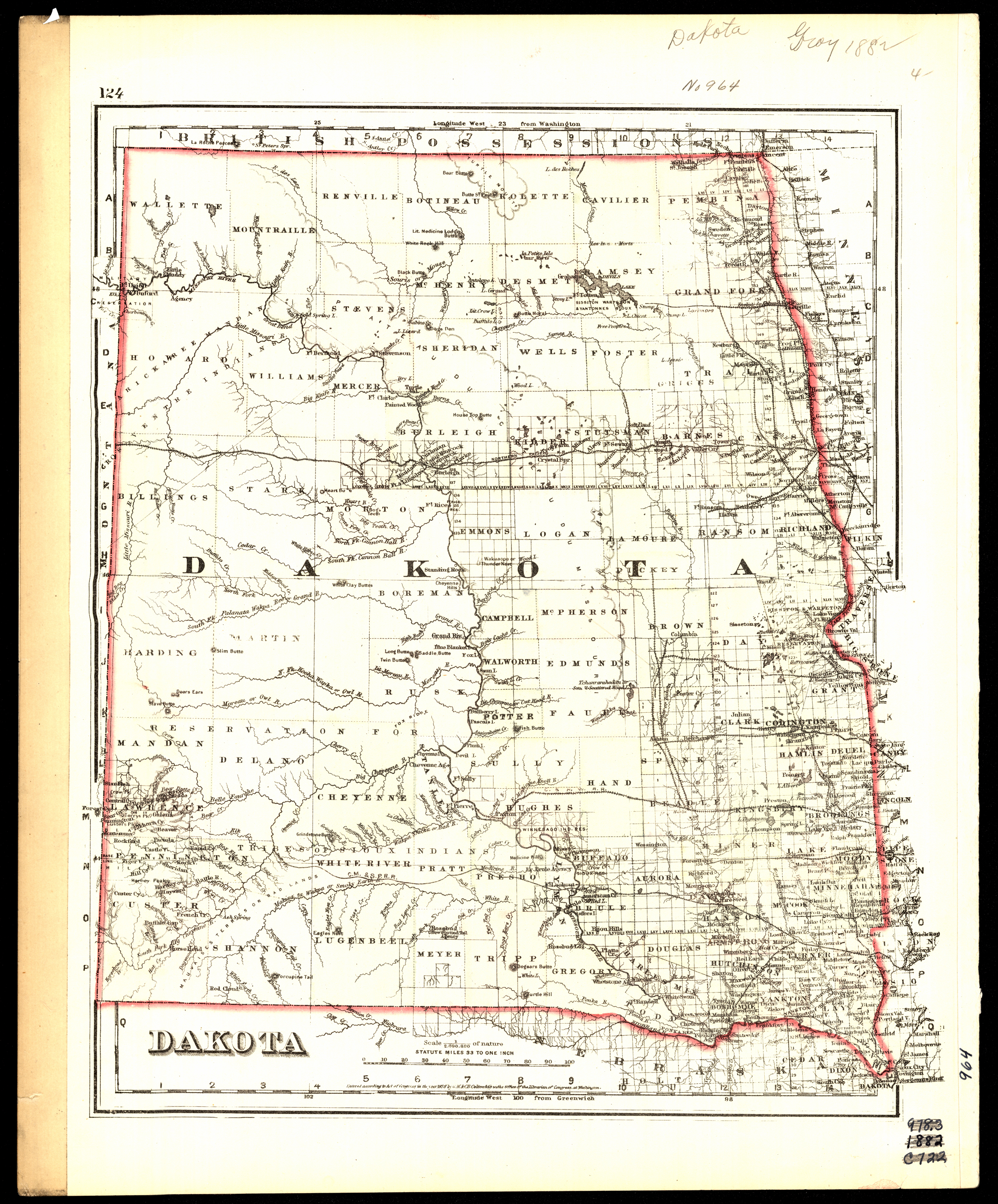
Collection: 978.402 G11d 1884 - Dakota
Folder:
Library
Item:
978.402 G11d 1884
Date:
Copyright 1876 - 1884
Creator:
G.W. & C.B. Colton & Co
Title:
Dakota
Collection: 978.402 G11d 1883 - Dakota
Folder:
Library
Item:
978.402 G11d 1883
Date:
Copyright 1876 - 1883
Creator:
G.W. & C.B. Colton & Co
Title:
Dakota
Collection: 978.402 G11d 1882 - Dakota
Folder:
Library
Item:
978.402 G11d 1882
Date:
1882- copyright 1876
Creator:
G.W. & C.B. Colton & Co
Title:
Dakota
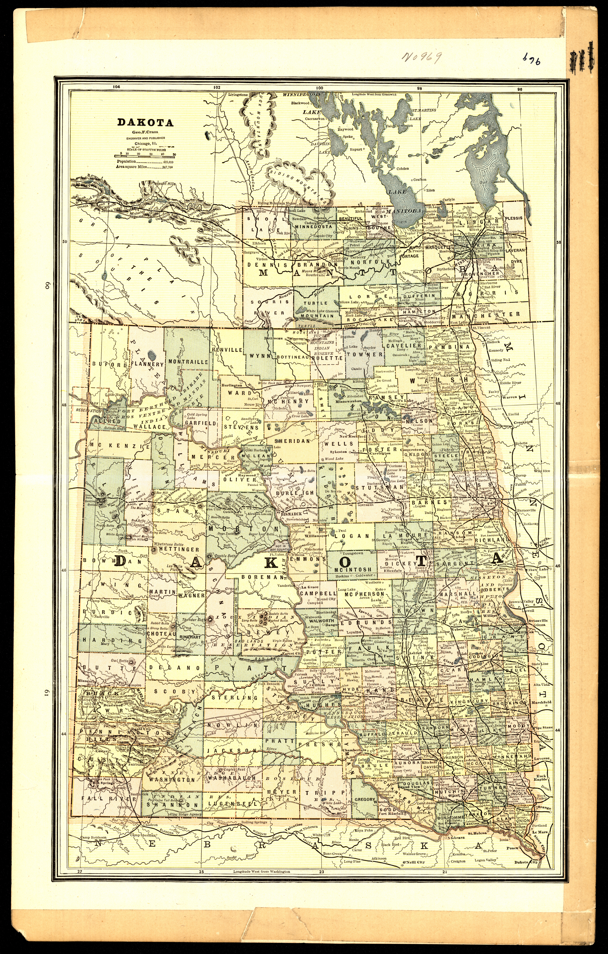
Collection: 978.402 C889d 1887 - Dakota / __ __Geo. F. Cram
Folder:
Library
Item:
978.402 C889d 1887
Date:
1887
Creator:
Cram, George Franklin,--1841-1928
Title:
Dakota / __ __Geo. F. Cram
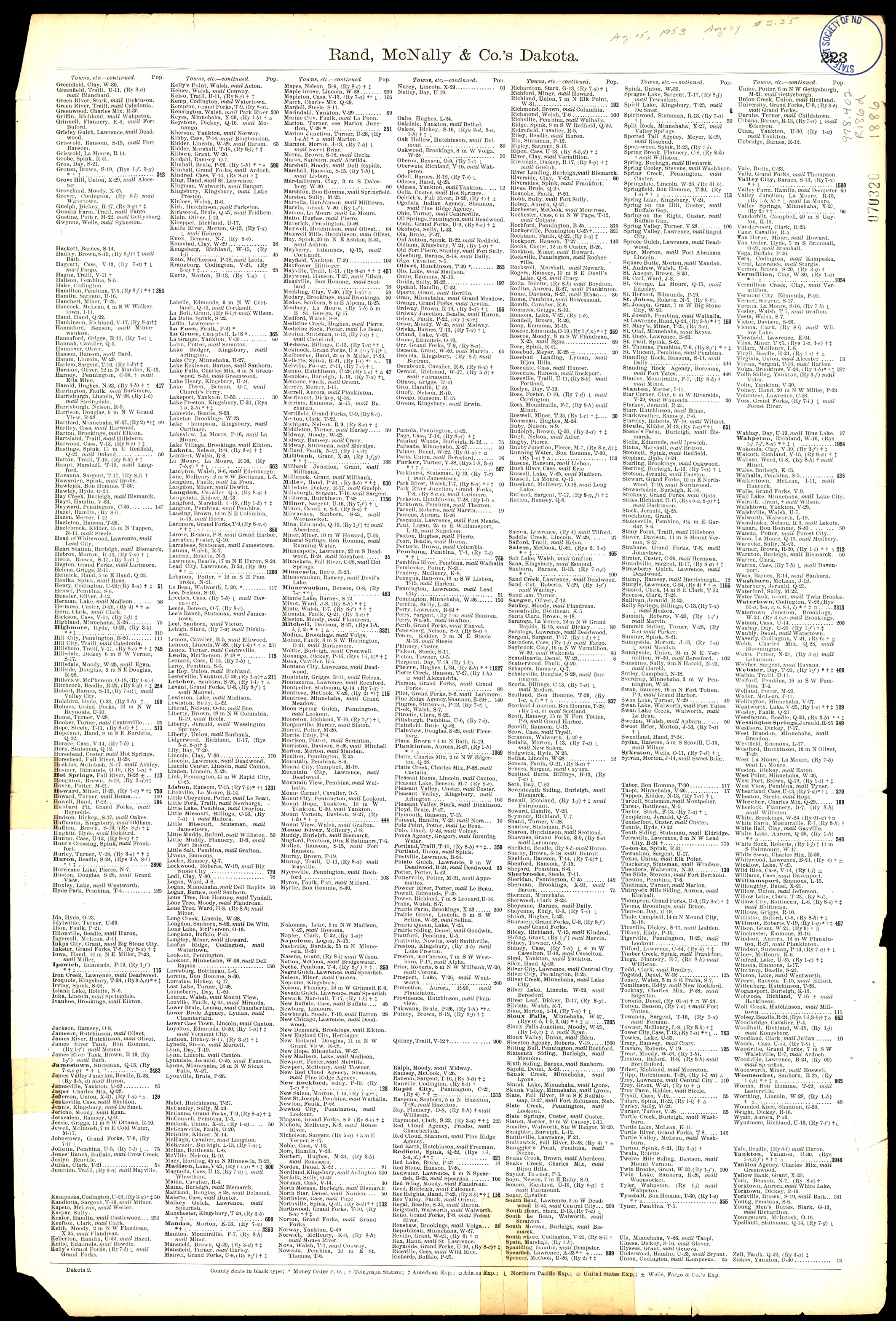
Collection: 978.402 R186d 1886 - Rand, McNally & Co.'s Dakota
Folder:
Library
Item:
978.402 R186d 1886
Date:
Copyright 1886
Creator:
Rand McNally and Company
Title:
Rand, McNally & Co.'s Dakota
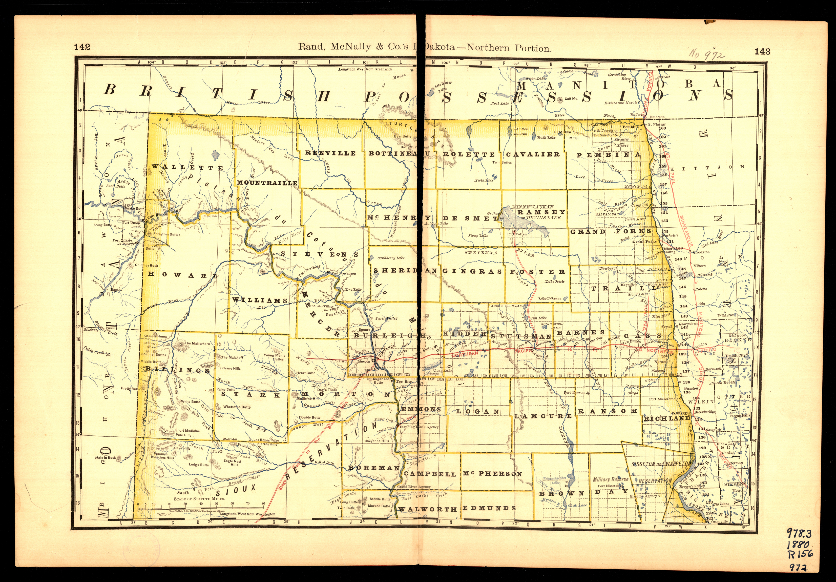
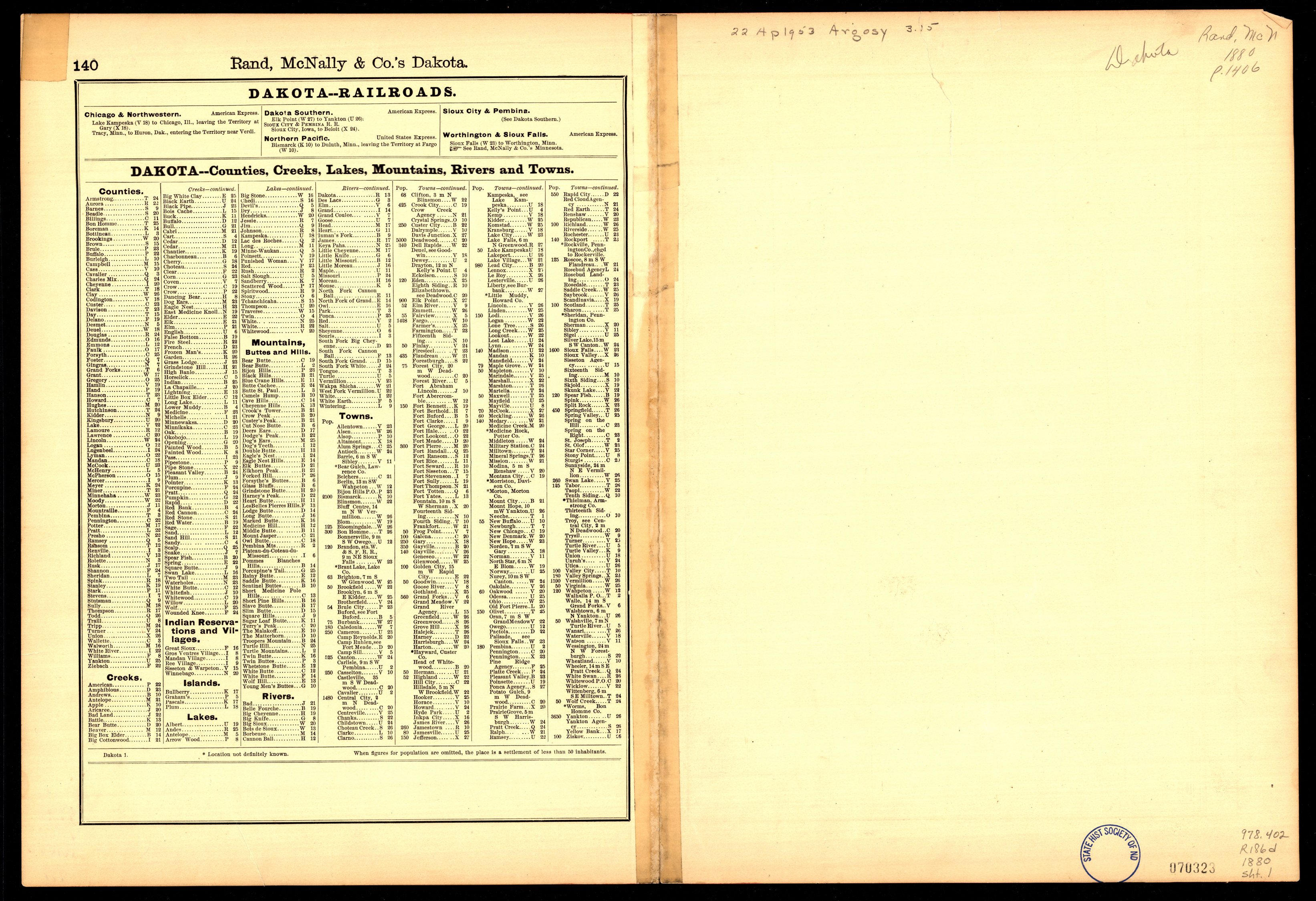
Collection: 978.402 R186d 1880 - Rand, McNally & Co.'s Dakota
Folder:
Library
Item:
978.402 R186d 1880
Date:
1880
Creator:
Rand McNally and Company
Title:
Rand, McNally & Co.'s Dakota
Collection: 978.402 R186d 1880 - Rand, McNally & Co.'s Dakota
Folder:
Library
Item:
978.402 R186d 1880
Date:
1880
Creator:
Rand McNally and Company
Title:
Rand, McNally & Co.'s Dakota
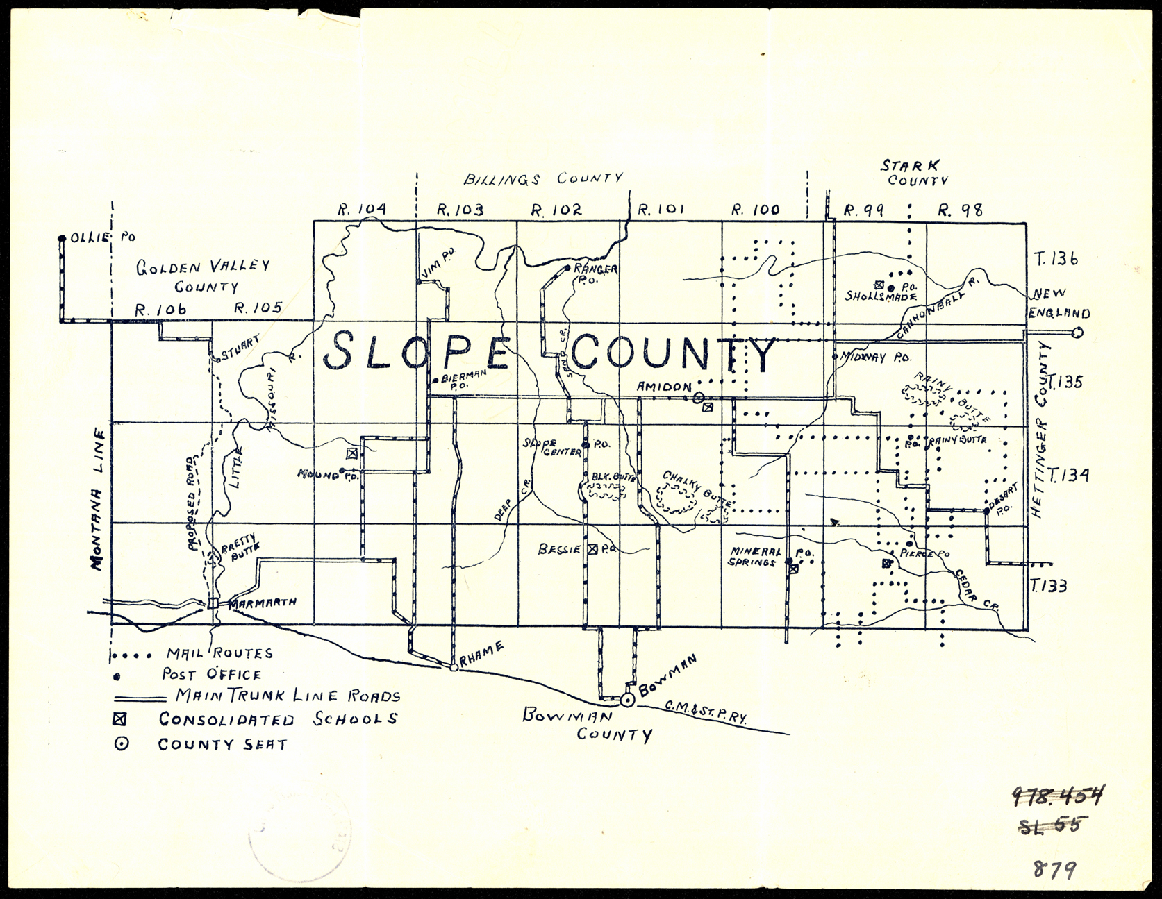
Collection: 978.493 S6346 1925 - Slope County
Folder:
Library
Item:
978.493 S6346 1925
Date:
1925
Creator:
Title:
Slope County
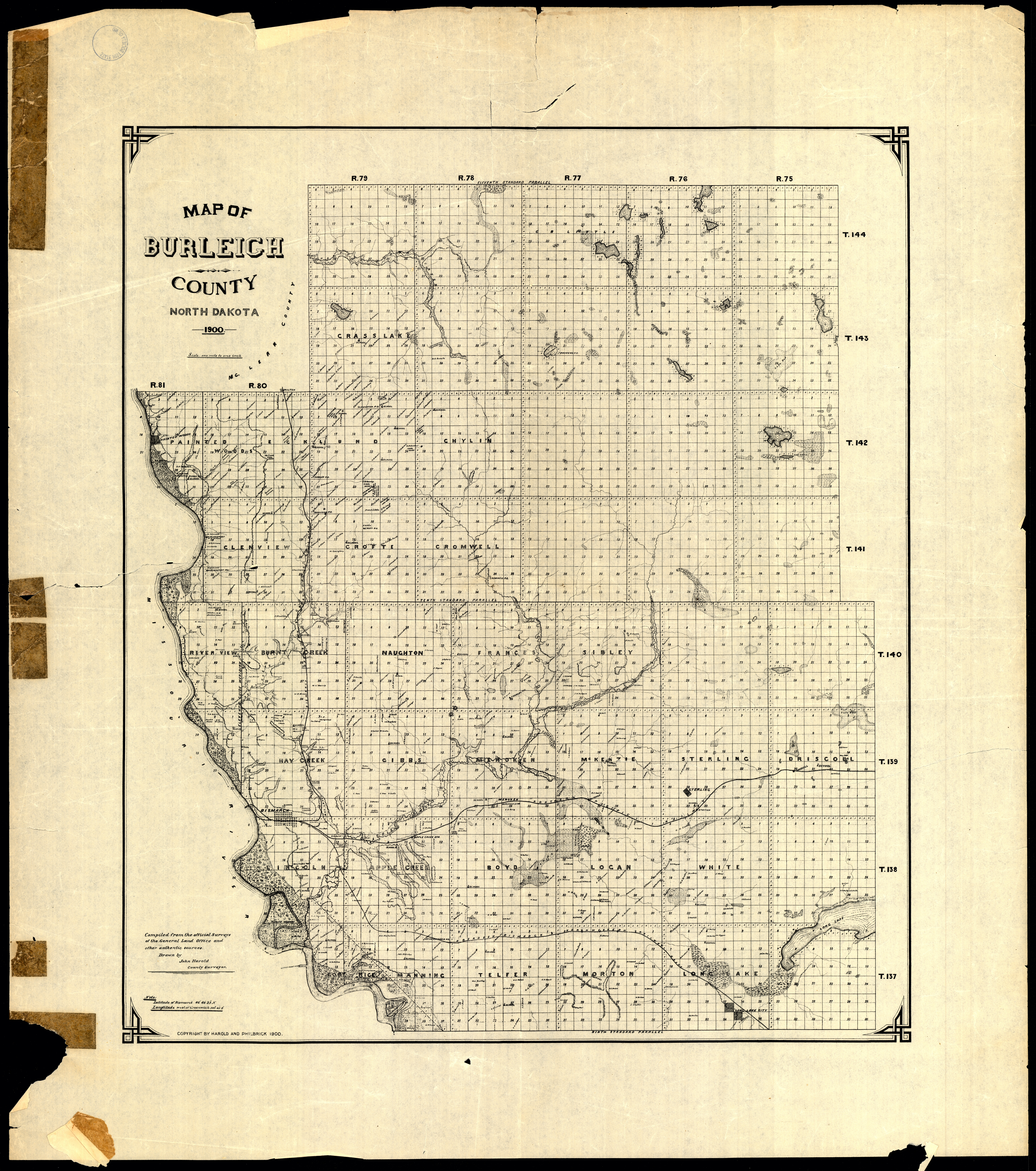
Collection: 978.477 H292m 1900 - Map of Burleigh County, North Dakota / __ __compiled from the official surveys of the General Land Office and other authentic sources; drawn by John Harold
Folder:
Library
Item:
978.477 H292m 1900
Date:
Copyright 1900
Creator:
Harold, John
Title:
Map of Burleigh County, North Dakota / __ __compiled from the official surveys of the General Land Office and other authentic sources; drawn by John Harold
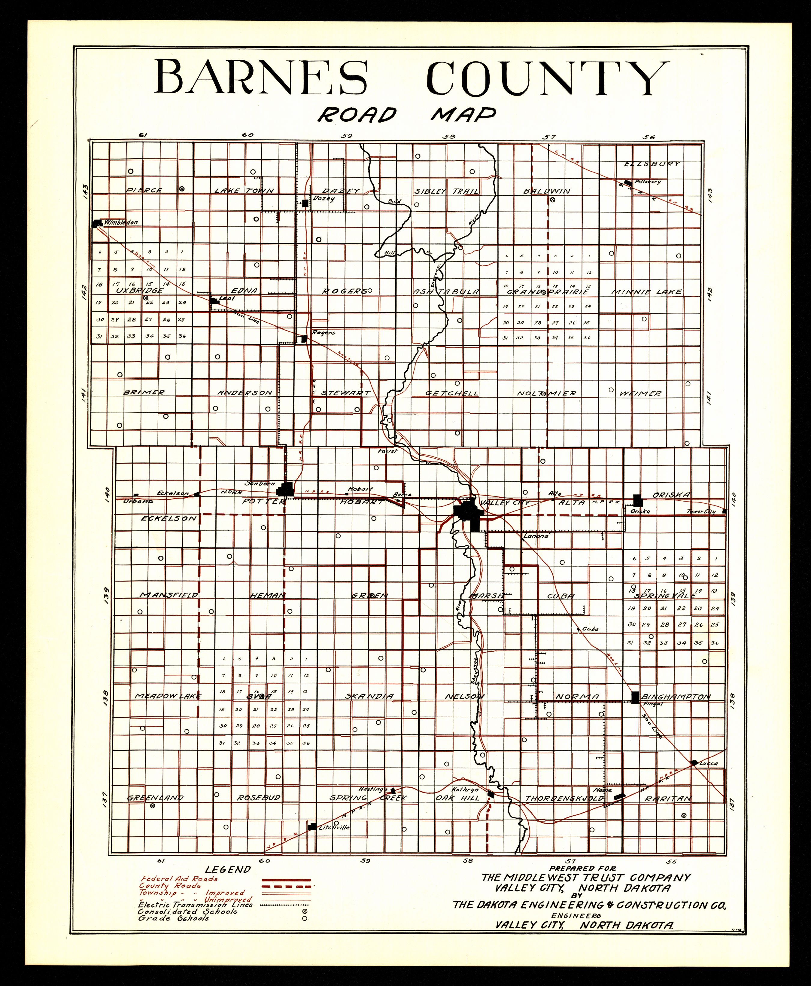
Collection: 978.432 D135r - Barnes County road map / __ __prepared for the Middlewest Trust Company by the Dakota Engineering & Construction Co
Folder:
Library
Item:
978.432 D135r
Date:
Creator:
Dakota Engineering & Construction Co
Title:
Barnes County road map / __ __prepared for the Middlewest Trust Company by the Dakota Engineering & Construction Co
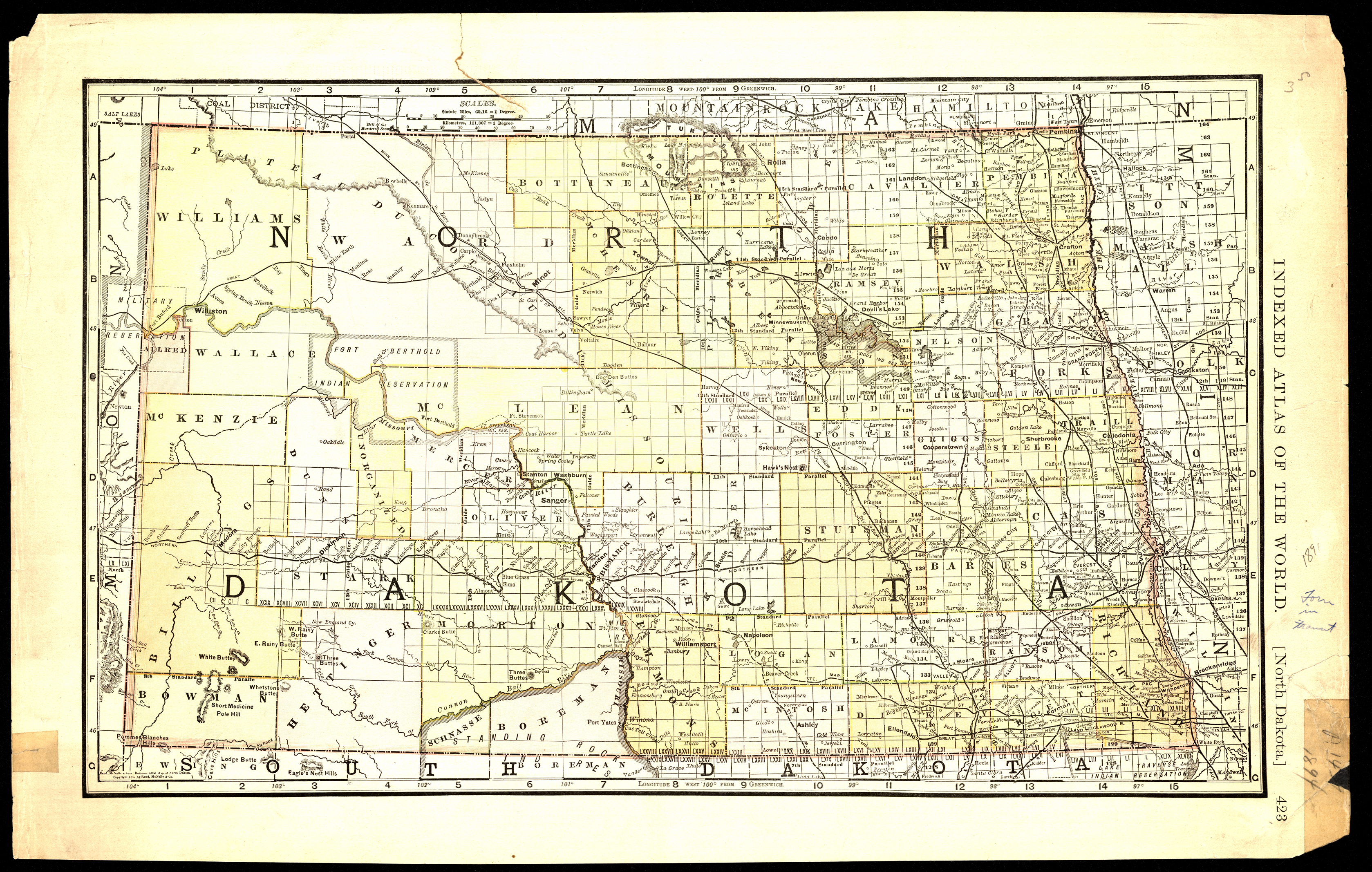
Collection: 978.4031 R186b 1891 - North Dakota
Folder:
Library
Item:
978.4031 R186b 1891
Date:
Copyright 1891
Creator:
Rand McNally and Company
Title:
North Dakota
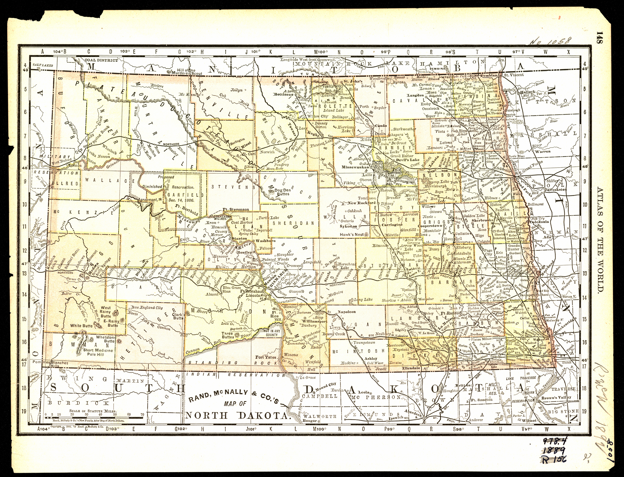
Collection: 978.4031 R186n 1889 - Rand, McNally & Co.'s map of North Dakota
Folder:
Library
Item:
978.4031 R186n 1889
Date:
Copyright 1889
Creator:
Rand McNally and Company
Title:
Rand, McNally & Co.'s map of North Dakota
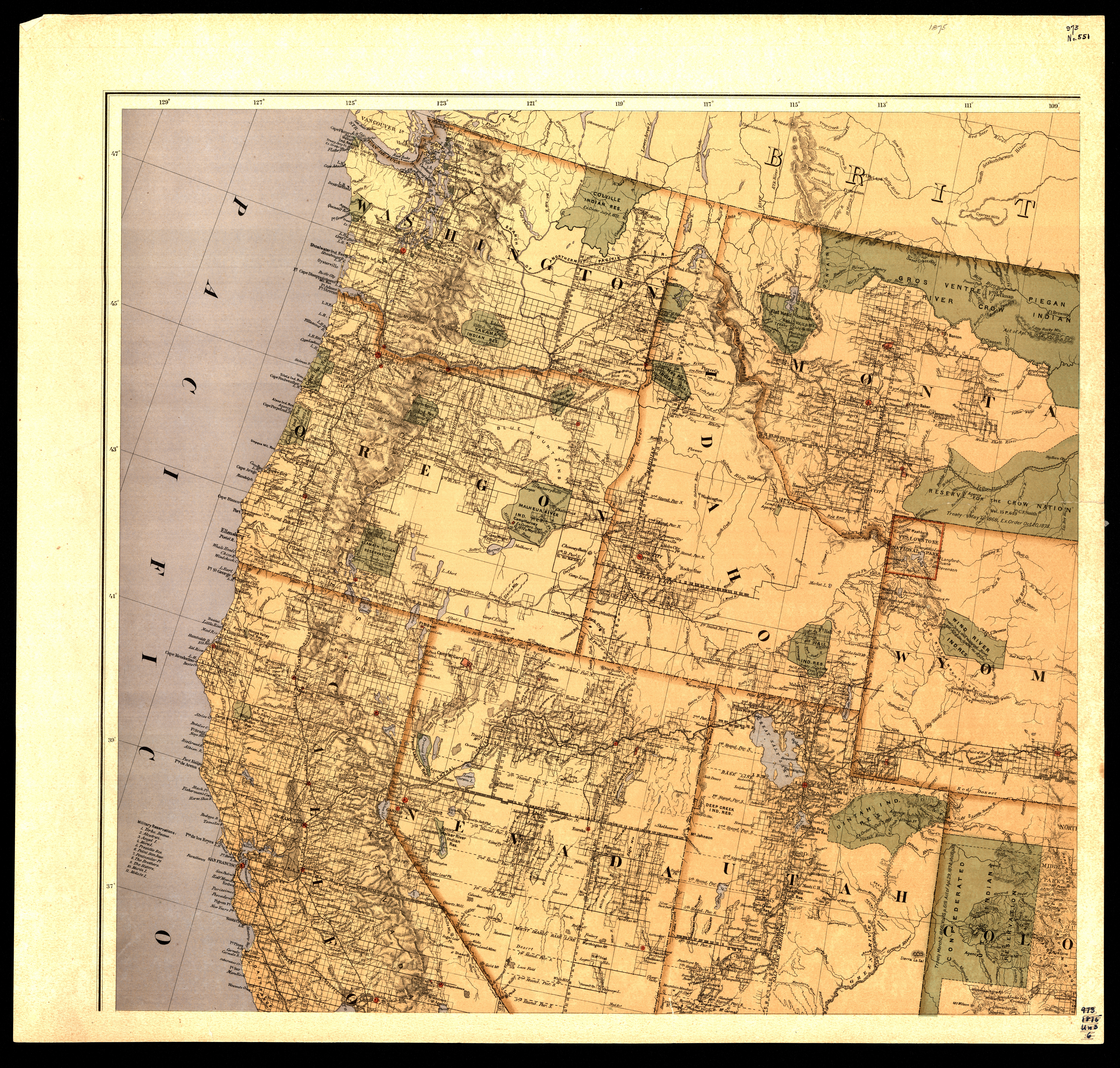
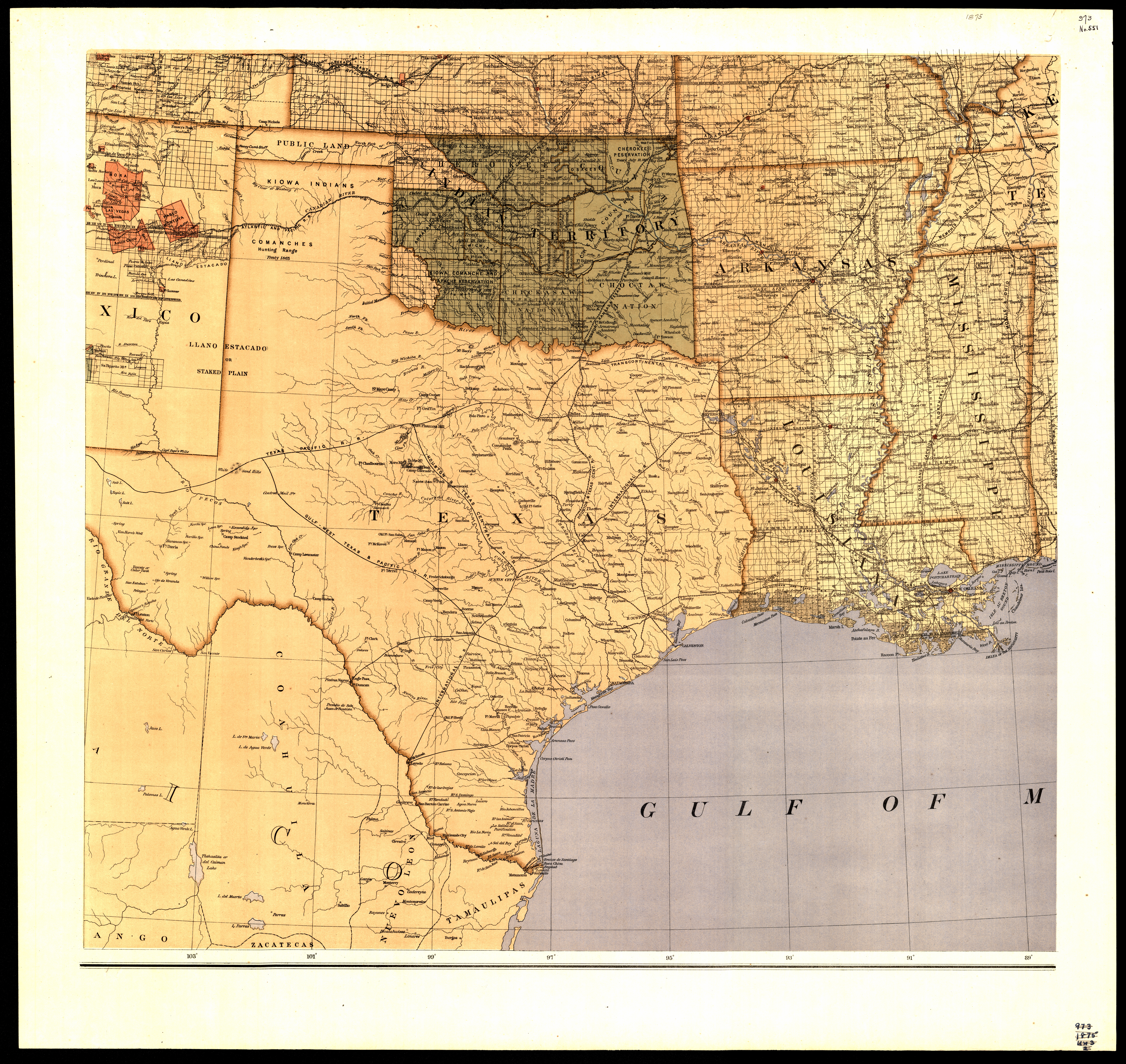
Collection: 973.82 U5813m 1875 - Map of the United States and territories : __showing the extent of public surveys, Indian and military reservations, land grant r.r., railroads, canals, and other details / __compiled from the official surveys of the General Land Office, and other authentic sources, under the direction of the Hon. S.S. Burdett
Folder:
Library
Item:
973.82 U5813m 1875
Date:
1875
Creator:
United States.--Department of the Interior
Title:
Map of the United States and territories : __showing the extent of public surveys, Indian and military reservations, land grant r.r., railroads, canals, and other details / __compiled from the official surveys of the General Land Office, and other authentic sources, under the direction of the Hon. S.S. Burdett