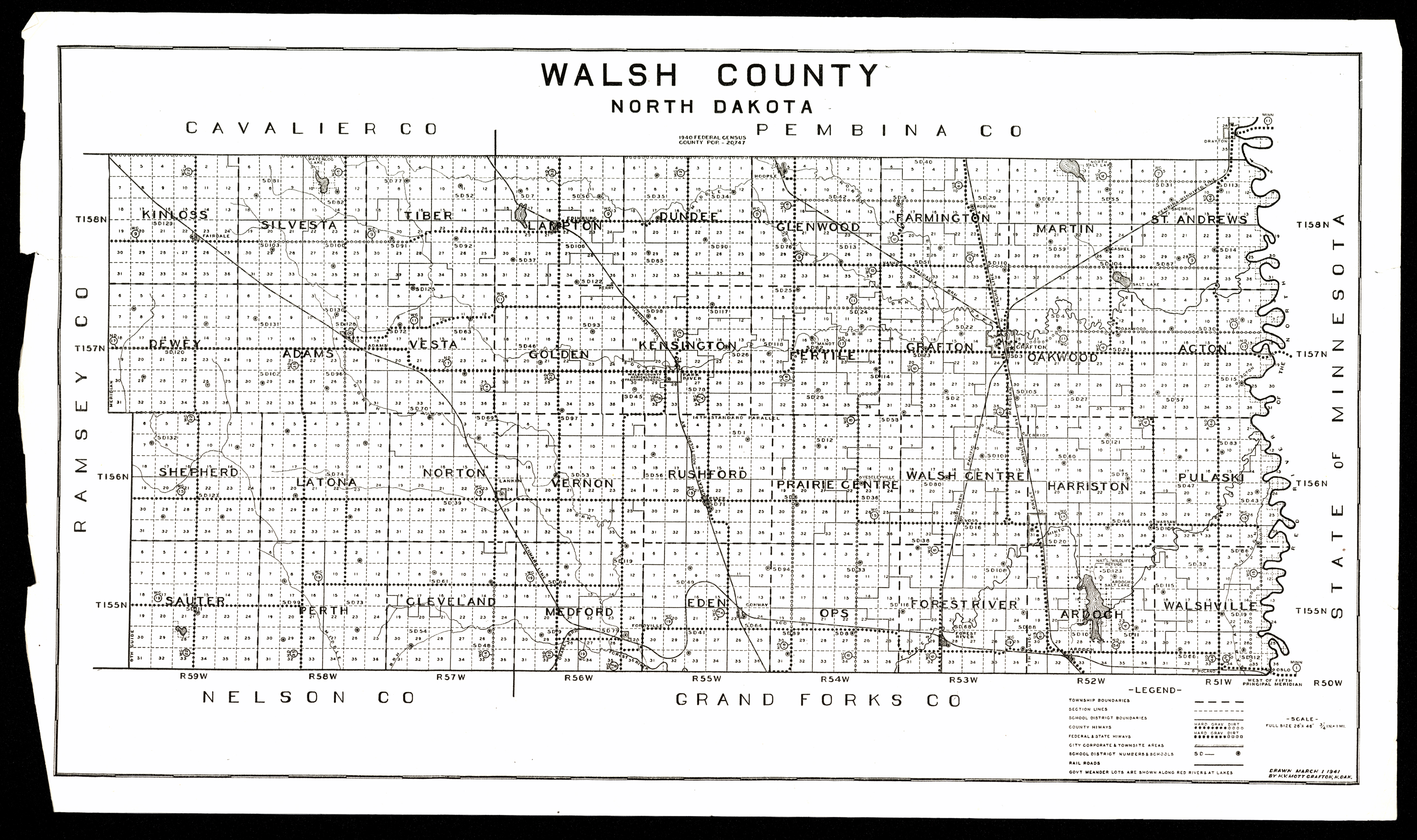
Collection: 978.418 M92w 1941 - Walsh County, North Dakota / __ __drawn by H.V. Mott
Folder:
Library
Item:
978.418 M92w 1941
Date:
1941
Creator:
Mott, Henry Valentine,--1890-
Title:
Walsh County, North Dakota / __ __drawn by H.V. Mott
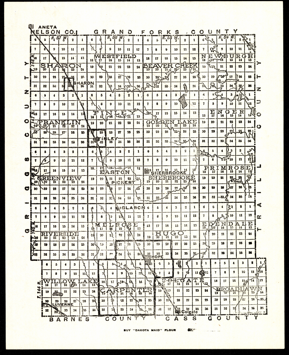
Collection: 978.433 M297 - [Map of Steele County, North Dakota]
Folder:
Library
Item:
978.433 M297
Date:
ca. 1950
Creator:
Title:
[Map of Steele County, North Dakota]
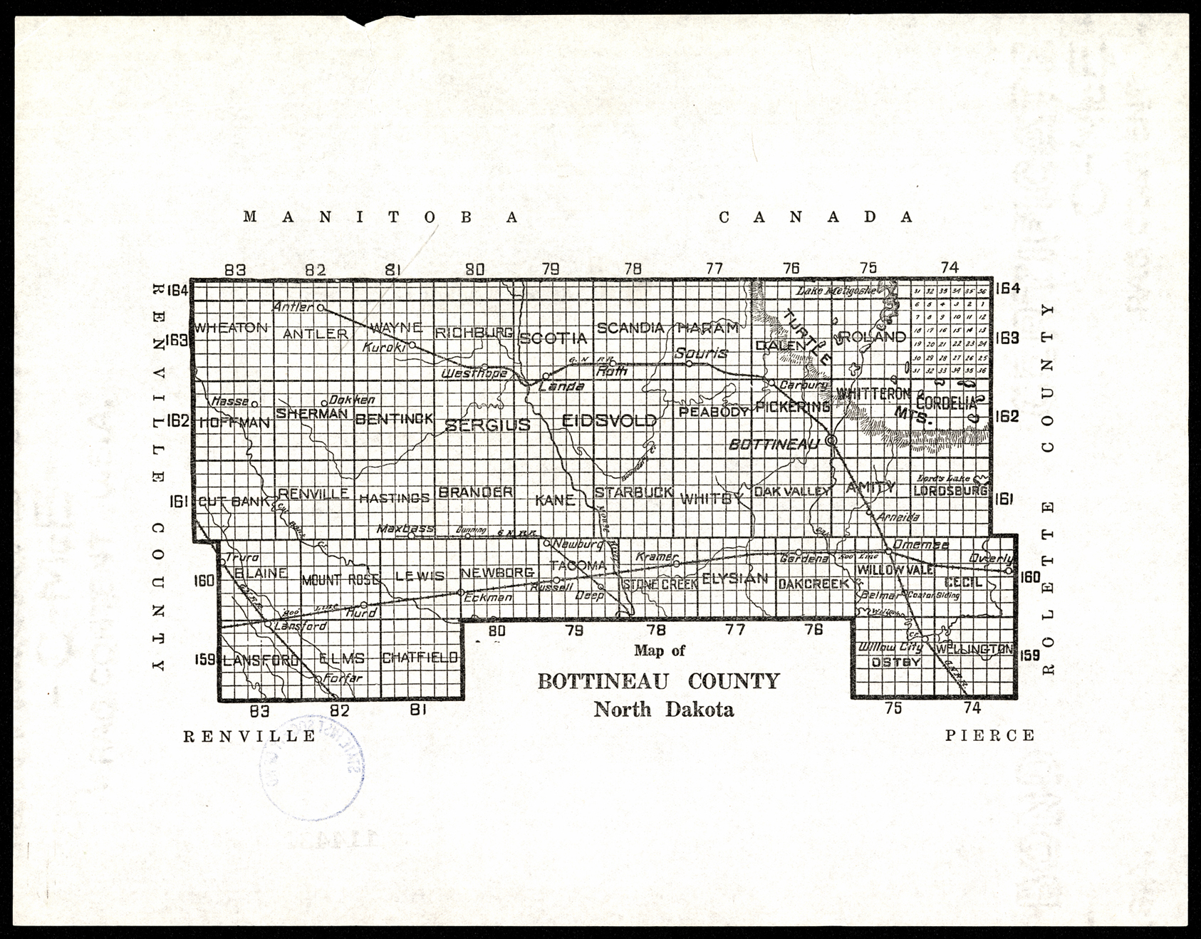
Collection: 978.461 M297 - Map of Bottineau County, North Dakota
Folder:
Library
Item:
978.461 M297
Date:
ca. 1950
Creator:
Title:
Map of Bottineau County, North Dakota
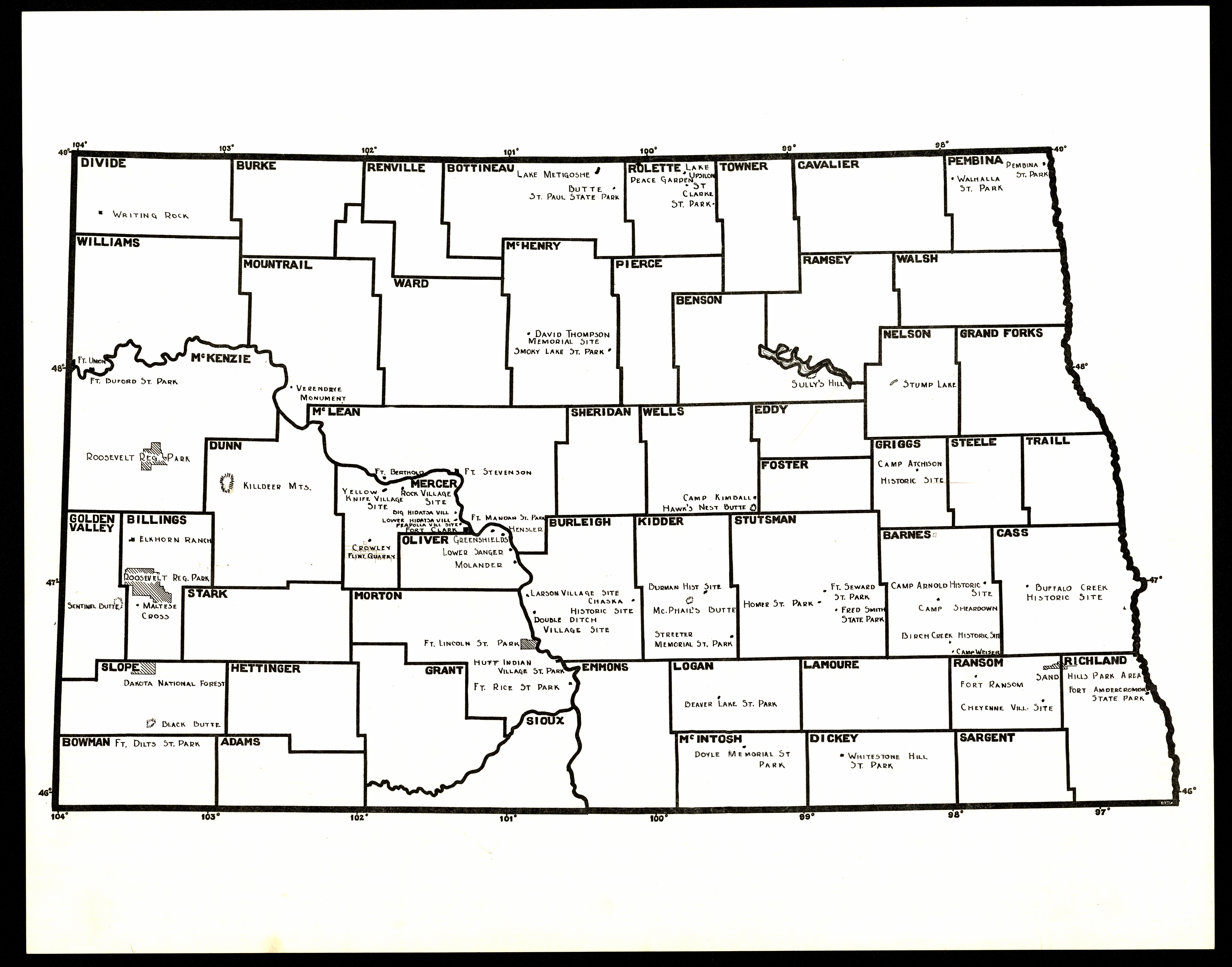
Collection: 978.4 M297 - [Map of North Dakota state parks and historic sites]
Folder:
Library
Item:
978.4 M297
Date:
1920 - 1933
Creator:
Title:
[Map of North Dakota state parks and historic sites]
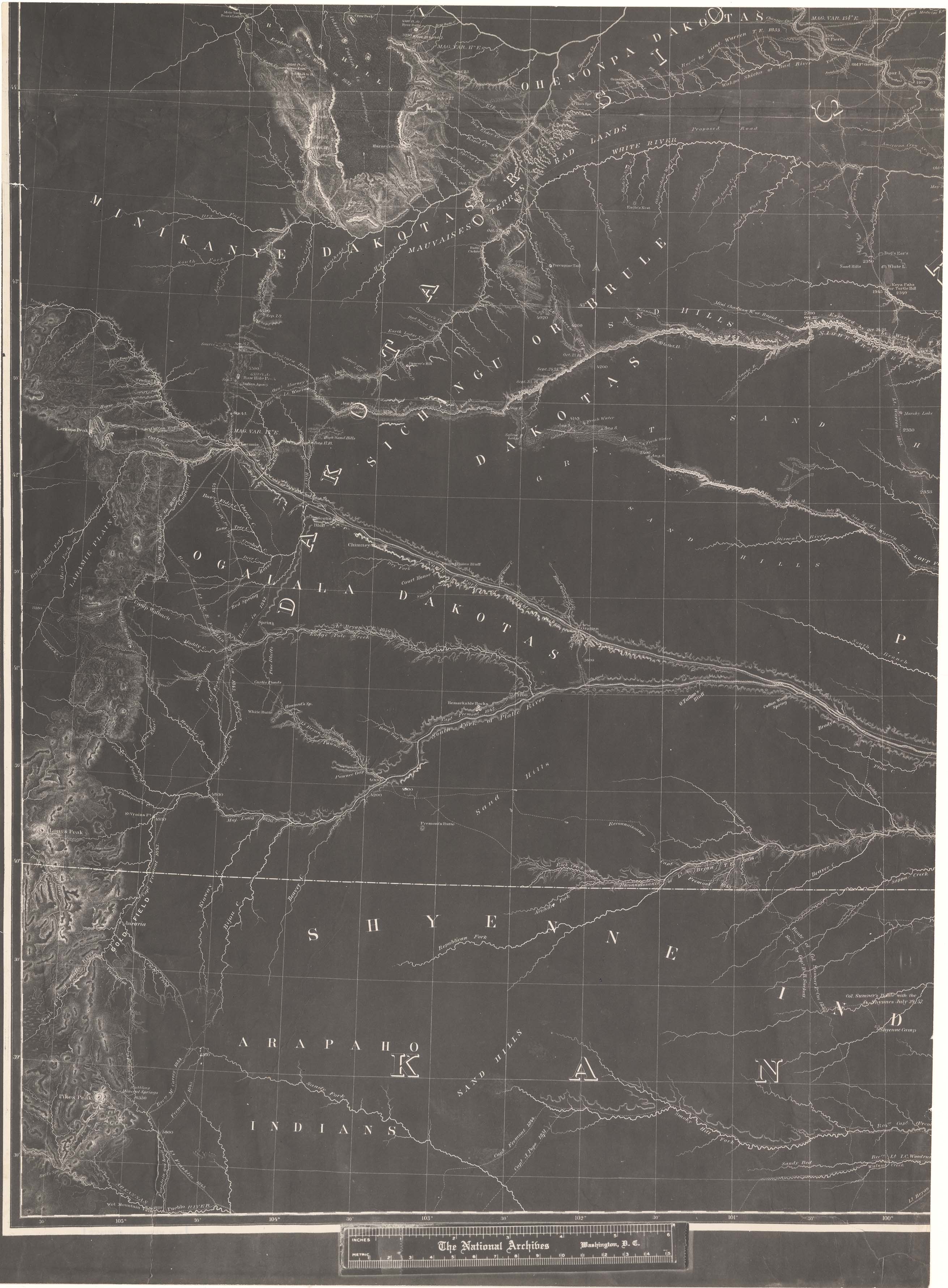
Collection: 978.02 W286m 1858 - Military map of Nebraska and Dakota / __ __by Lieut. G.K. Warren from the explorations made by him in 1855 & while attached to the staff of Brev. Brig. Gen. W.S. Harney, commg. Sioux Expedn. and in 1857 under the direction of the Office Explns. and Surveys, Capt. A.A. Humphreys in charge ; exhibiting also routes reconnoitred & surveyed by Capts. Lewis & Clark, U.S.A. ... [et al.]
Folder:
Library
Item:
978.02 W286m 1858
Date:
1858
Creator:
Warren, G. K.--(Gouverneur Kemble),--1830-1882
Title:
Military map of Nebraska and Dakota / __ __by Lieut. G.K. Warren from the explorations made by him in 1855 & while attached to the staff of Brev. Brig. Gen. W.S. Harney, commg. Sioux Expedn. and in 1857 under the direction of the Office Explns. and Surveys, Capt. A.A. Humphreys in charge ; exhibiting also routes reconnoitred & surveyed by Capts. Lewis & Clark, U.S.A. ... [et al.]
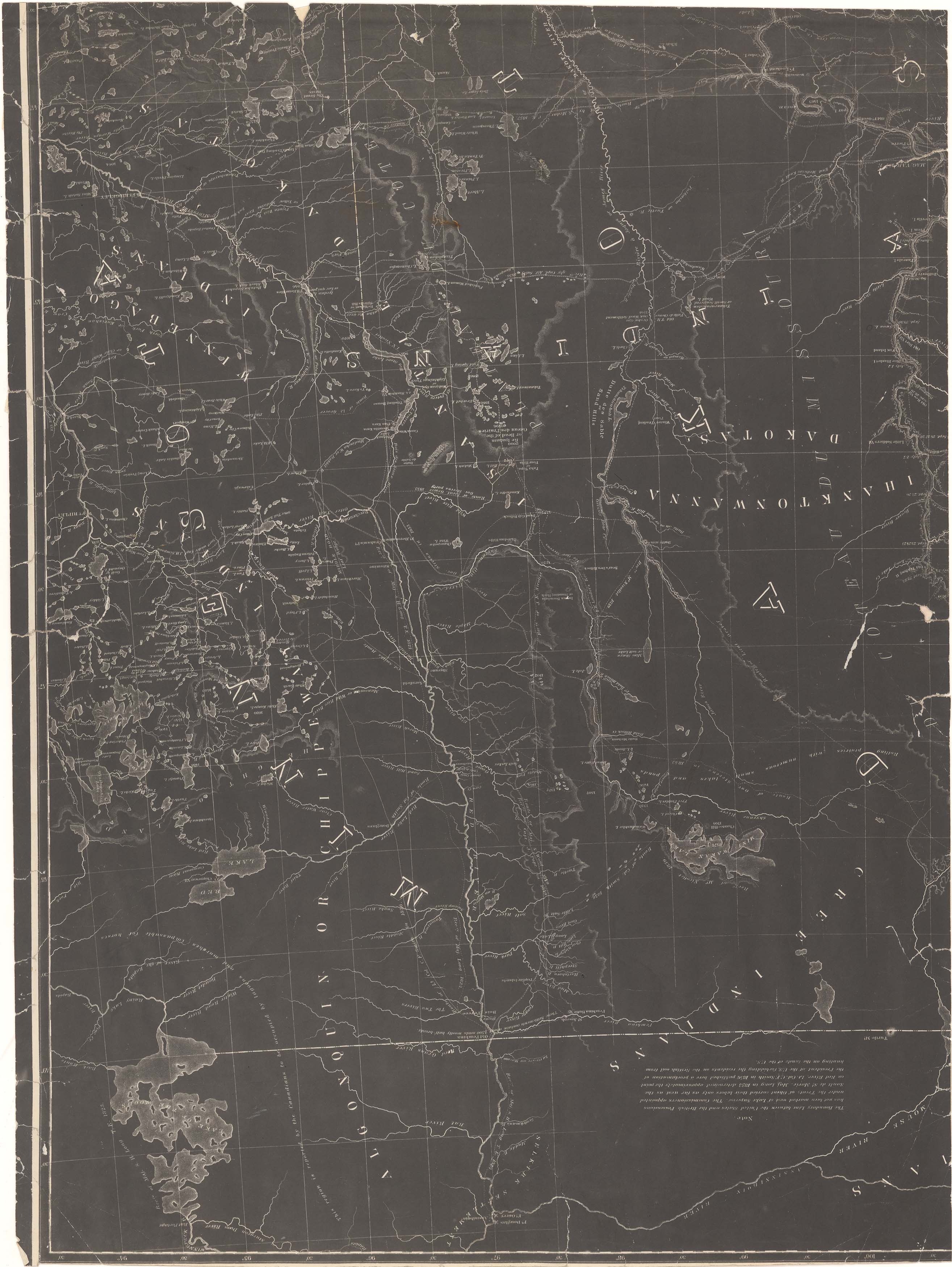
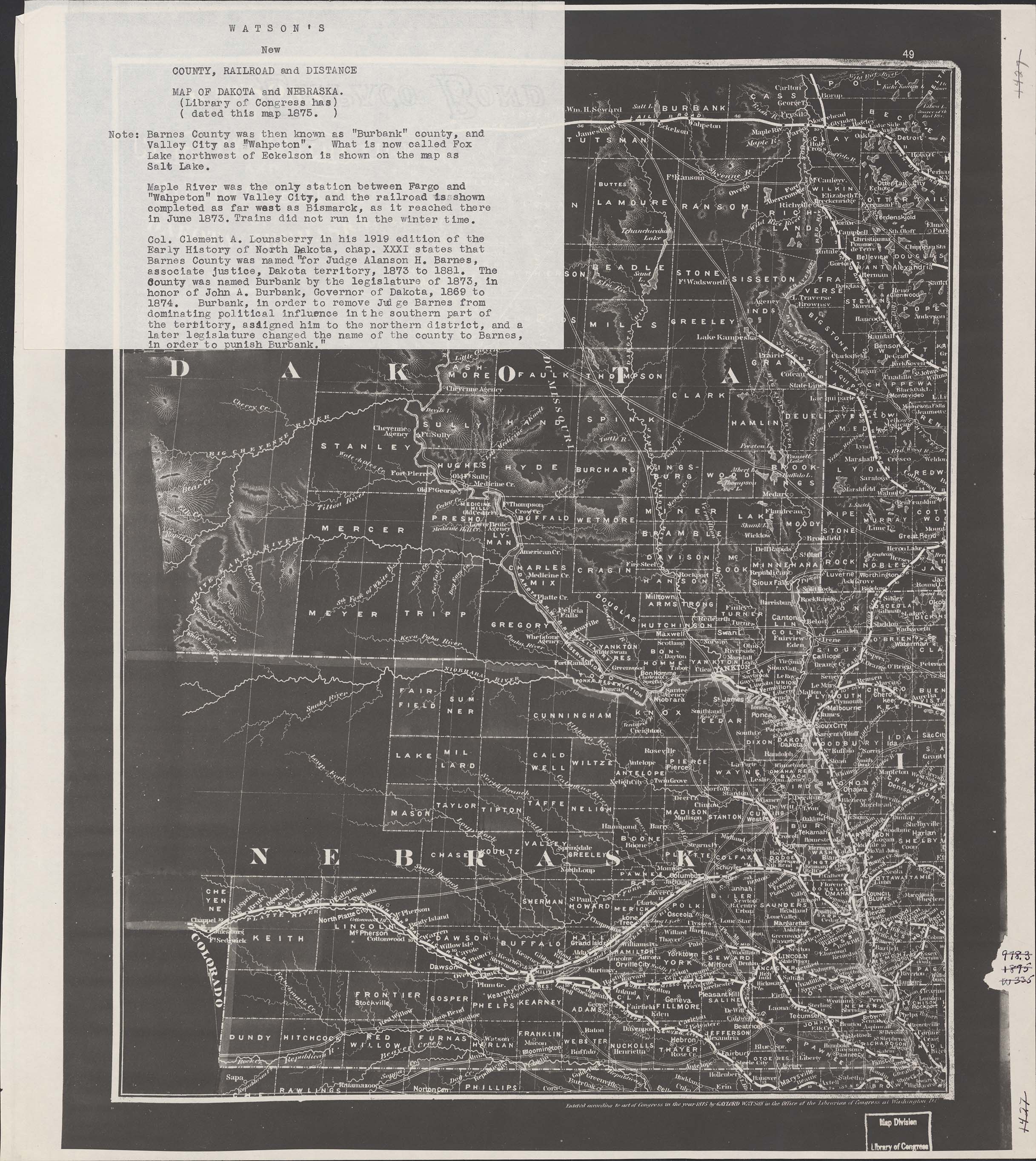
Collection: 978.02 W337w 1875 - Watson's new county, railroad and distance map of Dakota and Nebraska / __ __Gaylord Watson
Folder:
Library
Item:
978.02 W337w 1875
Date:
1875
Creator:
Watson, Gaylord
Title:
Watson's new county, railroad and distance map of Dakota and Nebraska / __ __Gaylord Watson
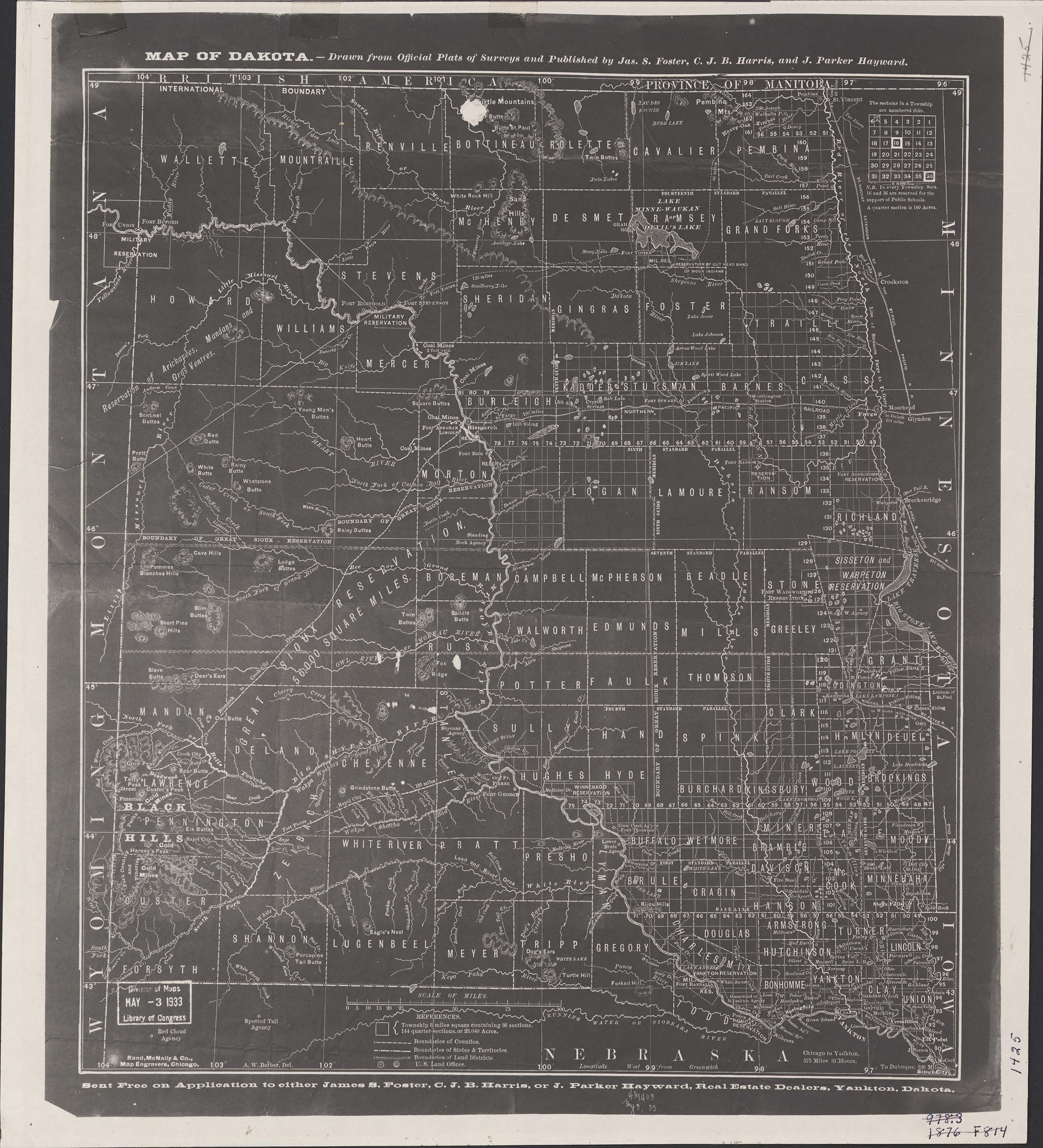
Collection: 978.402 F814m 1876 - Map of Dakota / __ __drawn from official plats of surveys and published by Jas. S. Foster, C.J.B. Harris, and J. Parker Hayward
Folder:
Library
Item:
978.402 F814m 1876
Date:
1876
Creator:
Foster, James S.,--1828-1890
Title:
Map of Dakota / __ __drawn from official plats of surveys and published by Jas. S. Foster, C.J.B. Harris, and J. Parker Hayward
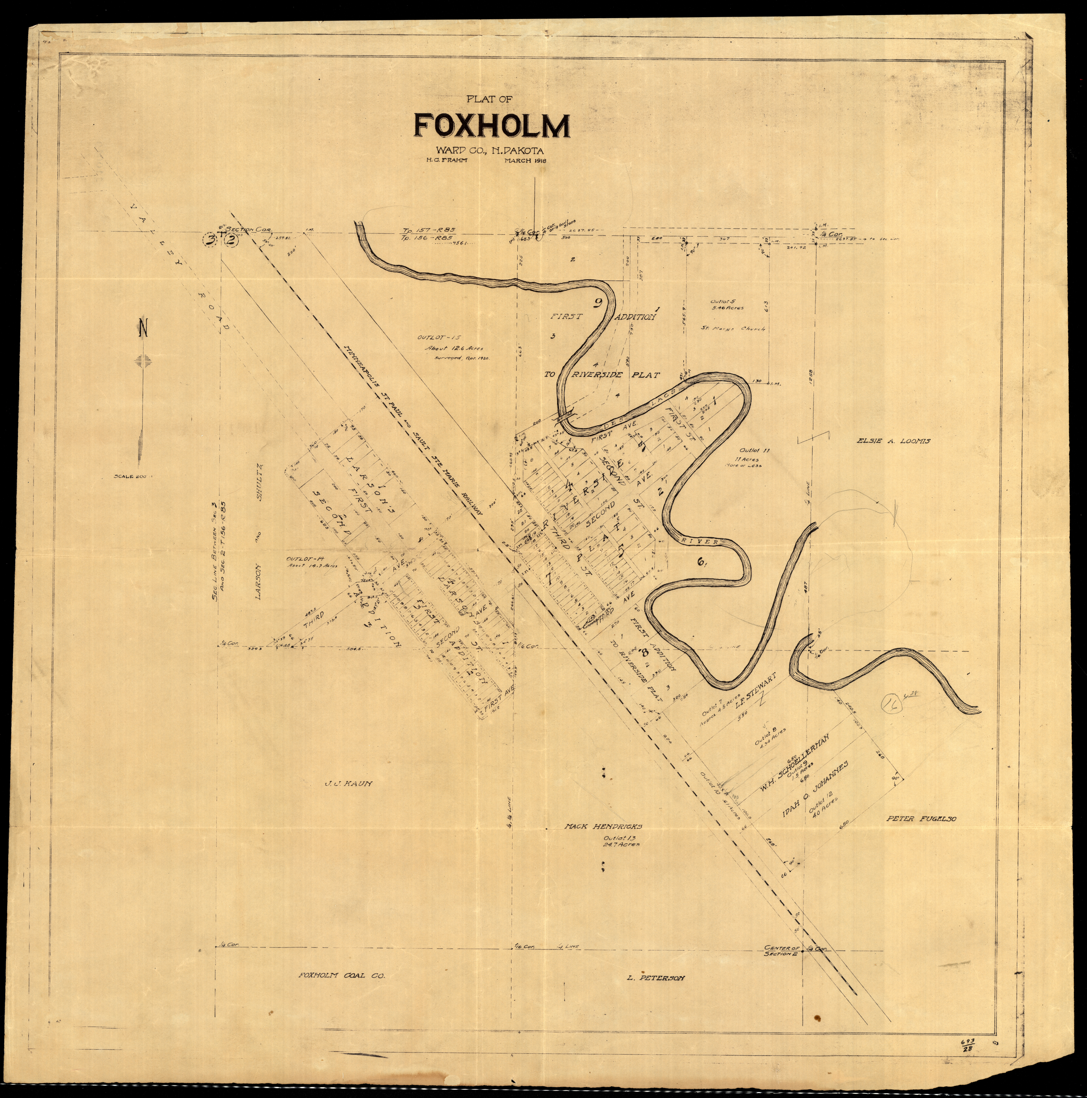
Collection: 978.463 F8p 1918 - Plat of Foxholm, Ward Co., N. Dakota / __ __H.C. Frahm
Folder:
Library
Item:
978.463 F8p 1918
Date:
1918
Creator:
Frahm, H. C
Title:
Plat of Foxholm, Ward Co., N. Dakota / __ __H.C. Frahm
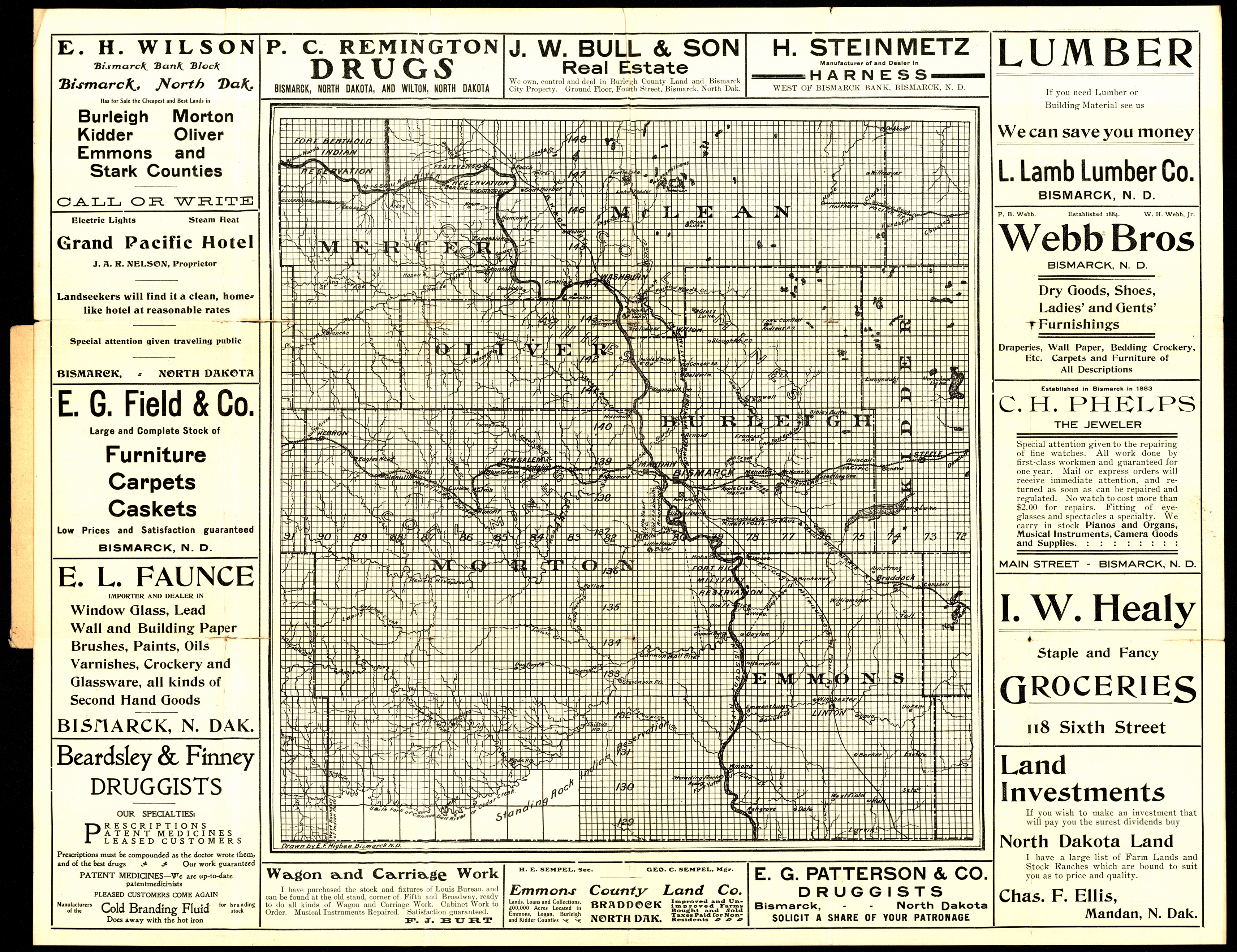
Collection: 978.48 H634r - Real estate : __North Dakota farm and ranch land for sale on easy terms / __drawn by E.F. Higbee
Folder:
Library
Item:
978.48 H634r
Date:
1902 - 1914
Creator:
Higbee, E. F
Title:
Real estate : __North Dakota farm and ranch land for sale on easy terms / __drawn by E.F. Higbee
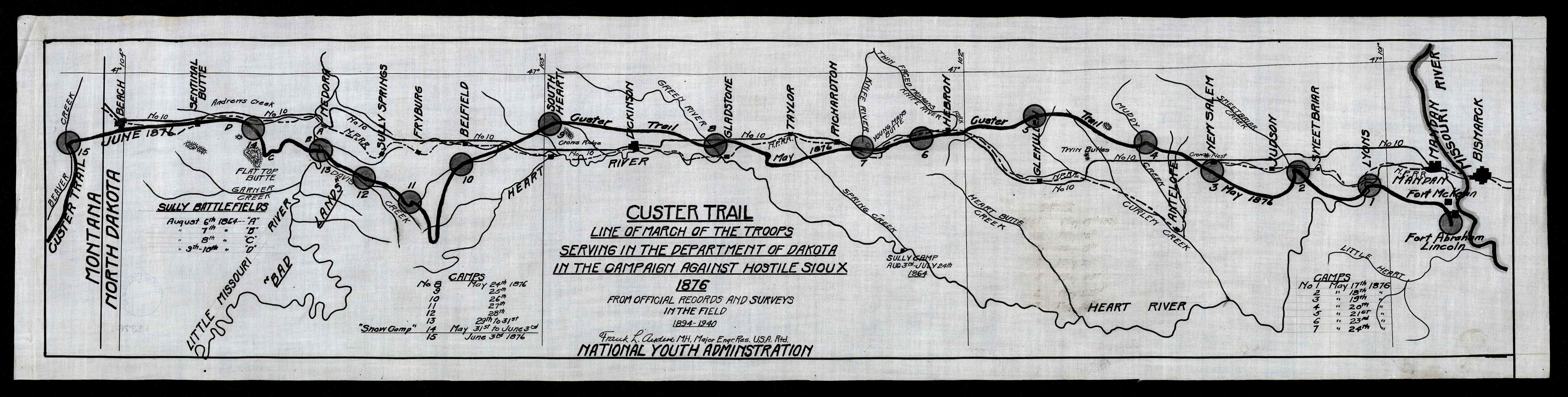
Collection: 973.82 A544c - Custer trail : __line of march of the troops serving in the Department of Dakota in the campaign against hostile Sioux, 1876 from official records and surveys in the field, 1894-1940 / __Frank L. Anders
Folder:
Library
Item:
973.82 A544c
Date:
1935 - 1939
Creator:
Anders, Frank L.,--1875-1966
Title:
Custer trail : __line of march of the troops serving in the Department of Dakota in the campaign against hostile Sioux, 1876 from official records and surveys in the field, 1894-1940 / __Frank L. Anders
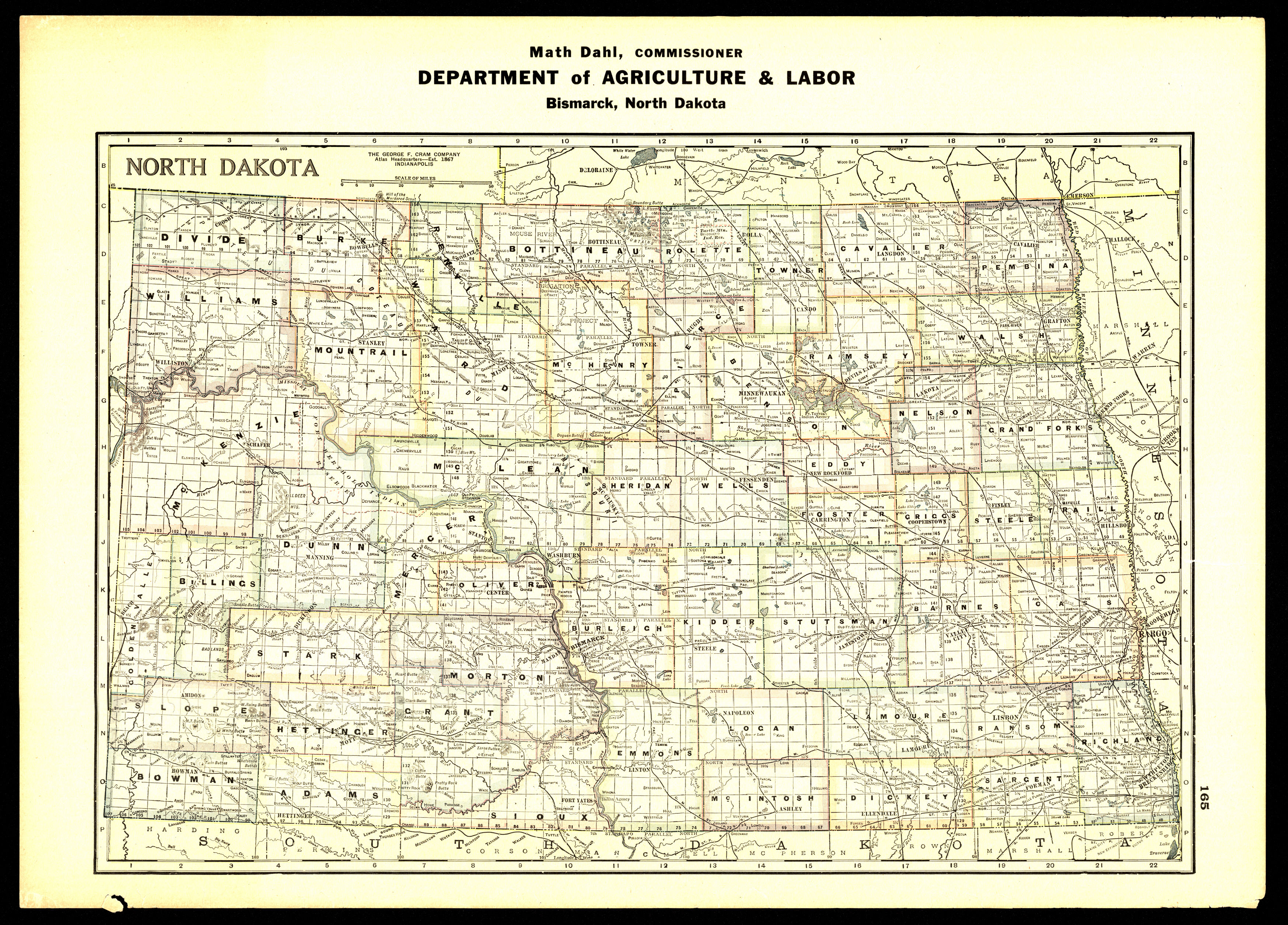
Collection: 978.4032 N864 - North Dakota / __ __Math Dahl, Commissioner, Department of Agriculture and Labor
Folder:
Library
Item:
978.4032 N864
Date:
1939 - 1945
Creator:
North Dakota.--Department of Agriculture and Labor
Title:
North Dakota / __ __Math Dahl, Commissioner, Department of Agriculture and Labor
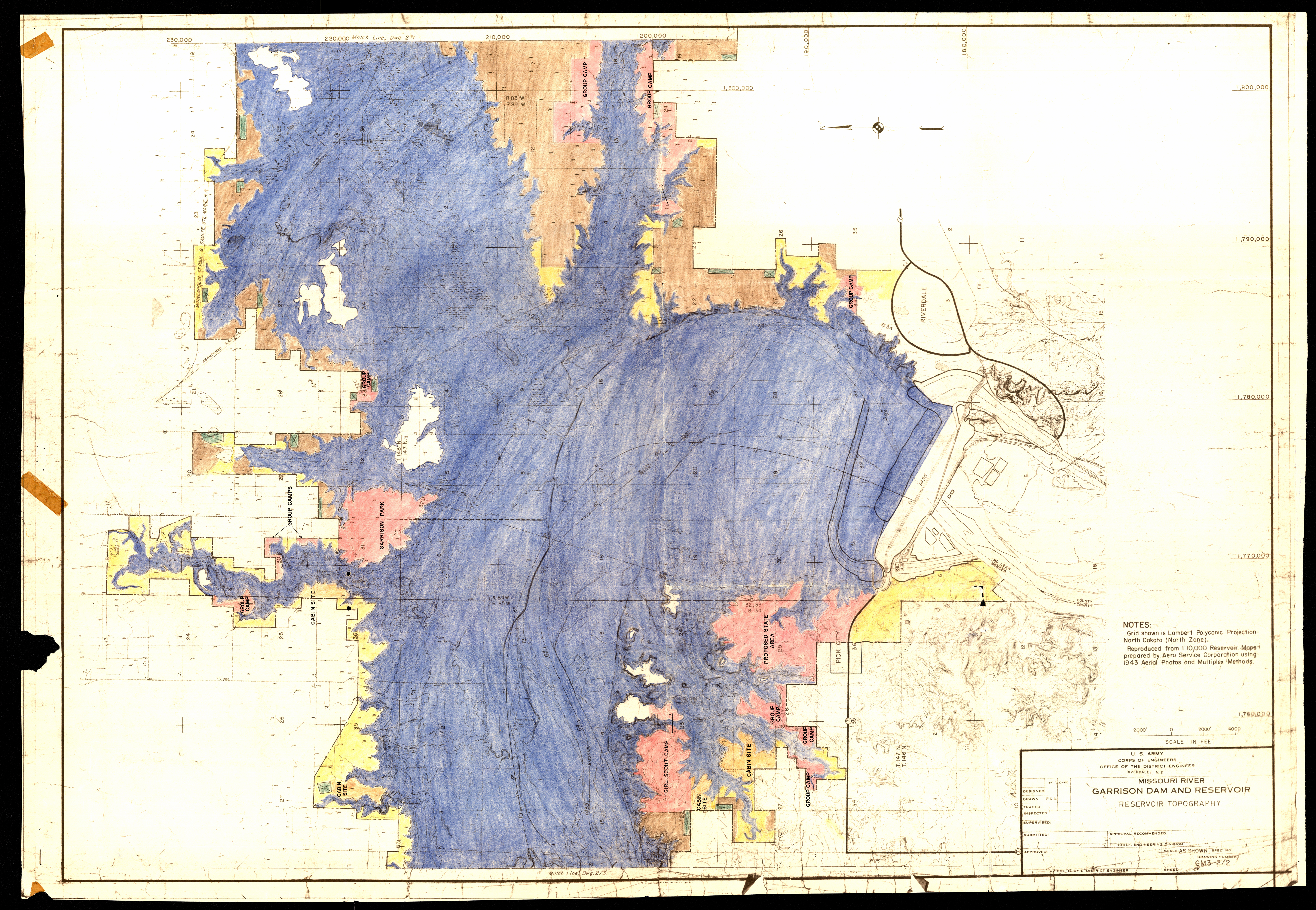
Collection: 333.91 U5813m - Missouri River, Garrison Dam and Reservoir : __reservoir topography / __U.S. Army, Corps of Engineers, Office of the District Engineer
Folder:
Library
Item:
333.91 U5813m
Date:
ca. 1955
Creator:
United States.--Army.--Corps of Engineers
Title:
Missouri River, Garrison Dam and Reservoir : __reservoir topography / __U.S. Army, Corps of Engineers, Office of the District Engineer
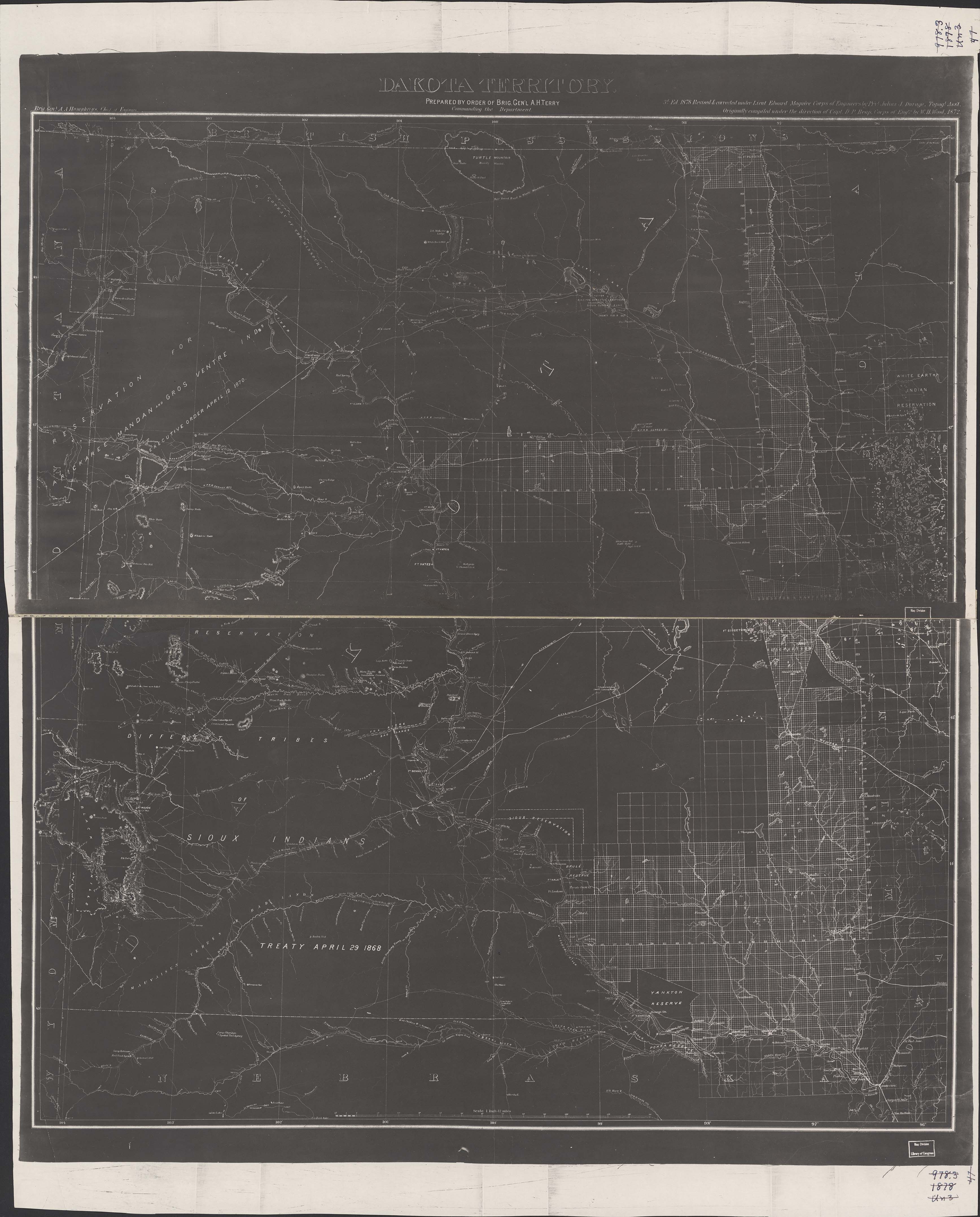
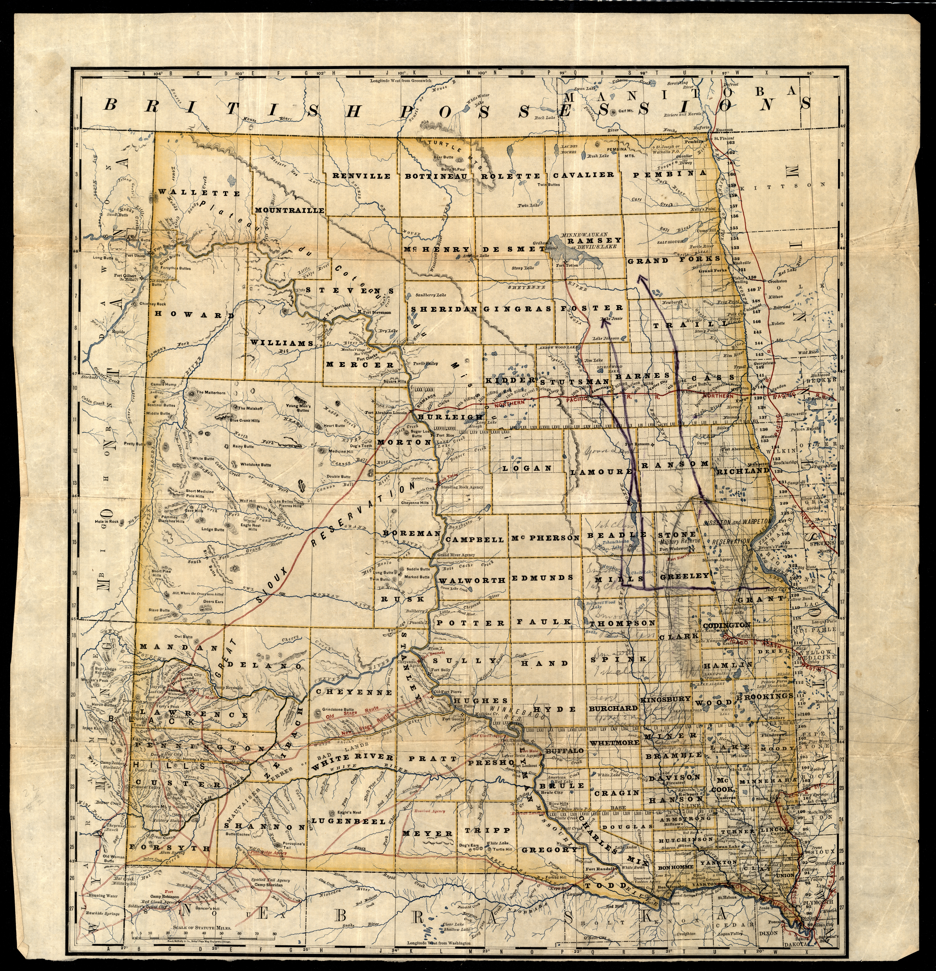
Collection: 978.402 D947d 1878 - Dakota Territory / __ __prepared by order of Brig. Gen'l. A.H. Terry ; revised & corrected under Lieut. Edward Maguire, Corps of Engineers, by Pr'vt. Julius J. Durage
Folder:
Library
Item:
978.402 D947d 1878
Date:
1878
Creator:
Title:
Dakota Territory / __ __prepared by order of Brig. Gen'l. A.H. Terry ; revised & corrected under Lieut. Edward Maguire, Corps of Engineers, by Pr'vt. Julius J. Durage
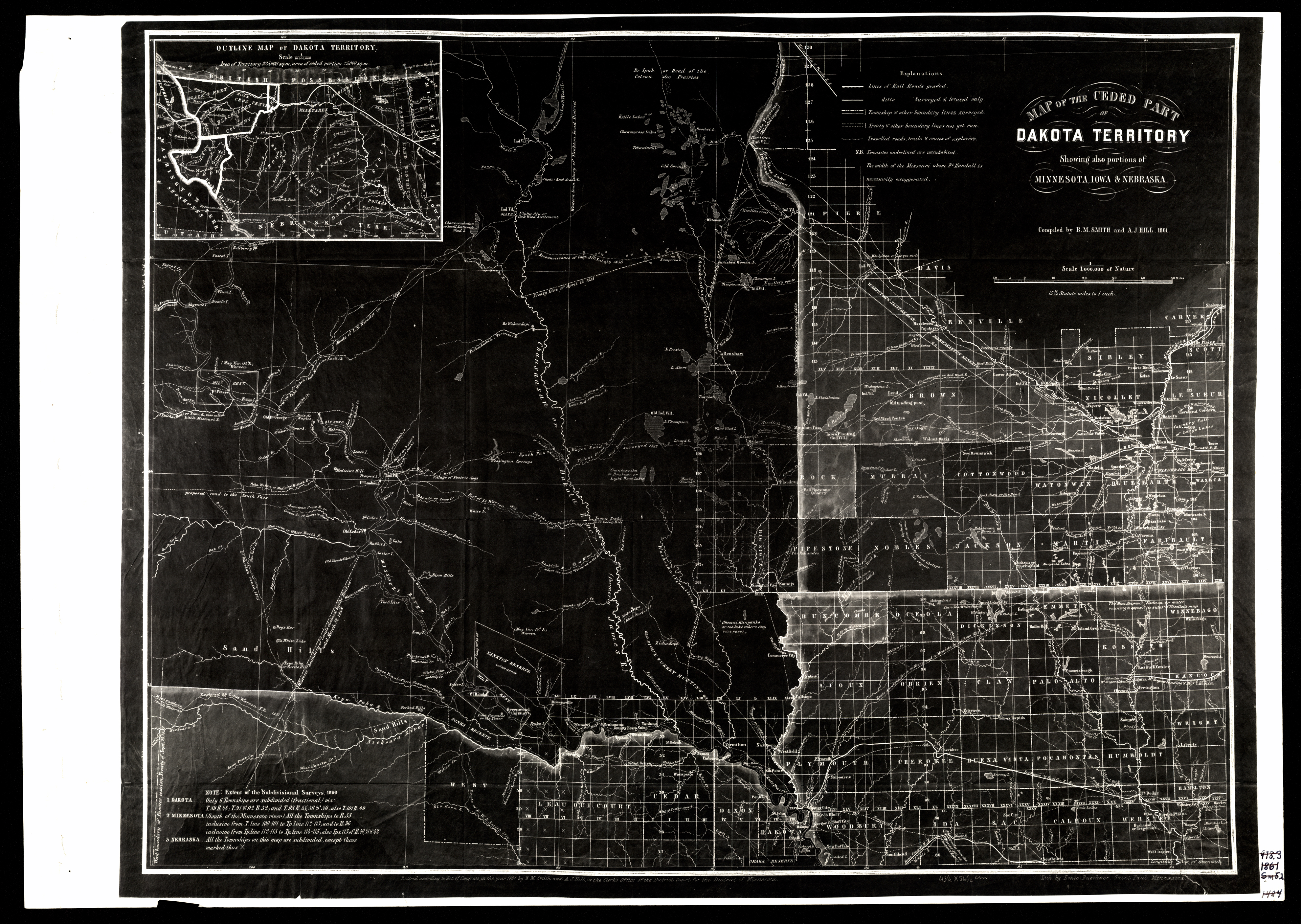
Collection: 978.401 S642m 1861 - Map of the ceded part of Dakota Territory : __showing also portions of Minnesota, Iowa & Nebraska / __compiled by B.M. Smith and A.J. Hill, 1861
Folder:
Library
Item:
978.401 S642m 1861
Date:
1861
Creator:
Smith, B. M.--(Byron M.)
Title:
Map of the ceded part of Dakota Territory : __showing also portions of Minnesota, Iowa & Nebraska / __compiled by B.M. Smith and A.J. Hill, 1861
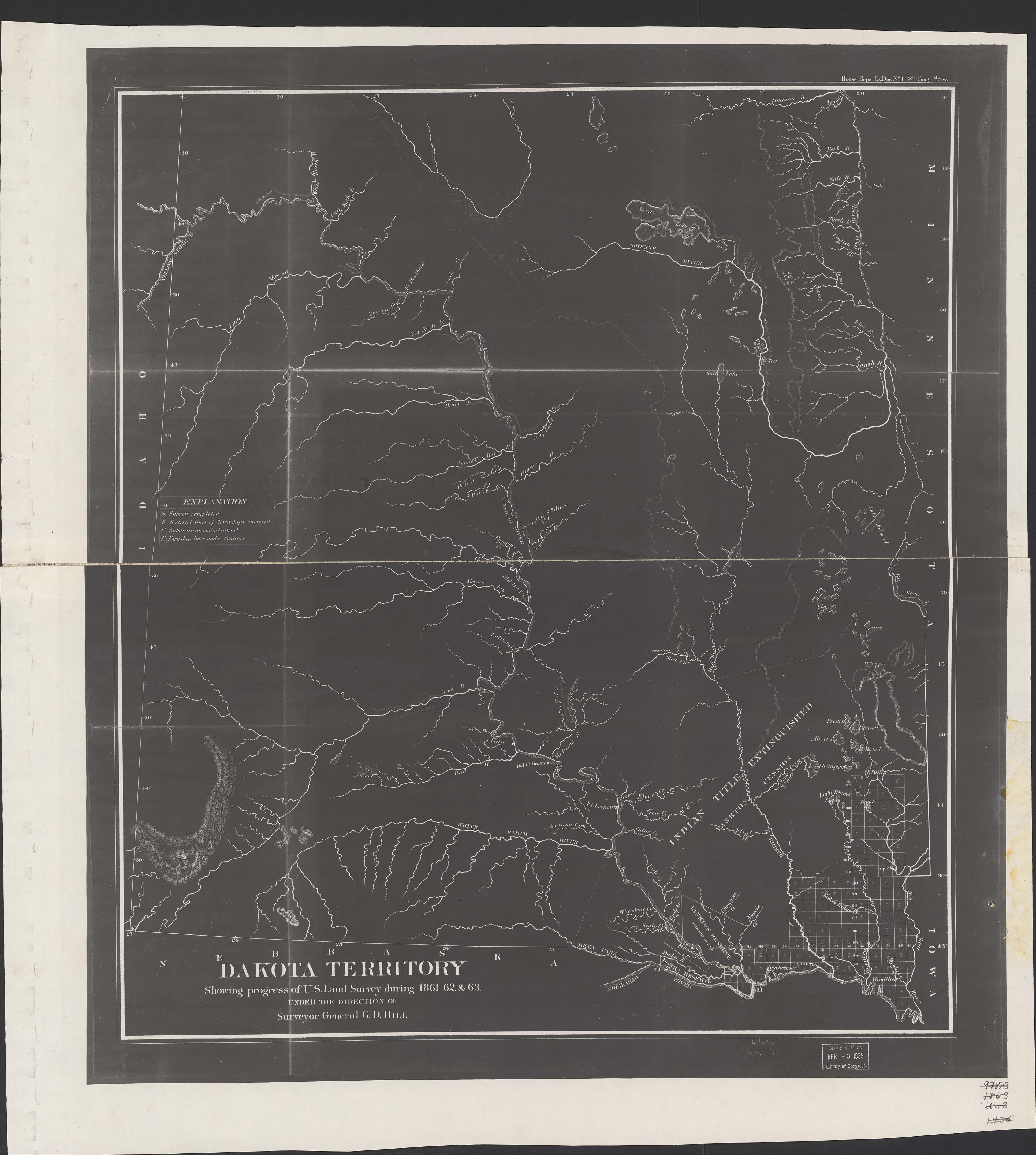
Collection: 978.402 H645d 1863 - Dakota Territory showing progress of U.S. land survey during 1861, 62 & 63 / __ __under the direction of Surveyor General G.D. Hill
Folder:
Library
Item:
978.402 H645d 1863
Date:
1863
Creator:
Hill, G. D
Title:
Dakota Territory showing progress of U.S. land survey during 1861, 62 & 63 / __ __under the direction of Surveyor General G.D. Hill
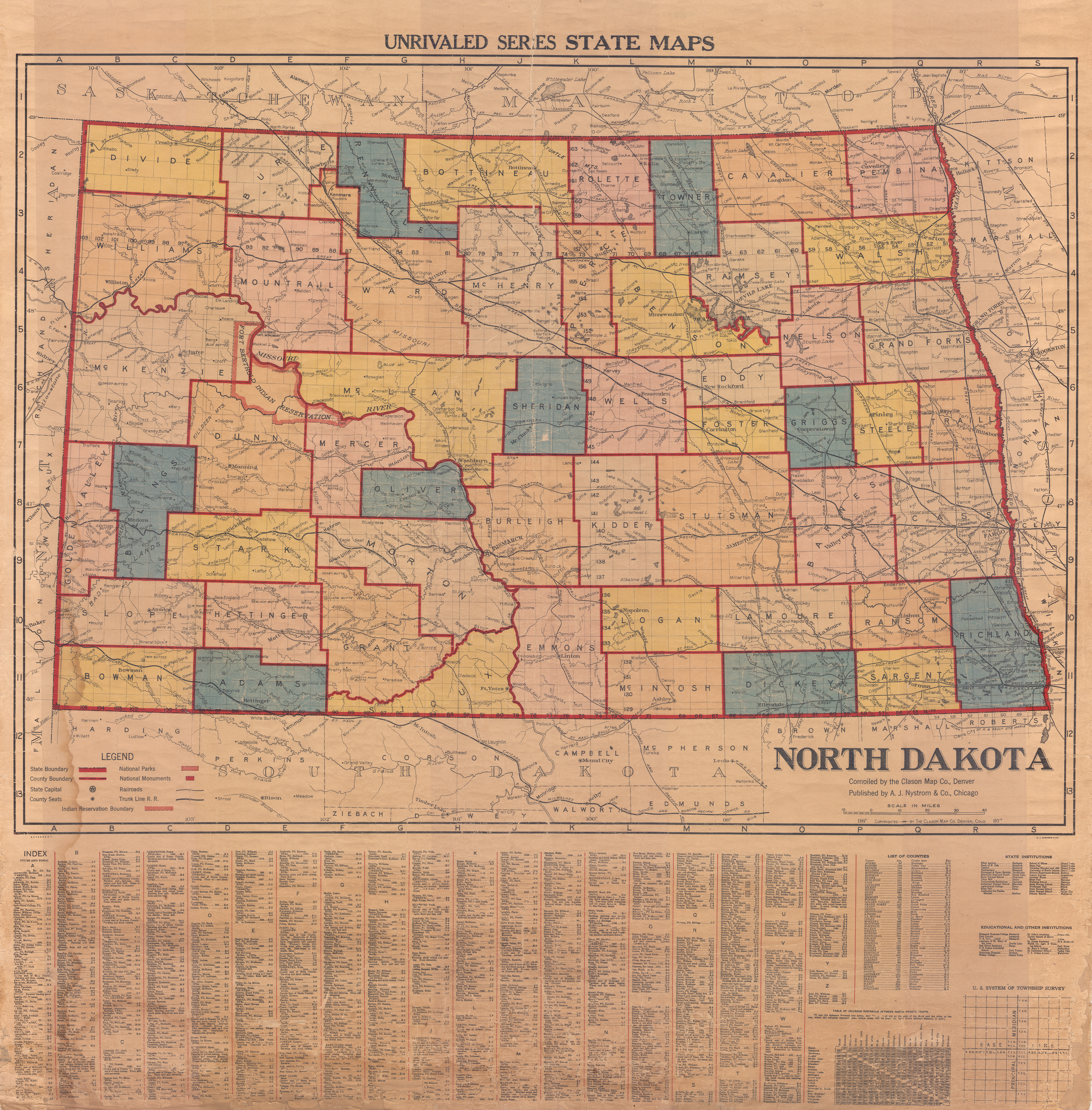
Collection: 978.4032 C6142n - North Dakota __ __compiled by the Clason Map Co., Denver
Folder:
Library
Item:
978.4032 C6142n
Date:
[192-?]
Creator:
Clason Map Co
Title:
North Dakota __ __compiled by the Clason Map Co., Denver
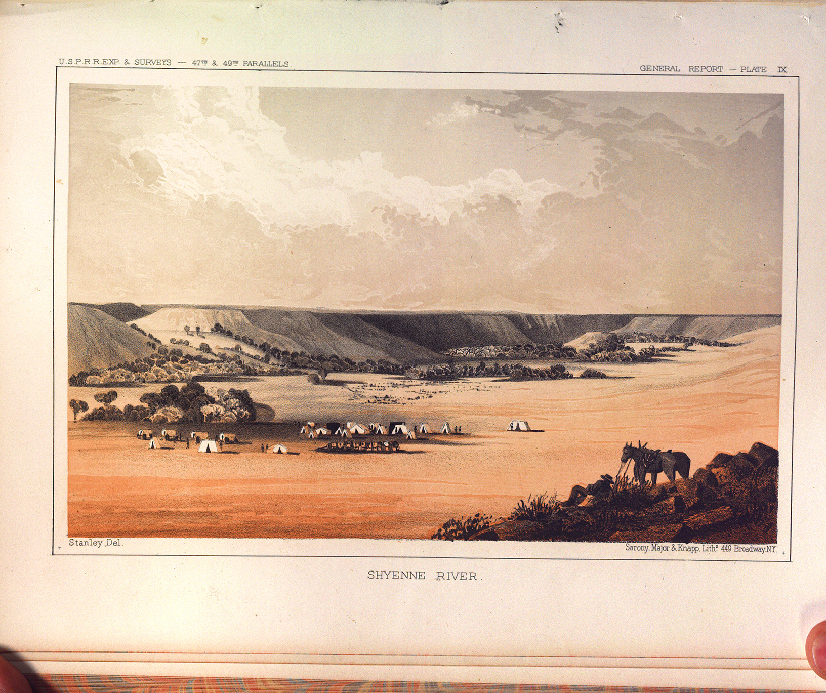
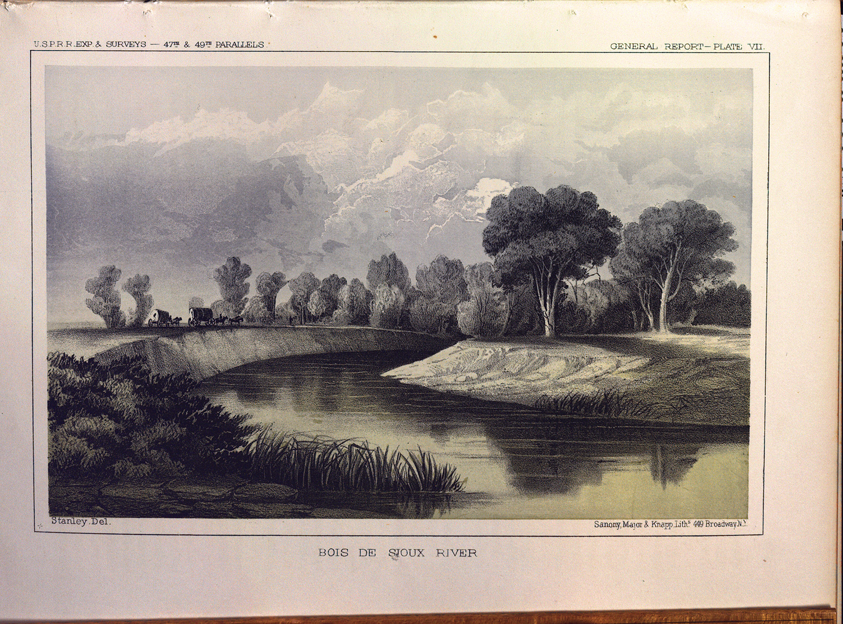
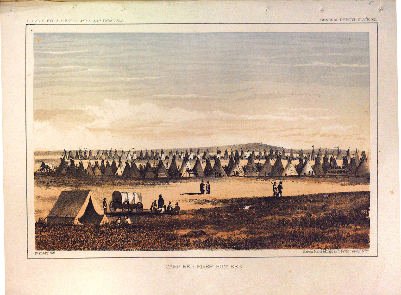
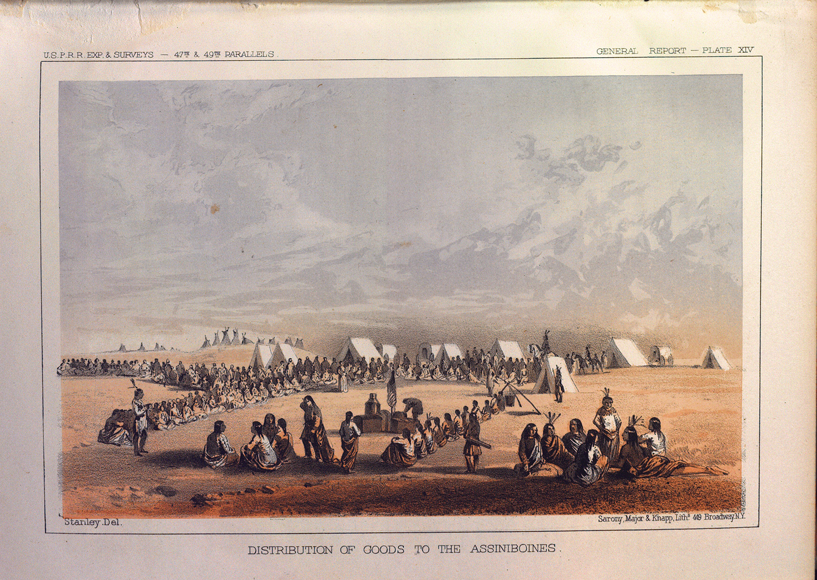
Collection: 917.8 Un3r - Reports of explorations and surveys, to ascertain the most practicable and economical route for a railroad from the Mississippi River to the Pacific Ocean / __ __made under the direction of the Secretary of War, in 1853-[6] ..
Folder:
Library
Item:
917.8 Un3r
Date:
1855 - 1860
Creator:
United States.--War Department
Title:
Reports of explorations and surveys, to ascertain the most practicable and economical route for a railroad from the Mississippi River to the Pacific Ocean / __ __made under the direction of the Secretary of War, in 1853-[6] ..
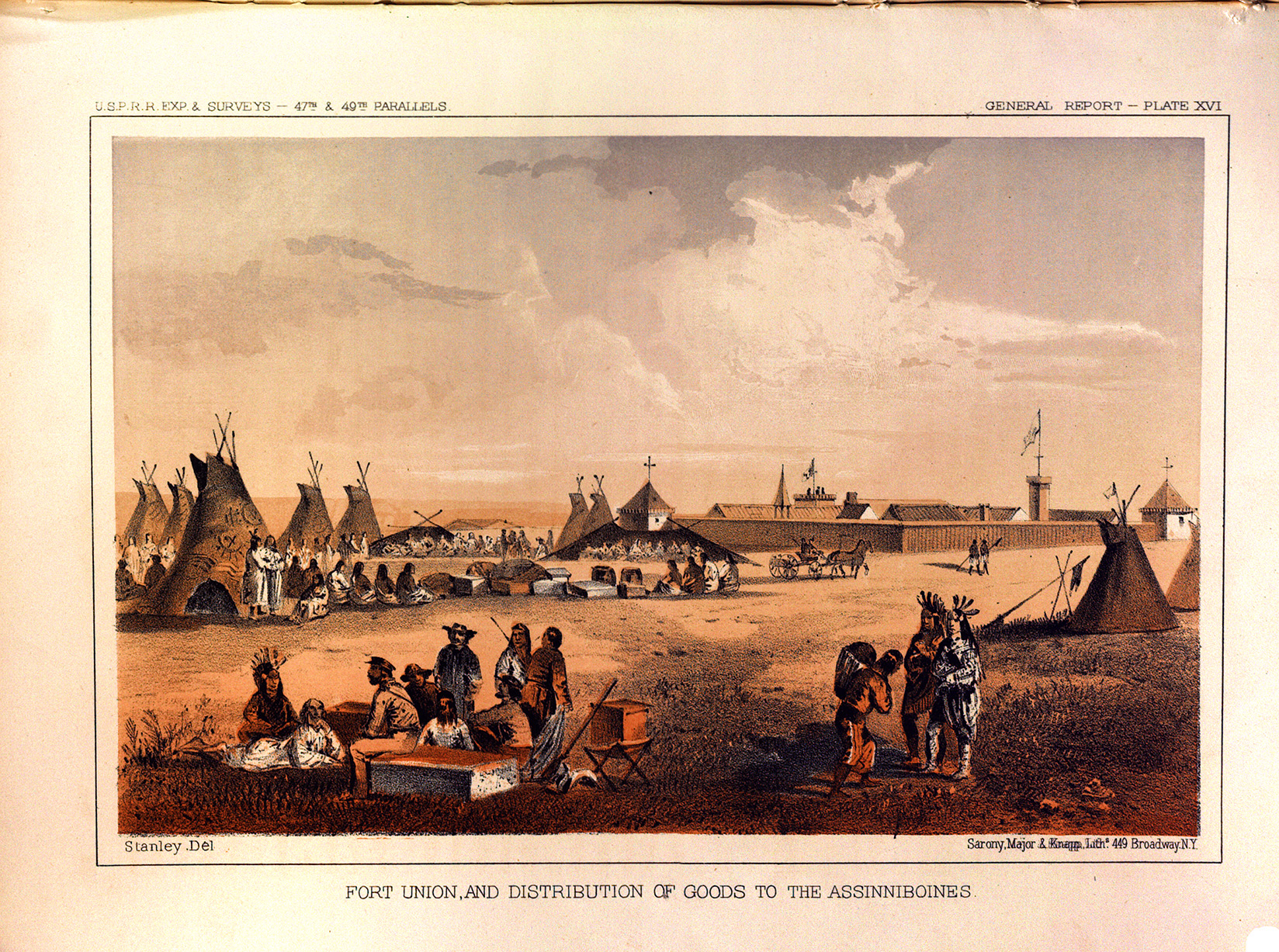
Collection: 978.402 R186d 1879 - Rand, McNally & Co.'s Dakota
Folder:
Library
Item:
978.402 R186d 1879
Date:
1879.
Creator:
Rand McNally and Company
Title:
Rand, McNally & Co.'s Dakota
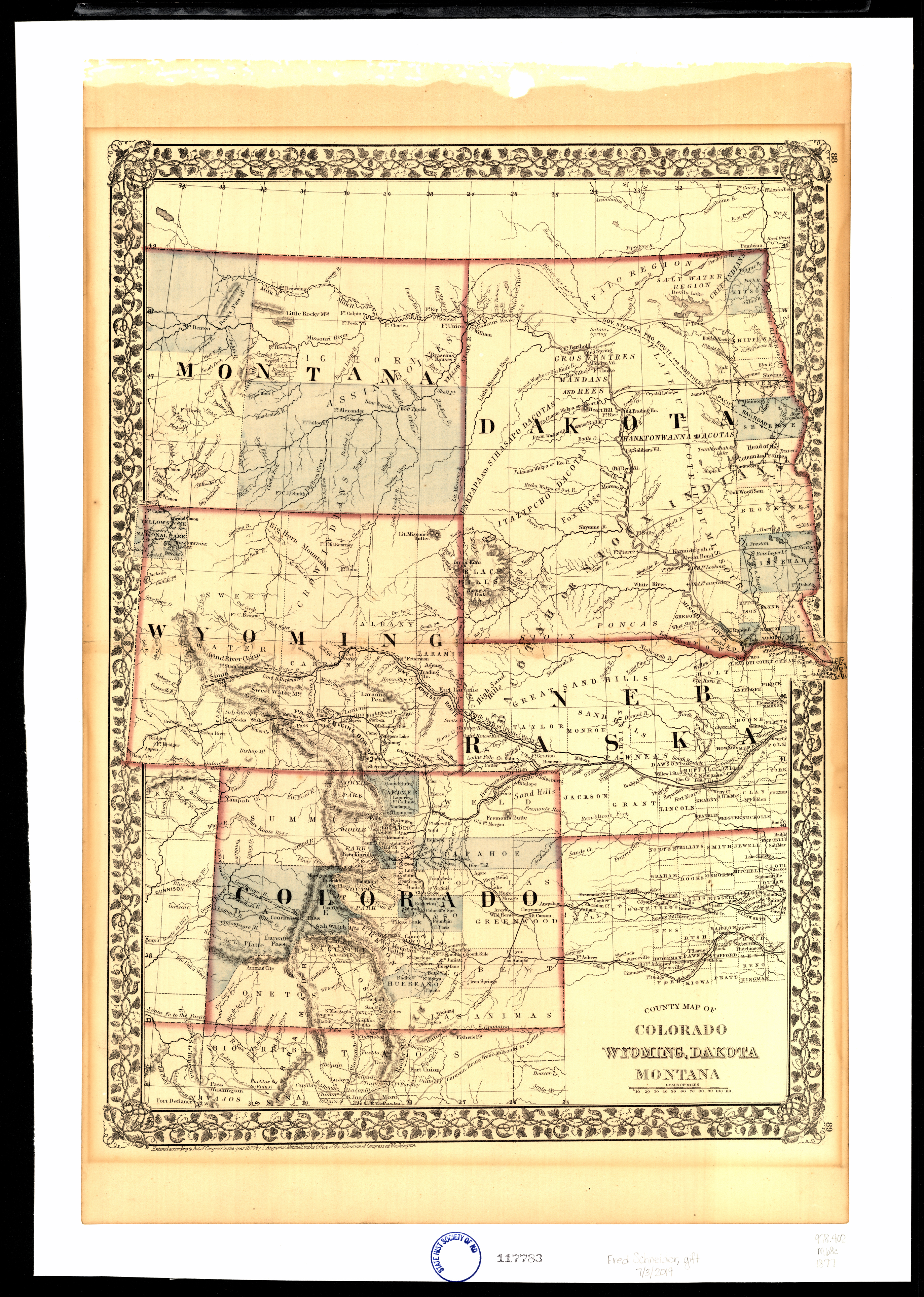
Collection: 978.402 M68c 1877 - County map of Colorado, Wyoming, Dakota, Montana
Folder:
Library
Item:
978.402 M68c 1877
Date:
c1877.
Creator:
Mitchell, S. Augustus--(Samuel Augustus),--1792-1868
Title:
County map of Colorado, Wyoming, Dakota, Montana
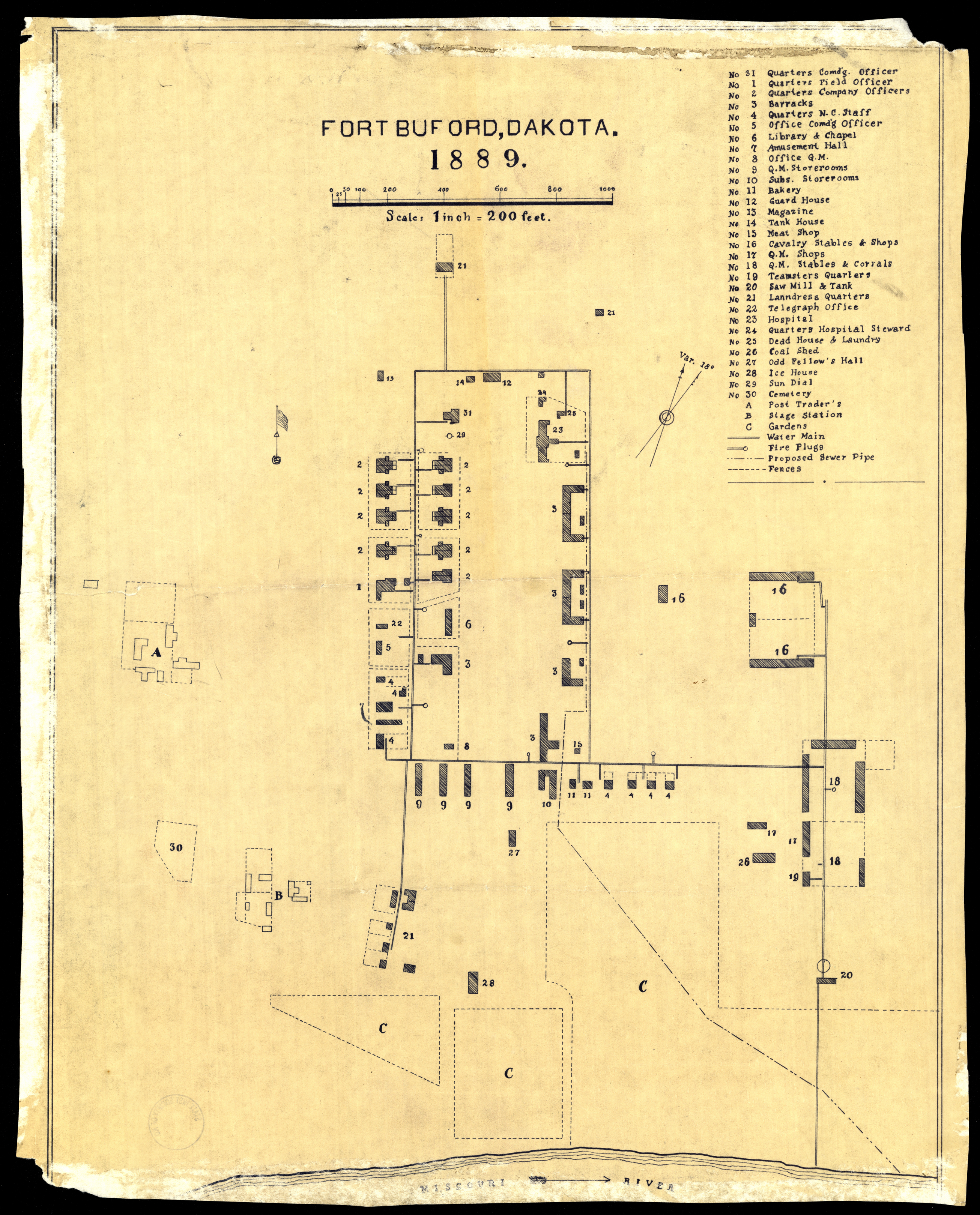
Collection: 978.473 F735b 1889 - Fort Buford, Dakota, 1889
Folder:
Library
Item:
978.473 F735b 1889
Date:
[1889?]
Creator:
Title:
Fort Buford, Dakota, 1889