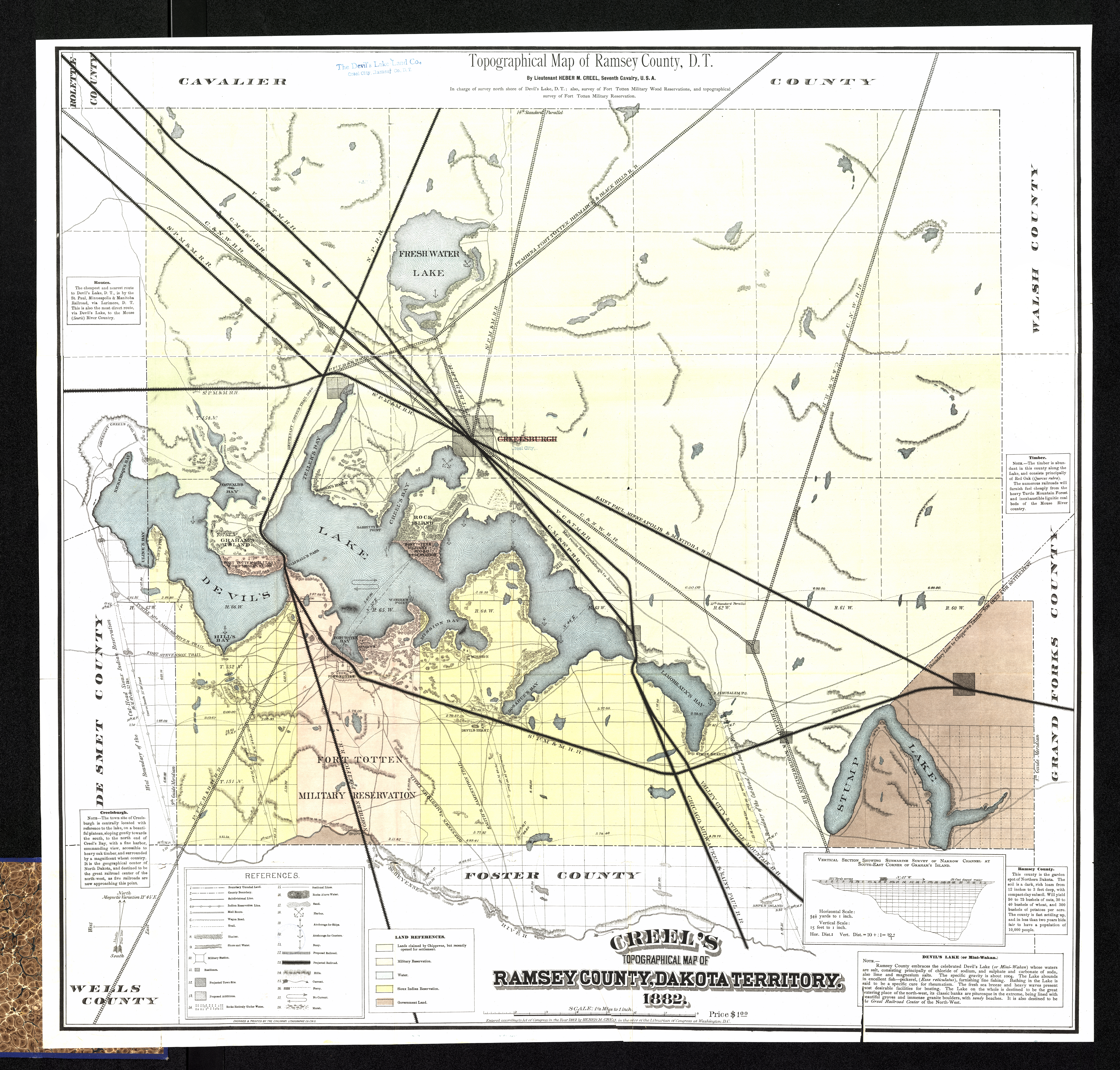
Collection: 978.436 C9135t 1882 - Topographical map of Ramsey County, D.T. / __ __by Heber M. Creel
Folder:
Library
Item:
978.436 C9135t 1882
Date:
1882
Creator:
Creel, Heber M
Title:
Topographical map of Ramsey County, D.T. / __ __by Heber M. Creel
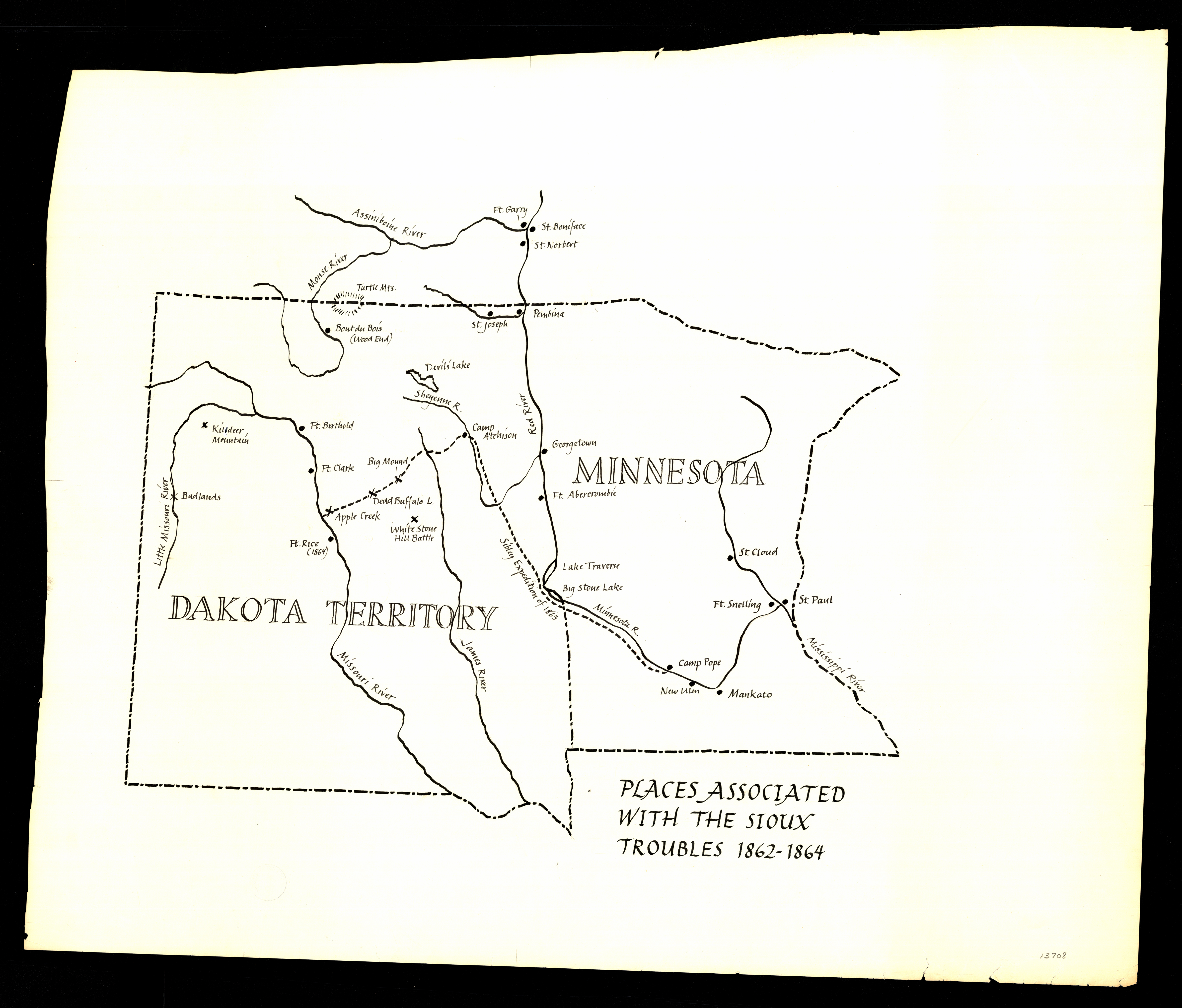
Collection: 973.82 P6978 - Places associated with the Sioux Troubles, 1862-1864
Folder:
Library
Item:
973.82 P6978
Date:
ca. 1950
Creator:
Title:
Places associated with the Sioux Troubles, 1862-1864
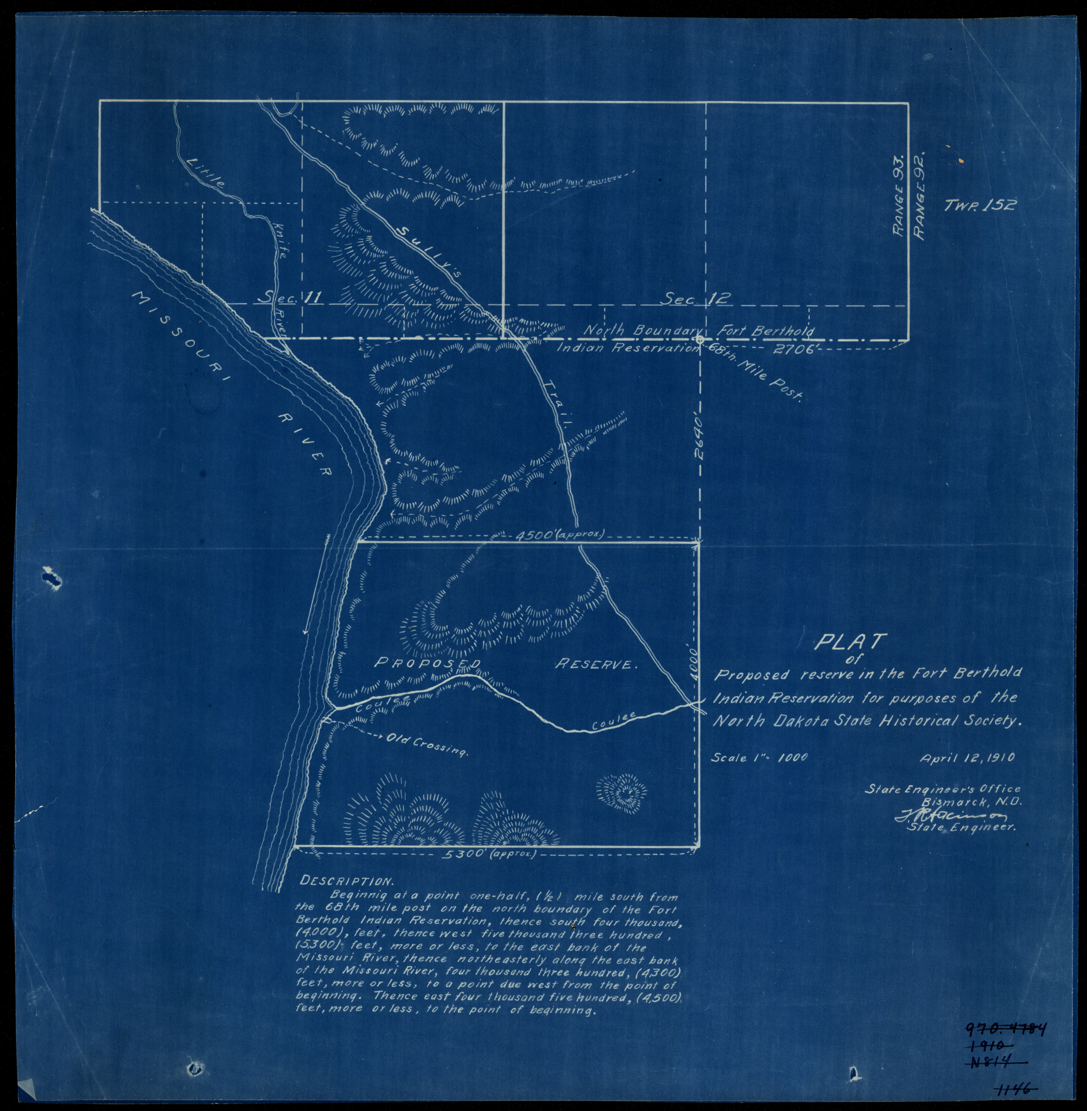
Collection: 978.47 N864p 1910 - Plat of proposed reserve in the Fort Berthold Indian Reservation for purposes of the North Dakota State Historical Society / __ __State Engineer's Office
Folder:
Library
Item:
978.47 N864p 1910
Date:
1910
Creator:
North Dakota.--State Engineer
Title:
Plat of proposed reserve in the Fort Berthold Indian Reservation for purposes of the North Dakota State Historical Society / __ __State Engineer's Office
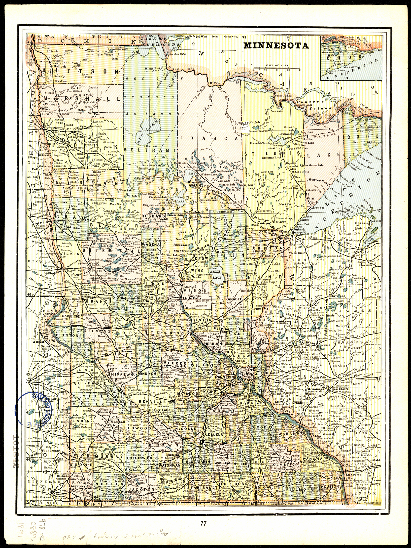
Collection: 978.403 C889n 1891 - North Dakota
Folder:
Library
Item:
978.403 C889n 1891
Date:
1891
Creator:
Cram, George Franklin,--1841-1928
Title:
North Dakota
Collection: 978.403 C889n 1898 - North Dakota
Folder:
Library
Item:
978.403 C889n 1898
Date:
1898
Creator:
Cram, George Franklin,--1841-1928
Title:
North Dakota
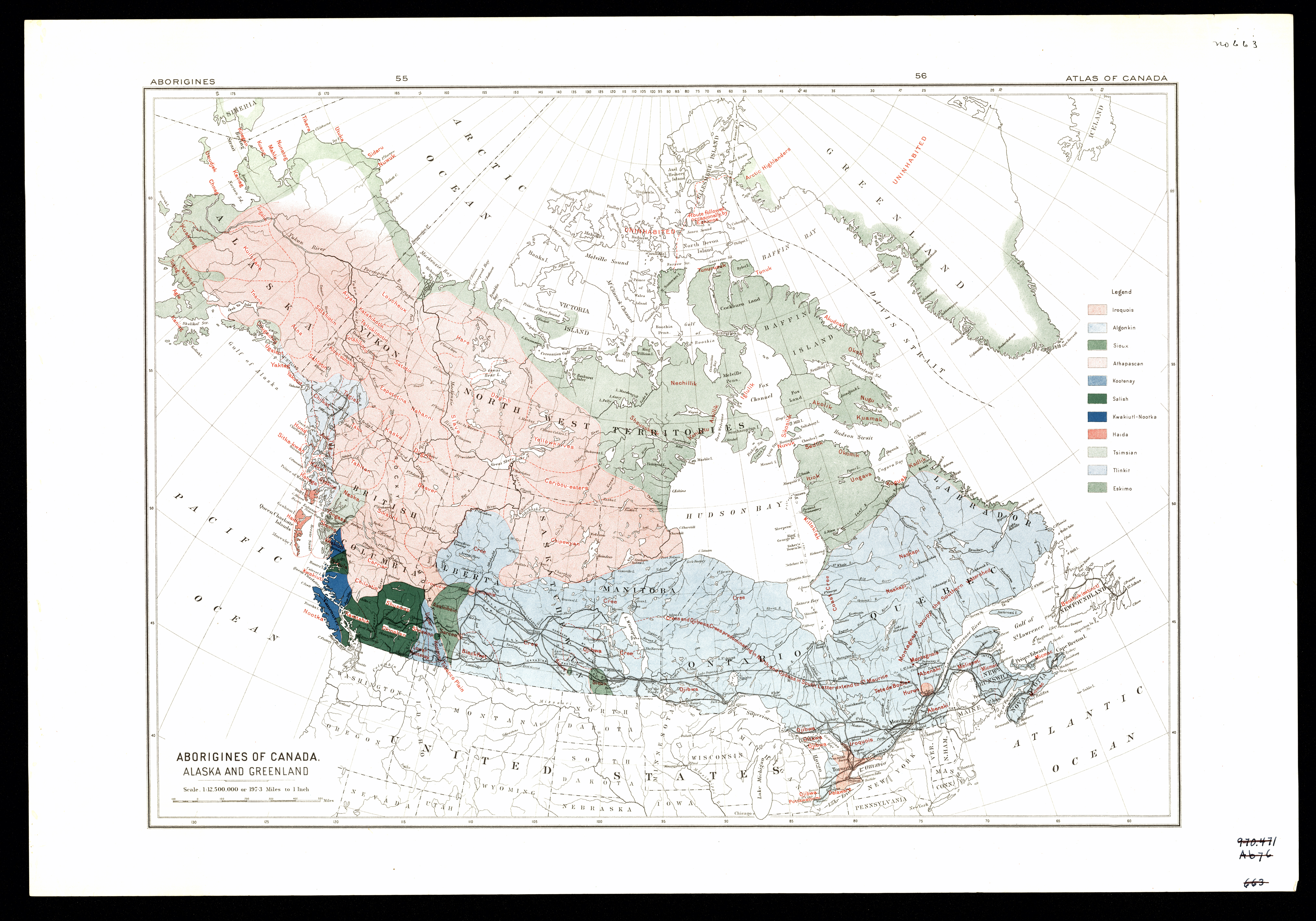
Collection: 971.00497 A1546 - Aborigines of Canada, Alaska and Greenland
Folder:
Library
Item:
971.00497 A1546
Date:
ca. 1910
Creator:
Title:
Aborigines of Canada, Alaska and Greenland
Collection: 978.486 D135s - Southwestern North Dakota / __ __Dakota Loan & Securities Company
Folder:
Library
Item:
978.486 D135s
Date:
ca. 1915
Creator:
Dakota Loan & Securities Company
Title:
Southwestern North Dakota / __ __Dakota Loan & Securities Company
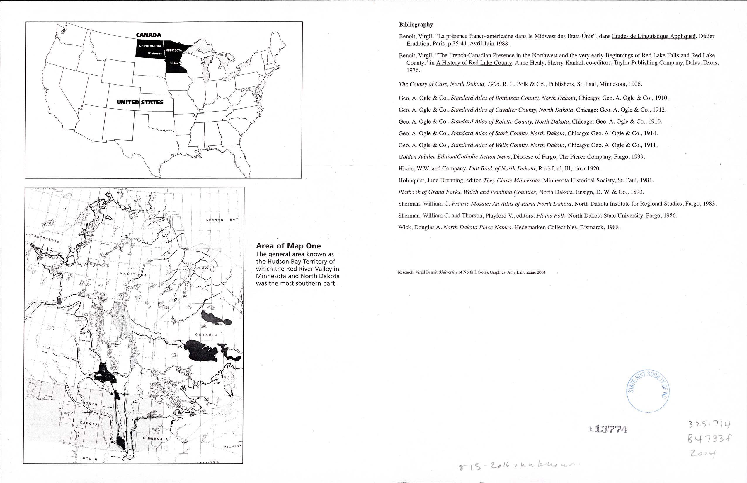
Collection: 325.714 B4733f 2004 - French heritage in the Midwest of the United States : __the Red River Valley of the North / __research, Virgil Benoit ; graphics, Amy LaFontaine
Folder:
Library
Item:
325.714 B4733f 2004
Date:
Copyright 2004
Creator:
Benoit, Virgil
Title:
French heritage in the Midwest of the United States : __the Red River Valley of the North / __research, Virgil Benoit ; graphics, Amy LaFontaine
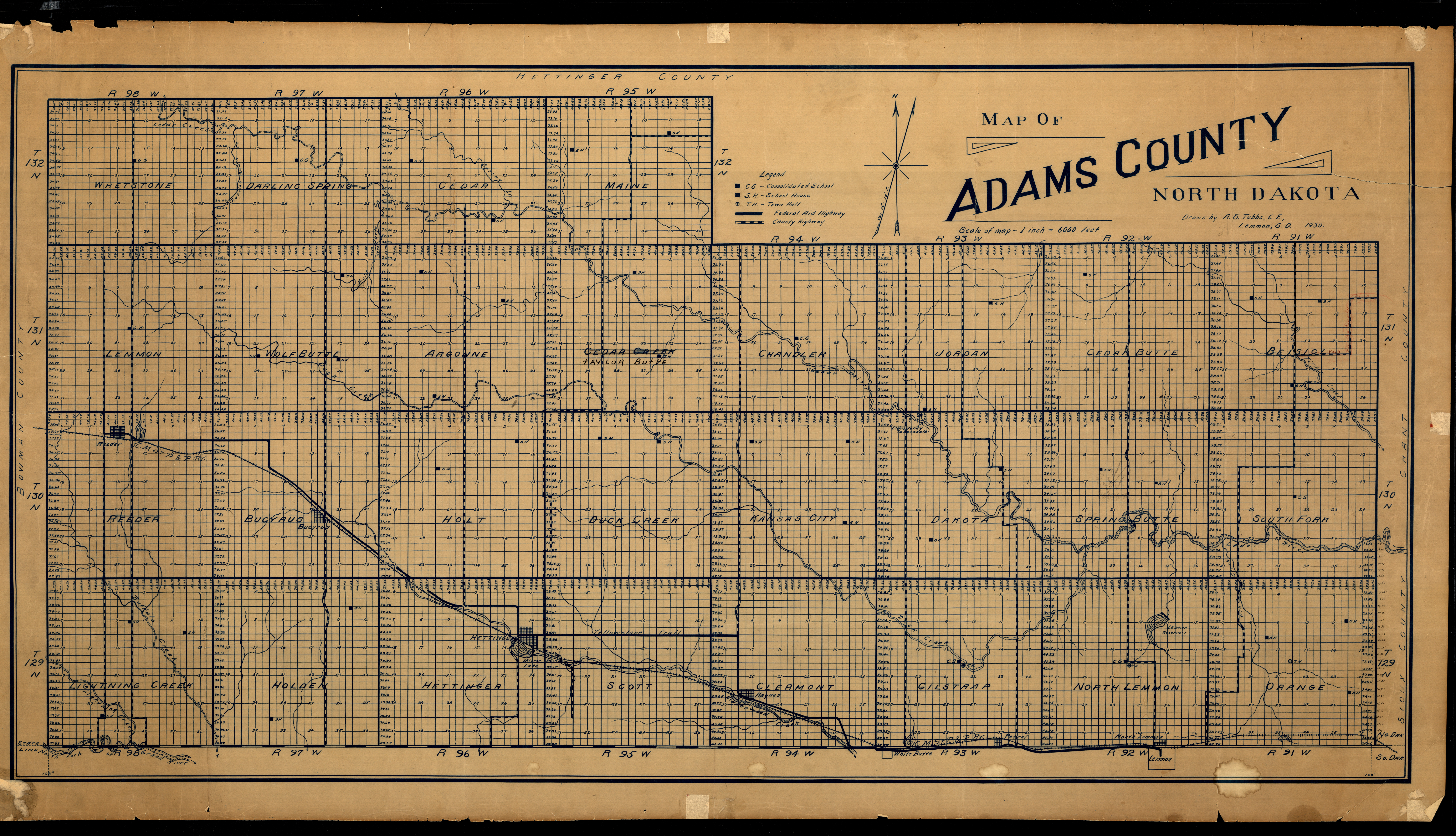
Collection: 978.489 T884m 1930 - Map of Adams County, North Dakota / __ __drawn by A.S. Tubbs
Folder:
Library
Item:
978.489 T884m 1930
Date:
1930
Creator:
Tubbs, A. S
Title:
Map of Adams County, North Dakota / __ __drawn by A.S. Tubbs
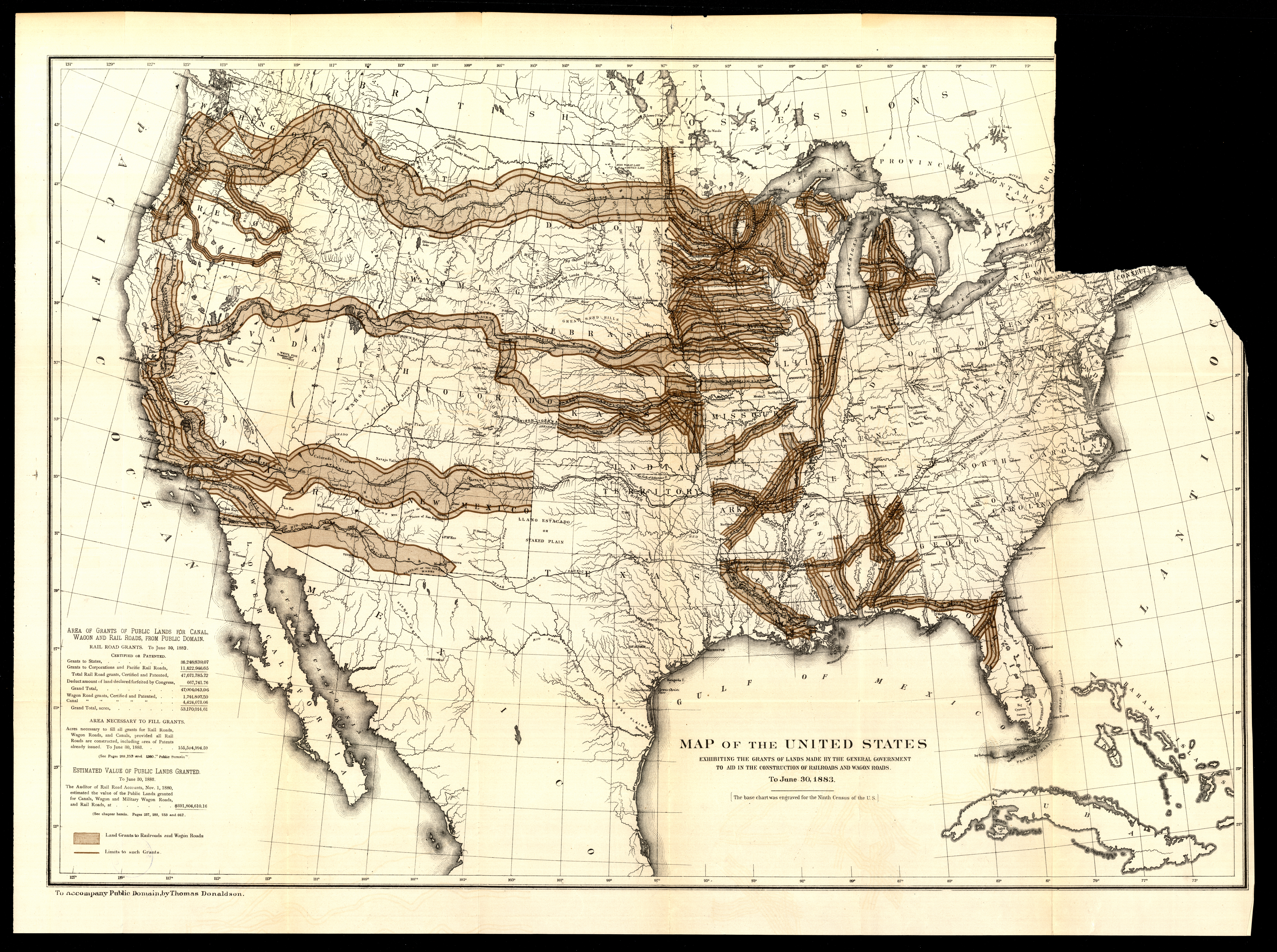
Collection: 973.84 M297 1883 - Map of the United States exhibiting the grants of lands made by the general government to aid in the construction of railroads and wagon roads, to June 30, 1883
Folder:
Library
Item:
973.84 M297 1883
Date:
1883
Creator:
Title:
Map of the United States exhibiting the grants of lands made by the general government to aid in the construction of railroads and wagon roads, to June 30, 1883
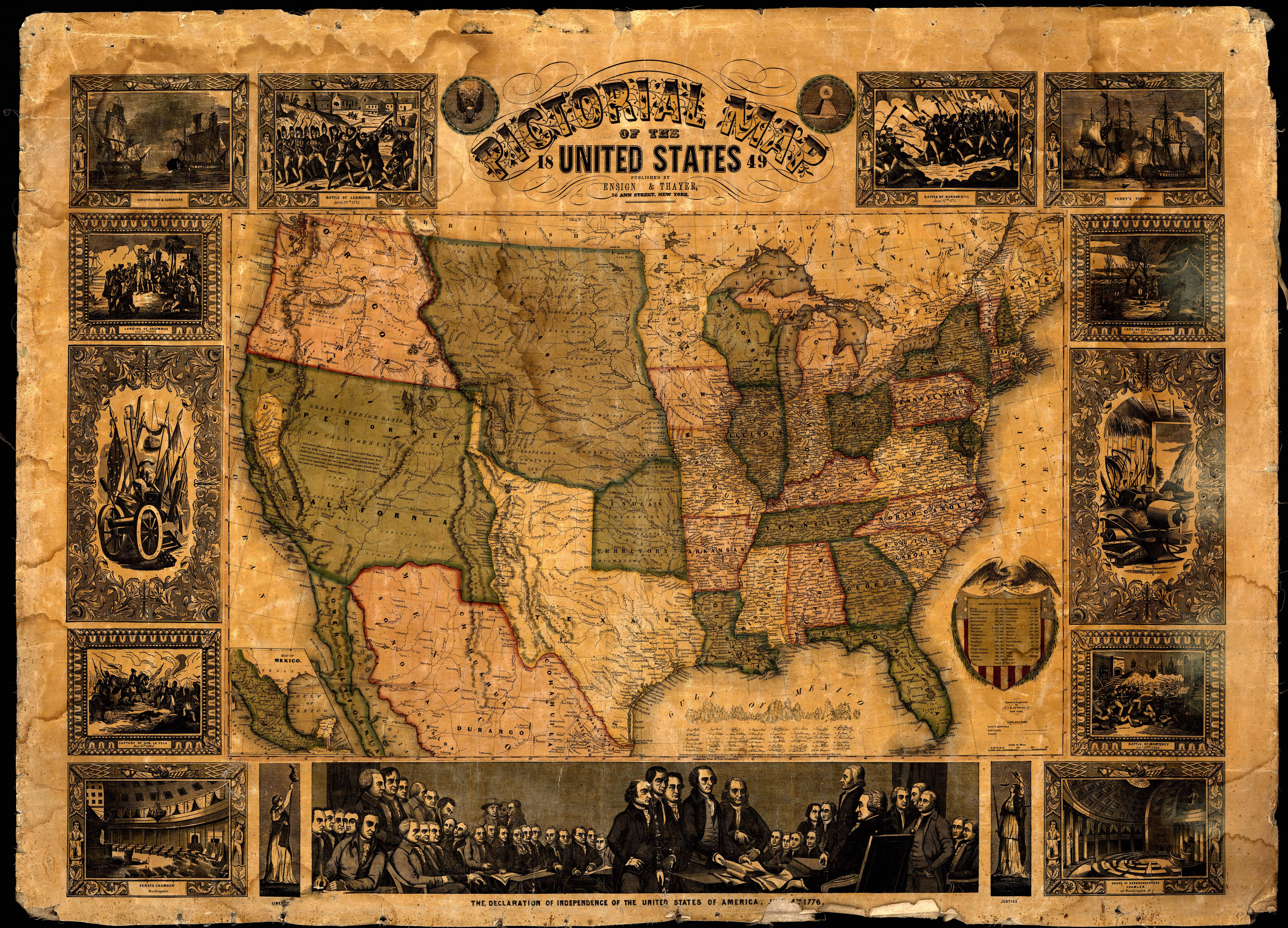
Collection: 973.5 A8873p 1849 - Pictorial map of the United States, 1849 / __ __drawn & engraved by J.M. Atwood
Folder:
Library
Item:
973.5 A8873p 1849
Date:
Copyright 1847 - 1849
Creator:
Atwood, John M.,--approximately 1818-
Title:
Pictorial map of the United States, 1849 / __ __drawn & engraved by J.M. Atwood
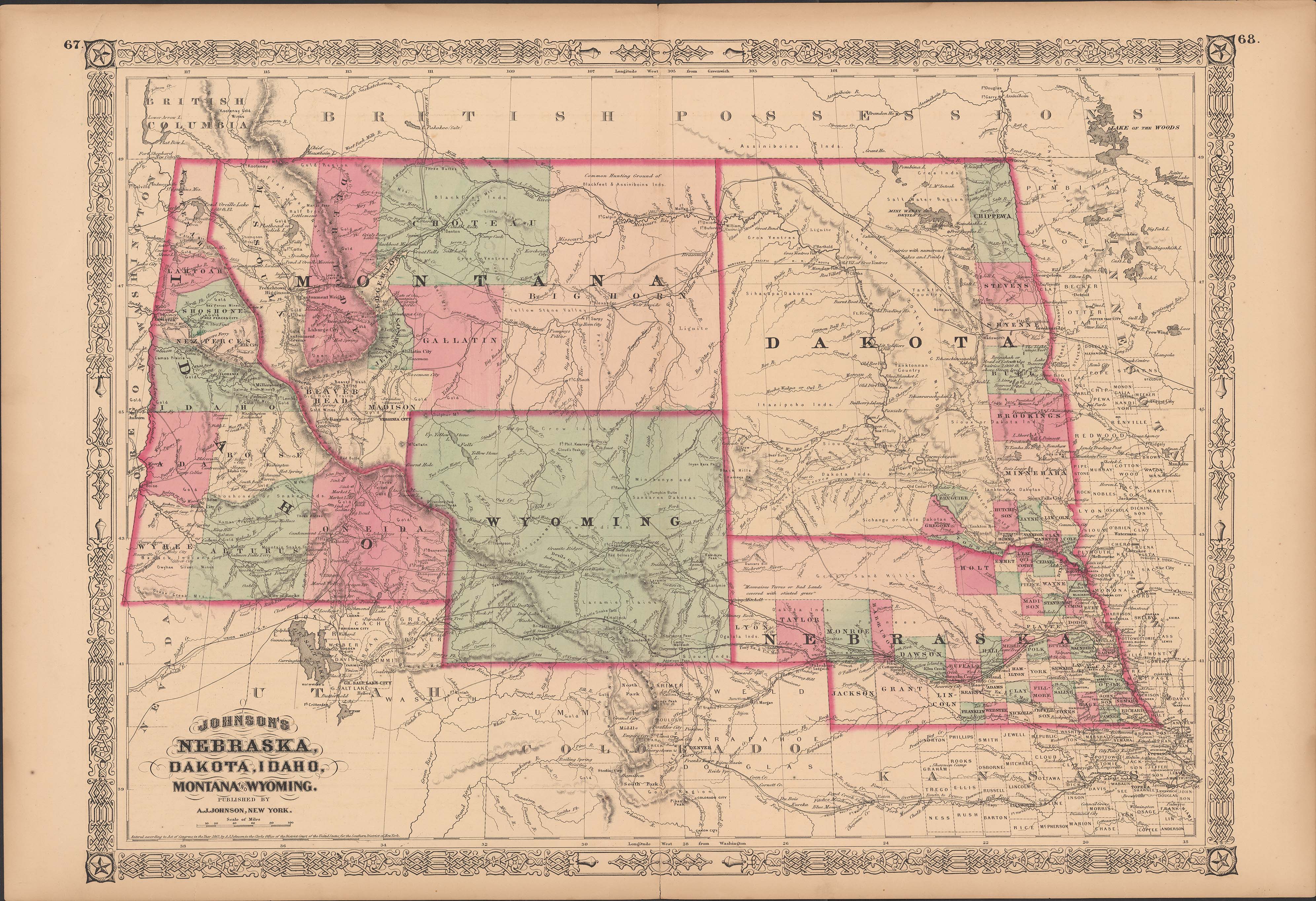
Collection: 978.02 J66j 1868 - Johnson's Nebraska, Dakota, Idaho, Montana, and Wyoming
Folder:
Library
Item:
978.02 J66j 1868
Date:
1865 - 1868
Creator:
Johnson, A. J.--(Alvin Jewett),--1827-1884
Title:
Johnson's Nebraska, Dakota, Idaho, Montana, and Wyoming
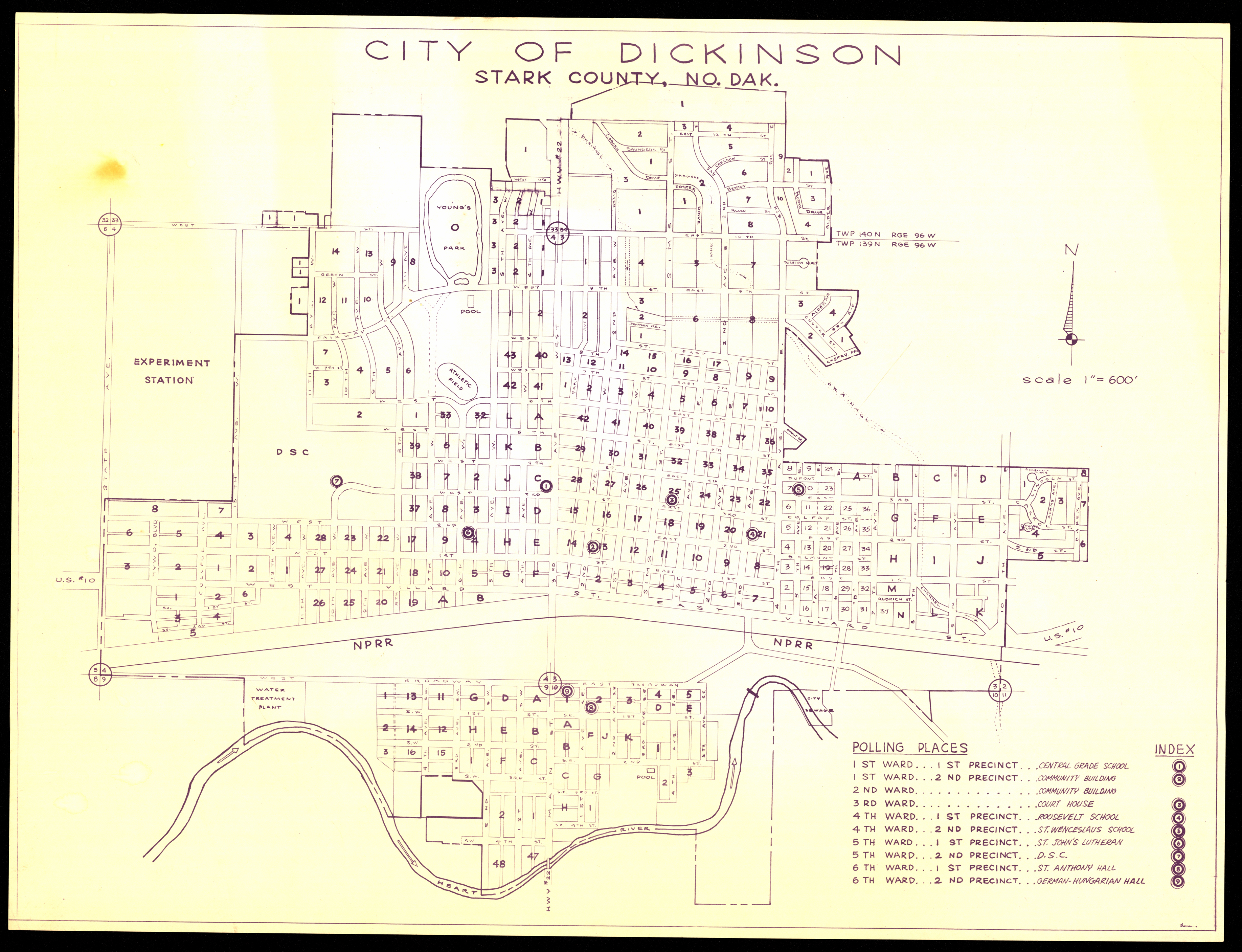
Collection: 324.978444 C5814 - City of Dickinson, Stark County, No. Dak
Folder:
Library
Item:
324.978444 C5814
Date:
ca. 1945
Creator:
Title:
City of Dickinson, Stark County, No. Dak
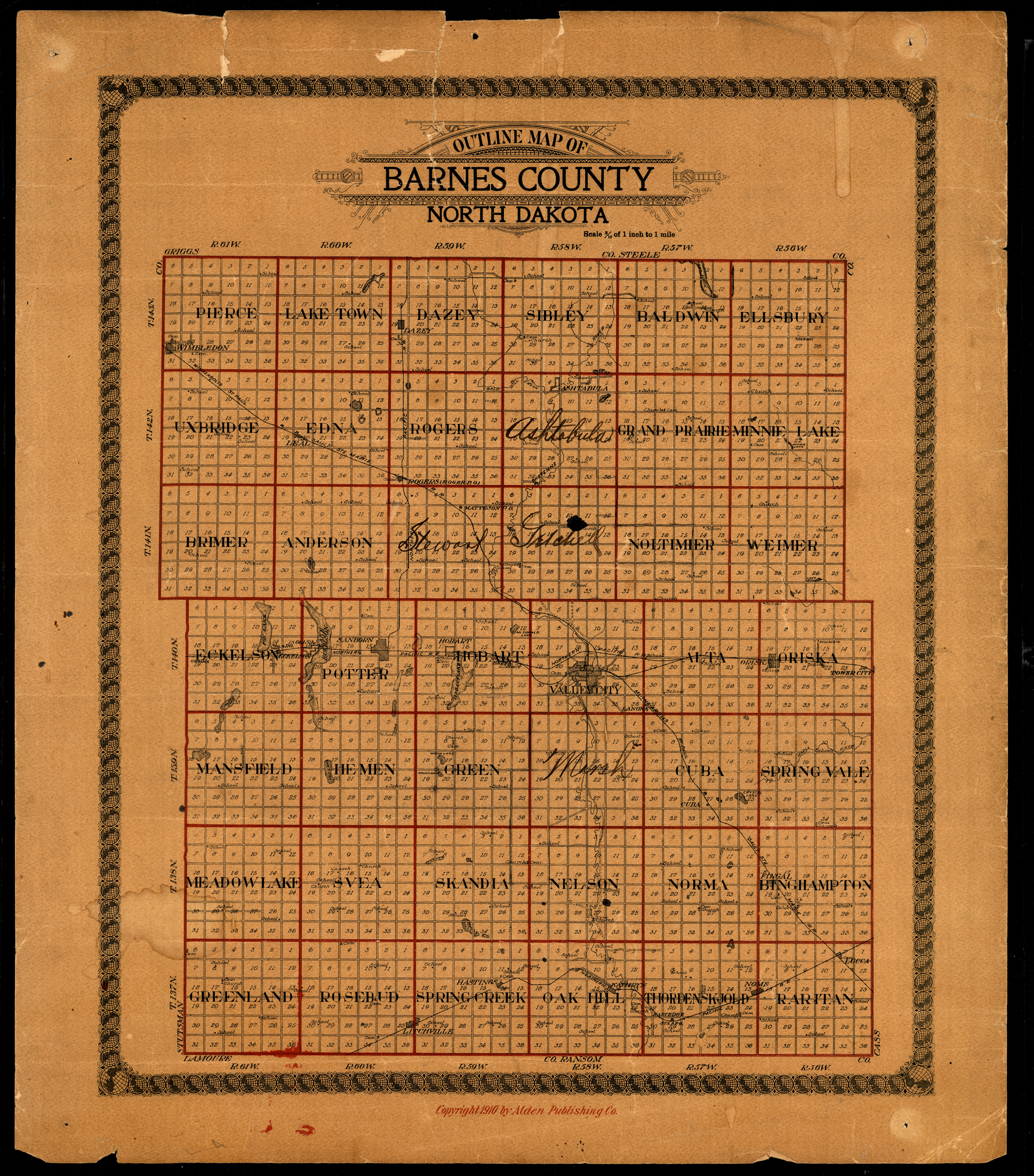
Collection: 978.432 O946 1910 - Outline map of Barnes County North Dakota
Folder:
Library
Item:
978.432 O946 1910
Date:
Copyright 1910
Creator:
Title:
Outline map of Barnes County North Dakota
Collection: 978.4031 D135n 1911 - North Dakota, South Dakota
Folder:
Library
Item:
978.4031 D135n 1911
Date:
1911
Creator:
Title:
North Dakota, South Dakota
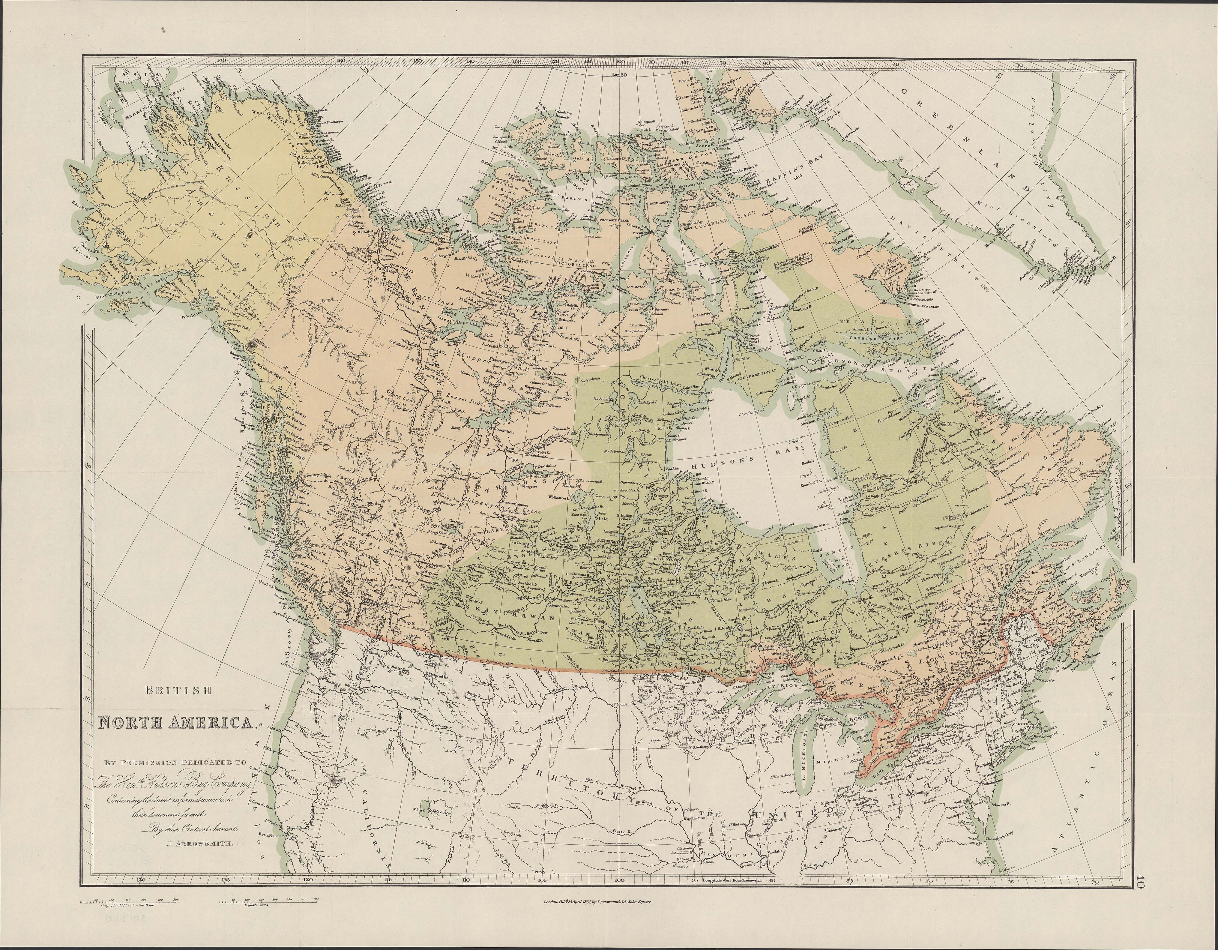
Collection: 971.04 A779b 1854 - British North America : __by permission dedicated to the Honble. Hudsons Bay Company ; containing the latest information which their documents furnish / __by their obedient servant, J. Arrowsmith
Folder:
Library
Item:
971.04 A779b 1854
Date:
1854
Creator:
Arrowsmith, John,--1790-1873
Title:
British North America : __by permission dedicated to the Honble. Hudsons Bay Company ; containing the latest information which their documents furnish / __by their obedient servant, J. Arrowsmith
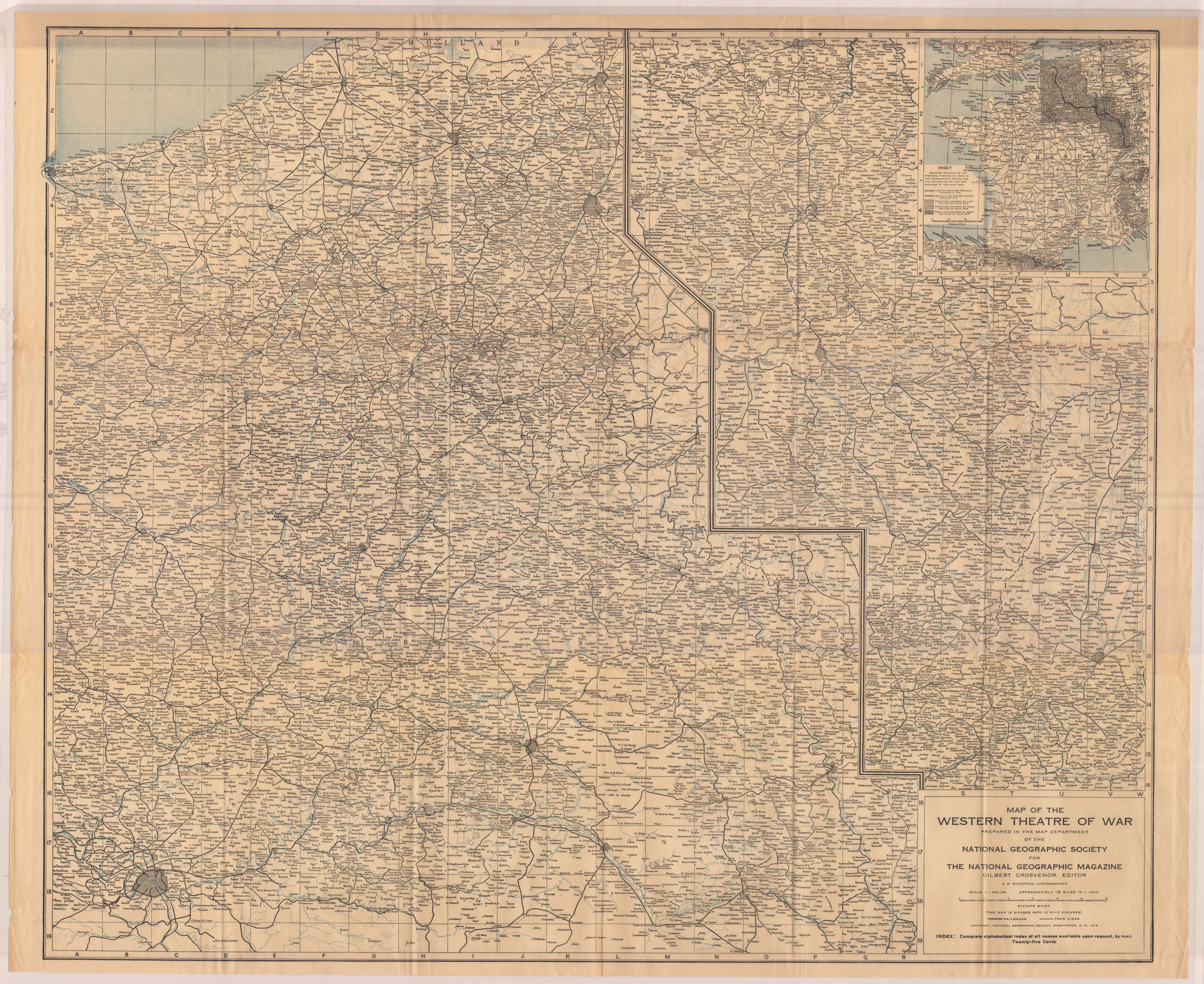
Collection: 940.3 N277m 1918 - Map of the Western Theatre of war / __ __prepared in the Map Department of the National Geographic Society for the National Geographic Magazine ; A.H. Bumstead, cartographer
Folder:
Library
Item:
940.3 N277m 1918
Date:
1918
Creator:
National Geographic Society (U.S.).--Map Department
Title:
Map of the Western Theatre of war / __ __prepared in the Map Department of the National Geographic Society for the National Geographic Magazine ; A.H. Bumstead, cartographer
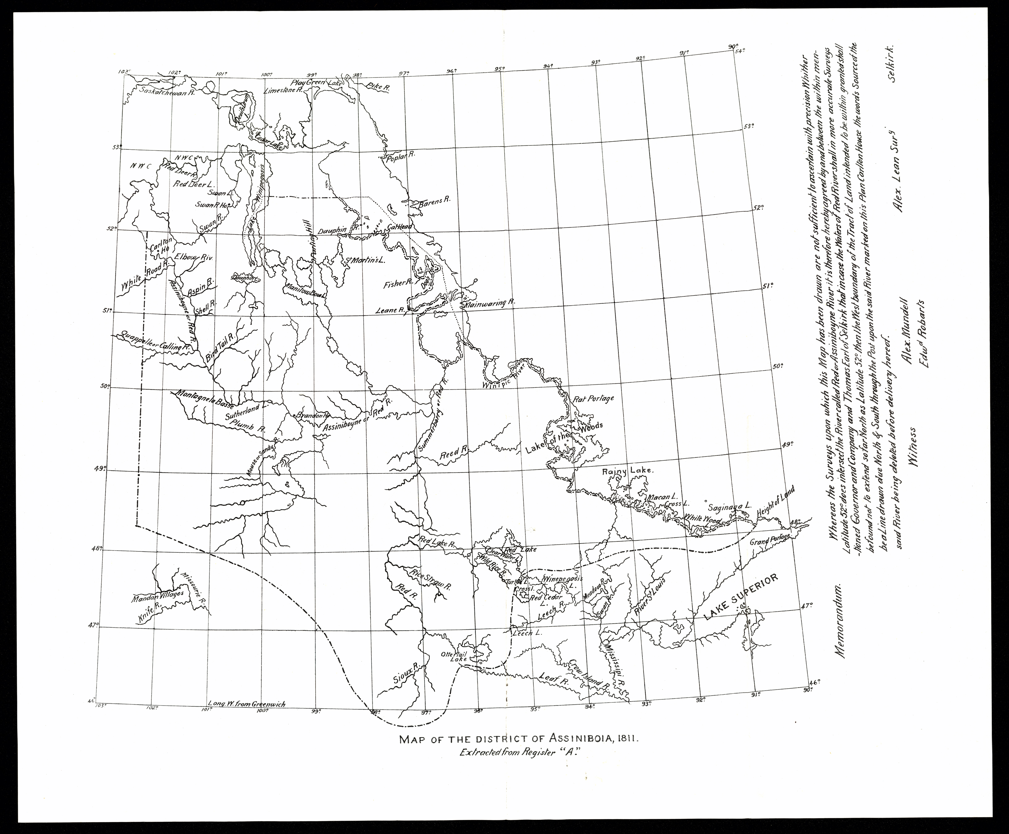
Collection: 971.201 L437m 1811 - Map of the district of Assiniboia, 1811 : __extracted from Register "A" / __Alex Lean
Folder:
Library
Item:
971.201 L437m 1811
Date:
1811
Creator:
Lean, Alex
Title:
Map of the district of Assiniboia, 1811 : __extracted from Register "A" / __Alex Lean
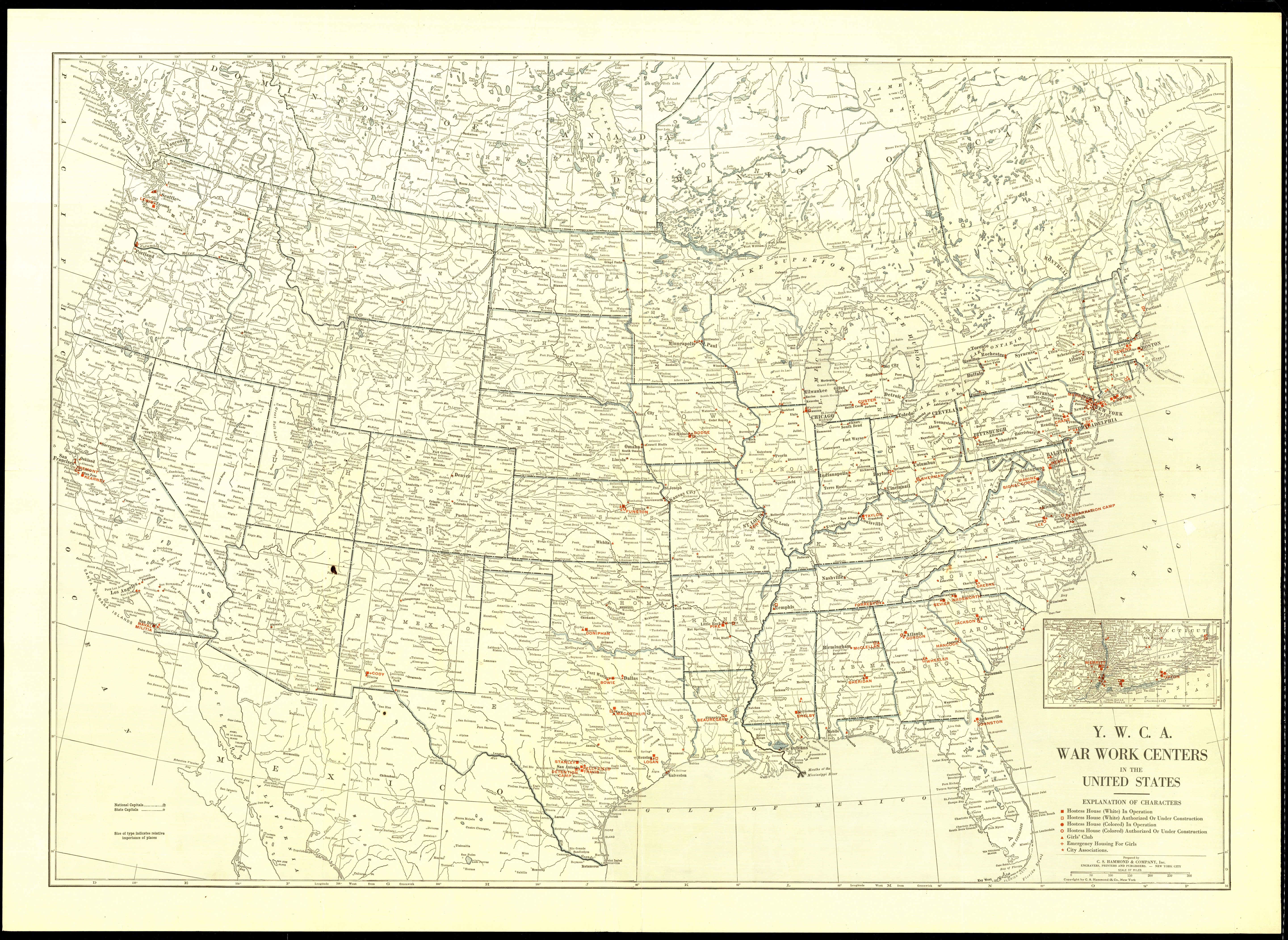
Collection: 940.3 H185y - Y.W.C.A. war work centers in the United States / __ __prepared by C.S. Hammond & Company, Inc
Folder:
Library
Item:
940.3 H185y
Date:
1914 - 1917
Creator:
C.S. Hammond & Company--cartographer
Title:
Y.W.C.A. war work centers in the United States / __ __prepared by C.S. Hammond & Company, Inc
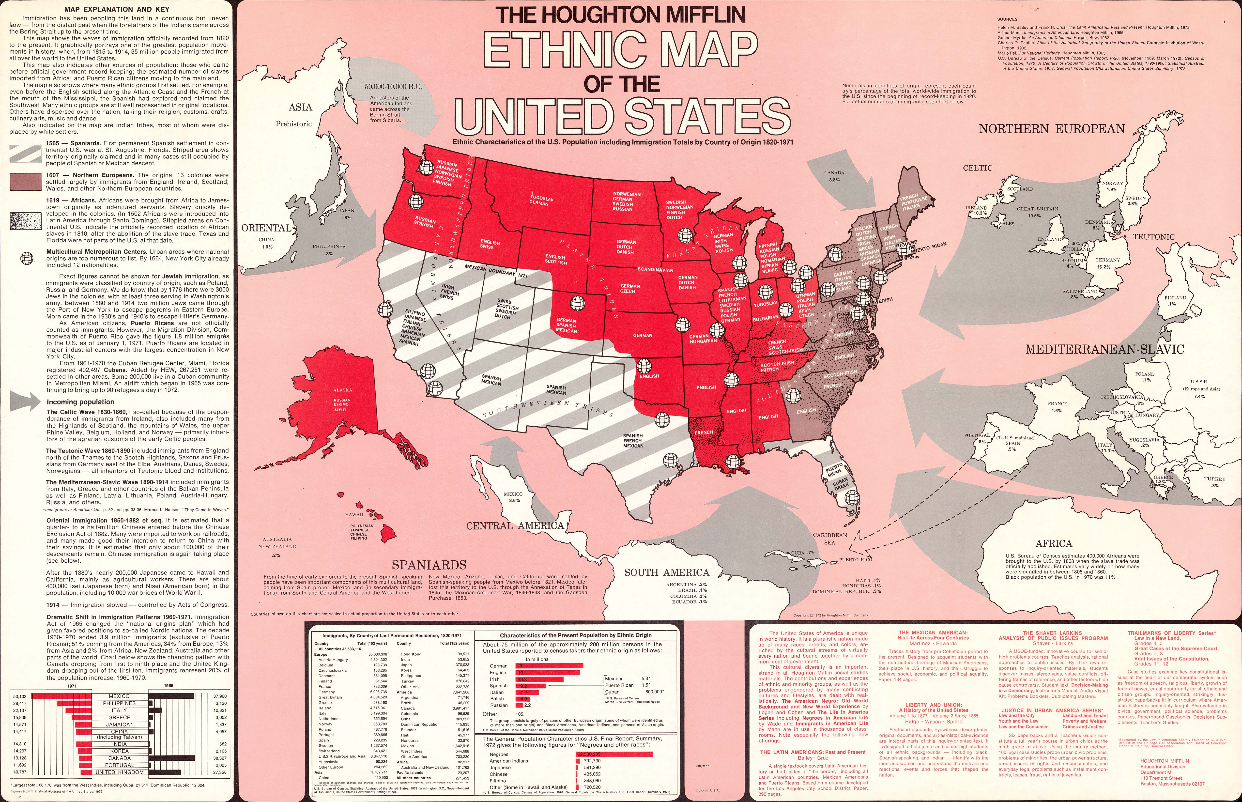
Collection: 305.800973 H8384h 1972 - The Houghton Mifflin ethnic map of the United States : __ethnic characteristics of the U.S. population including immigration totals by country of origin, 1820-1971 / __Houghton Mifflin Educational Division
Folder:
Library
Item:
305.800973 H8384h 1972
Date:
Copyright 1972
Creator:
Houghton Mifflin Company.--Educational Division
Title:
The Houghton Mifflin ethnic map of the United States : __ethnic characteristics of the U.S. population including immigration totals by country of origin, 1820-1971 / __Houghton Mifflin Educational Division
Collection: 978.4 G773m - Map of North Dakota showing location of E.C.W. state parks & connecting highways / __ __drawn by W.W. Gratton
Folder:
Library
Item:
978.4 G773m
Date:
ca. 1935
Creator:
Gratton, W. W
Title:
Map of North Dakota showing location of E.C.W. state parks & connecting highways / __ __drawn by W.W. Gratton
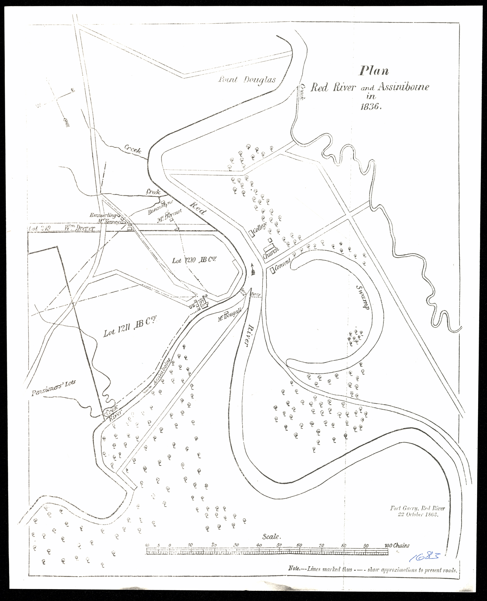
Collection: 971.201 P699 - Plan, Red River and Assiniboine in 1836
Folder:
Library
Item:
971.201 P699
Date:
1836 - 1899
Creator:
Title:
Plan, Red River and Assiniboine in 1836
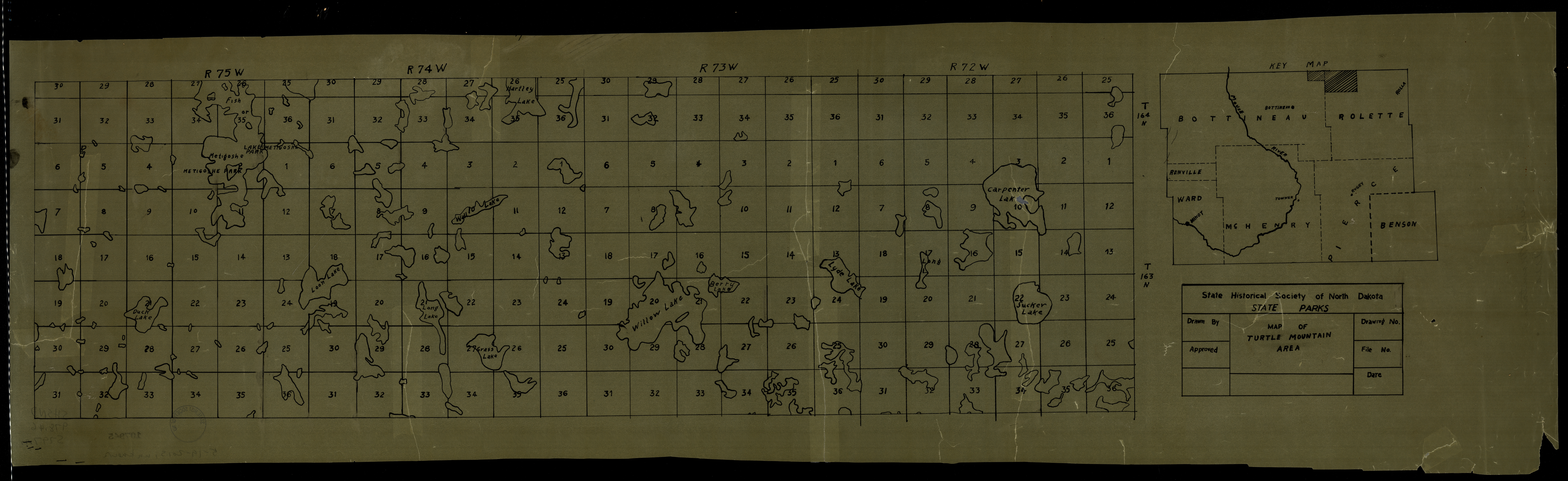
Collection: 978.46 S797m - Map of Turtle Mountain area / __ __State Historical Society of North Dakota, State Parks
Folder:
Library
Item:
978.46 S797m
Date:
ca. 1935
Creator:
State Historical Society of North Dakota
Title:
Map of Turtle Mountain area / __ __State Historical Society of North Dakota, State Parks
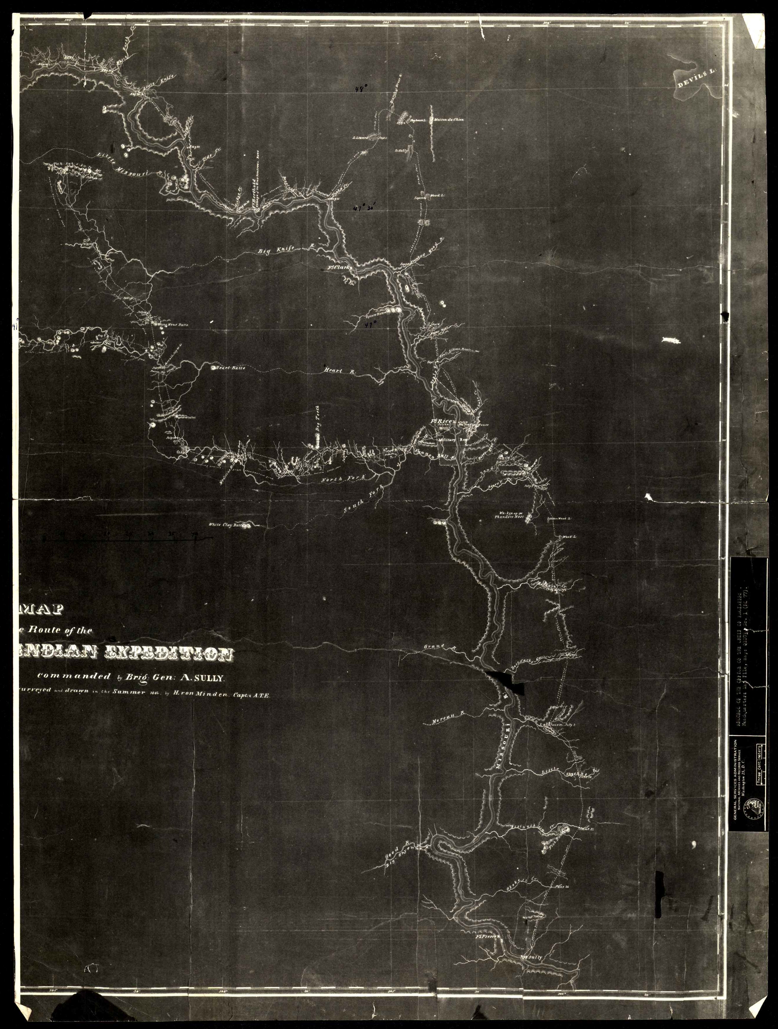
Collection: 973.82 V947m 1864 - Map of the route of the North Western Indian Expedition : __commanded by Brig. Gen. A. Sully / __surveyed & drawn in the summer 1864 by H. von Minden, Capt. A.T.E
Folder:
Library
Item:
973.82 V947m 1864
Date:
1864
Creator:
Von Minden, H.--(Henning)
Title:
Map of the route of the North Western Indian Expedition : __commanded by Brig. Gen. A. Sully / __surveyed & drawn in the summer 1864 by H. von Minden, Capt. A.T.E
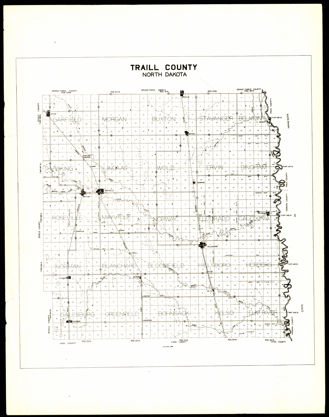
Collection: 978.414 L962t 1939 - Traill County, North Dakota / __ __J.G. Lund
Folder:
Library
Item:
978.414 L962t 1939
Date:
1939
Creator:
Lund, J. G
Title:
Traill County, North Dakota / __ __J.G. Lund