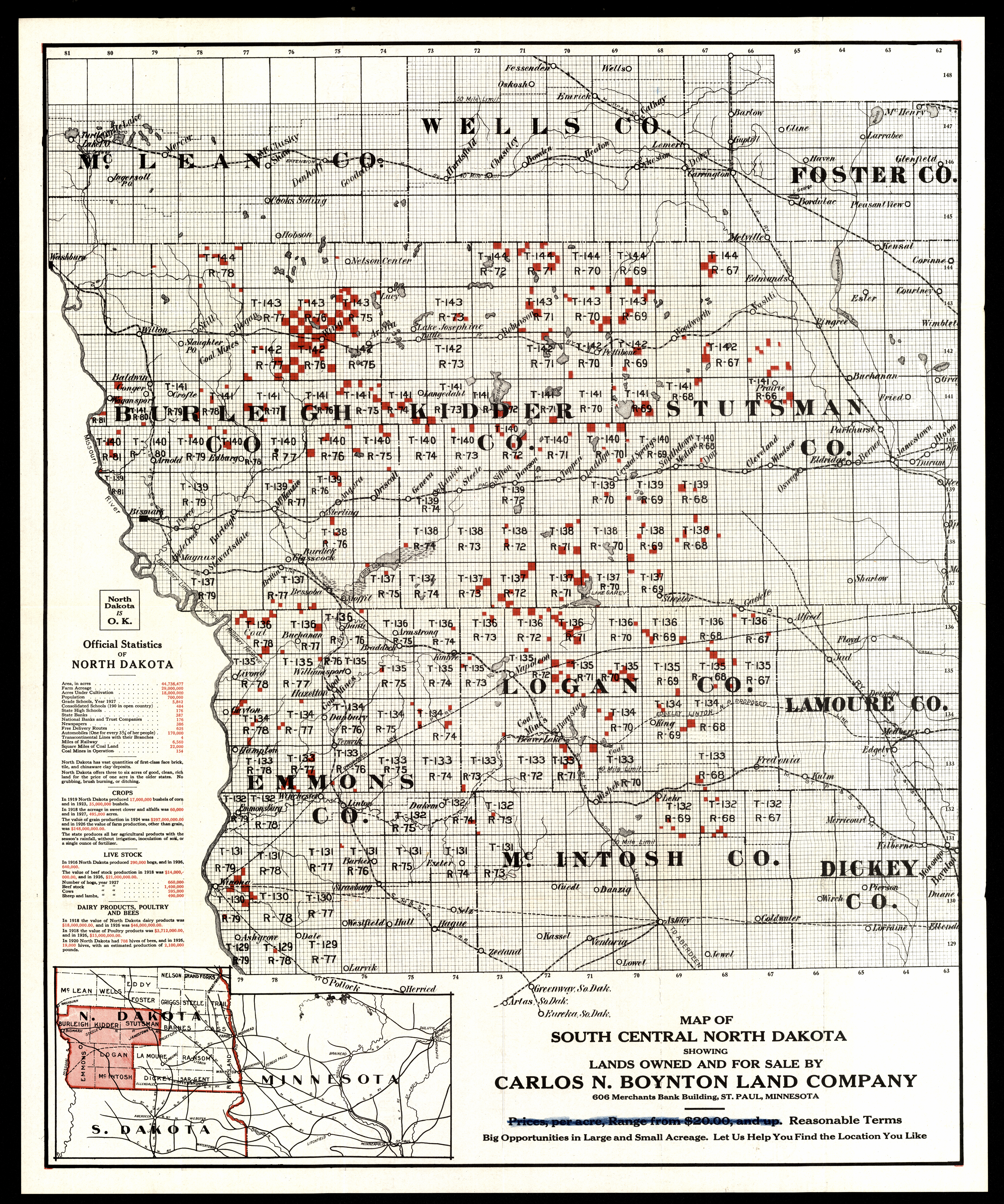
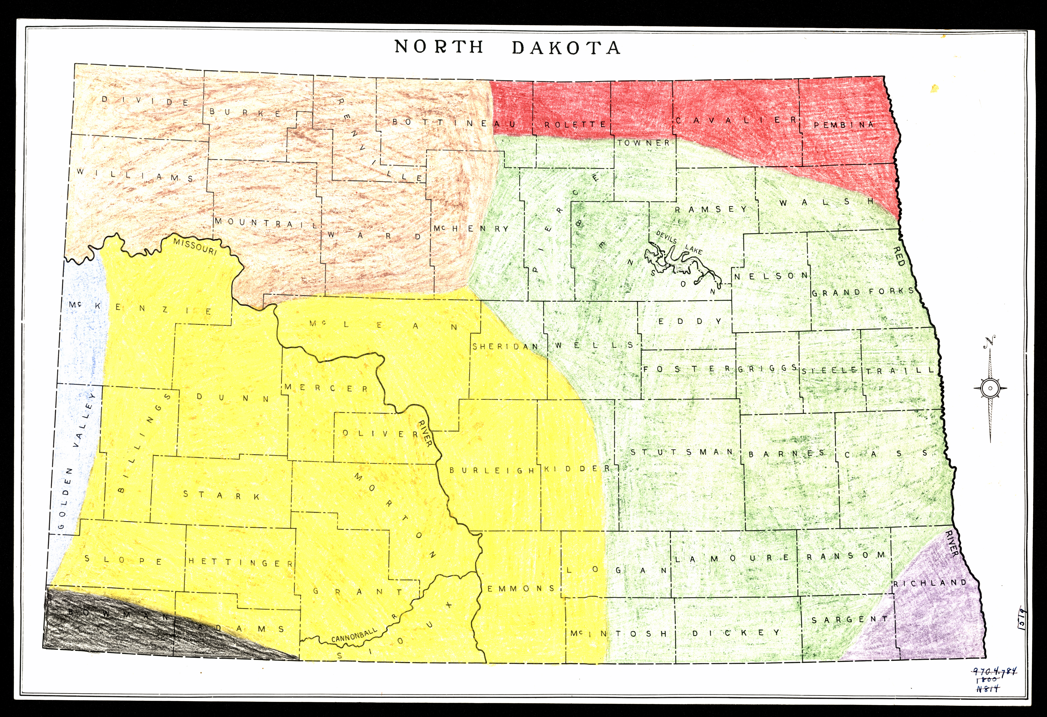
Collection: 978.45 M297sc 1928 - Map of south central North Dakota : __showing selected lands owned and for sale by Carlos N. Boynton
Folder:
Library
Item:
978.45 M297sc 1928
Date:
1928
Creator:
Title:
Map of south central North Dakota : __showing selected lands owned and for sale by Carlos N. Boynton
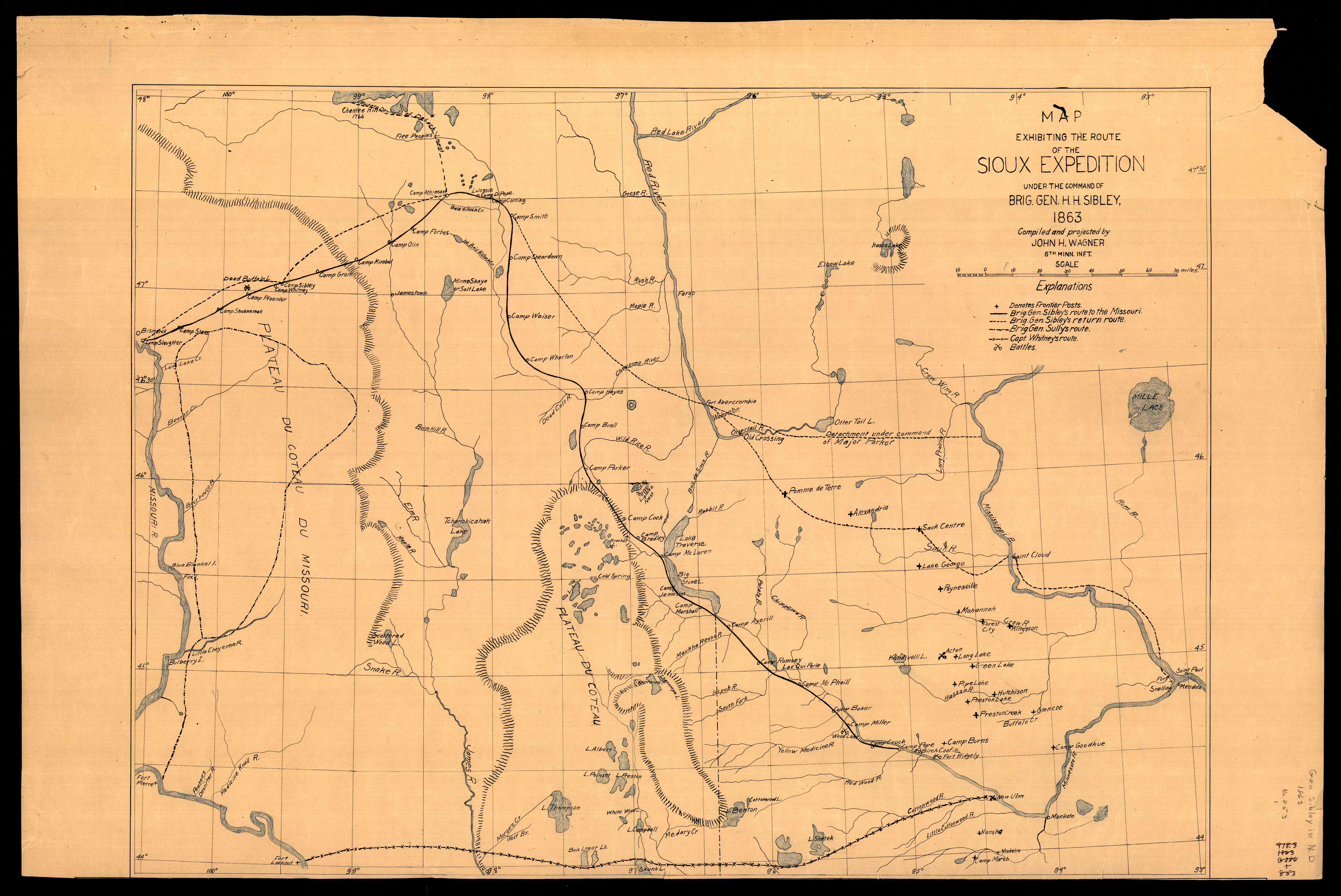
Collection: 973.7 G3263 - [General Sibley's expedition, 1863]
Folder:
Library
Item:
973.7 G3263
Date:
ca. 1950
Creator:
Title:
[General Sibley's expedition, 1863]
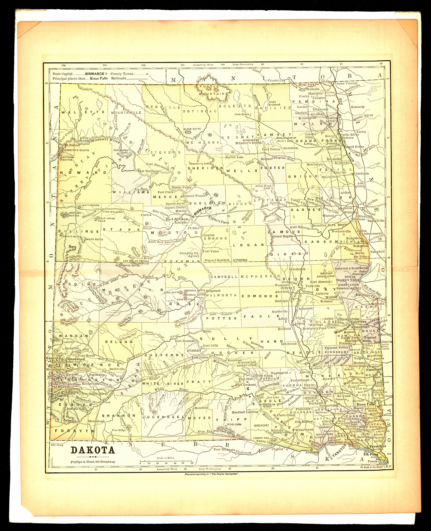
Collection: 978.402 P558d 1885 - Dakota / __ __Phillips & Hunt
Folder:
Library
Item:
978.402 P558d 1885
Date:
1885
Creator:
Phillips & Hunt
Title:
Dakota / __ __Phillips & Hunt
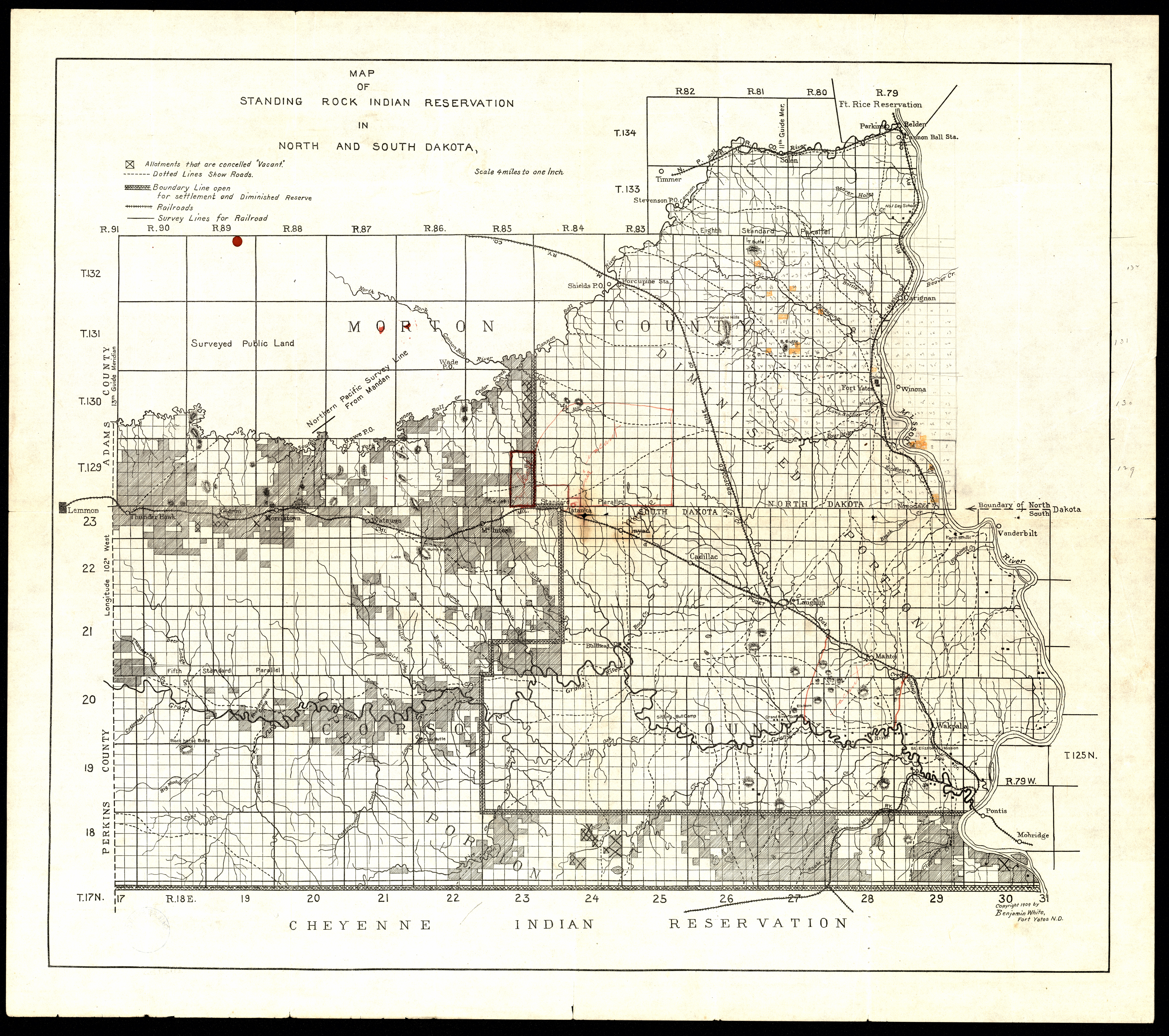
Collection: 978.488 W582m 1909 - Map of Standing Rock Indian Reservation in North and South Dakota / __ __Benjamin White
Folder:
Library
Item:
978.488 W582m 1909
Date:
Copyright 1909
Creator:
White, Benjamin
Title:
Map of Standing Rock Indian Reservation in North and South Dakota / __ __Benjamin White
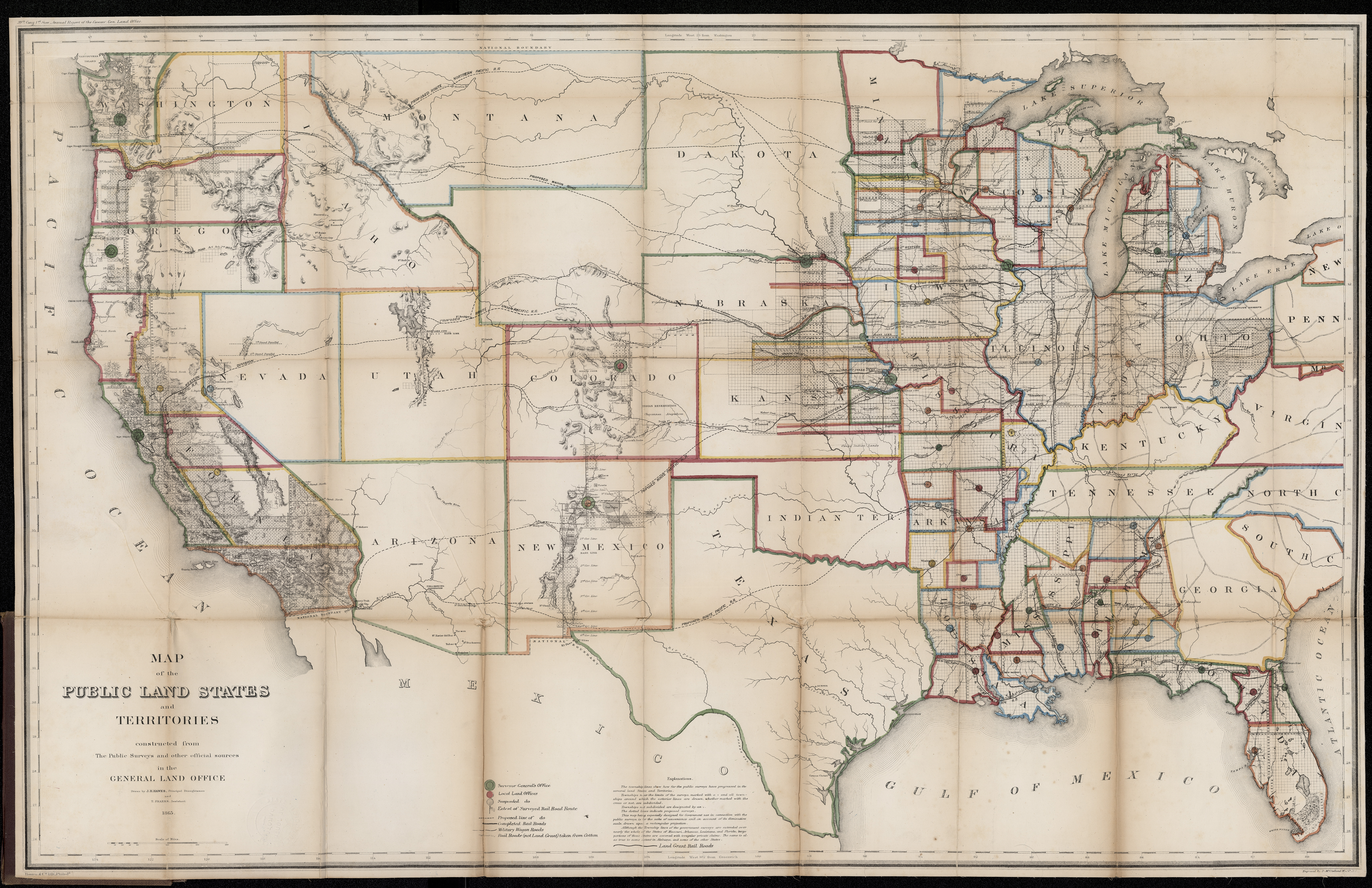
Collection: 333.1 U5813m 1866 - Map of the public land states and territories : __constructed from the public surveys and other official sources in the General Land Office / __drawn by J.H. Hawes, principal draughtsman and T. Franks, assistant, 1865 ; engraved by D. McClelland
Folder:
Library
Item:
333.1 U5813m 1866
Date:
1866
Creator:
United States.--General Land Office
Title:
Map of the public land states and territories : __constructed from the public surveys and other official sources in the General Land Office / __drawn by J.H. Hawes, principal draughtsman and T. Franks, assistant, 1865 ; engraved by D. McClelland
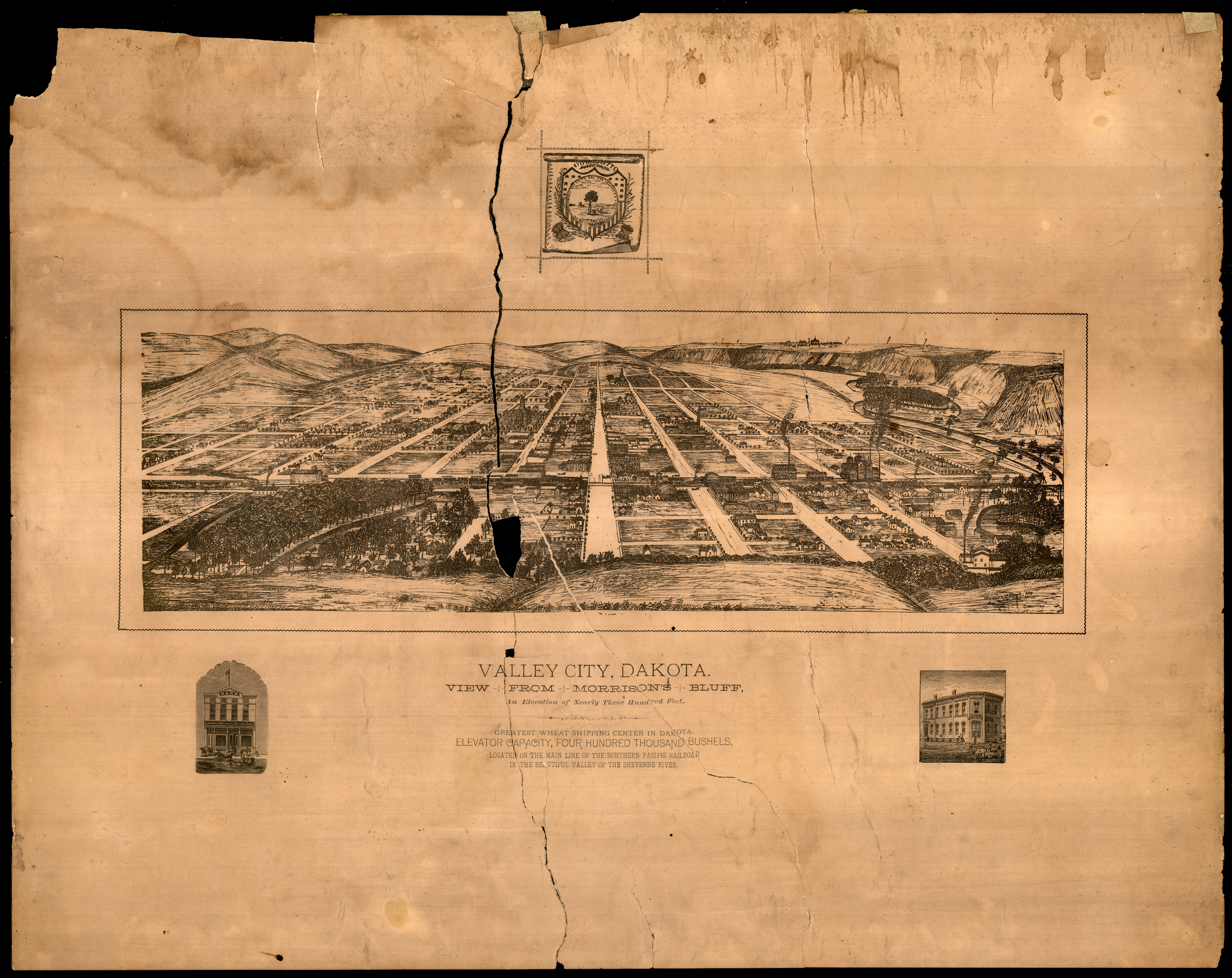
Collection: 978.432 V156 - Valley City, Dakota : __view from Morrison's Bluff, an elevation of nearly three hundred feet
Folder:
Library
Item:
978.432 V156
Date:
ca. 1885
Creator:
Title:
Valley City, Dakota : __view from Morrison's Bluff, an elevation of nearly three hundred feet
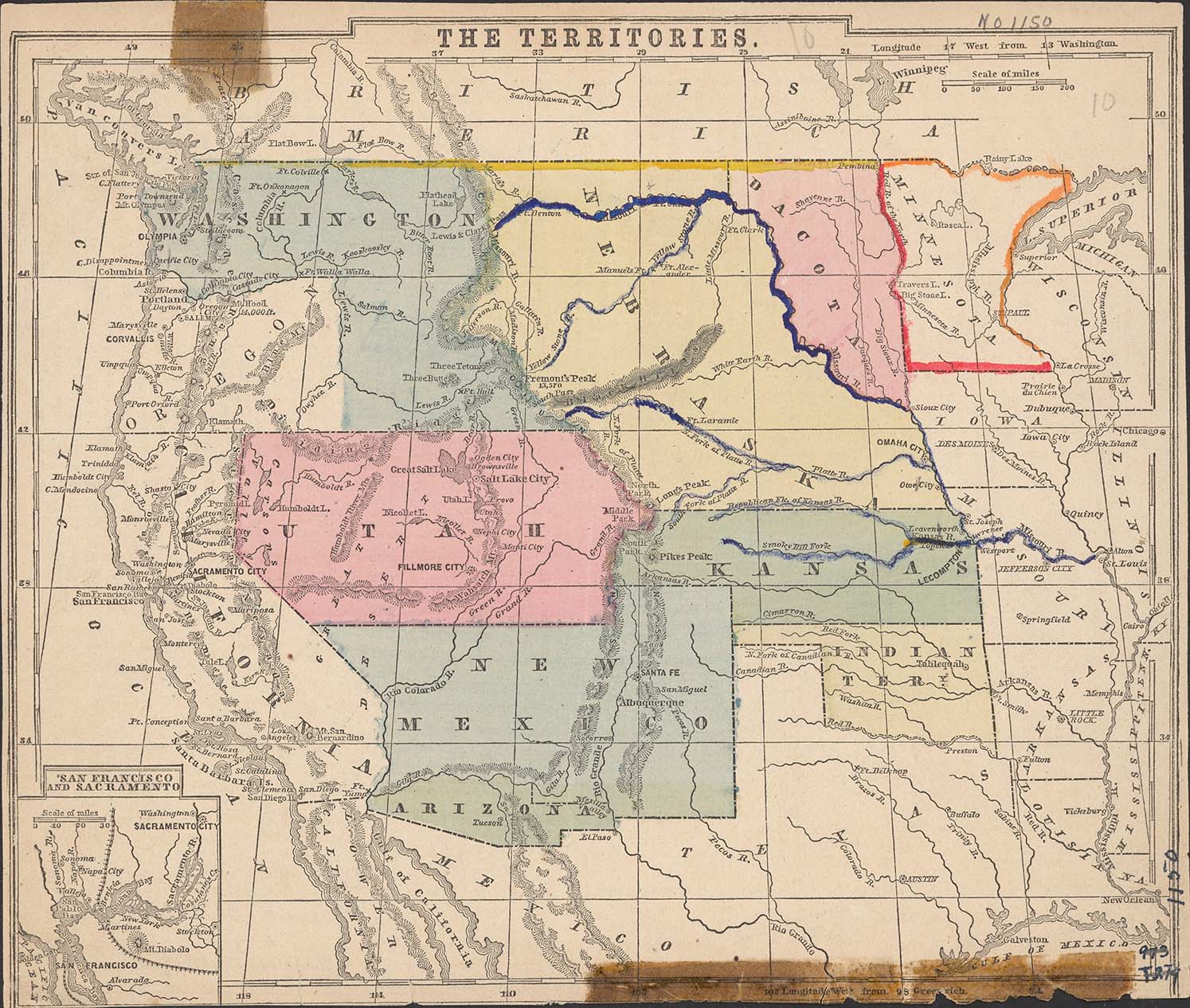
Collection: 978.02 T327 - The territories
Folder:
Library
Item:
978.02 T327
Date:
1853 - 1861
Creator:
Title:
The territories
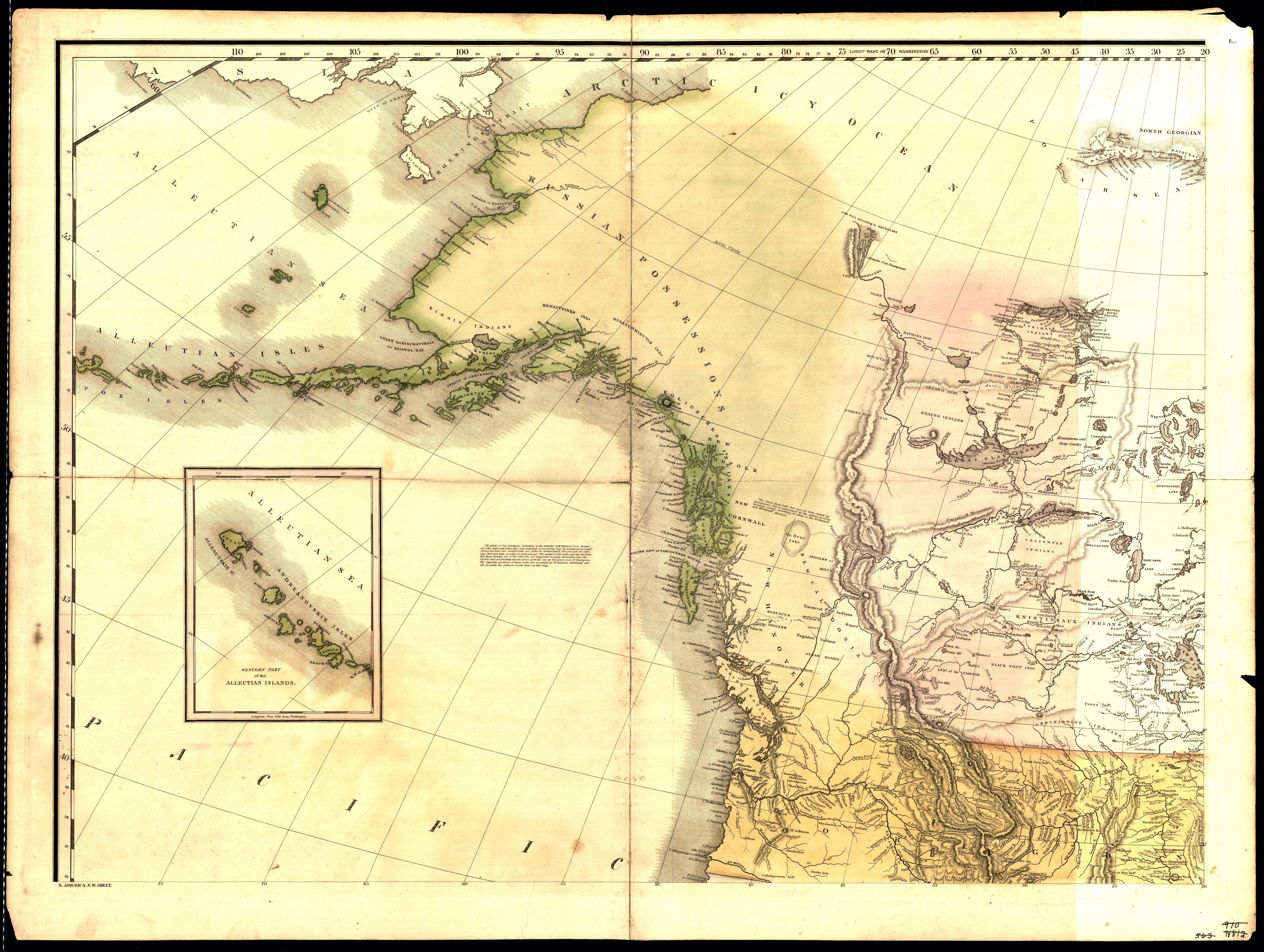
Collection: 970.00497 T1664n 1823 - N. America, N.W. sheet
Folder:
Library
Item:
970.00497 T1664n 1823
Date:
1823
Creator:
Tanner, Henry Schenck,--1786-1858
Title:
N. America, N.W. sheet
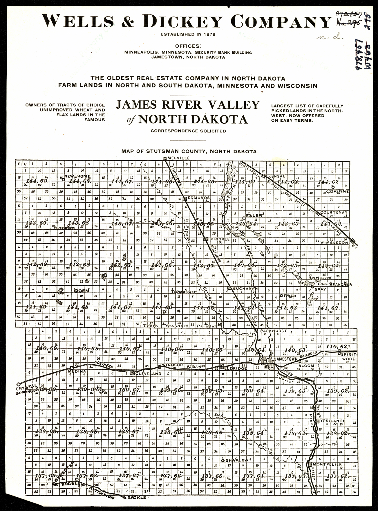
Collection: 978.452 W449m - Map of Stutsman County, North Dakota / __ __Wells & Dickey Company
Folder:
Library
Item:
978.452 W449m
Date:
ca. 1925
Creator:
Wells & Dickey Company
Title:
Map of Stutsman County, North Dakota / __ __Wells & Dickey Company
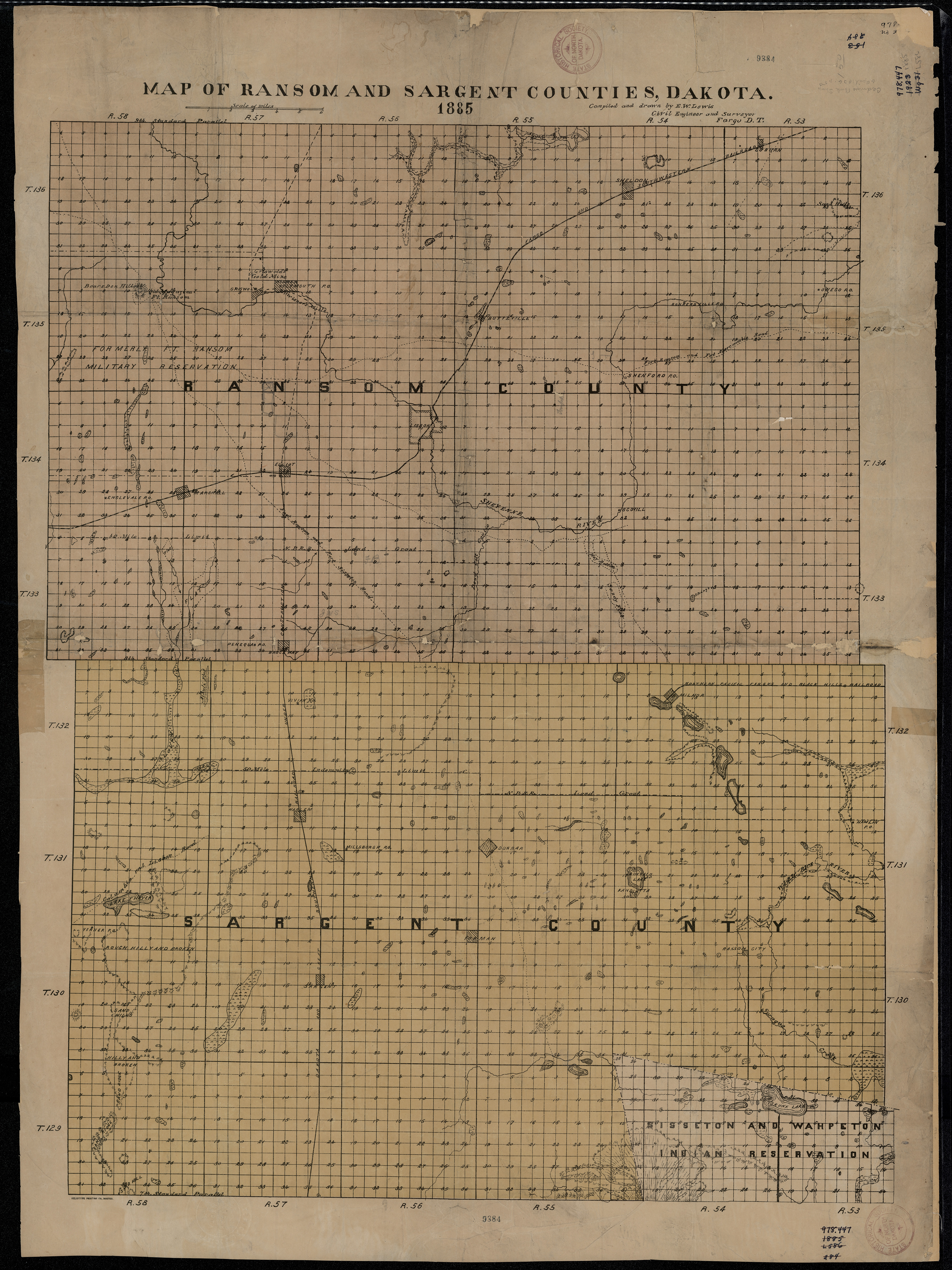
Collection: 978.431 L673m 1885 - Map of Ransom and Sargent Counties, Dakota / __ __compiled and drawn by E.W. Lewis, civil engineer and surveyor
Folder:
Library
Item:
978.431 L673m 1885
Date:
1885
Creator:
Lewis, E. W
Title:
Map of Ransom and Sargent Counties, Dakota / __ __compiled and drawn by E.W. Lewis, civil engineer and surveyor
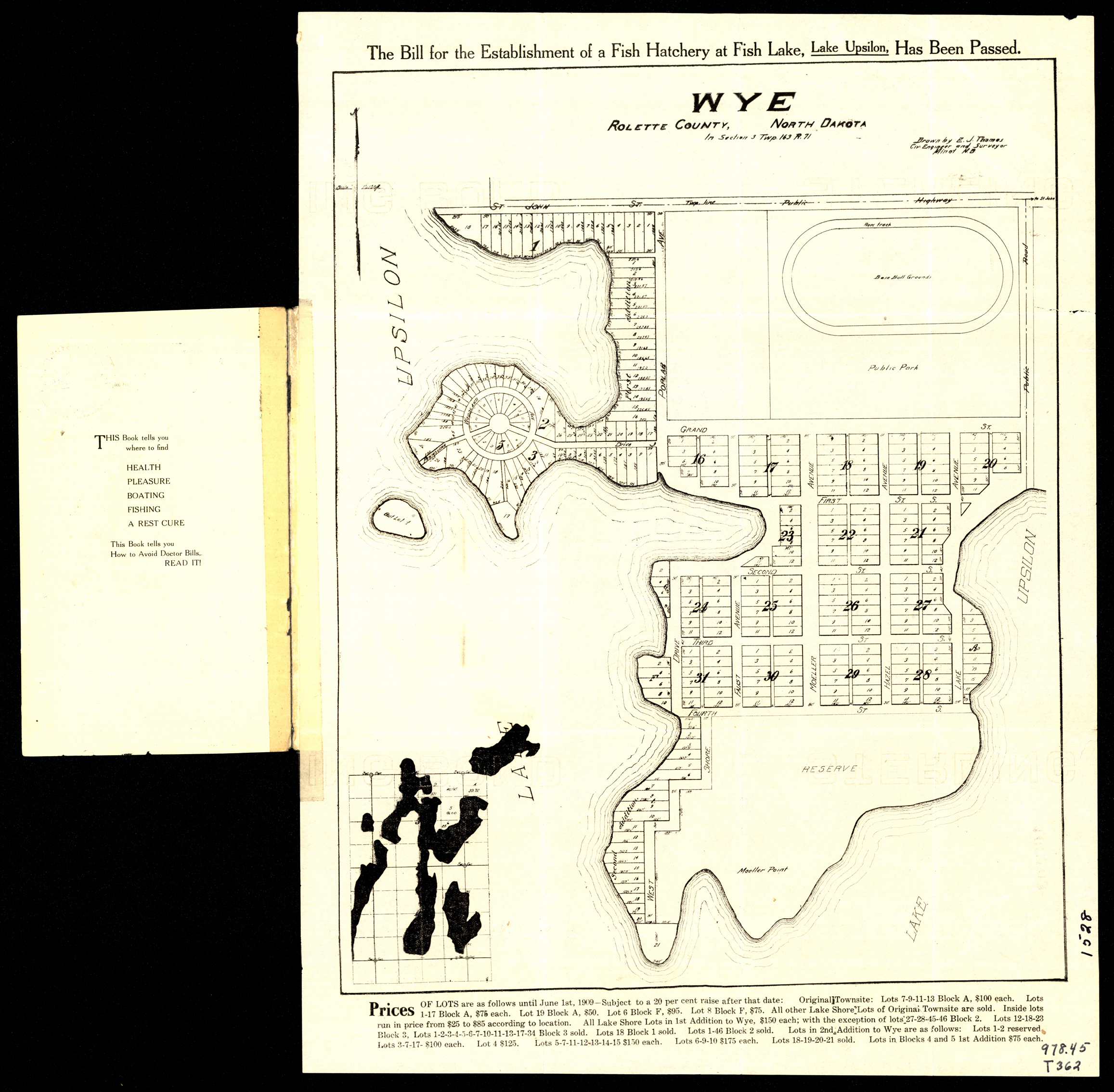
Collection: 978.4592 T454w 1909 - Wye, Rolette County, North Dakota in section 3 Twp. 163 R 71 / __ __drawn by E.J. Thomas, civ. engineer and surveyor
Folder:
Library
Item:
978.4592 T454w 1909
Date:
1909
Creator:
Thomas, E. J
Title:
Wye, Rolette County, North Dakota in section 3 Twp. 163 R 71 / __ __drawn by E.J. Thomas, civ. engineer and surveyor
Collection: 978.400497 D6144 - Distribution of Indian tribes in North Dakota
Folder:
Library
Item:
978.400497 D6144
Date:
ca. 1935
Creator:
Title:
Distribution of Indian tribes in North Dakota
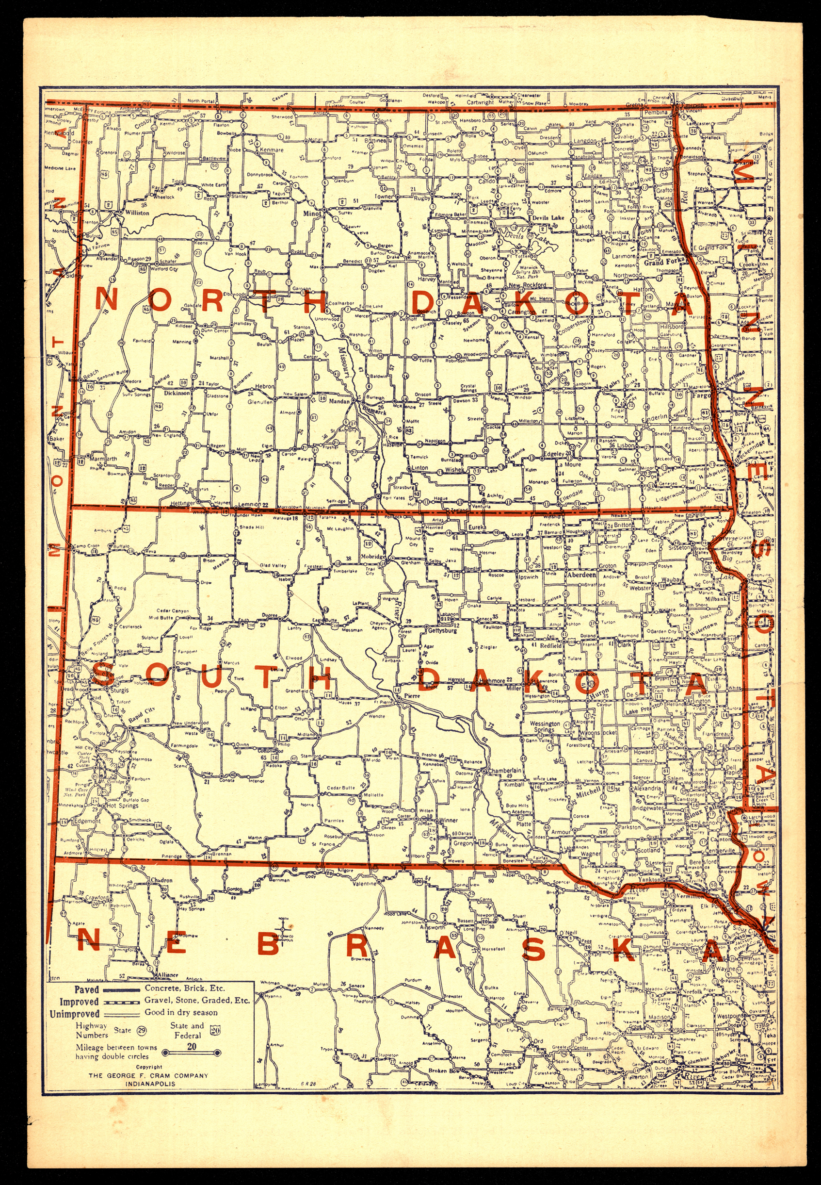
Collection: 978 C889n 1930 - North Dakota, South Dakota, Nebraska / __ __George F. Cram Company
Folder:
Library
Item:
978 C889n 1930
Date:
1930
Creator:
George F. Cram Company
Title:
North Dakota, South Dakota, Nebraska / __ __George F. Cram Company
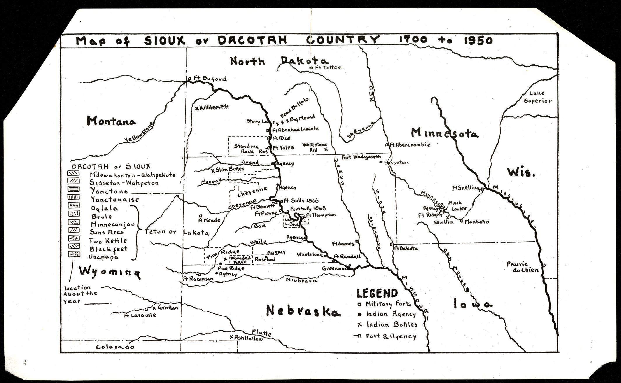
Collection: 978.400497 M297 - Map of Sioux or Dakotah country 1700 to 1950
Folder:
Library
Item:
978.400497 M297
Date:
ca. 1955
Creator:
Title:
Map of Sioux or Dakotah country 1700 to 1950
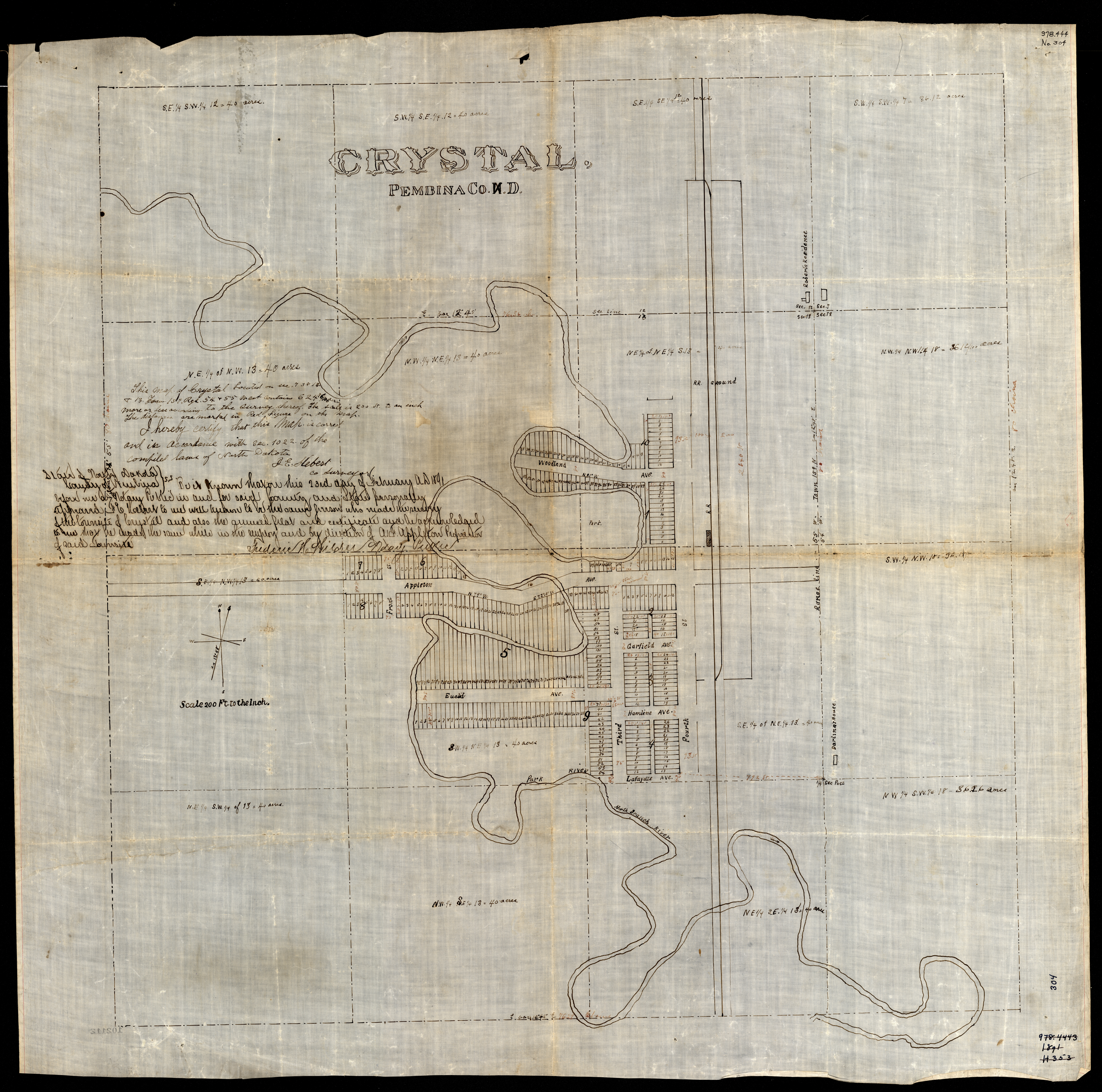
Collection: 978.419 H446c 1891 - Crystal, Pembina Co. N.D. / __ __F.E. Hebert, surveyor
Folder:
Library
Item:
978.419 H446c 1891
Date:
1891
Creator:
Hebert, F. E
Title:
Crystal, Pembina Co. N.D. / __ __F.E. Hebert, surveyor
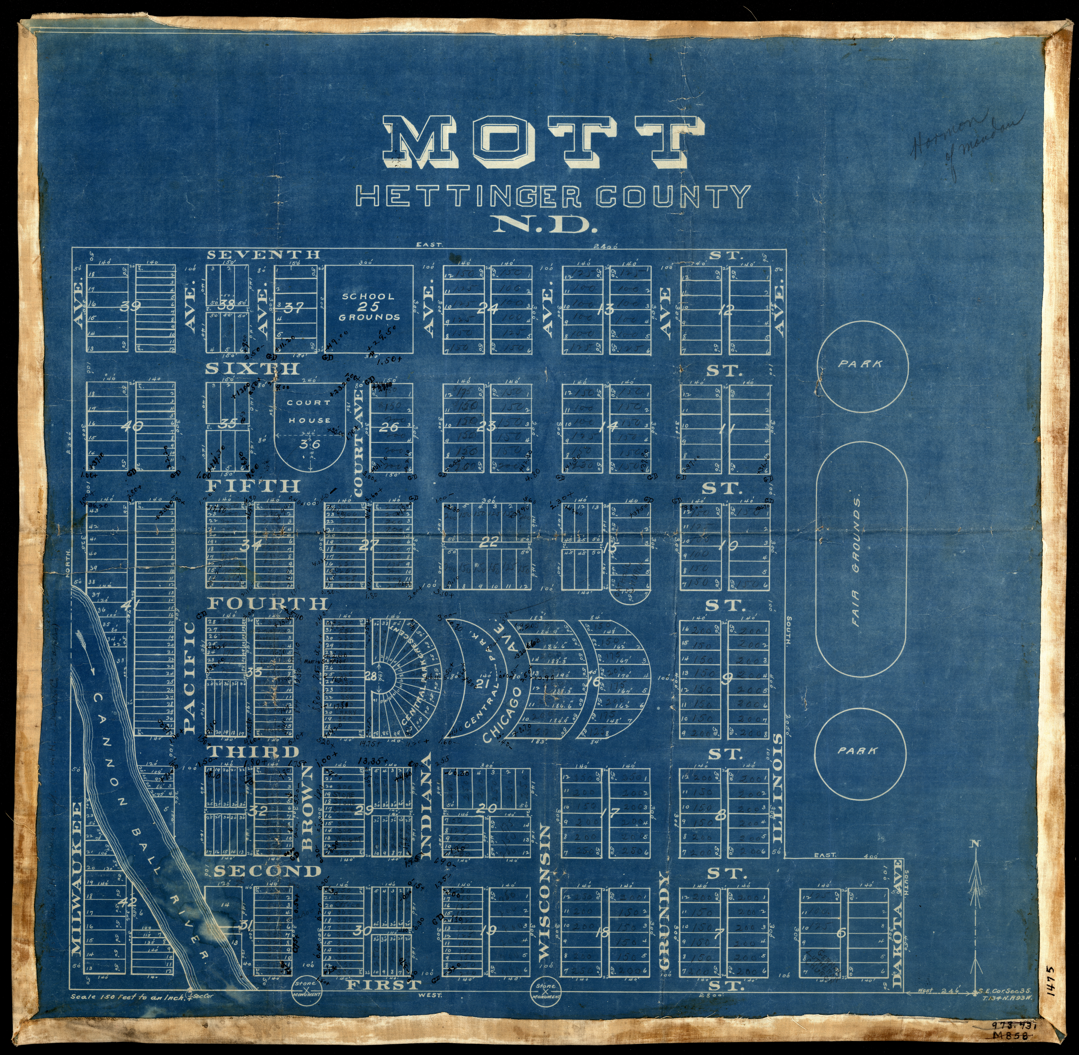
Collection: 978.486 M858 - Mott, Hettinger County, N.D
Folder:
Library
Item:
978.486 M858
Date:
1908 - 1910
Creator:
Title:
Mott, Hettinger County, N.D
Collection: 978.4843 O946 1917 - Outline map of Oliver County, North Dakota
Folder:
Library
Item:
978.4843 O946 1917
Date:
1917
Creator:
Title:
Outline map of Oliver County, North Dakota
Collection: 978.463 P173m 1902 - Map of the incorporate village of Berthold Ward Co., N. Dak. / __ __E.C. Palmer, surveyor
Folder:
Library
Item:
978.463 P173m 1902
Date:
1902
Creator:
Palmer, E. C
Title:
Map of the incorporate village of Berthold Ward Co., N. Dak. / __ __E.C. Palmer, surveyor
Collection: 978.477 H292m - Map of Burleigh County, North Dakota
Folder:
Library
Item:
978.477 H292m
Date:
1900 - 1912
Creator:
Title:
Map of Burleigh County, North Dakota
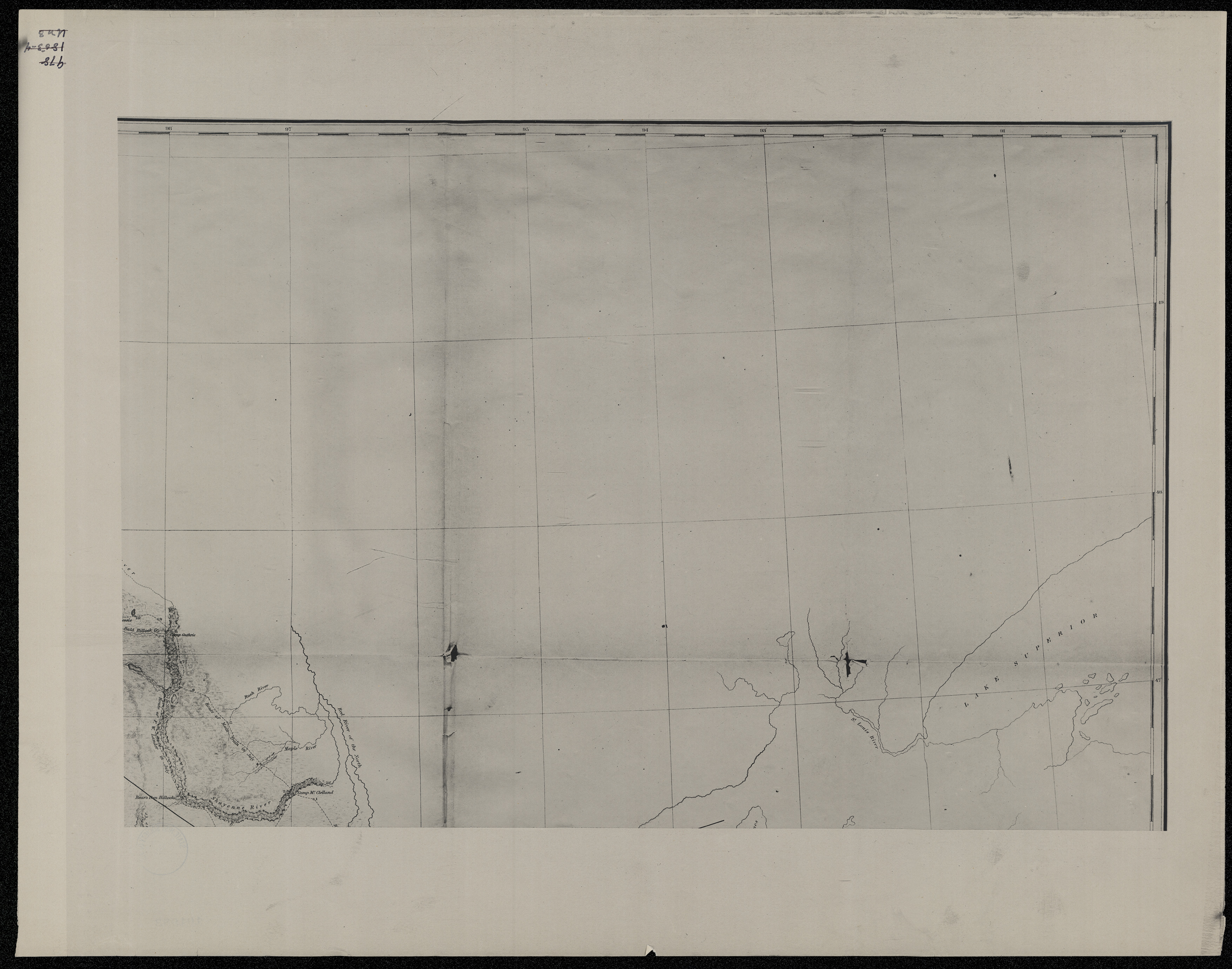
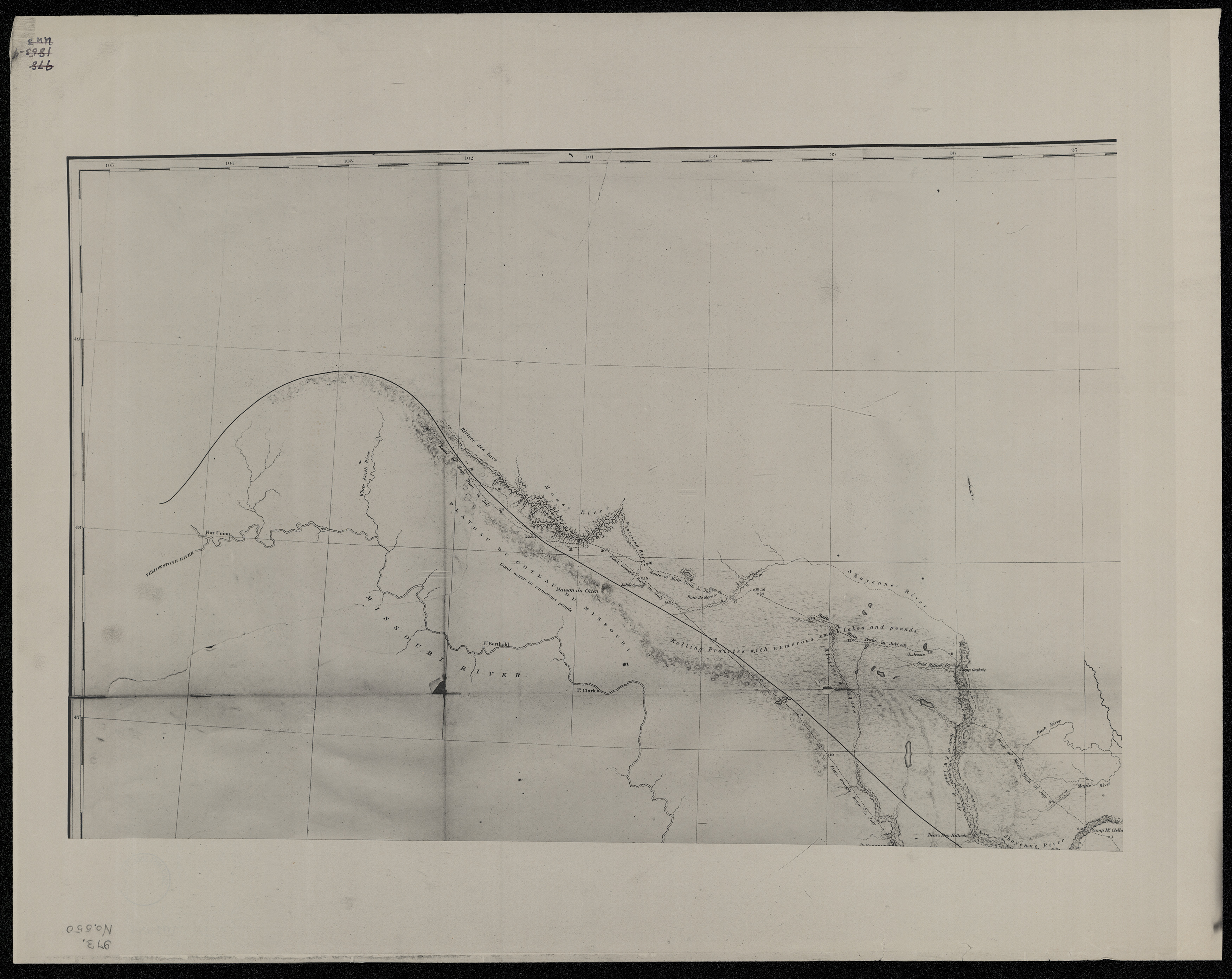
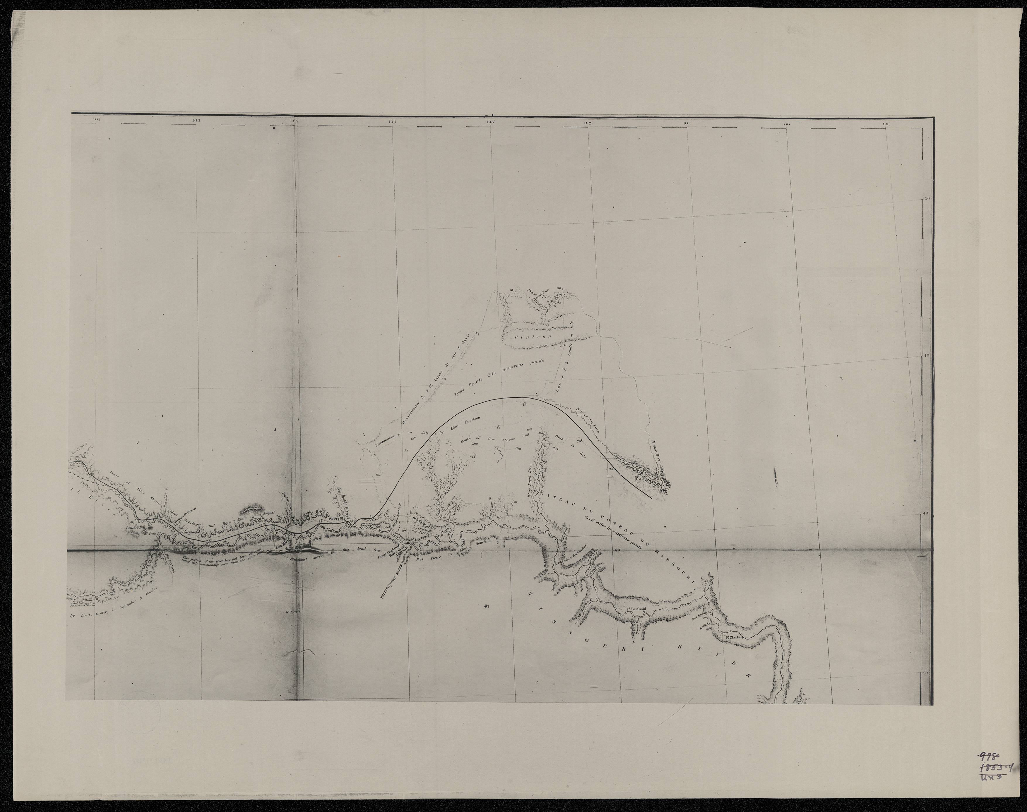
Collection: 917.8 Un3r 1855-1860 - Explorations and surveys for a rail road route from the Mississippi River to the Pacific Ocean / __ __War Department ; by Isaac I. Stevens ; engr. by Selmar Siebert
Folder:
Library
Item:
917.8 Un3r 1855-1860
Date:
1855 - 1860
Creator:
Stevens, Isaac Ingalls,--1818-1862
Title:
Explorations and surveys for a rail road route from the Mississippi River to the Pacific Ocean / __ __War Department ; by Isaac I. Stevens ; engr. by Selmar Siebert
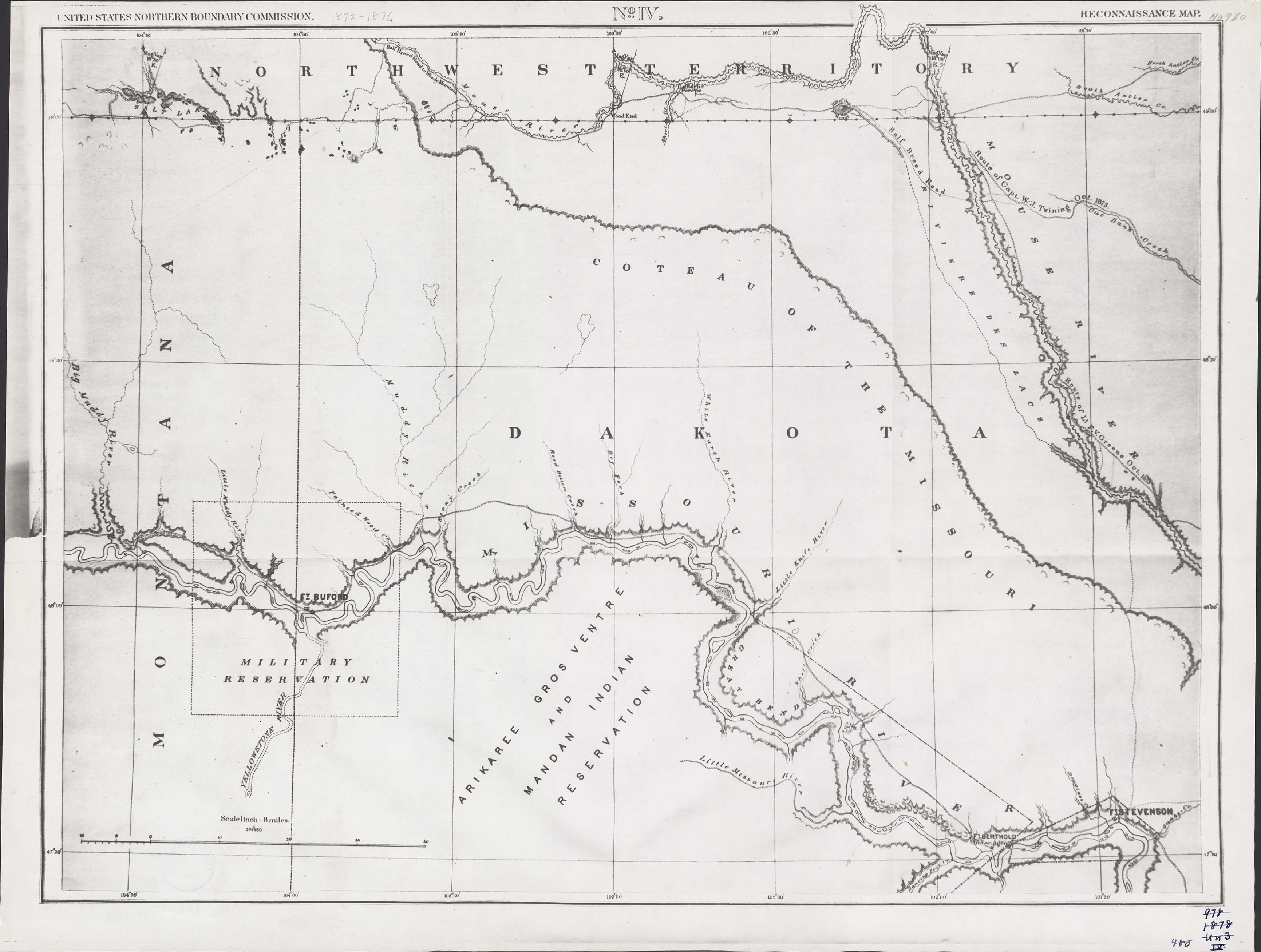
Collection: 917.98 Un3r 1878 no. 4 - Reconnaissance map, no. IV
Folder:
Library
Item:
917.98 Un3r 1878 no. 4
Date:
1878
Creator:
United States Northern Boundary Commission
Title:
Reconnaissance map, no. IV
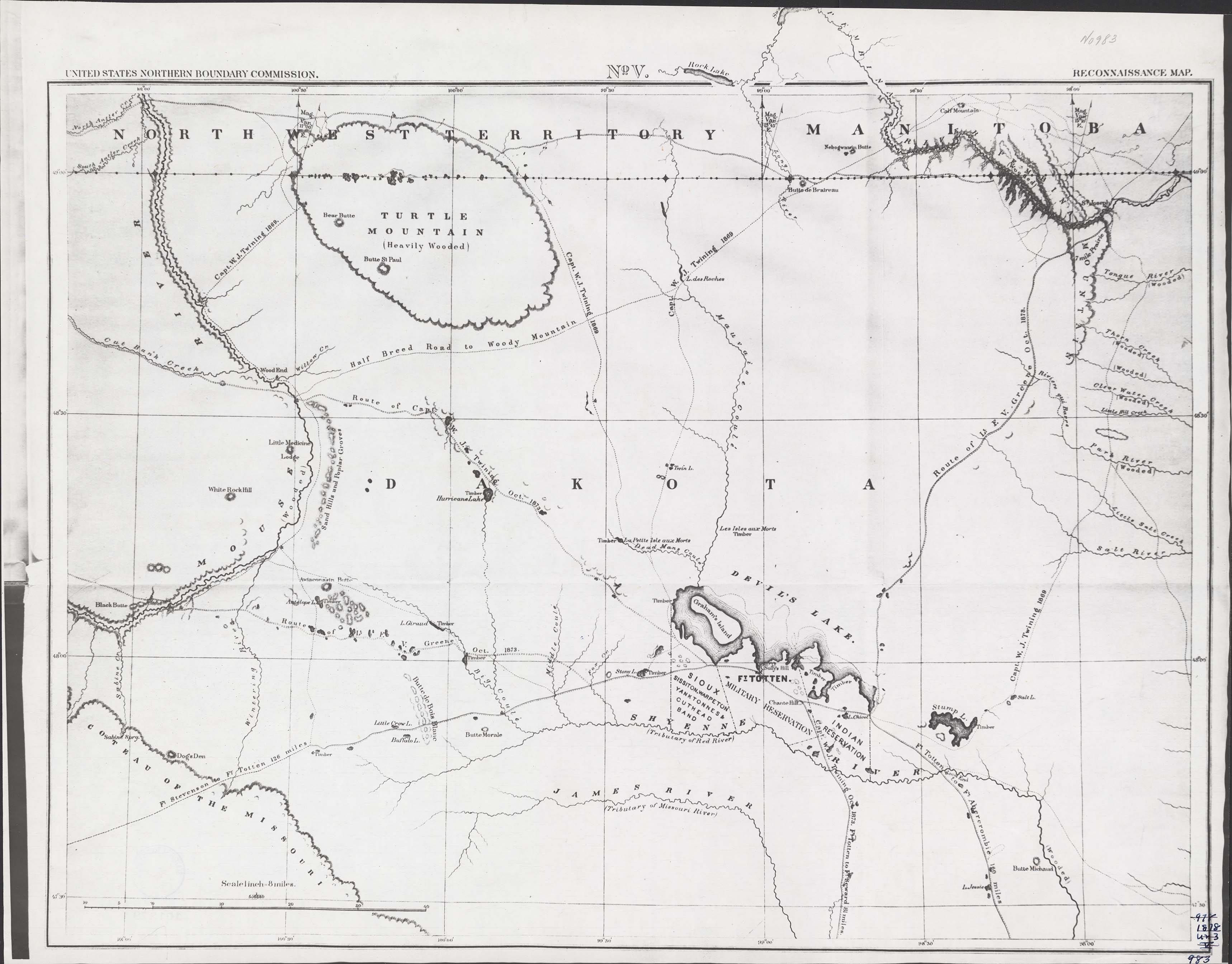
Collection: 917.98 Un3r 1878 no. 5 - Reconnaissance map, no. V
Folder:
Library
Item:
917.98 Un3r 1878 no. 5
Date:
1878
Creator:
United States Northern Boundary Commission
Title:
Reconnaissance map, no. V