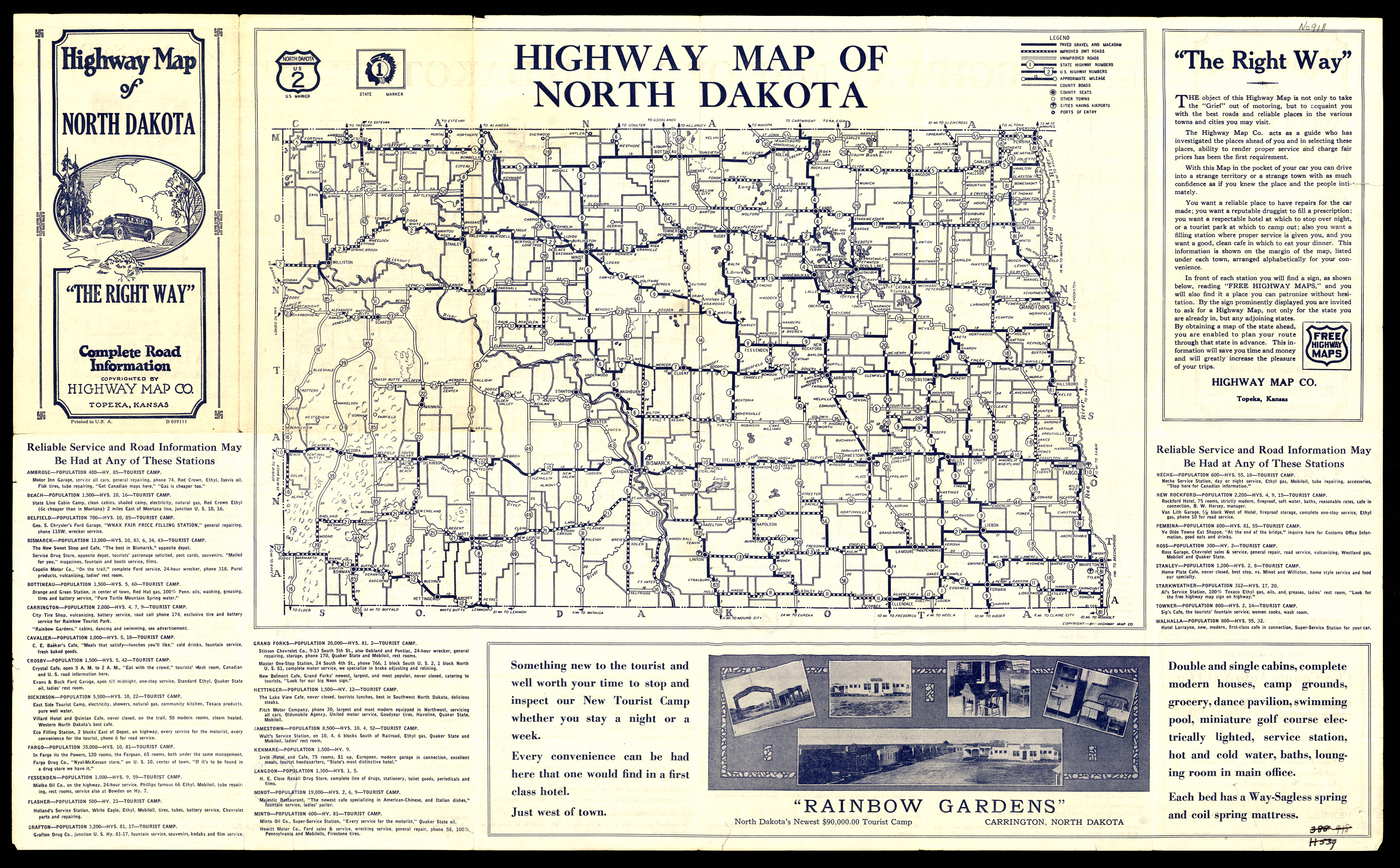
Collection: 978.4032 H6388h - Highway map of North Dakota : __highway map of South Dakota / __Highway Map Co
Folder:
Library
Item:
978.4032 H6388h
Date:
ca. 1935
Creator:
Highway Map Co
Title:
Highway map of North Dakota : __highway map of South Dakota / __Highway Map Co
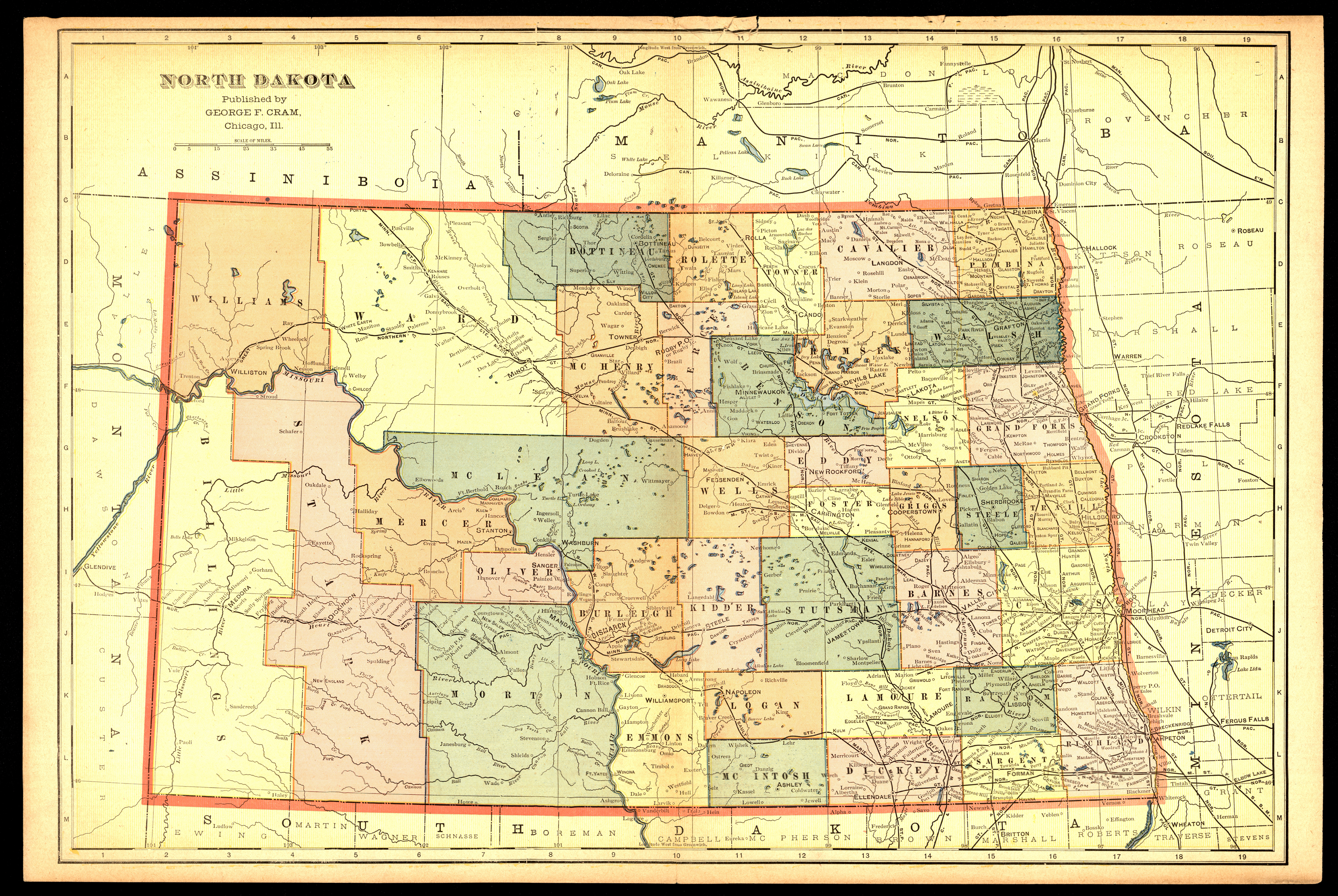
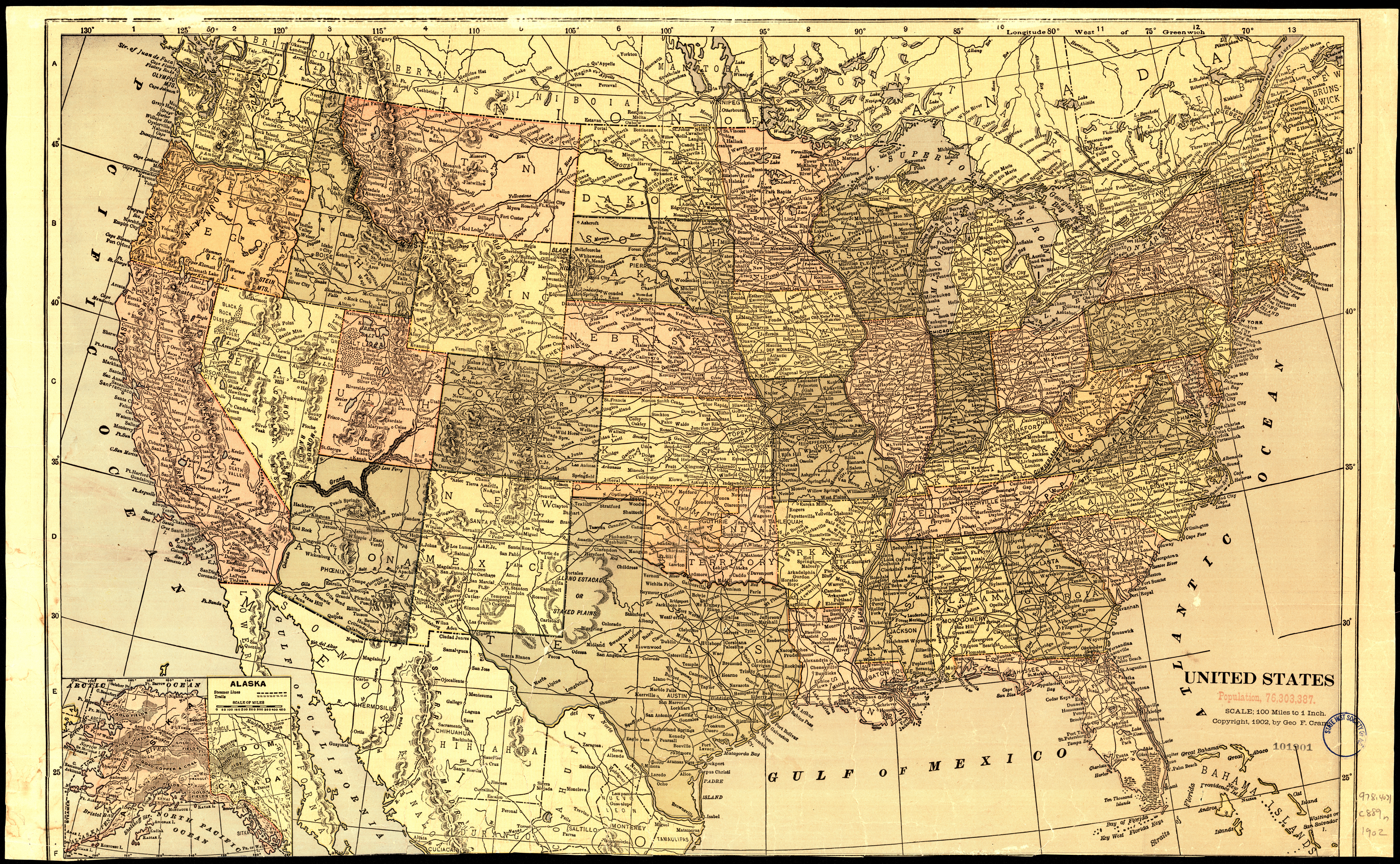
Collection: 978.403 C889n - North Dakota
Folder:
Library
Item:
978.403 C889n
Date:
1898 - 1905
Creator:
Cram, George Franklin,--1841-1928
Title:
North Dakota
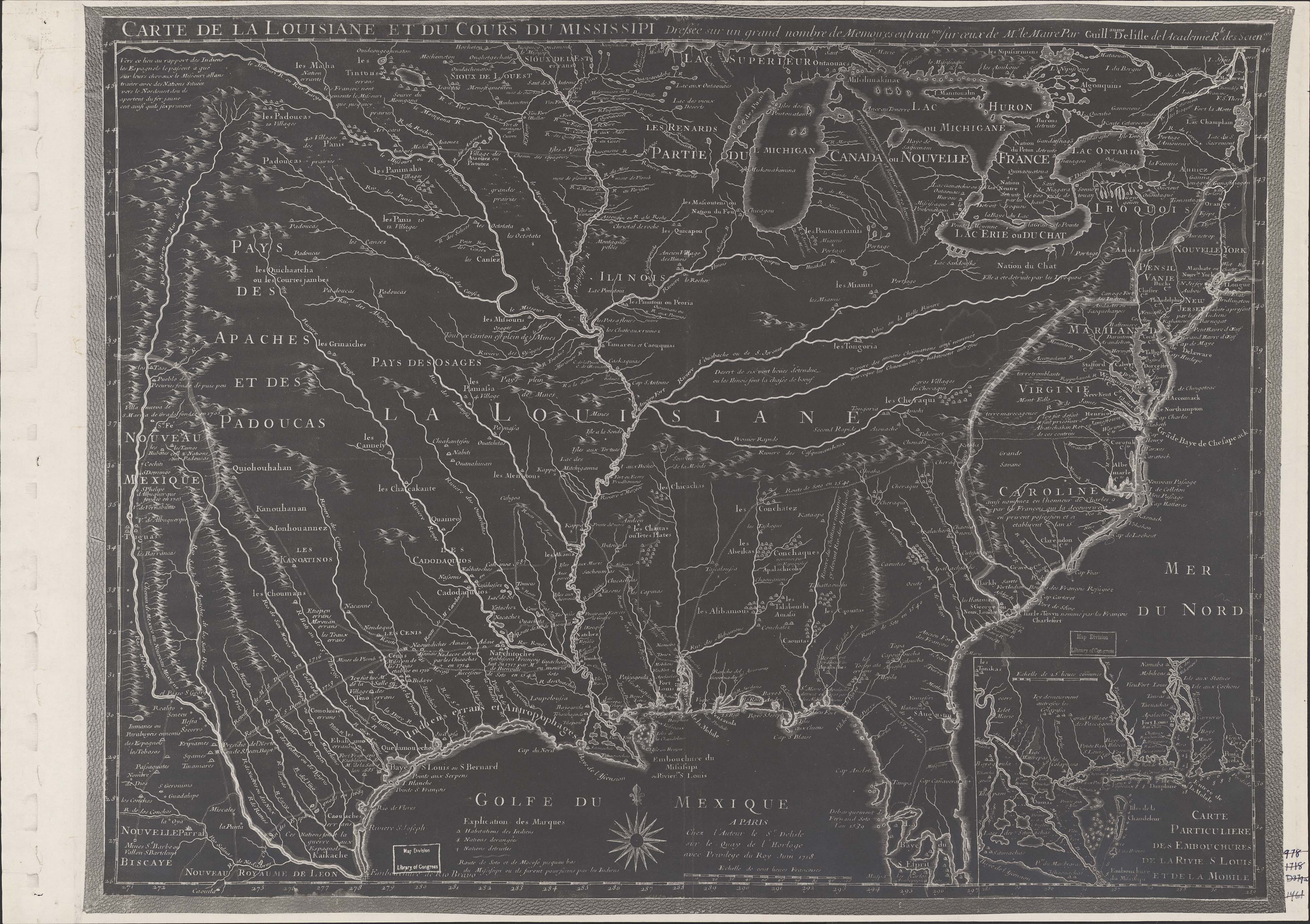
Collection: 973.2 L771ca 1718 - Carte de la Louisiane et du cours du Mississipi : __dressée sur un grand nombre de Memoires entrau tres sur ceux de Mr. le Maire / __par Guillaume De l'Isle
Folder:
Library
Item:
973.2 L771ca 1718
Date:
1718
Creator:
L'Isle, Guillaume de,--1675-1726
Title:
Carte de la Louisiane et du cours du Mississipi : __dressée sur un grand nombre de Memoires entrau tres sur ceux de Mr. le Maire / __par Guillaume De l'Isle
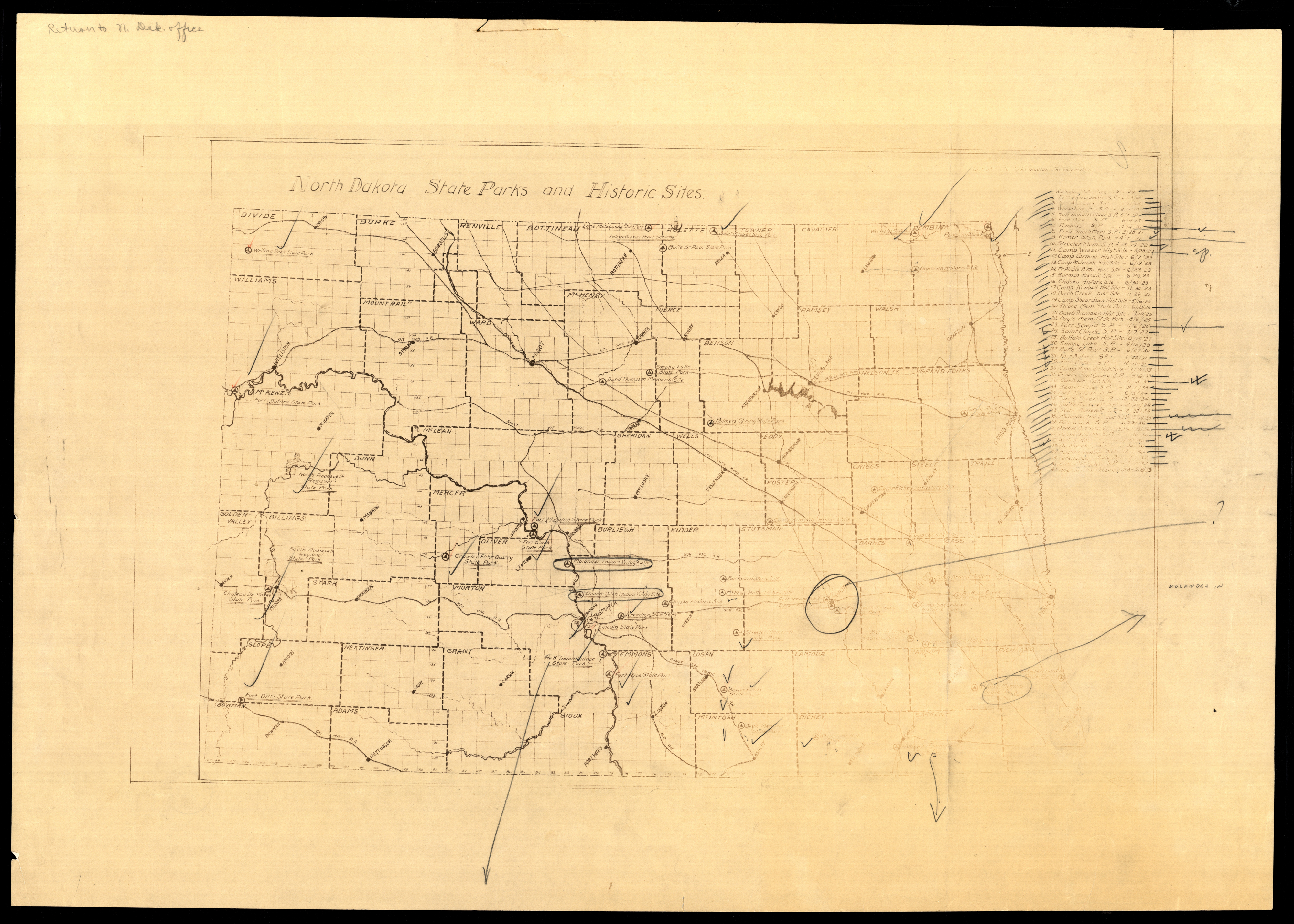
Collection: 978.4 N814nd 1937 - North Dakota state parks and historic sites
Folder:
Library
Item:
978.4 N814nd 1937
Date:
1937
Creator:
Title:
North Dakota state parks and historic sites
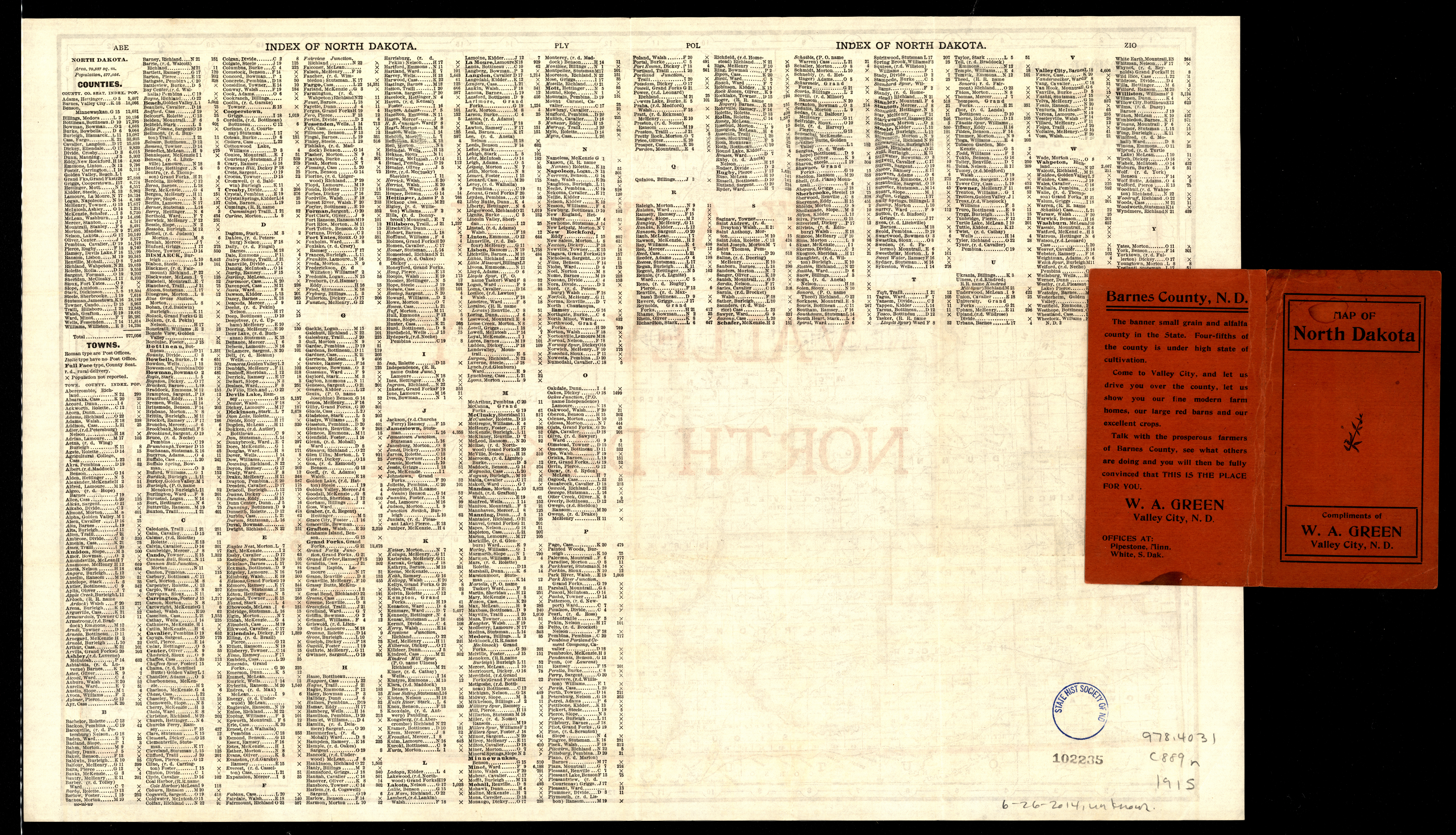
Collection: 978.4031 C889n 1915 - North Dakota / __ __George F. Cram Company
Folder:
Library
Item:
978.4031 C889n 1915
Date:
1915
Creator:
George F. Cram Company
Title:
North Dakota / __ __George F. Cram Company
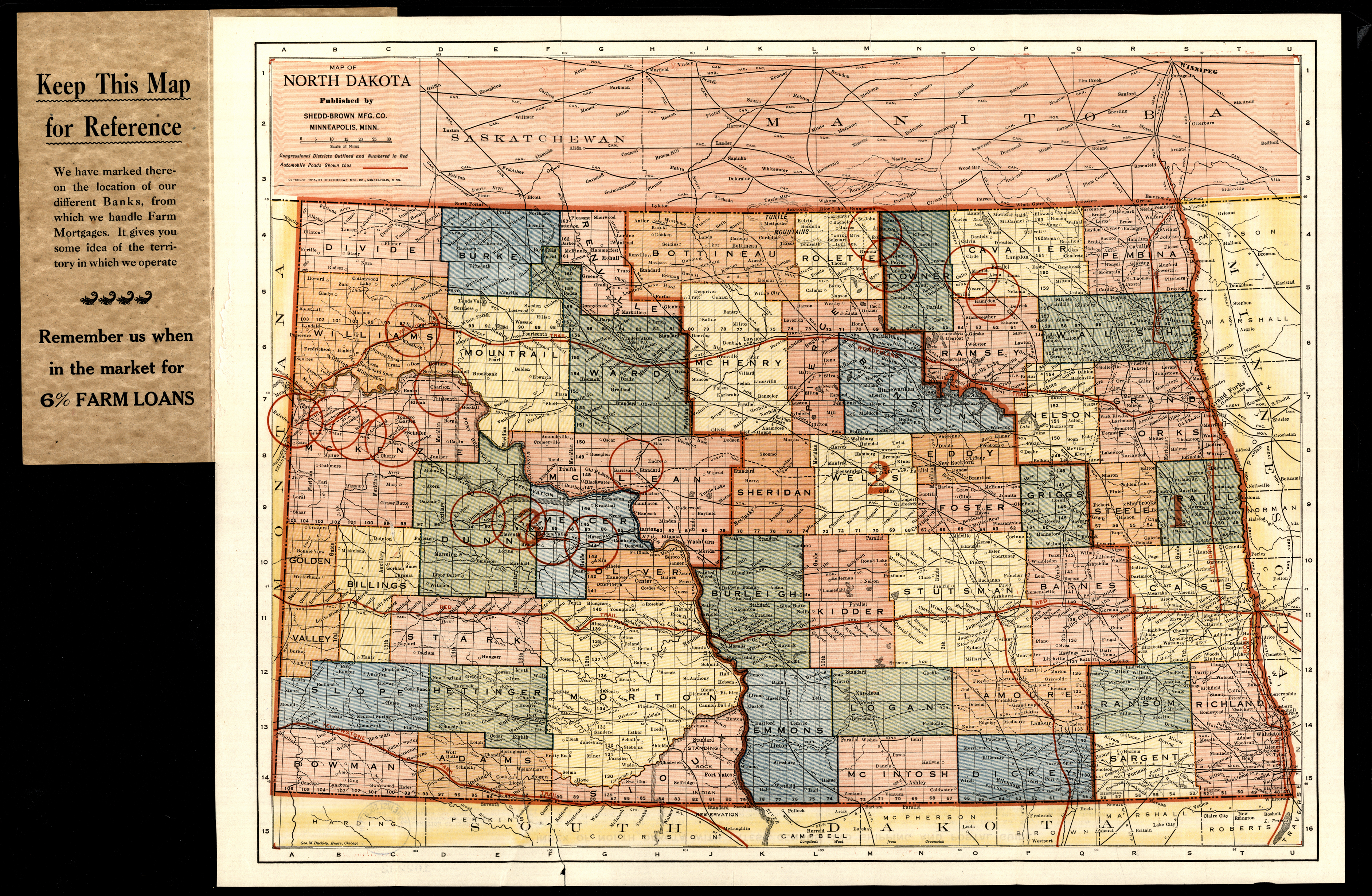
Collection: 978.4031 S541m 1915 - Map of North Dakota
Folder:
Library
Item:
978.4031 S541m 1915
Date:
1915
Creator:
Shedd-Brown Mfg. Co
Title:
Map of North Dakota
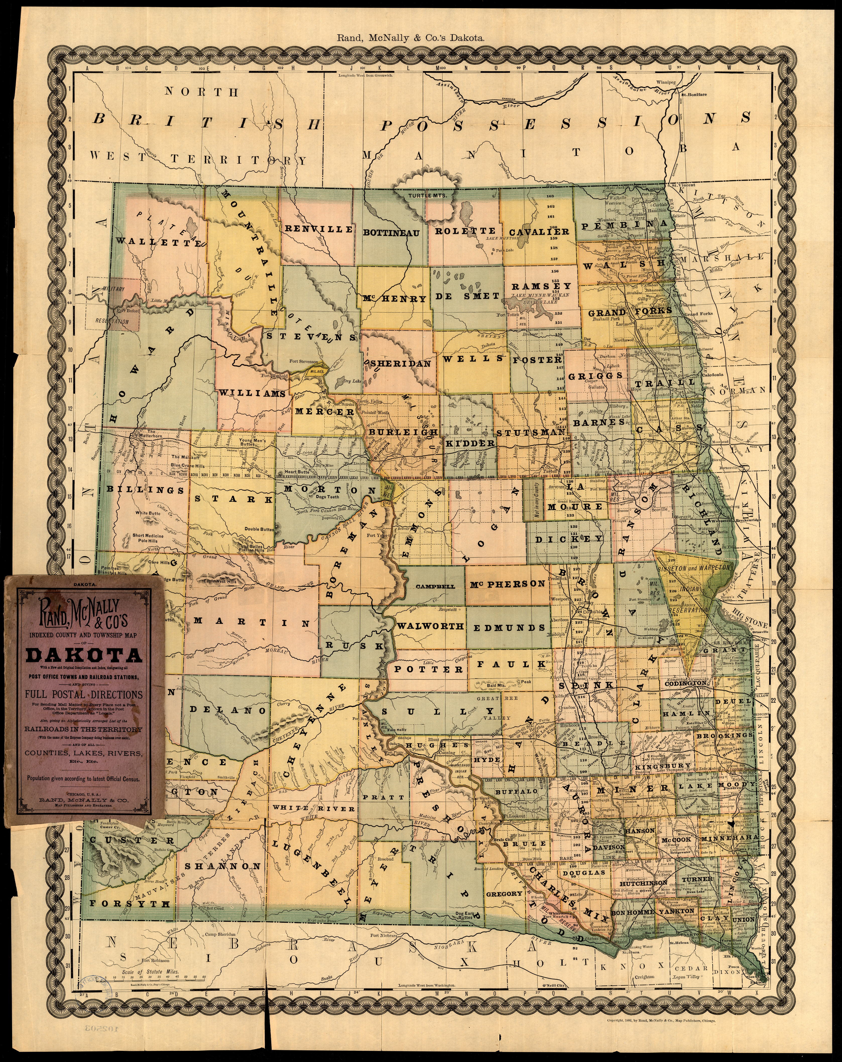
Collection: 978.402 R186d 1882 - Rand, McNally & Co.'s Dakota
Folder:
Library
Item:
978.402 R186d 1882
Date:
1882
Creator:
Rand McNally and Company
Title:
Rand, McNally & Co.'s Dakota
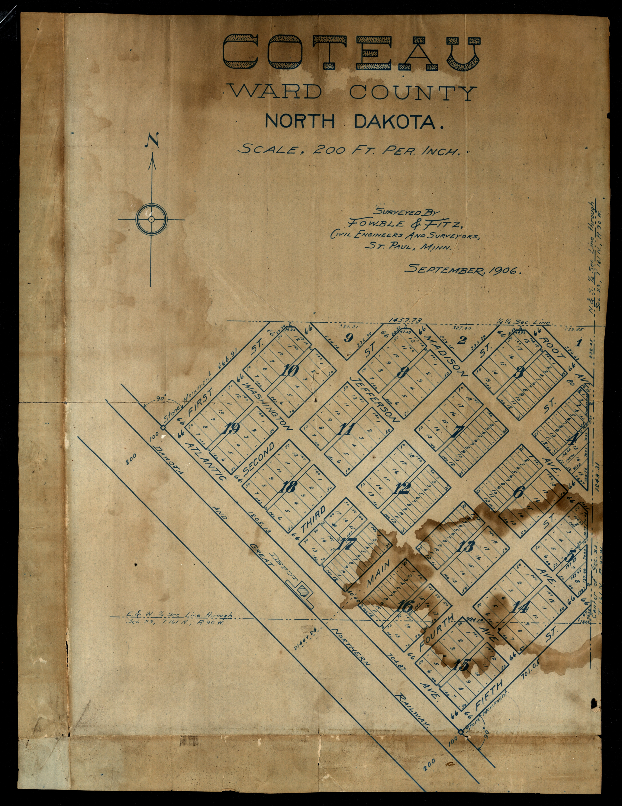
Collection: 978.463 F784c 1906 - Coteau, Ward County, North Dakota / __ __surveyed by Fowble & Fitz
Folder:
Library
Item:
978.463 F784c 1906
Date:
1906
Creator:
Fowble & Fitz (Saint Paul, Minn.)
Title:
Coteau, Ward County, North Dakota / __ __surveyed by Fowble & Fitz
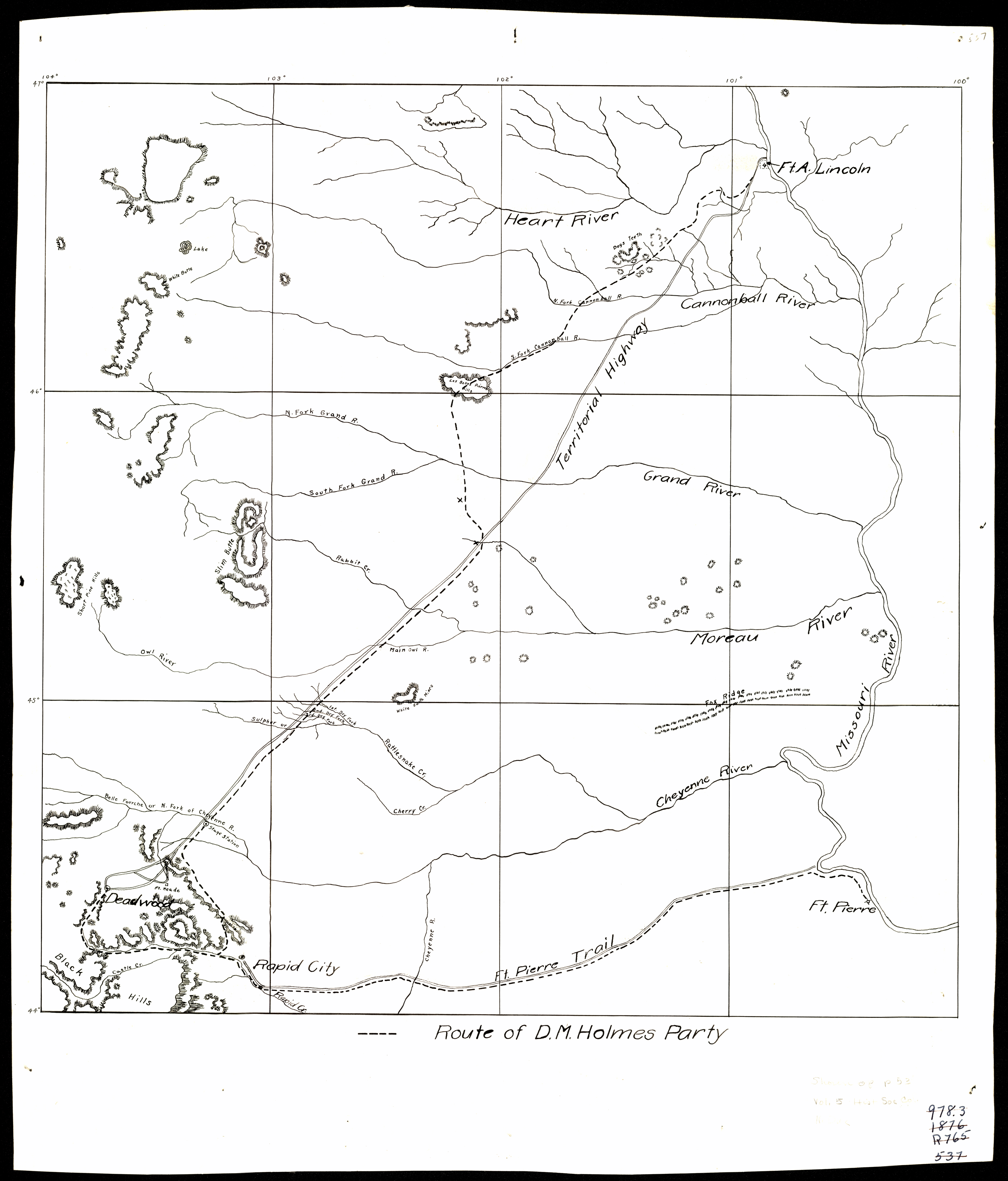
Collection: 978.302 S797r 1923 - Route of D.M. Holmes party
Folder:
Library
Item:
978.302 S797r 1923
Date:
1923
Creator:
State Historical Society of North Dakota
Title:
Route of D.M. Holmes party
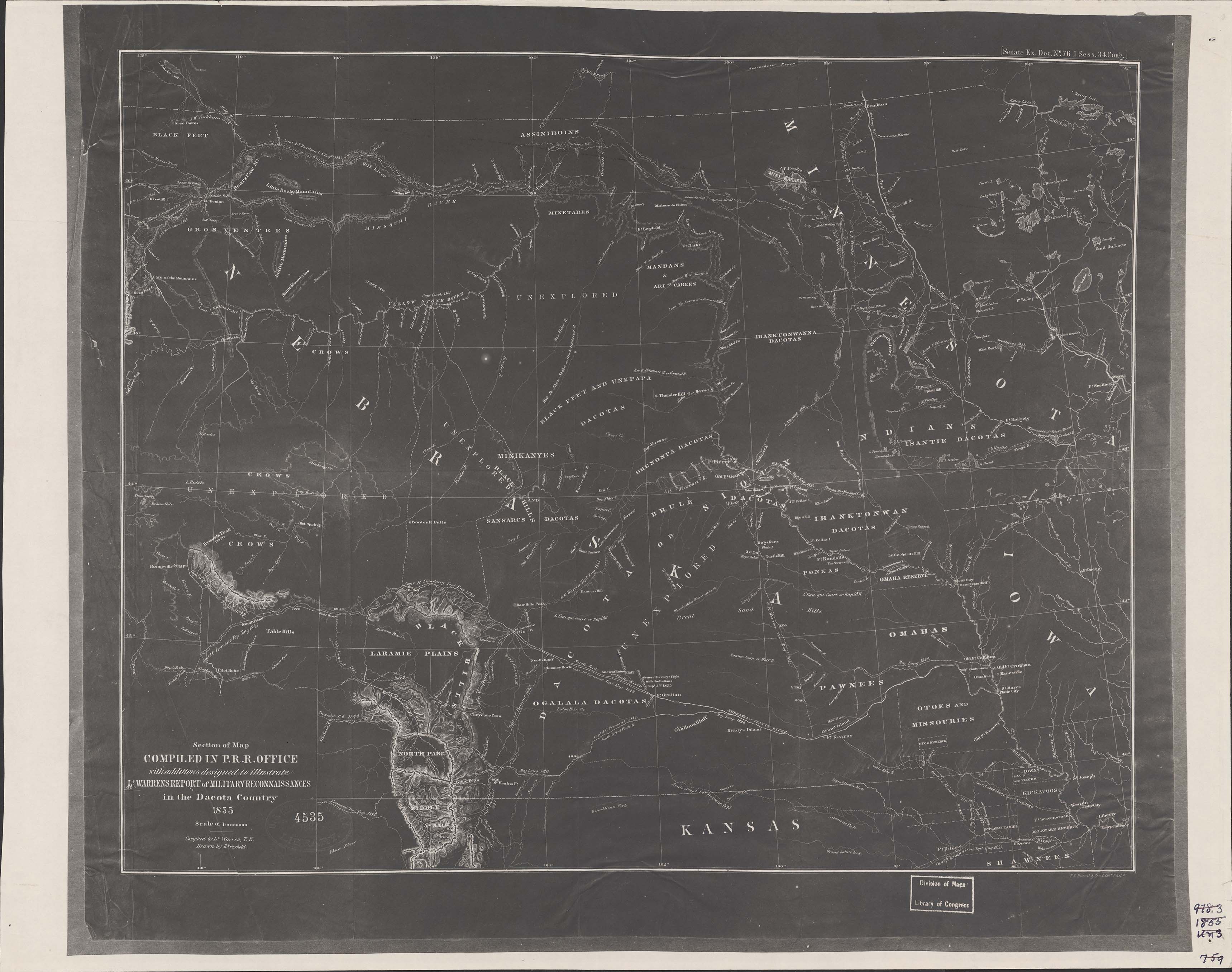
Collection: 978.02 W286s 1856 - Section of map compiled in P.R.R. Office with additions designed to illustrate Lt. Warrens report of military reconnaissances in the Dacota Country, 1855 / __ __compiled by Lt. [G.K.] Warren, T.E., drawn by E. Fréyhold
Folder:
Library
Item:
978.02 W286s 1856
Date:
1856
Creator:
Warren, G. K.--(Gouverneur Kemble),--1830-1882
Title:
Section of map compiled in P.R.R. Office with additions designed to illustrate Lt. Warrens report of military reconnaissances in the Dacota Country, 1855 / __ __compiled by Lt. [G.K.] Warren, T.E., drawn by E. Fréyhold
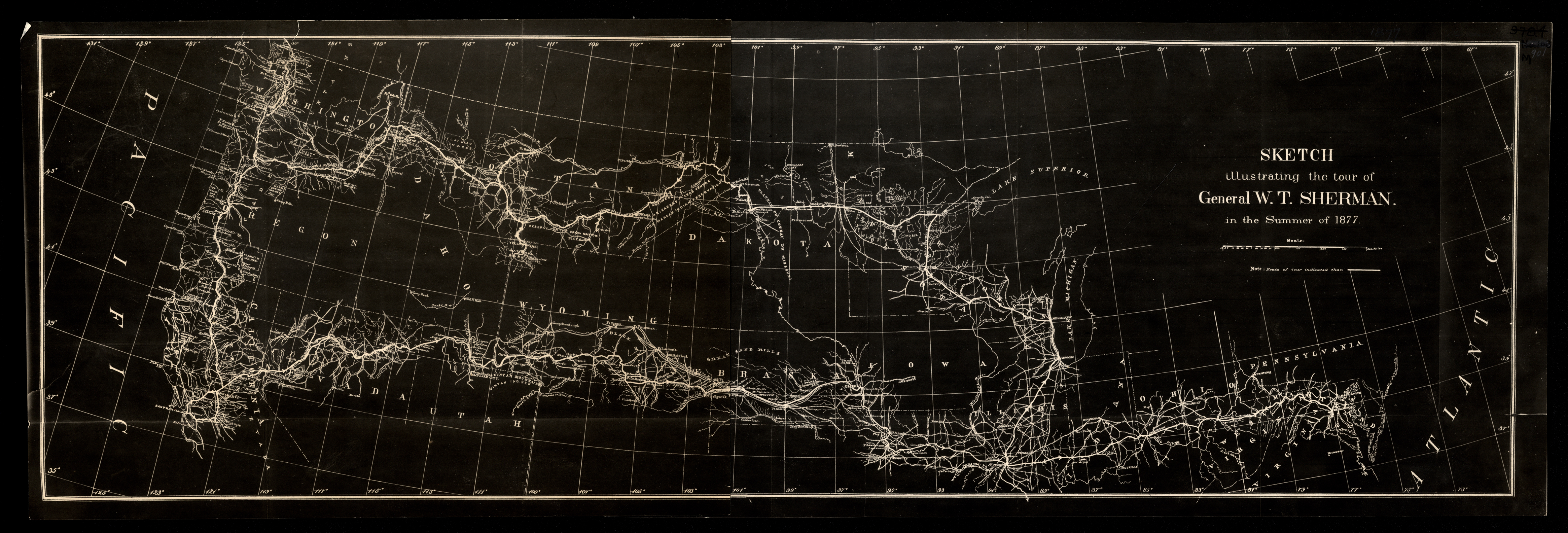
Collection: 973.82 U5813s 1878 - Sketch illustrating the tour of General W.T. Sherman in the summer of 1877
Folder:
Library
Item:
973.82 U5813s 1878
Date:
1878
Creator:
United States.--War Department
Title:
Sketch illustrating the tour of General W.T. Sherman in the summer of 1877
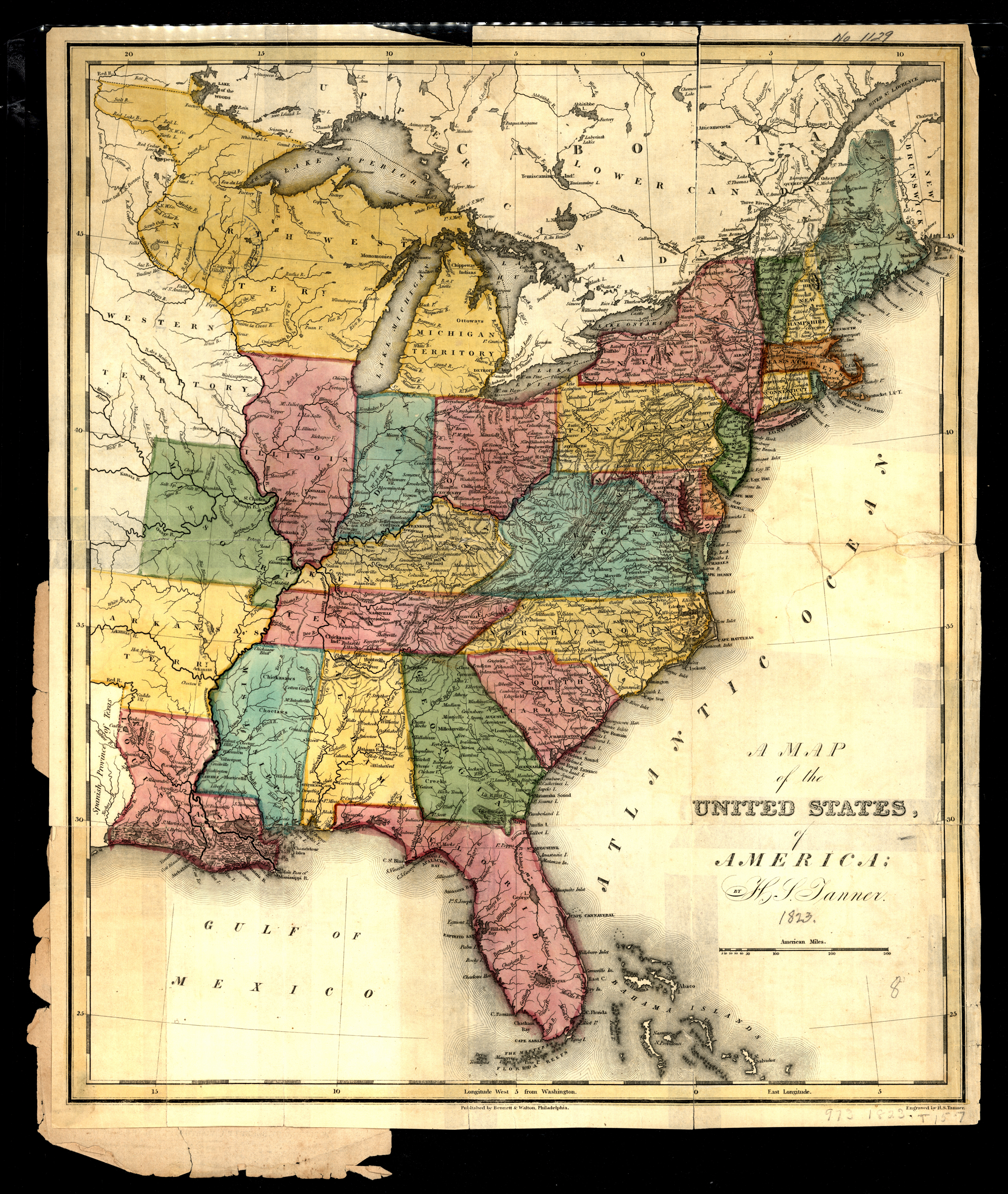
Collection: 973.5 T1664m 1823 - A map of the United States of America / __ __by H.S. Tanner
Folder:
Library
Item:
973.5 T1664m 1823
Date:
ca. 1823
Creator:
Tanner, Henry Schenck,--1786-1858
Title:
A map of the United States of America / __ __by H.S. Tanner
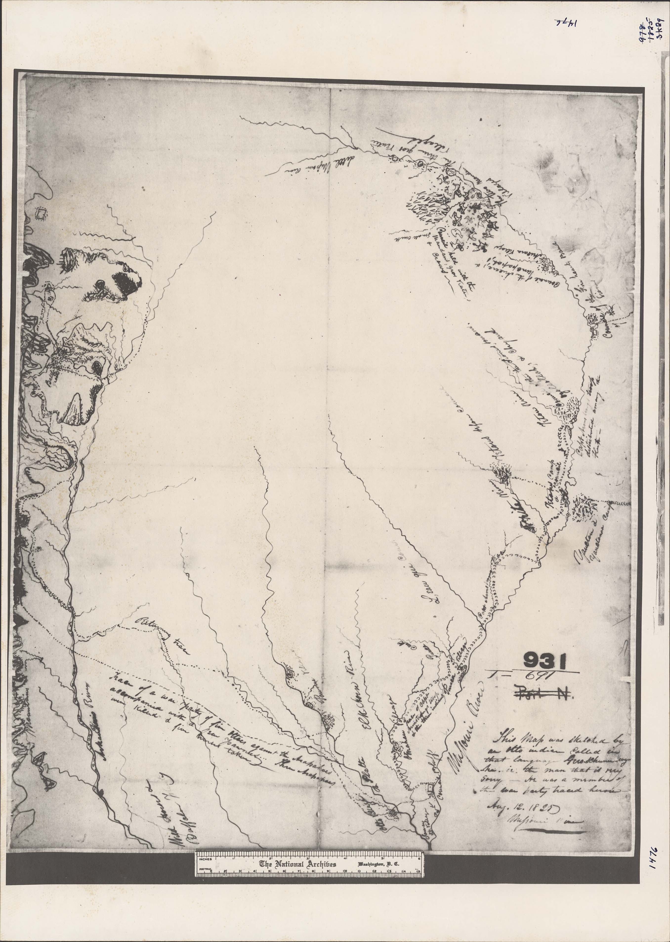
Collection: 970.00497 G377s 1825 - [Sketch made in 1825 by an Otoe Indian showing track of war party of Otoes against the Arapahoes / __ __sketched by Gero-Schunu-Wy-Ha]
Folder:
Library
Item:
970.00497 G377s 1825
Date:
1825
Creator:
Gero-Schunu-Wy-Ha
Title:
[Sketch made in 1825 by an Otoe Indian showing track of war party of Otoes against the Arapahoes / __ __sketched by Gero-Schunu-Wy-Ha]
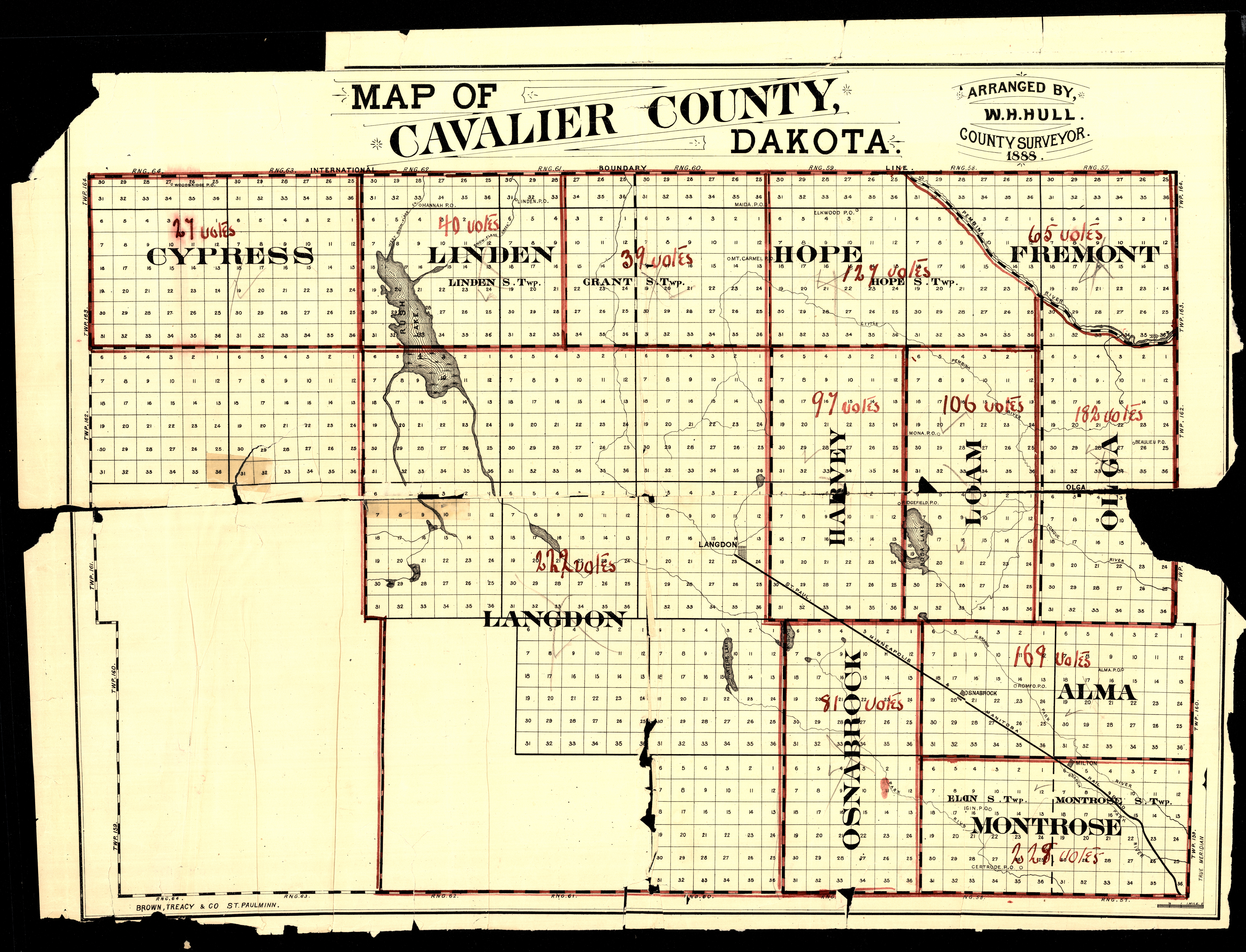
Collection: 978.437 H913m 1888 - Map of Cavalier County, Dakota / __ __arranged by W.H. Hull, County Surveyor
Folder:
Library
Item:
978.437 H913m 1888
Date:
1888
Creator:
Hull, W. H
Title:
Map of Cavalier County, Dakota / __ __arranged by W.H. Hull, County Surveyor
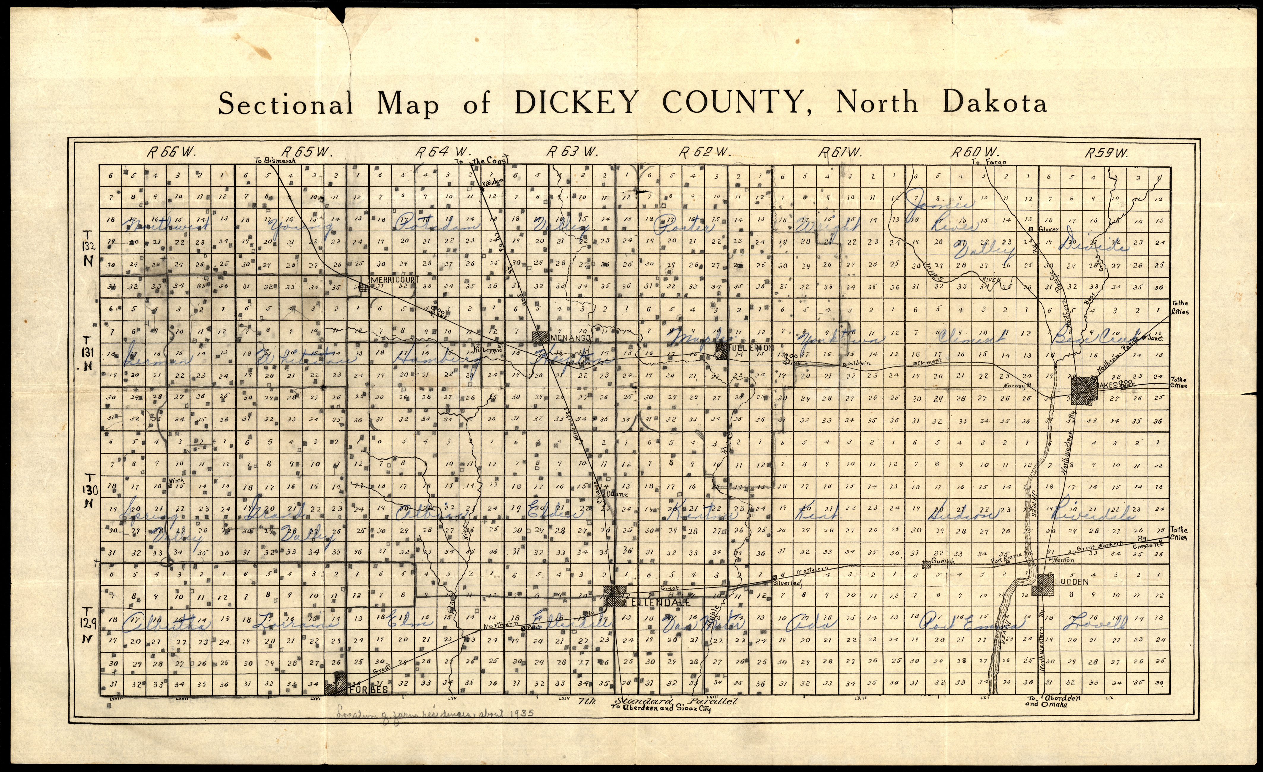
Collection: 978.454 S4465 - Sectional map of Dickey County, North Dakota
Folder:
Library
Item:
978.454 S4465
Date:
1900 - 1930
Creator:
Title:
Sectional map of Dickey County, North Dakota
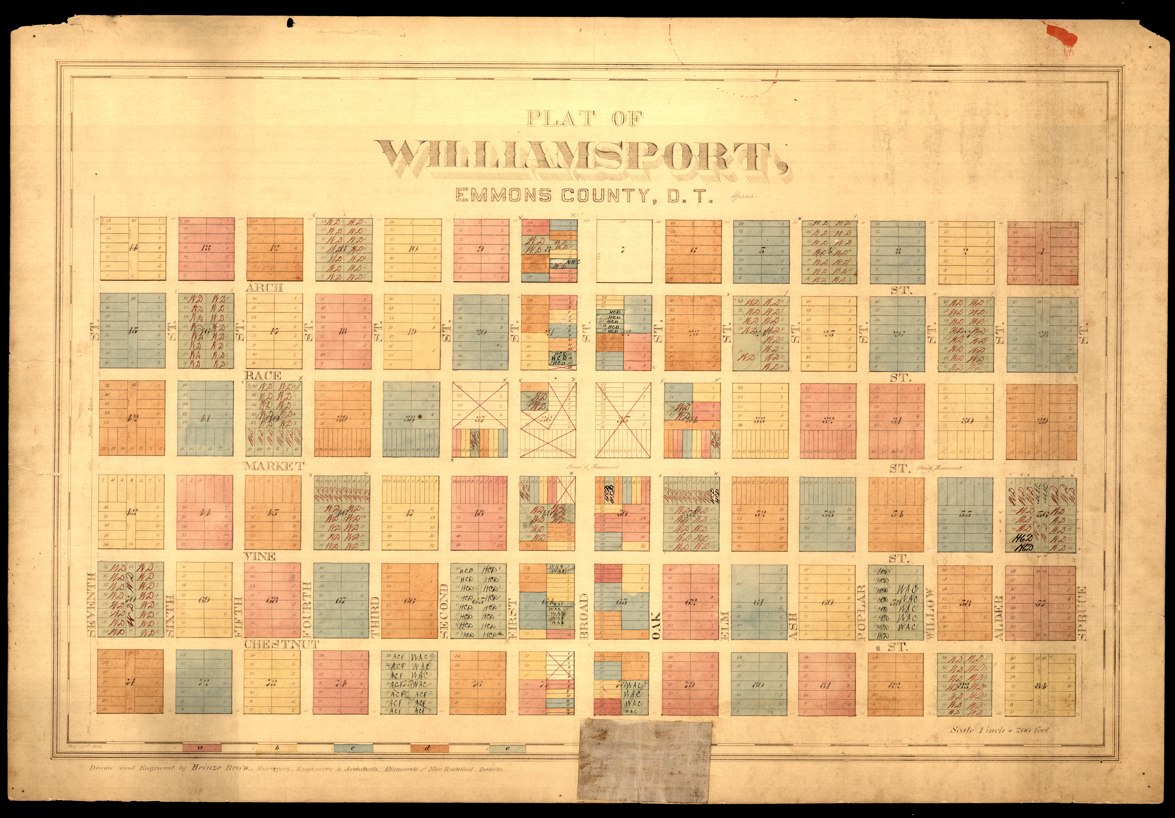
Collection: 978.478 H472p 1884 - Plat of Williamsport, Emmons County, D.T. / __ __drawn and engraved by Heinze Bro's., surveyors, engineers & architects
Folder:
Library
Item:
978.478 H472p 1884
Date:
1884
Creator:
Heinze Bros
Title:
Plat of Williamsport, Emmons County, D.T. / __ __drawn and engraved by Heinze Bro's., surveyors, engineers & architects
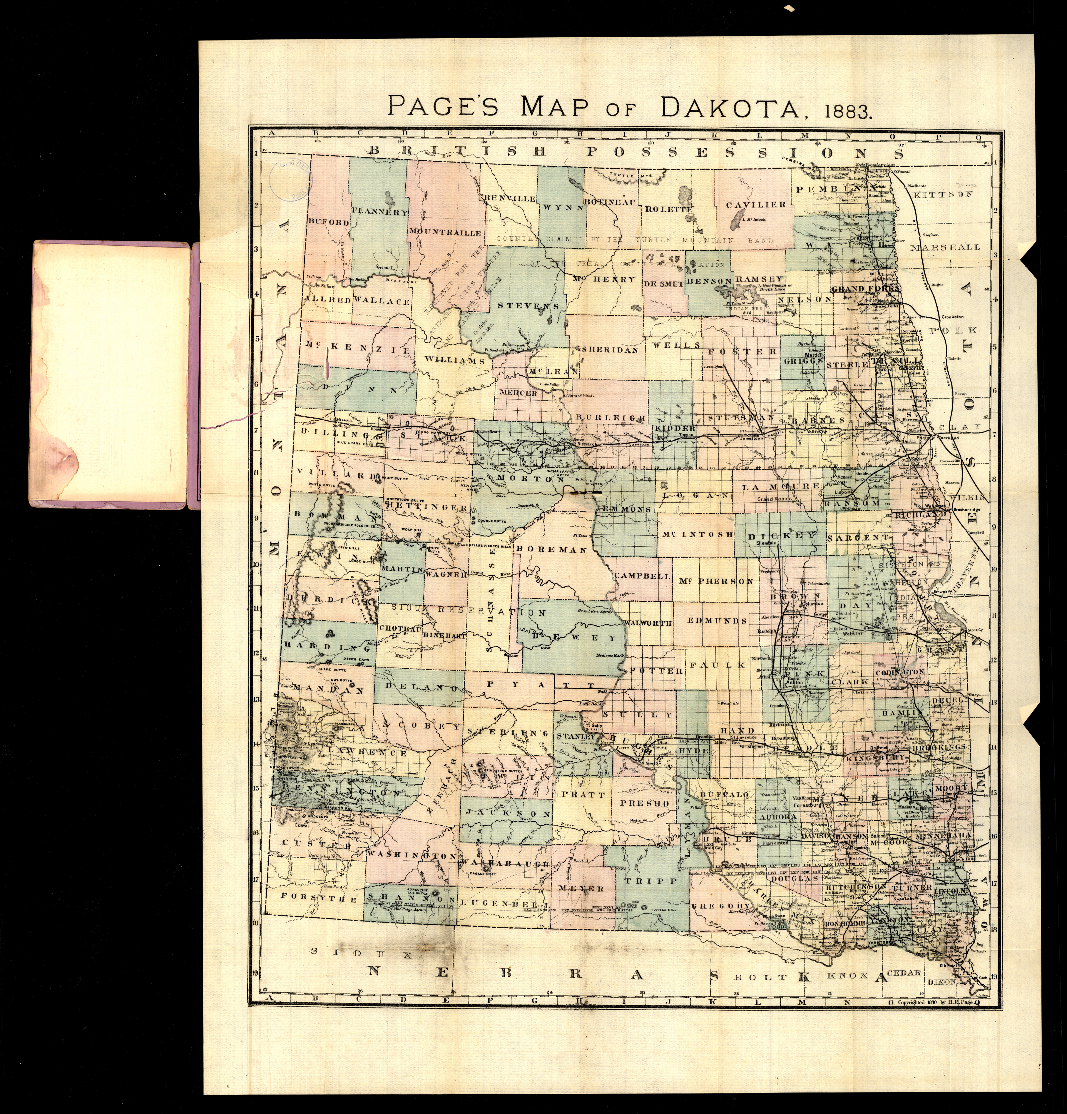
Collection: 978.402 H11p 1883 - Page's map of Dakota, 1883
Folder:
Library
Item:
978.402 H11p 1883
Date:
1883
Creator:
H.R. Page & Co
Title:
Page's map of Dakota, 1883
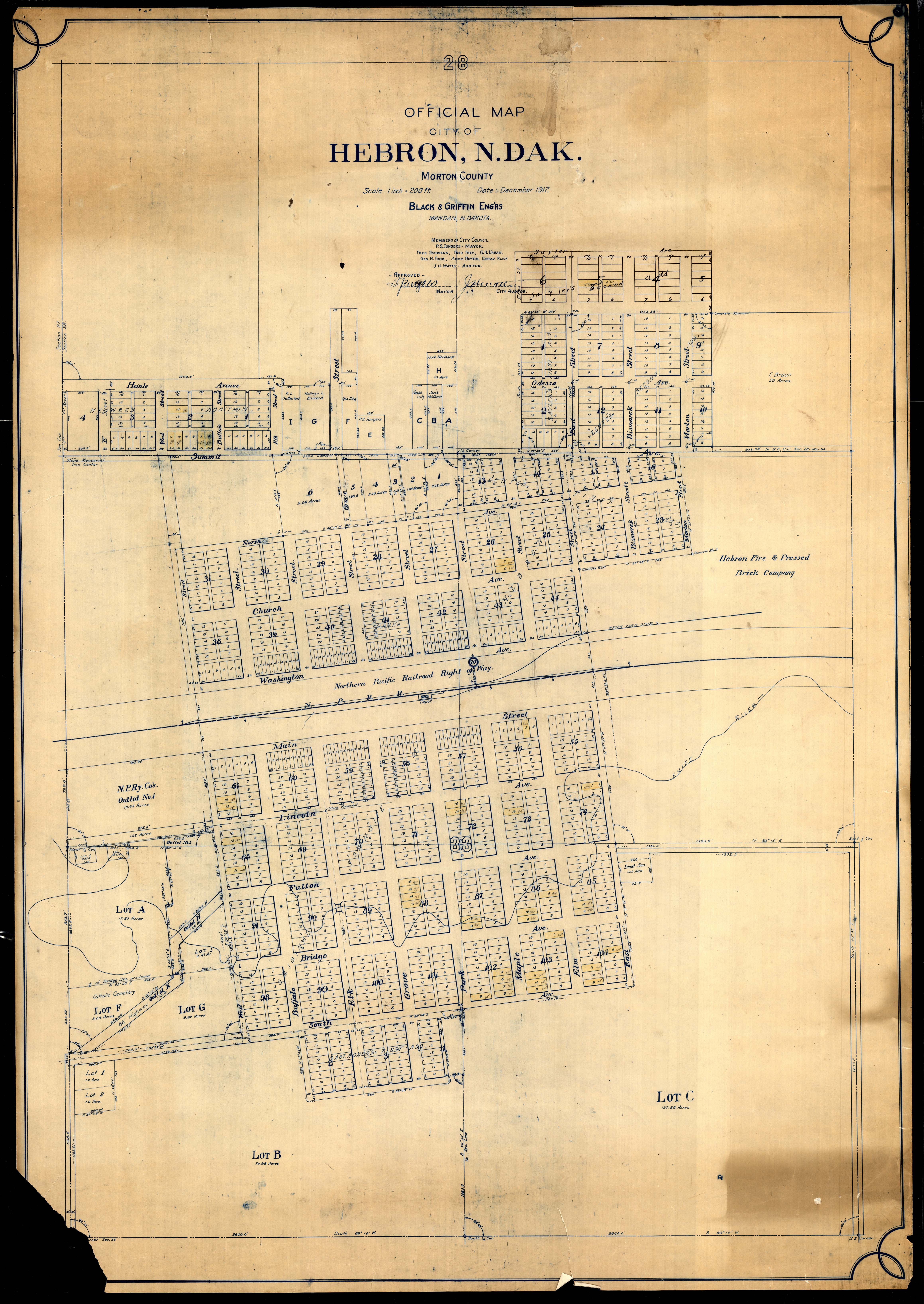
Collection: 978.485 B627h 1917 - Official map, city of Hebron, N. Dak., Morton County / __ __Black & Griffin
Folder:
Library
Item:
978.485 B627h 1917
Date:
1917
Creator:
Black & Griffin
Title:
Official map, city of Hebron, N. Dak., Morton County / __ __Black & Griffin
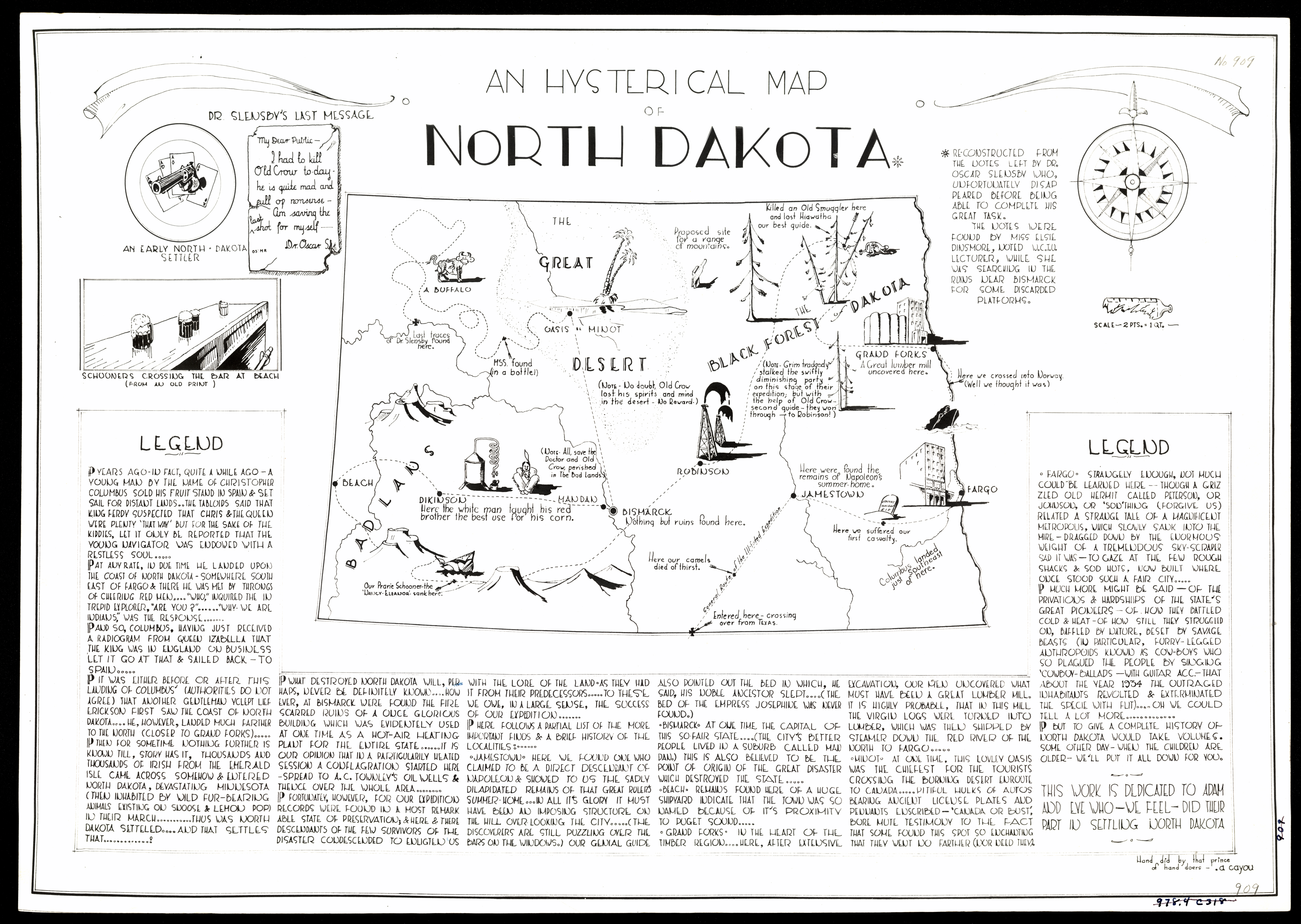
Collection: 978.4032 C385h - An hysterical map of North Dakota / __ __hand did by that prince of hand doers A. Cayou
Folder:
Library
Item:
978.4032 C385h
Date:
ca. 1935
Creator:
Cayou, A
Title:
An hysterical map of North Dakota / __ __hand did by that prince of hand doers A. Cayou
Collection: 978.4031 C889n 1902 - North Dakota
Folder:
Library
Item:
978.4031 C889n 1902
Date:
Copyright 1902
Creator:
Cram, George Franklin,--1841-1928
Title:
North Dakota
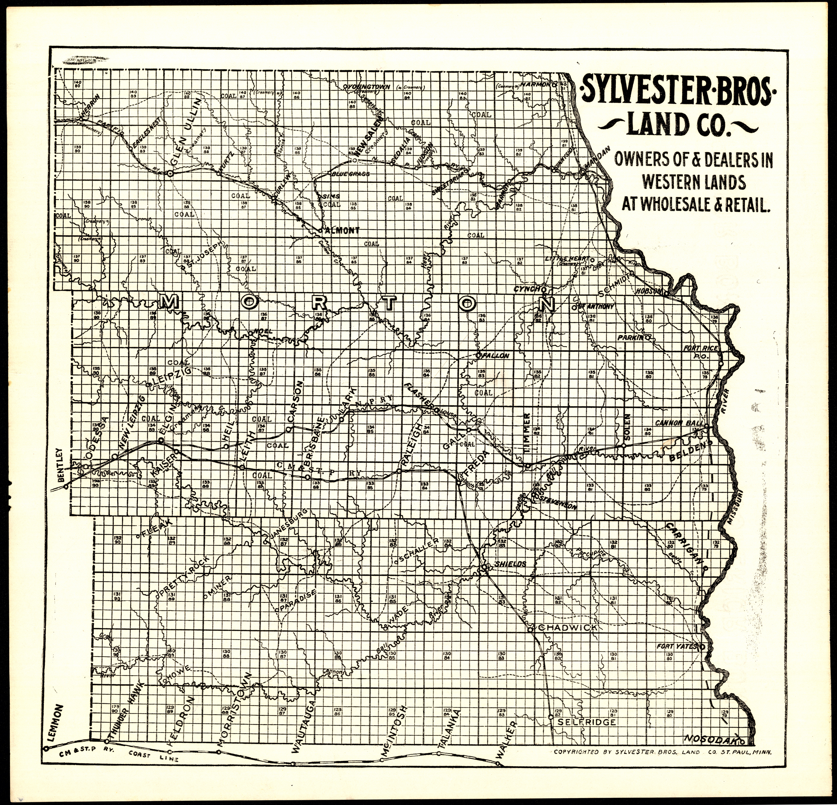
Collection: 978.485 S985 - [Map of Morton County, N.D.] / __ __Sylvester Bros. Land Co
Folder:
Library
Item:
978.485 S985
Date:
1900 - 1914
Creator:
Sylvester Brothers Land Company (Mandan, N.D.)
Title:
[Map of Morton County, N.D.] / __ __Sylvester Bros. Land Co
Collection: 978.4031 G3452n 1914 - North Dakota / __ __published expressly for the Grand Rapids Stationery Co
Folder:
Library
Item:
978.4031 G3452n 1914
Date:
Copyright 1914
Creator:
Geographical Publishing Co
Title:
North Dakota / __ __published expressly for the Grand Rapids Stationery Co
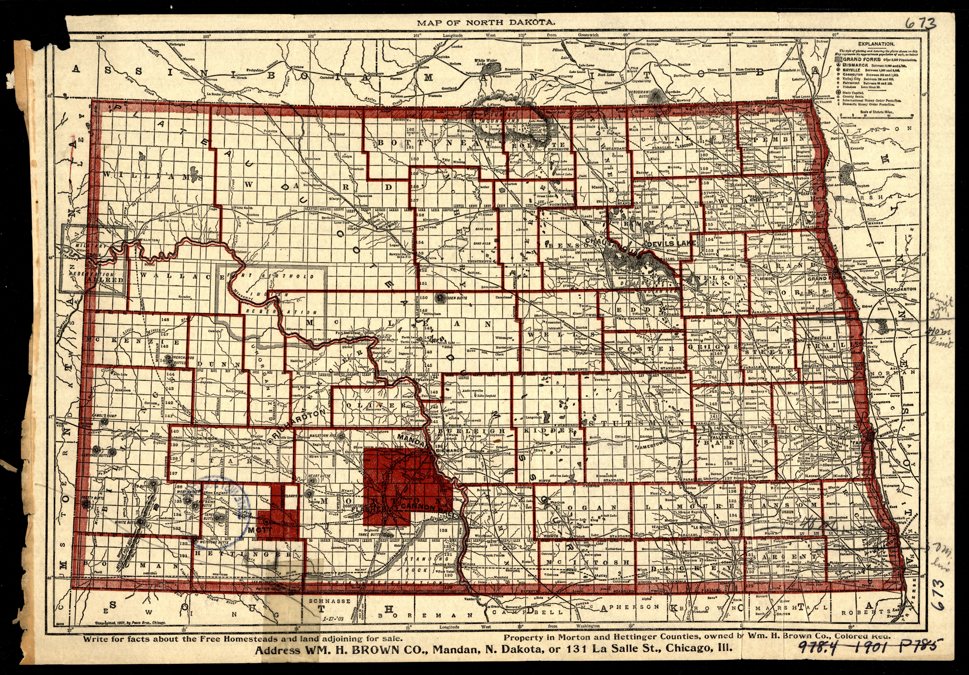
Collection: 978.4031 P82m 1901 - Map of North Dakota / __ __Poole Bros
Folder:
Library
Item:
978.4031 P82m 1901
Date:
Copyright 1901
Creator:
Poole Brothers
Title:
Map of North Dakota / __ __Poole Bros
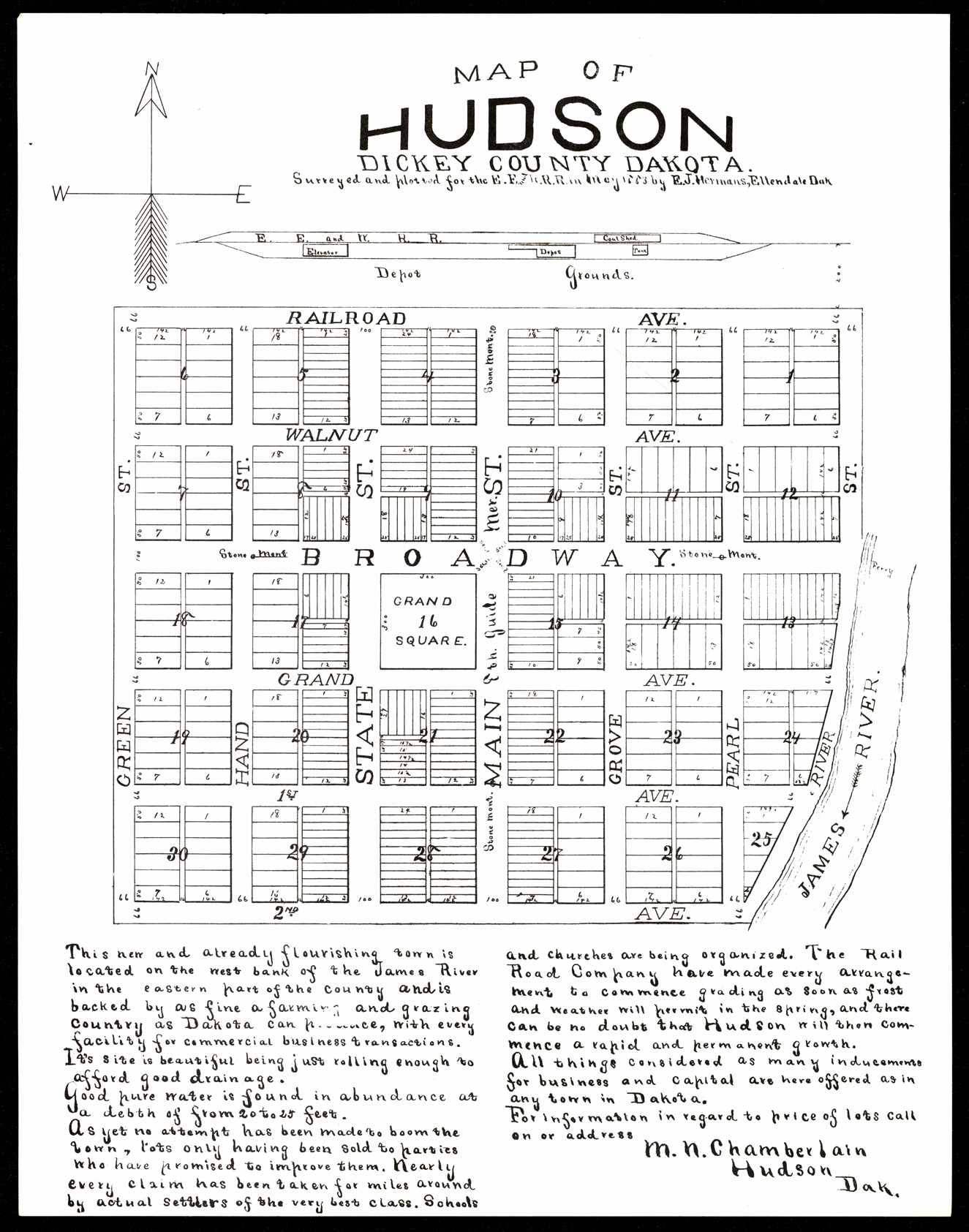
Collection: 978.454 H5528m 1883 - Map of Hudson, Dickey County, Dakota / __ __surveyed and potted for the E.F. and W. RR in May 1883 by E.J. Hermans
Folder:
Library
Item:
978.454 H5528m 1883
Date:
1883
Creator:
Hermans, E. J
Title:
Map of Hudson, Dickey County, Dakota / __ __surveyed and potted for the E.F. and W. RR in May 1883 by E.J. Hermans
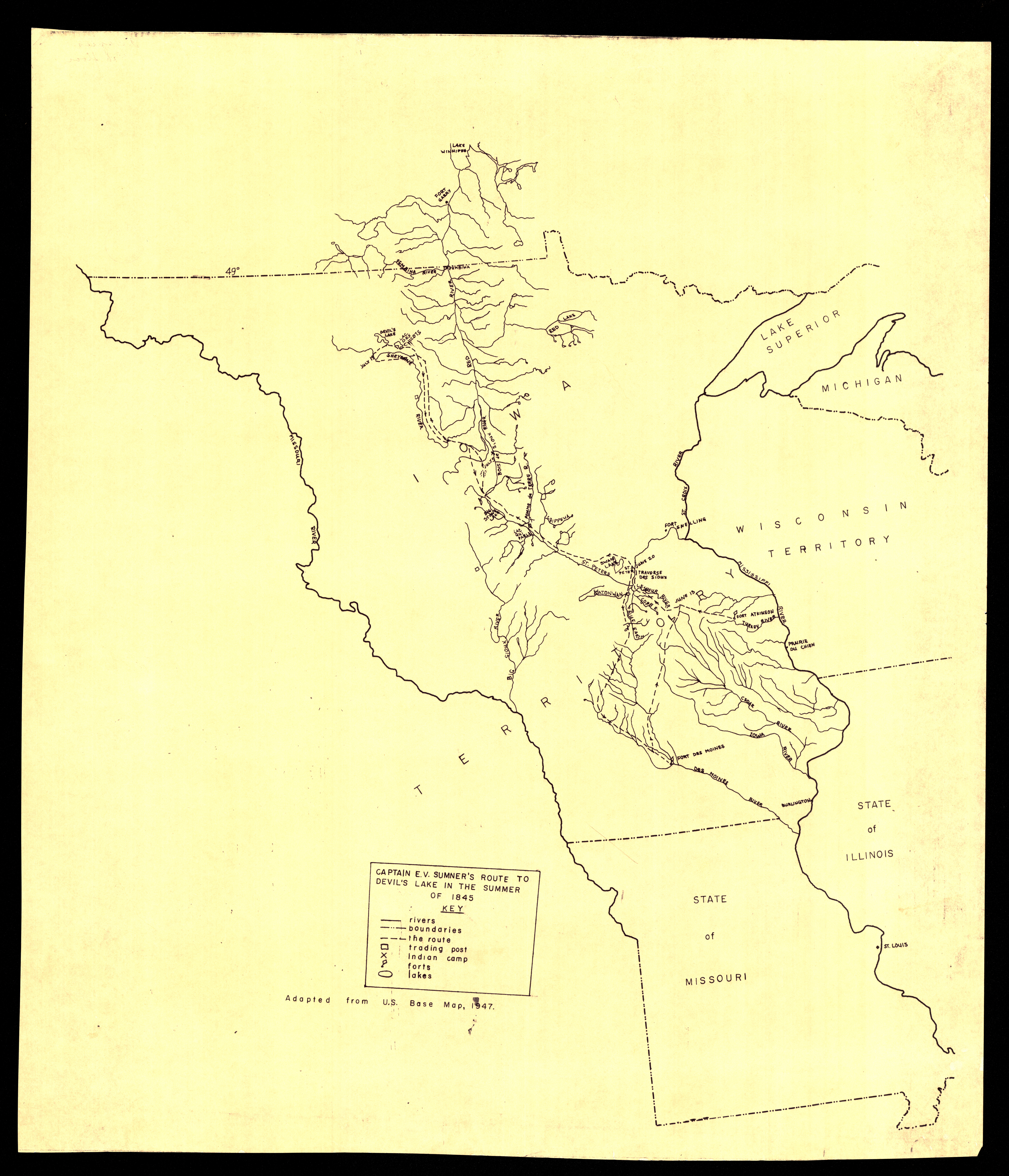
Collection: 978.401 C254 1947 - Captain E.V. Sumner's route to Devil's [sic] Lake in the summer of 1845
Folder:
Library
Item:
978.401 C254 1947
Date:
1947
Creator:
Title:
Captain E.V. Sumner's route to Devil's [sic] Lake in the summer of 1845