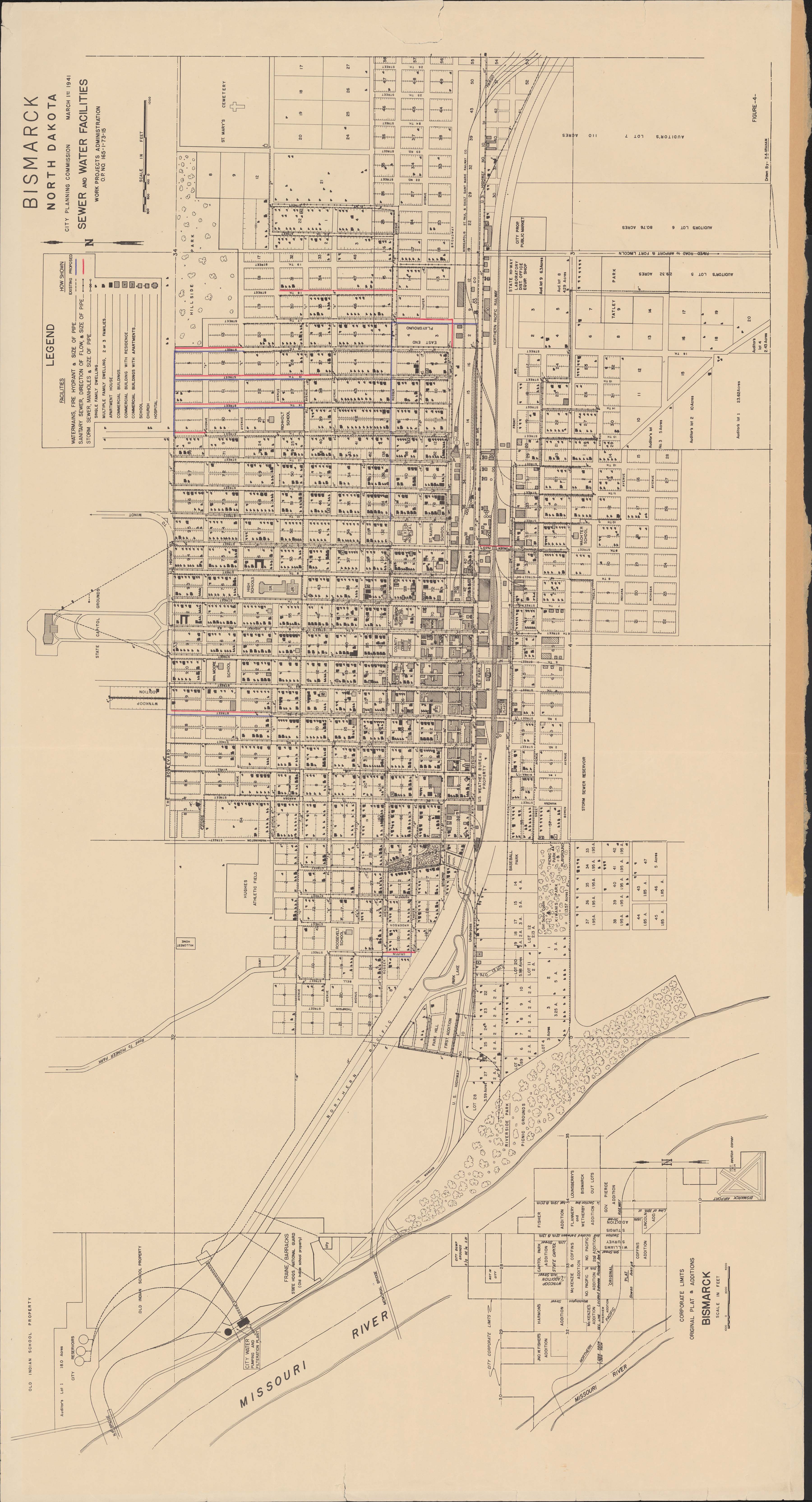
Collection: 628.2 U5813b 1941 - Bismarck, North Dakota, sewer and water facilities / __ __City Planning Commission ; drawn by H.A. Graham
Folder:
Library
Item:
628.2 U5813b 1941
Date:
1941
Creator:
United States.--Work Projects Administration
Title:
Bismarck, North Dakota, sewer and water facilities / __ __City Planning Commission ; drawn by H.A. Graham
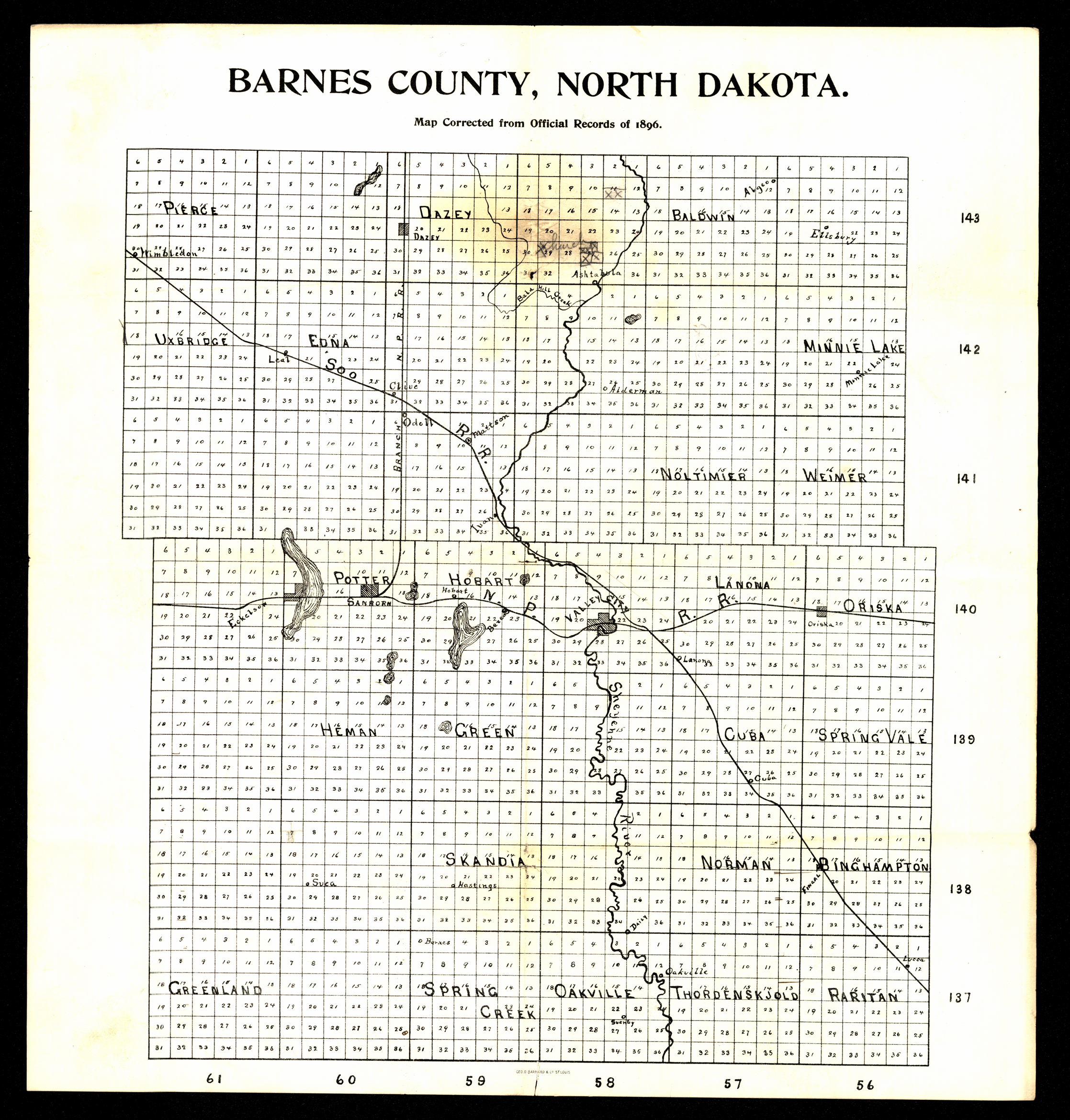
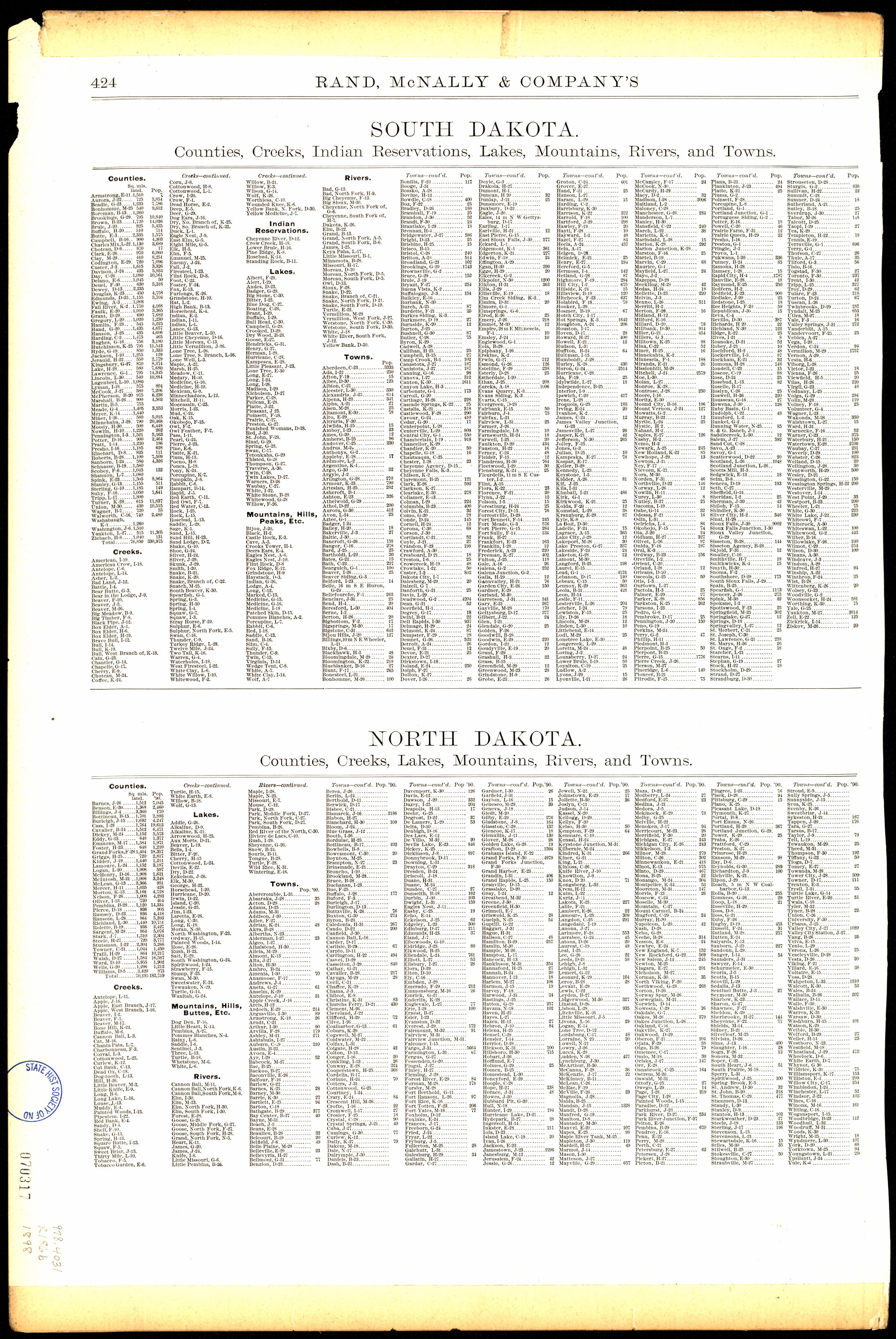
Collection: 978.432 B26 1896 - Barnes County, North Dakota
Folder:
Library
Item:
978.432 B26 1896
Date:
1896
Creator:
Title:
Barnes County, North Dakota
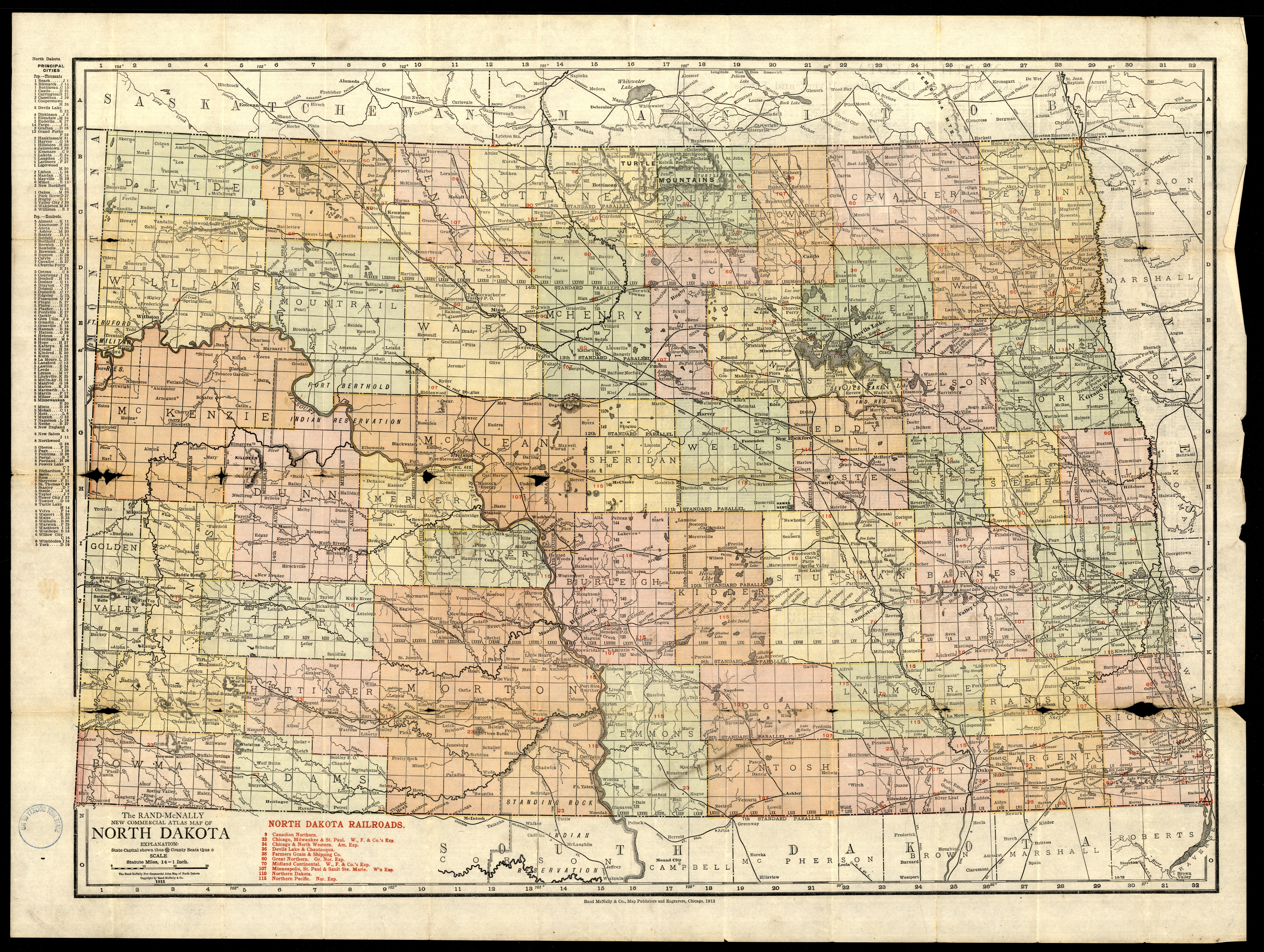
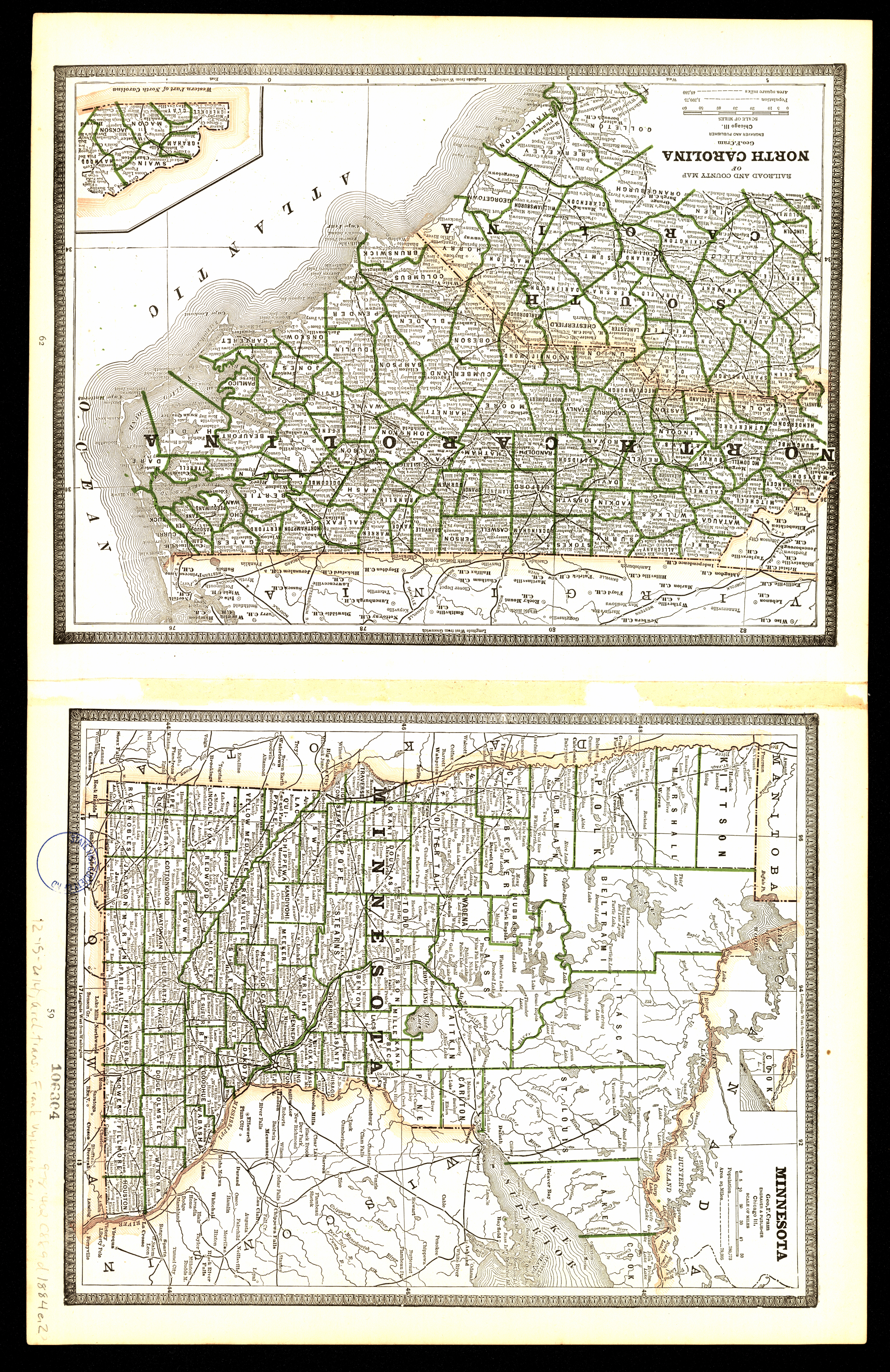
Collection: 978.4031 R186c 1913 - The Rand-McNally new commercial atlas map of North Dakota
Folder:
Library
Item:
978.4031 R186c 1913
Date:
1913
Creator:
Rand McNally and Company
Title:
The Rand-McNally new commercial atlas map of North Dakota
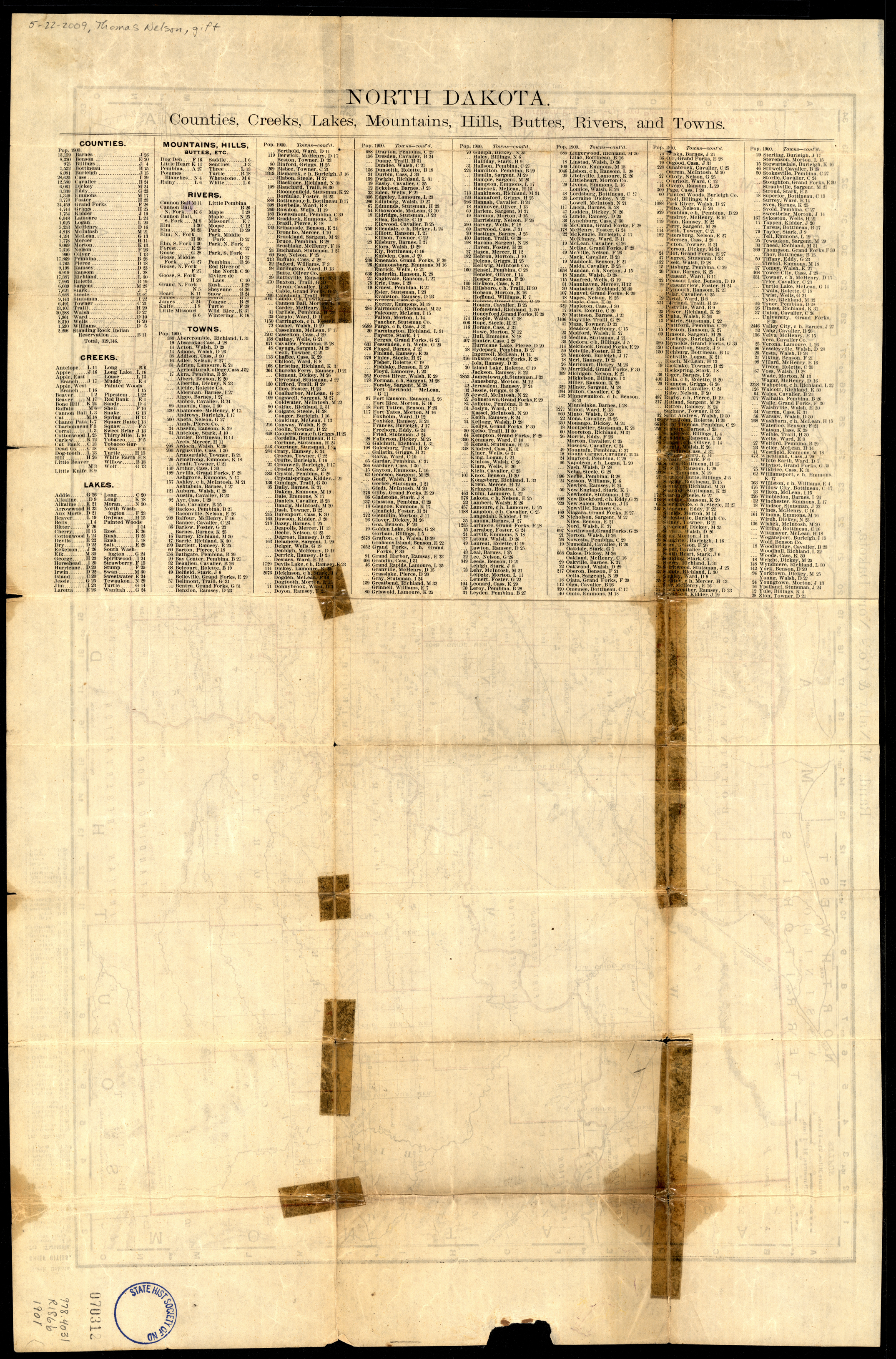
Collection: 978.4031 R186b 1901 - Rand, McNally & Co.'s North Dakota / __ __Rand, McNally & Co
Folder:
Library
Item:
978.4031 R186b 1901
Date:
1901
Creator:
Rand McNally and Company
Title:
Rand, McNally & Co.'s North Dakota / __ __Rand, McNally & Co
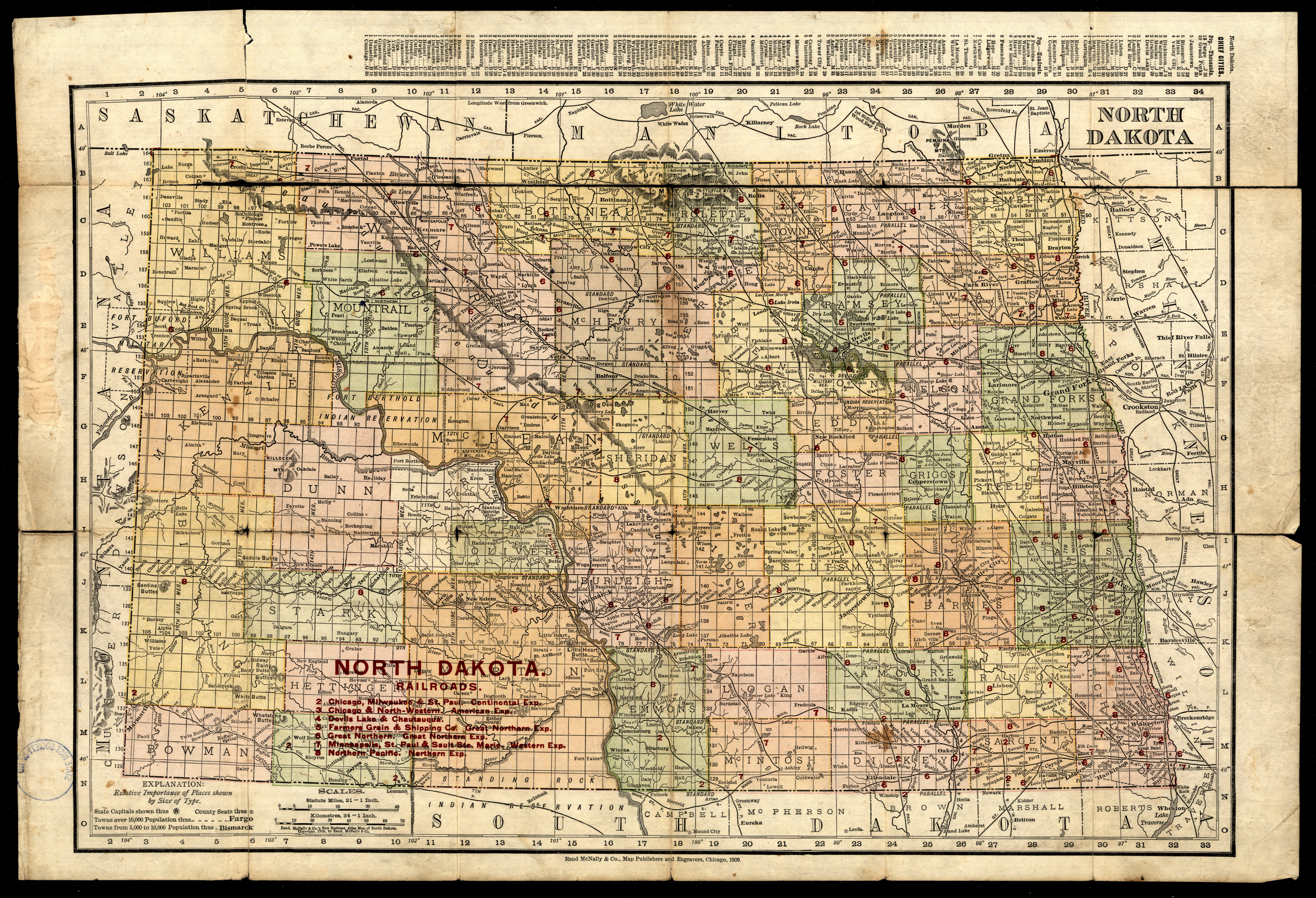
Collection: 978.4031 R186b 1909 - North Dakota
Folder:
Library
Item:
978.4031 R186b 1909
Date:
Copyright 1909
Creator:
Rand McNally and Company
Title:
North Dakota
Collection: 978.4031 R186b 1898 - North Dakota
Folder:
Library
Item:
978.4031 R186b 1898
Date:
Copyright 1898
Creator:
Rand McNally and Company
Title:
North Dakota
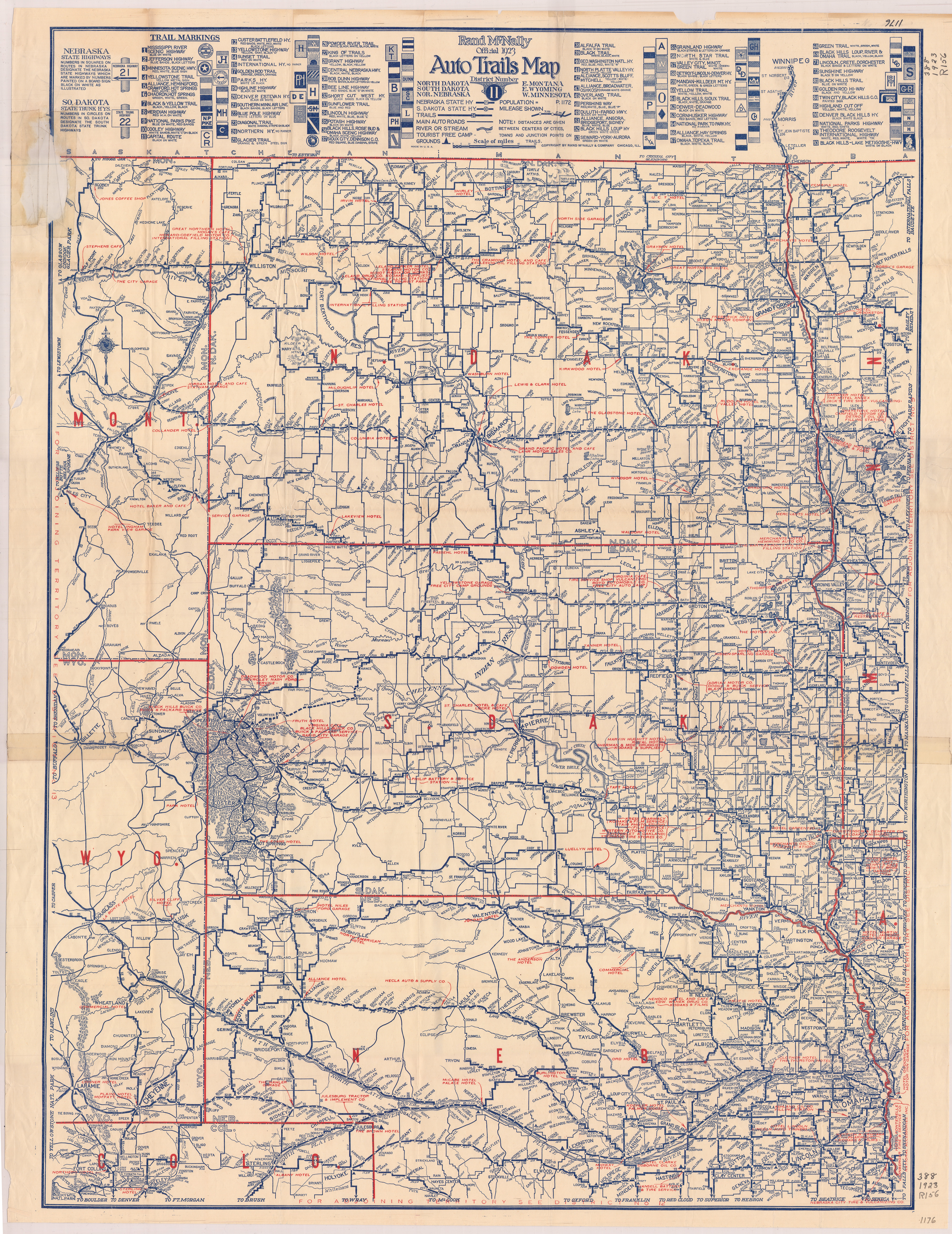
Collection: 388.1 R186r 1923 - Rand McNally official 1923 auto trails map, district no. 11 : __North Dakota, South Dakota, Nor. Nebraska, E. Montana, E. Wyoming, W. Minnesota
Folder:
Library
Item:
388.1 R186r 1923
Date:
1923
Creator:
Rand McNally and Company
Title:
Rand McNally official 1923 auto trails map, district no. 11 : __North Dakota, South Dakota, Nor. Nebraska, E. Montana, E. Wyoming, W. Minnesota
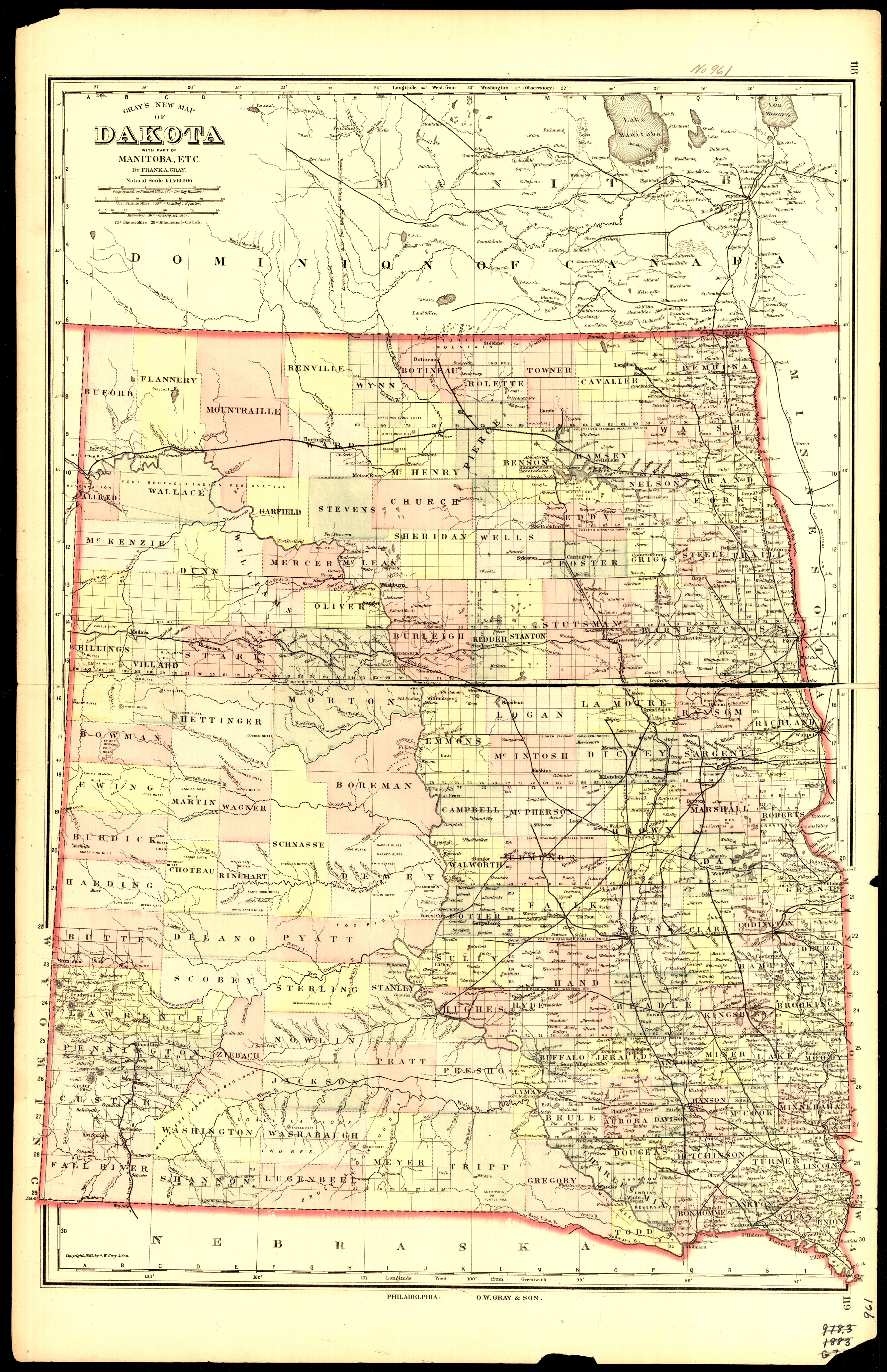
Collection: 978.402 G778g 1887 - Gray's new map of Dakota : __with part of Manitoba, etc. / __by Frank A. Gray
Folder:
Library
Item:
978.402 G778g 1887
Date:
Copyright 1883 - 1887
Creator:
Gray, Frank A
Title:
Gray's new map of Dakota : __with part of Manitoba, etc. / __by Frank A. Gray
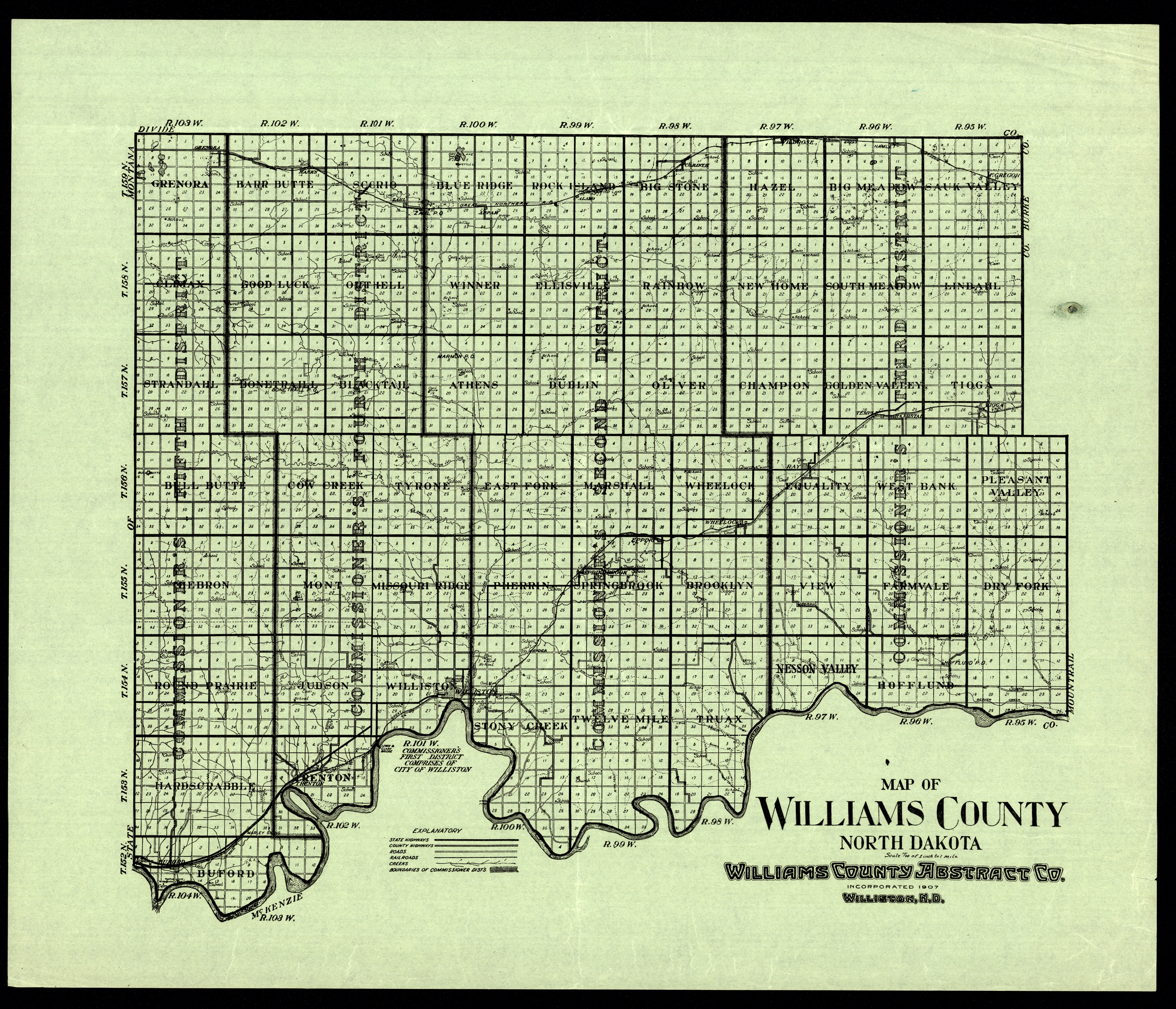
Collection: 978.473 M297 - Map of Williams County, North Dakota
Folder:
Library
Item:
978.473 M297
Date:
ca. 1935
Creator:
Title:
Map of Williams County, North Dakota
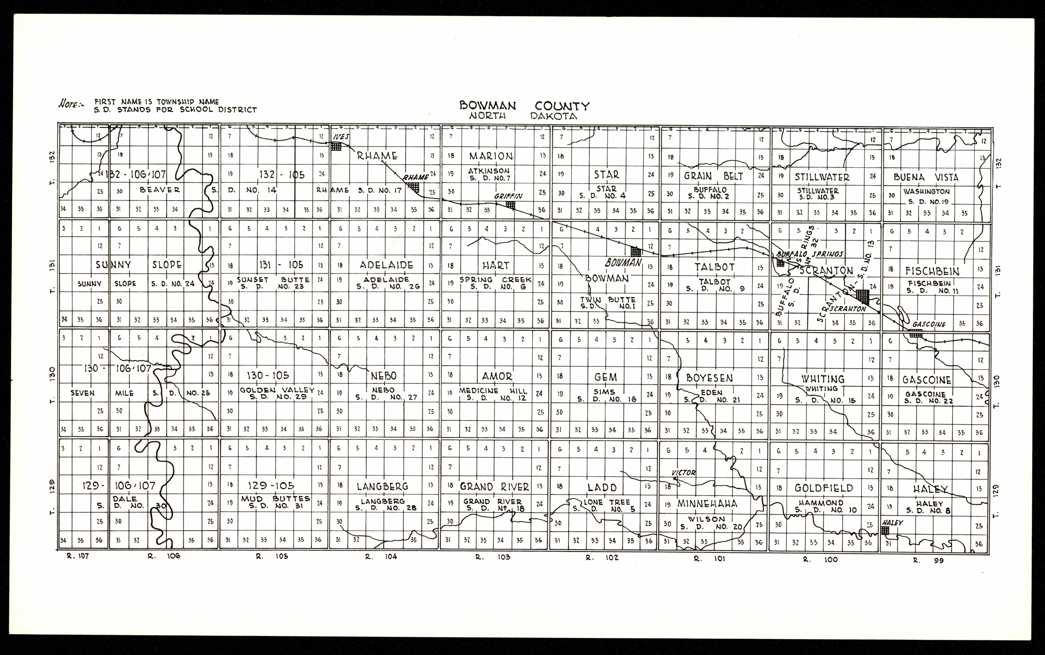
Collection: 978.492 B7874 - Bowman County, North Dakota
Folder:
Library
Item:
978.492 B7874
Date:
ca. 1910
Creator:
Title:
Bowman County, North Dakota
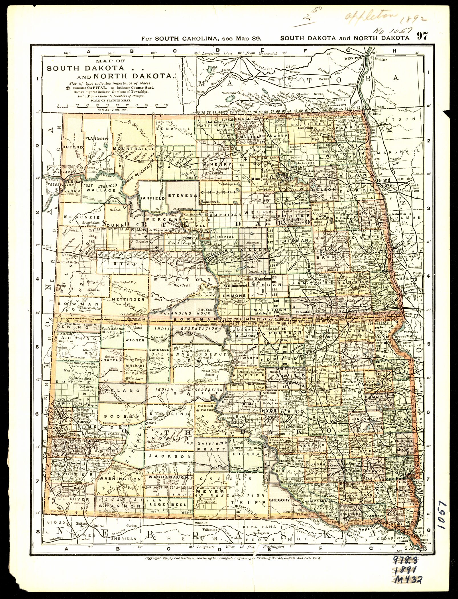
Collection: 978.4031 M438m 1891 - Map of South Dakota and North Dakota
Folder:
Library
Item:
978.4031 M438m 1891
Date:
Copyright 1891
Creator:
Matthews-Northrup Company
Title:
Map of South Dakota and North Dakota
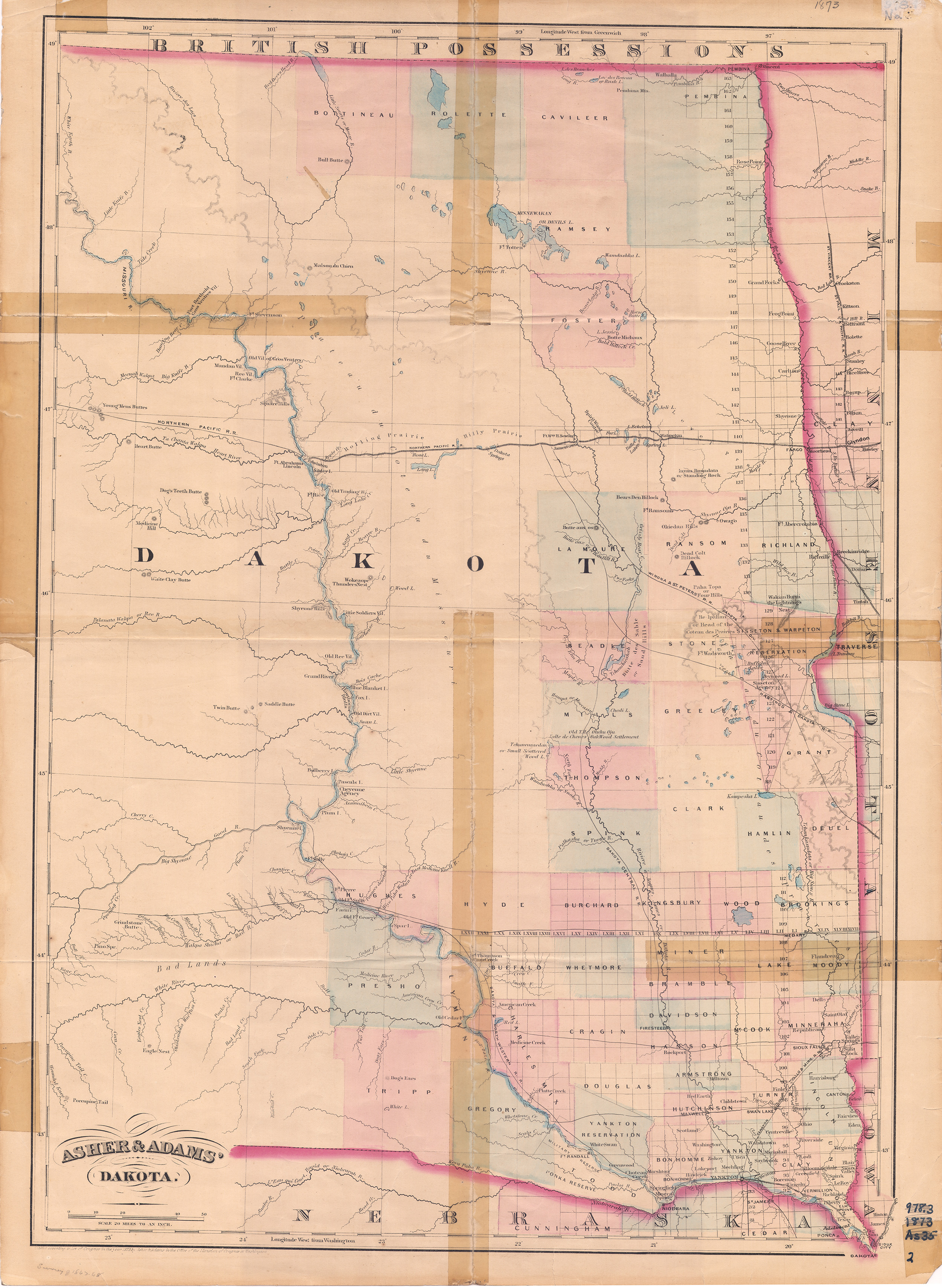
Collection: 978.402 A825a 1873 - Asher & Adams' Dakota
Folder:
Library
Item:
978.402 A825a 1873
Date:
Copyright 1873
Creator:
Asher & Adams
Title:
Asher & Adams' Dakota
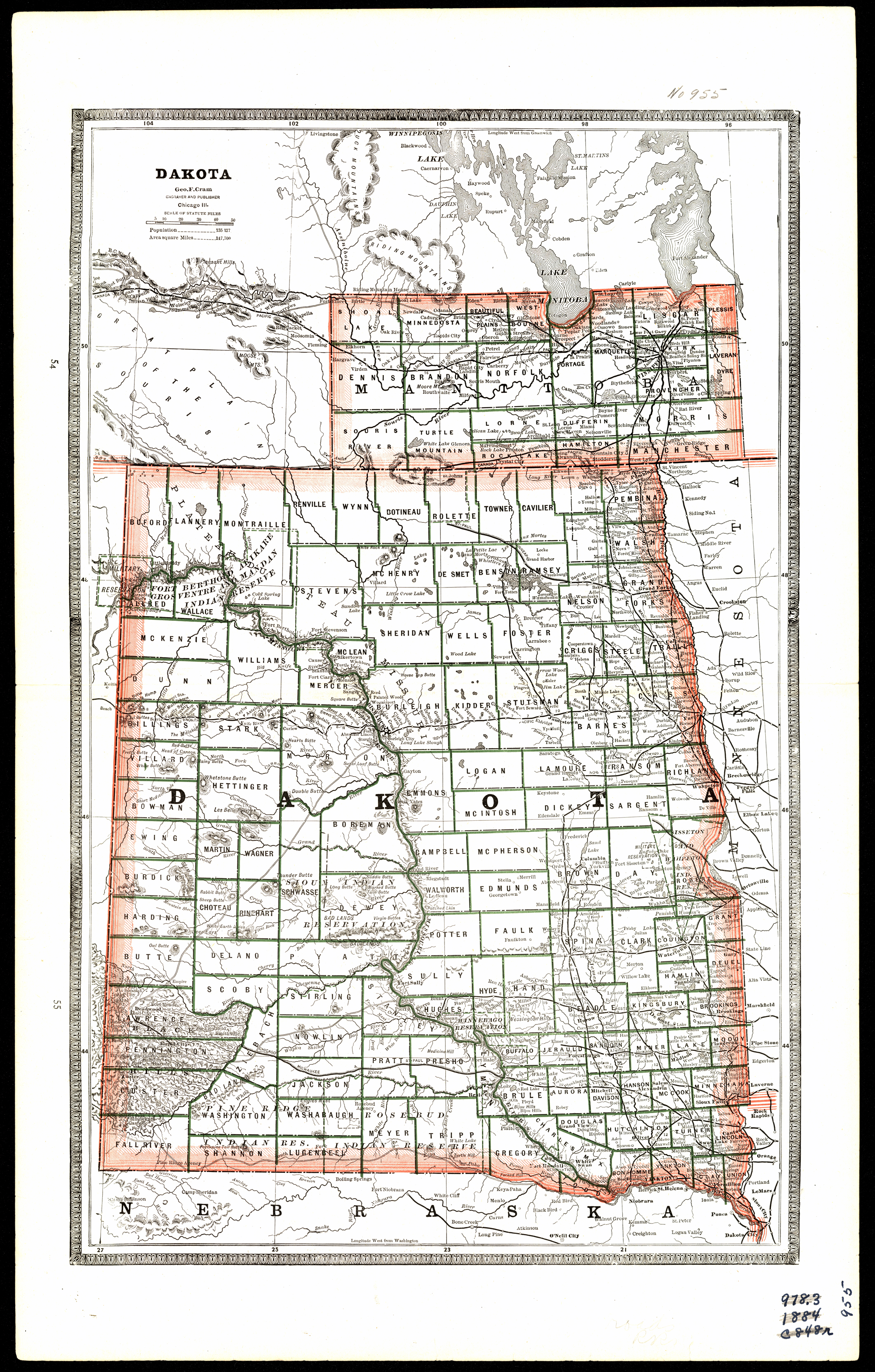
Collection: 978.402 C889d 1884 - Dakota / __ __Geo. F. Cram
Folder:
Library
Item:
978.402 C889d 1884
Date:
1884
Creator:
Cram, George Franklin,--1841-1928
Title:
Dakota / __ __Geo. F. Cram
Collection: 978.402 C889d 1884 - Dakota / __ __Geo. F. Cram
Folder:
Library
Item:
978.402 C889d 1884
Date:
1884
Creator:
Cram, George Franklin,--1841-1928
Title:
Dakota / __ __Geo. F. Cram
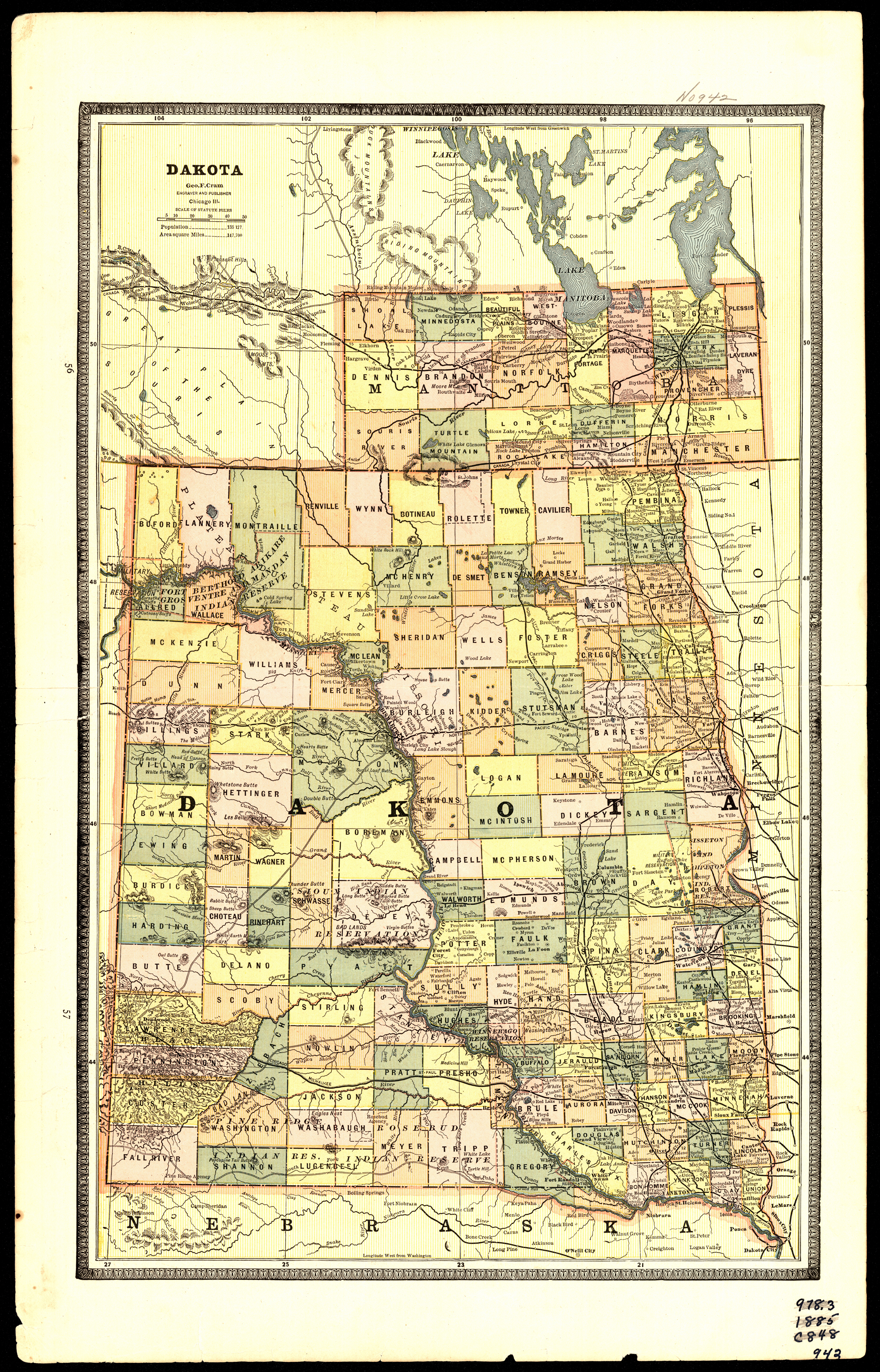
Collection: 978.402 C889d 1885 - Dakota / __ __Geo. F. Cram
Folder:
Library
Item:
978.402 C889d 1885
Date:
1885
Creator:
Cram, George Franklin,--1841-1928
Title:
Dakota / __ __Geo. F. Cram
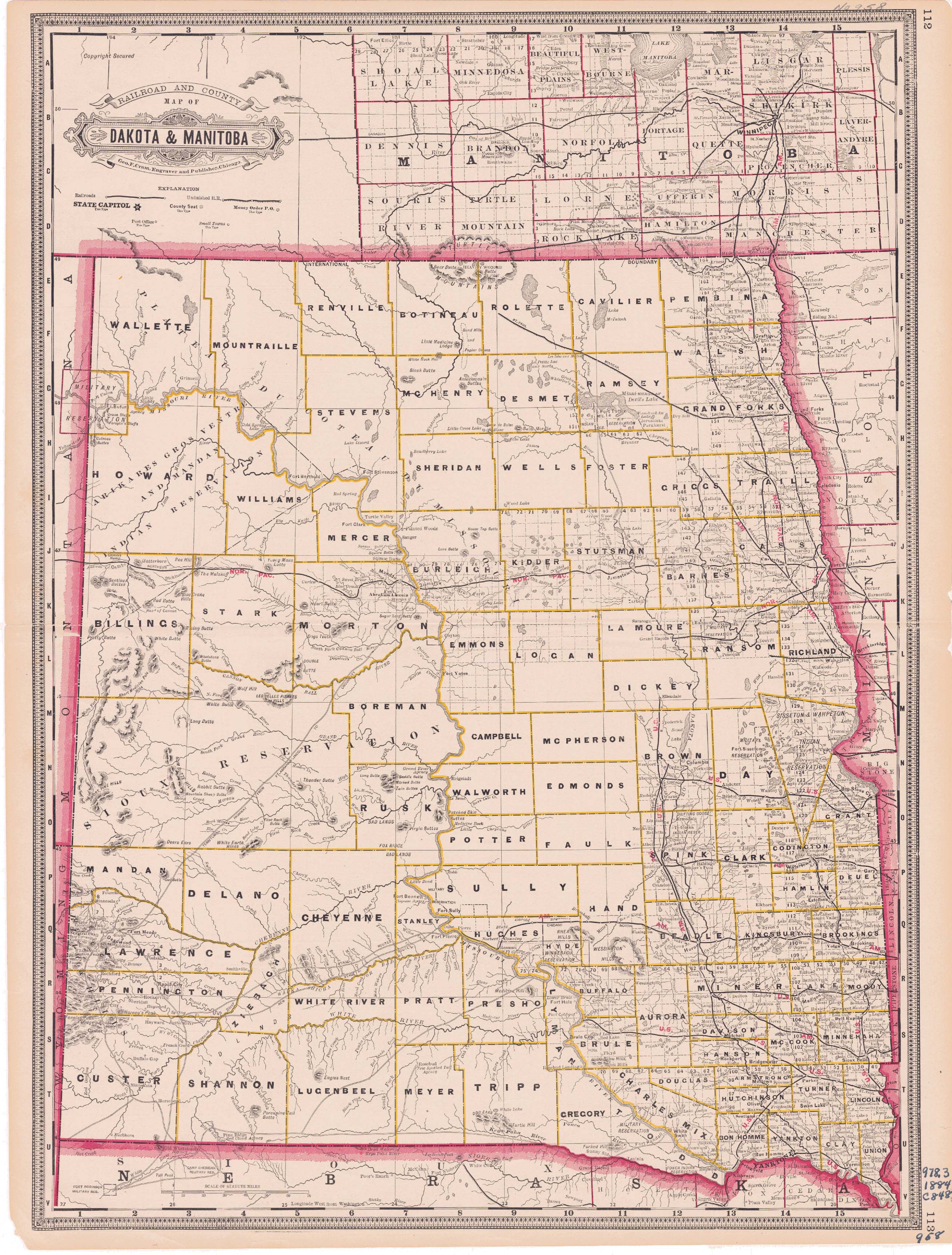
Collection: 978.402 C889r 1884 - Railroad and county map of Dakota & Manitoba / __ __Geo. F. Cram
Folder:
Library
Item:
978.402 C889r 1884
Date:
1884
Creator:
Cram, George Franklin,--1841-1928
Title:
Railroad and county map of Dakota & Manitoba / __ __Geo. F. Cram
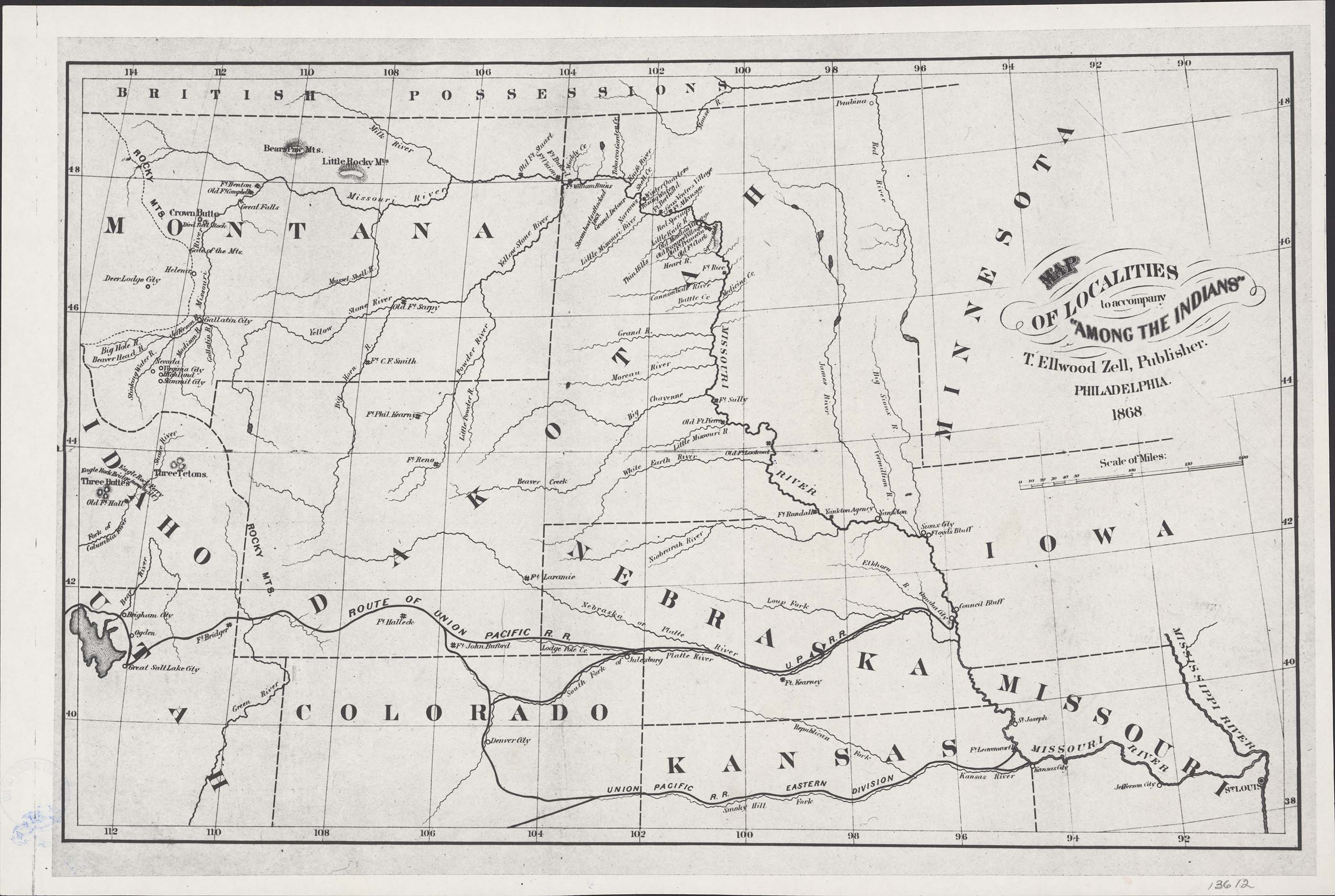
Collection: 970.1 B638 map - Map of localities to accompany "Among the Indians" / __ __T. Ellwood Zell
Folder:
Library
Item:
970.1 B638 map
Date:
1868
Creator:
Zell, T. Ellwood
Title:
Map of localities to accompany "Among the Indians" / __ __T. Ellwood Zell
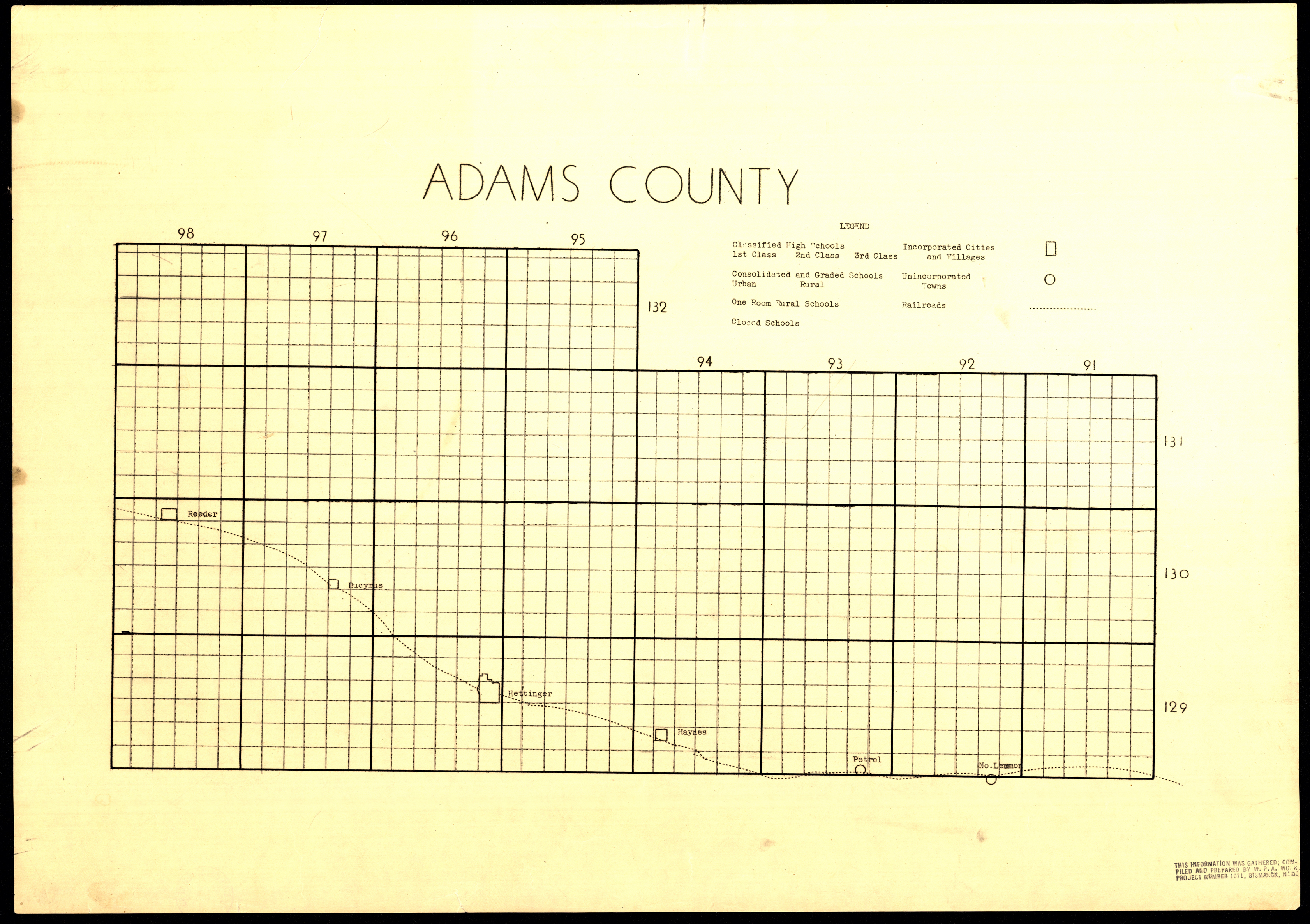
Collection: 978.489 A2 - Adams County
Folder:
Library
Item:
978.489 A2
Date:
ca. 1935
Creator:
Title:
Adams County
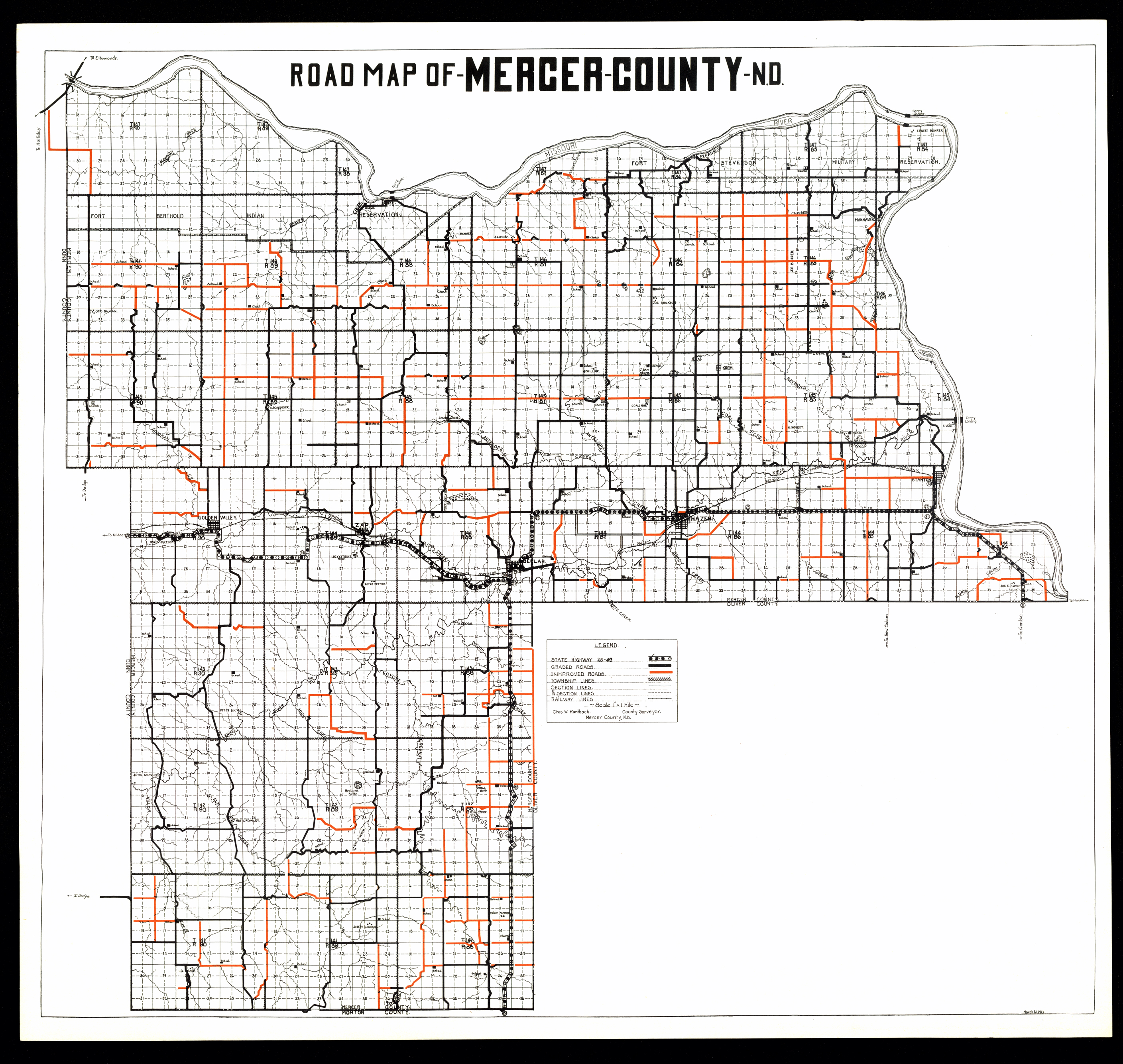
Collection: 978.483 K1682r 1927 - Road map of Mercer County, N.D. / __ __Chas. W. Kanthack
Folder:
Library
Item:
978.483 K1682r 1927
Date:
1927
Creator:
Kanthack, Chas. W
Title:
Road map of Mercer County, N.D. / __ __Chas. W. Kanthack
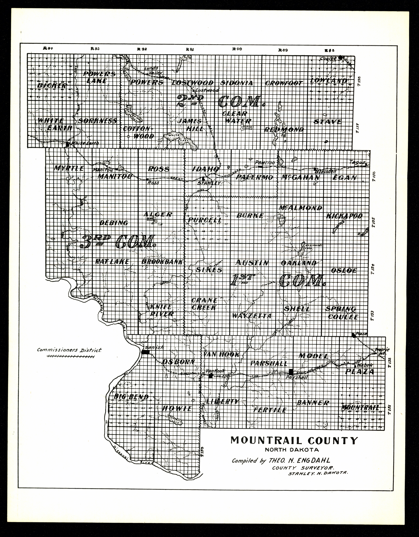
Collection: 978.474 E57m - Mountrail County, North Dakota / __ __compiled by Theo. N. Engdahl
Folder:
Library
Item:
978.474 E57m
Date:
ca. 1935
Creator:
Engdahl, Theo. N
Title:
Mountrail County, North Dakota / __ __compiled by Theo. N. Engdahl
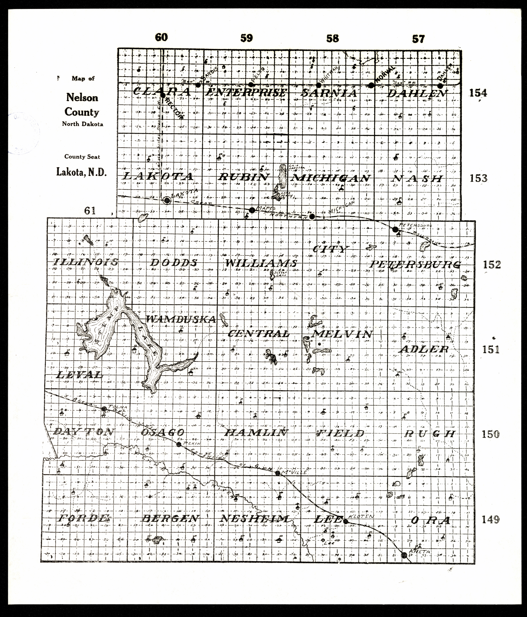
Collection: 978.435 M297 - Map of Nelson County, North Dakota
Folder:
Library
Item:
978.435 M297
Date:
1915 - 1925
Creator:
Title:
Map of Nelson County, North Dakota
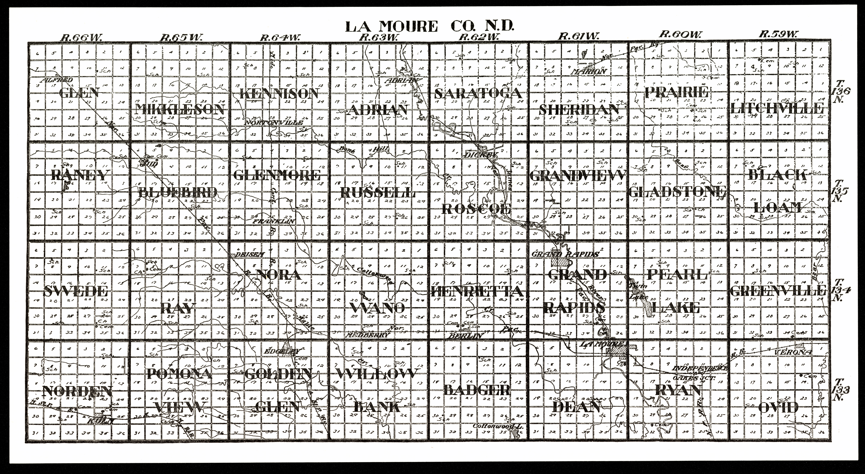
Collection: 978.453 W1117L 1916 - La Moure Co., N.D
Folder:
Library
Item:
978.453 W1117L 1916
Date:
1916
Creator:
W.W. Hixson & Co
Title:
La Moure Co., N.D
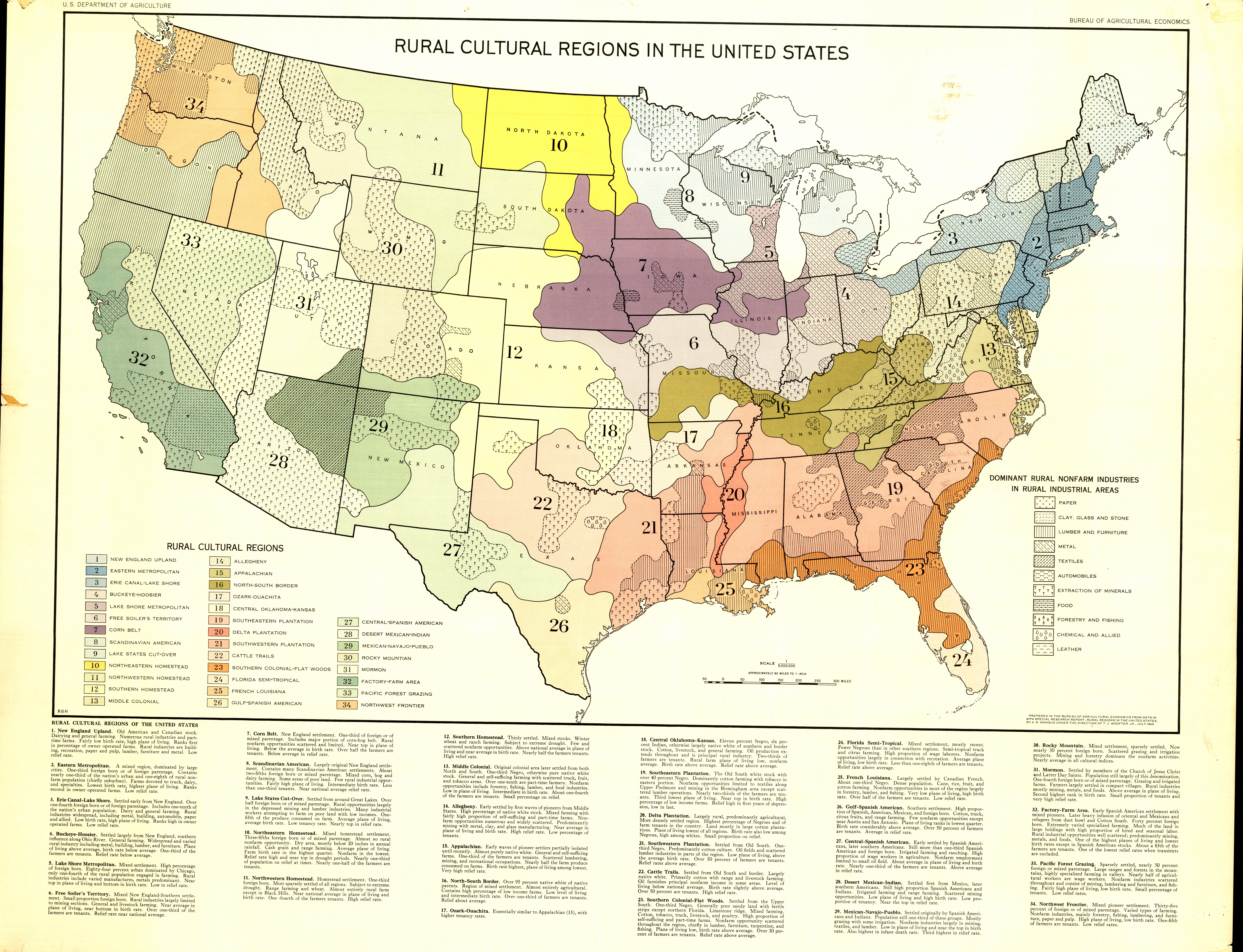
Collection: 333.0973 U5813r 1940 - Rural cultural regions in the United States / __ __U.S. Dept. of Agriculture, Bureau of Economic Relations
Folder:
Library
Item:
333.0973 U5813r 1940
Date:
1940
Creator:
United States.--Bureau of Agricultural Economics
Title:
Rural cultural regions in the United States / __ __U.S. Dept. of Agriculture, Bureau of Economic Relations
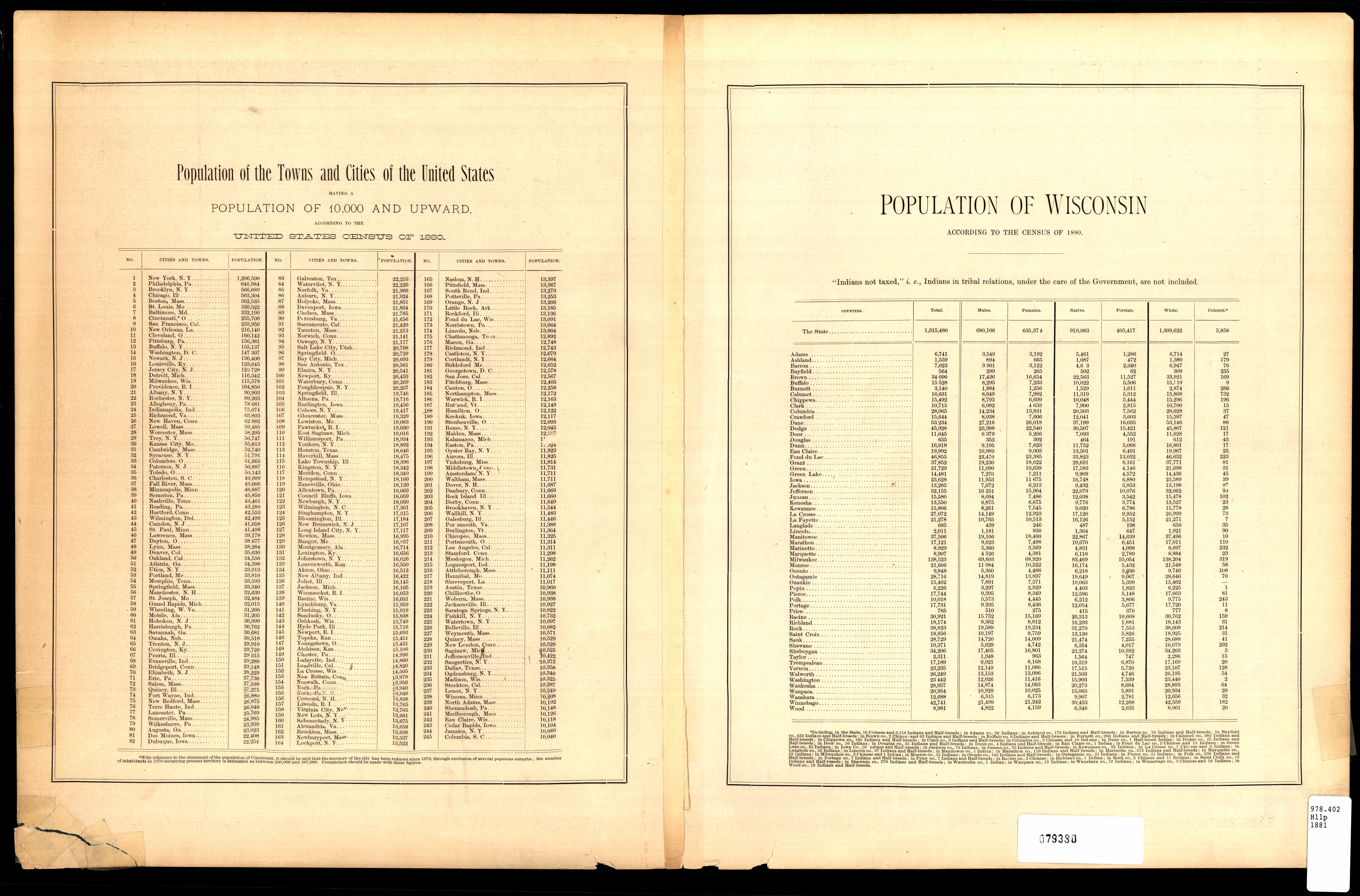
Collection: 978.402 H11p 1881 - Page's map of Dakota, 1881
Folder:
Library
Item:
978.402 H11p 1881
Date:
Copyright 1880 - 1881
Creator:
H.R. Page & Co
Title:
Page's map of Dakota, 1881
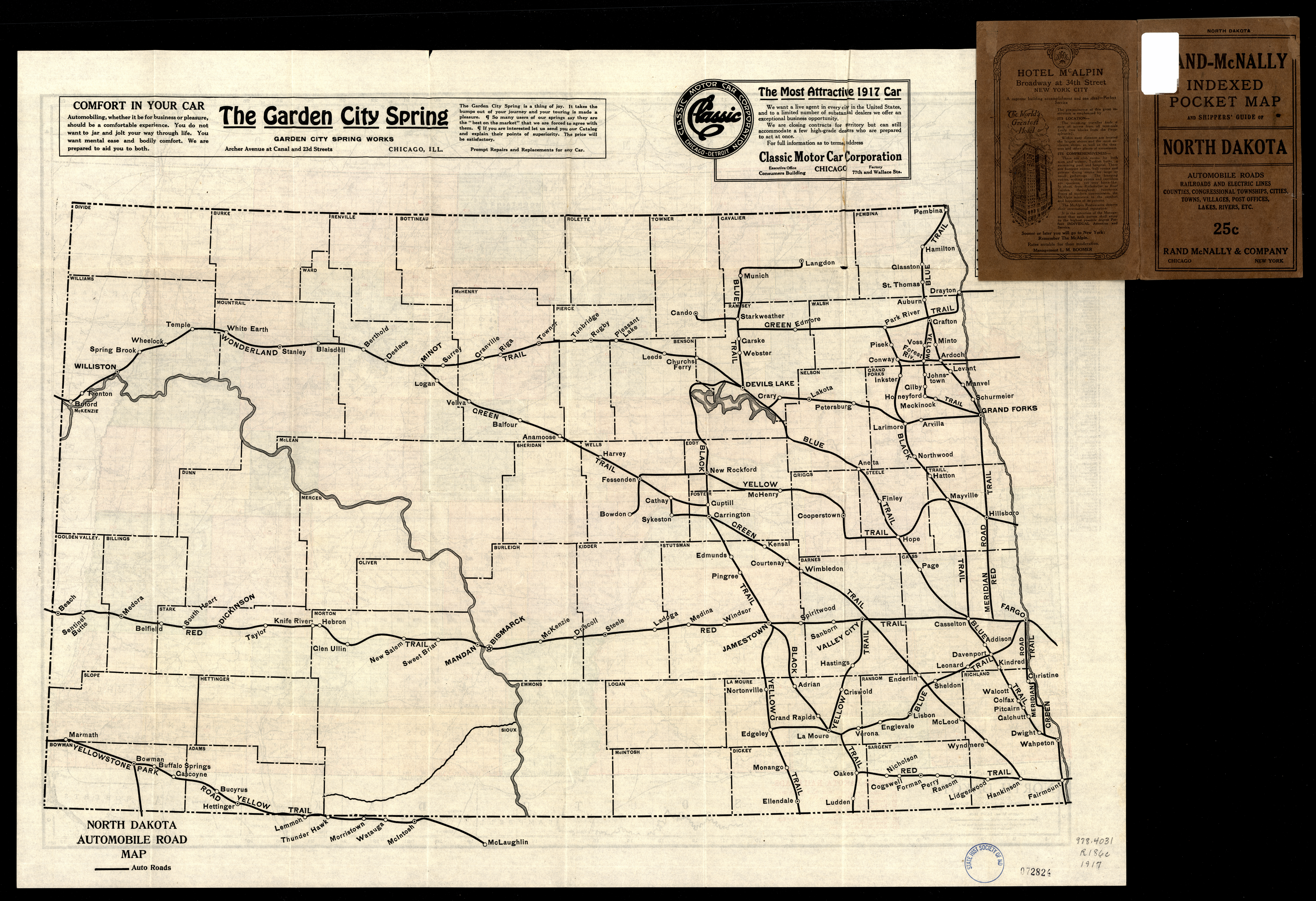
Collection: 978.4031 R186c 1917 - The Rand McNally new commercial atlas map of North Dakota ; __North Dakota automobile road map
Folder:
Library
Item:
978.4031 R186c 1917
Date:
Copyright 1917
Creator:
Rand McNally and Company
Title:
The Rand McNally new commercial atlas map of North Dakota ; __North Dakota automobile road map