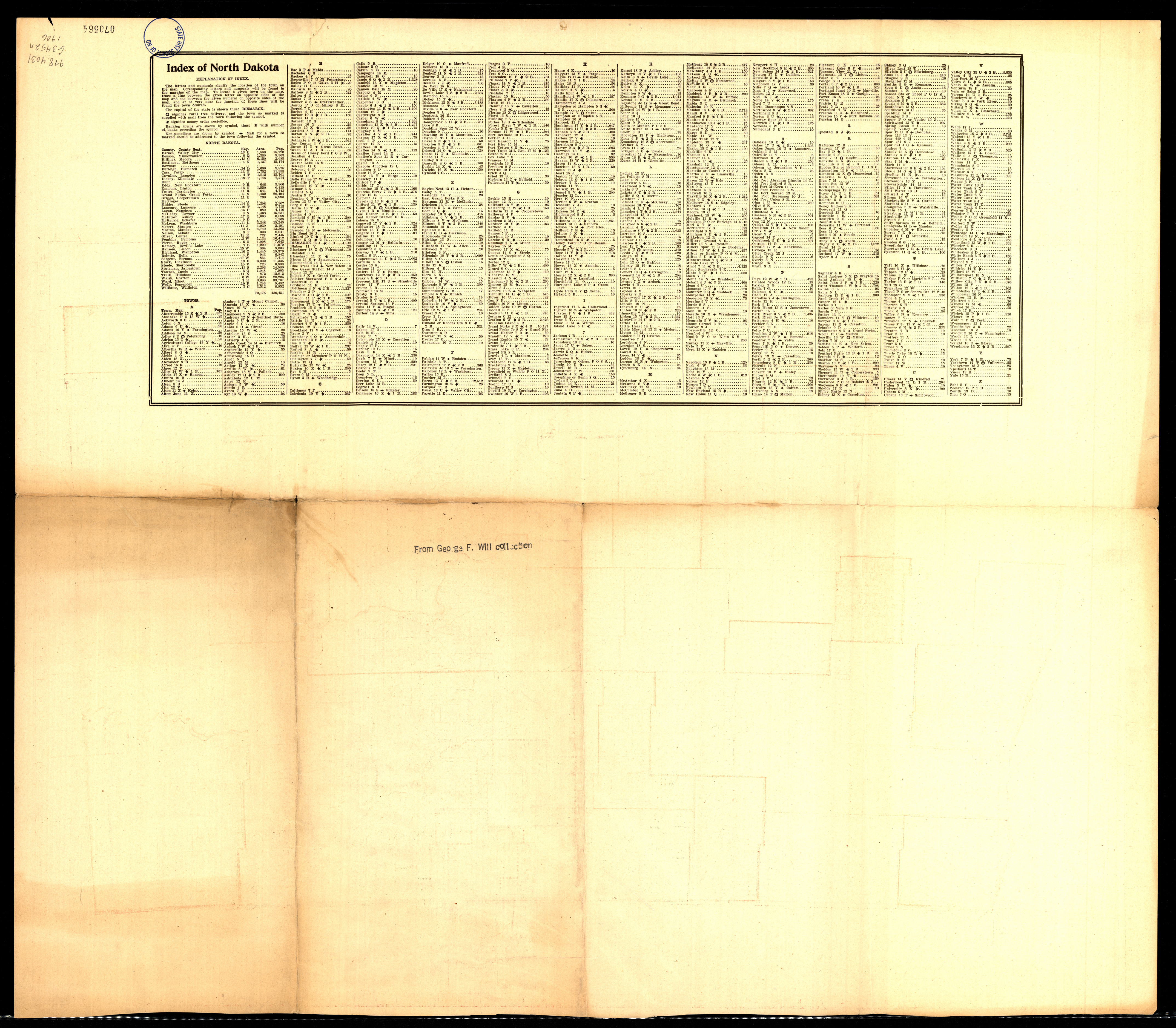
Collection: 978.4031 G3452n 1906 - North Dakota / __ __edited, engraved and published by the Geographical Publishing Co
Folder:
Library
Item:
978.4031 G3452n 1906
Date:
Copyright 1906
Creator:
Geographical Publishing Co
Title:
North Dakota / __ __edited, engraved and published by the Geographical Publishing Co
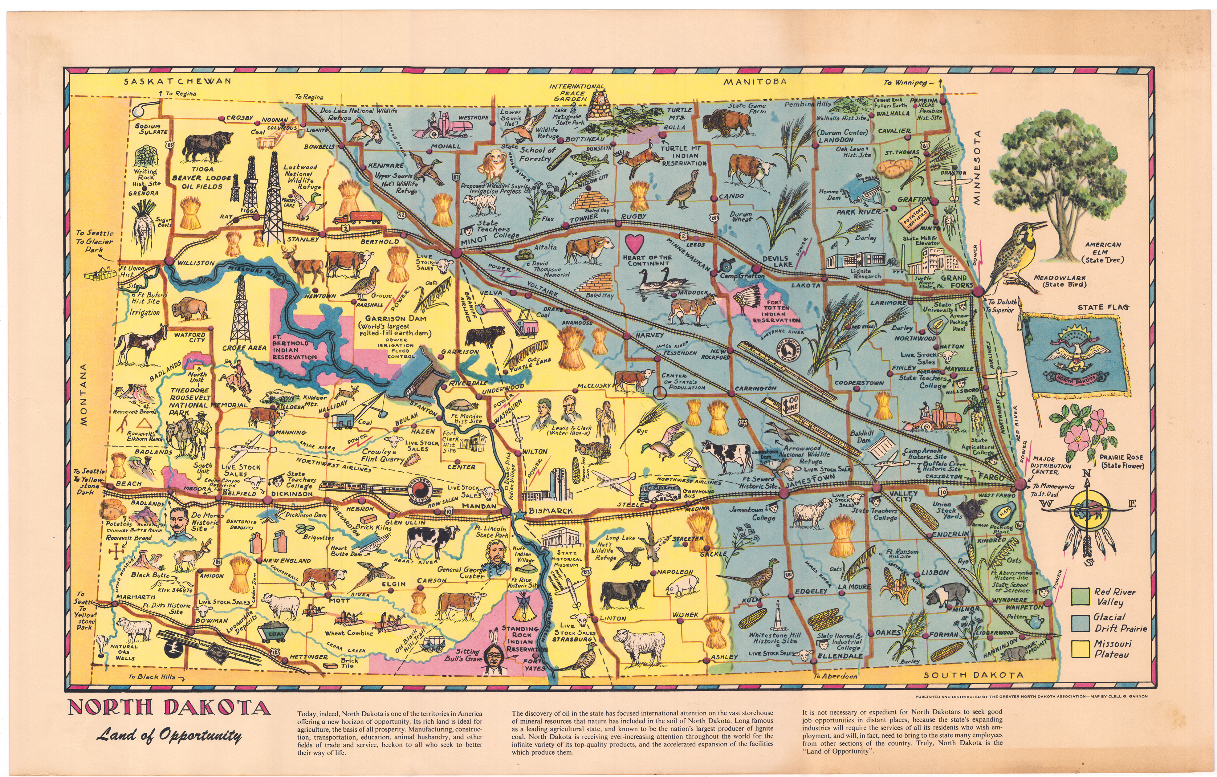
Collection: 978.4033 G198n - North Dakota, land of opportunity / __ __map by Clell G. Gannon
Folder:
Library
Item:
978.4033 G198n
Date:
ca. 1955
Creator:
Gannon, Clell Goebel,--1900-1962
Title:
North Dakota, land of opportunity / __ __map by Clell G. Gannon
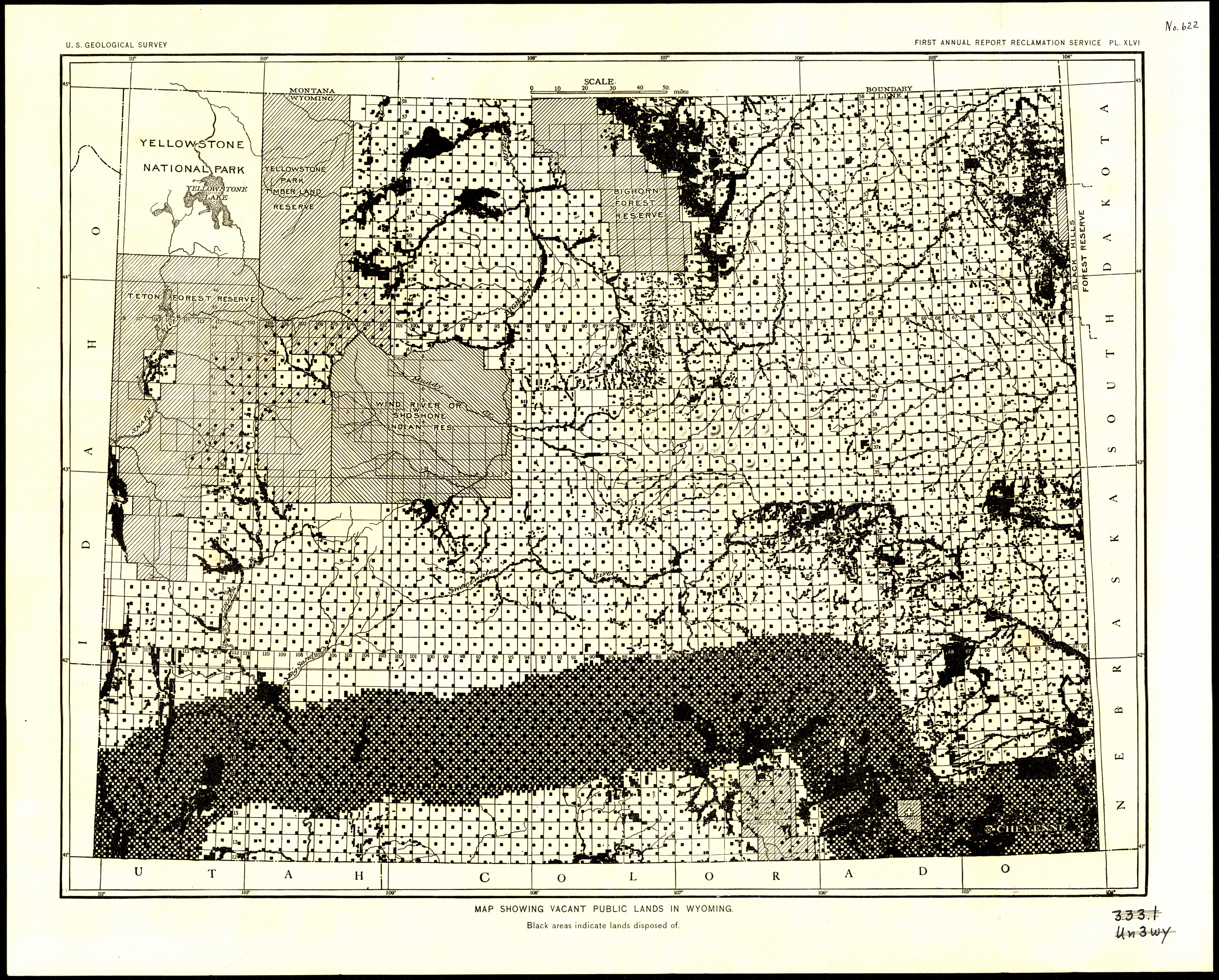
Collection: 333.109787 G3454m 1903 - Map showing vacant public lands in Wyoming / __ __U.S. Geological Survey [Reclamation Service]
Folder:
Library
Item:
333.109787 G3454m 1903
Date:
1903
Creator:
Geological Survey (U.S.).--Reclamation Service
Title:
Map showing vacant public lands in Wyoming / __ __U.S. Geological Survey [Reclamation Service]
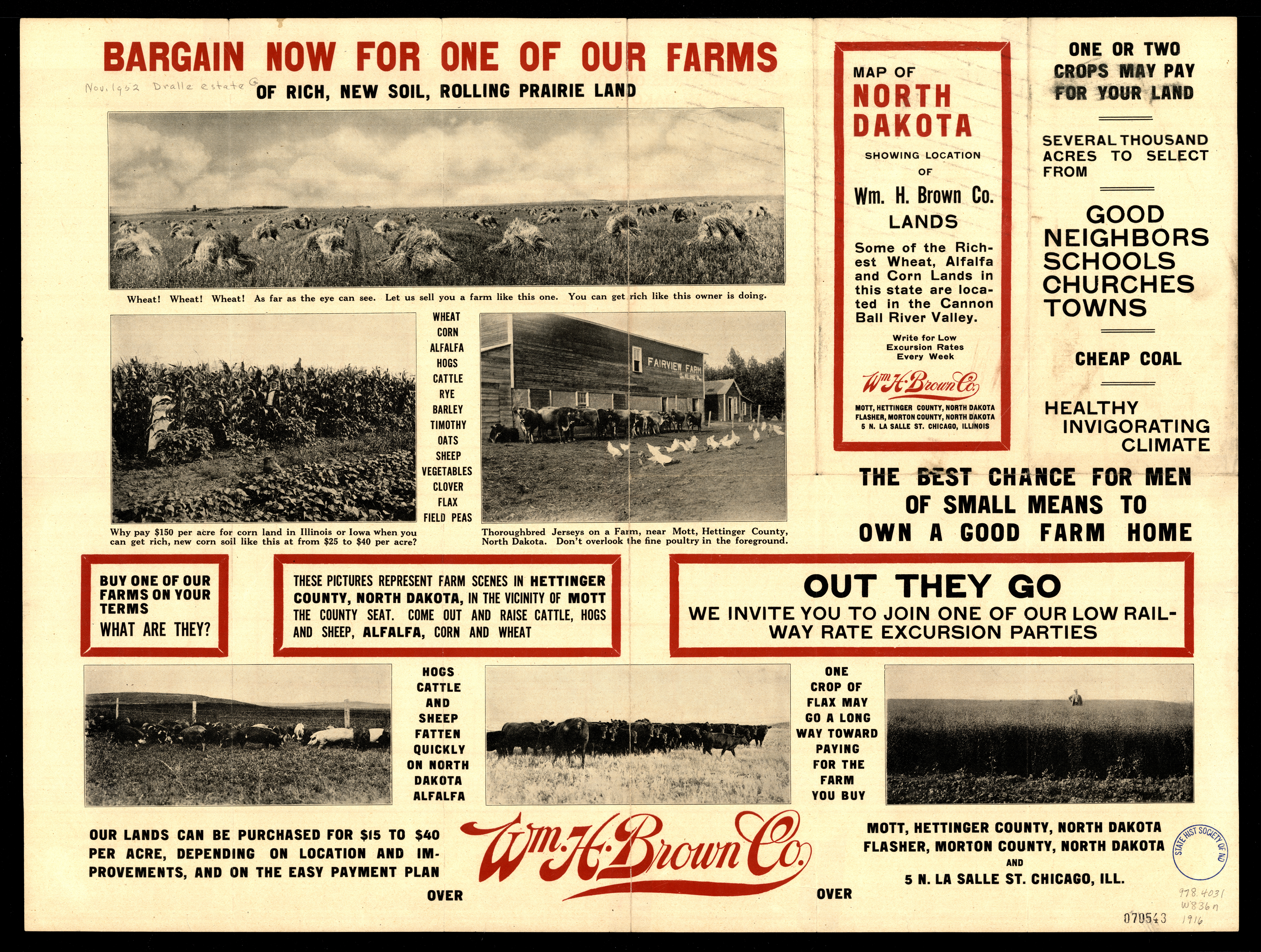
Collection: 978.4031 W836n 1916 - North Dakota / __ __published under direction of Wm. H. Brown Co
Folder:
Library
Item:
978.4031 W836n 1916
Date:
1916
Creator:
Wm. H. Brown Co
Title:
North Dakota / __ __published under direction of Wm. H. Brown Co
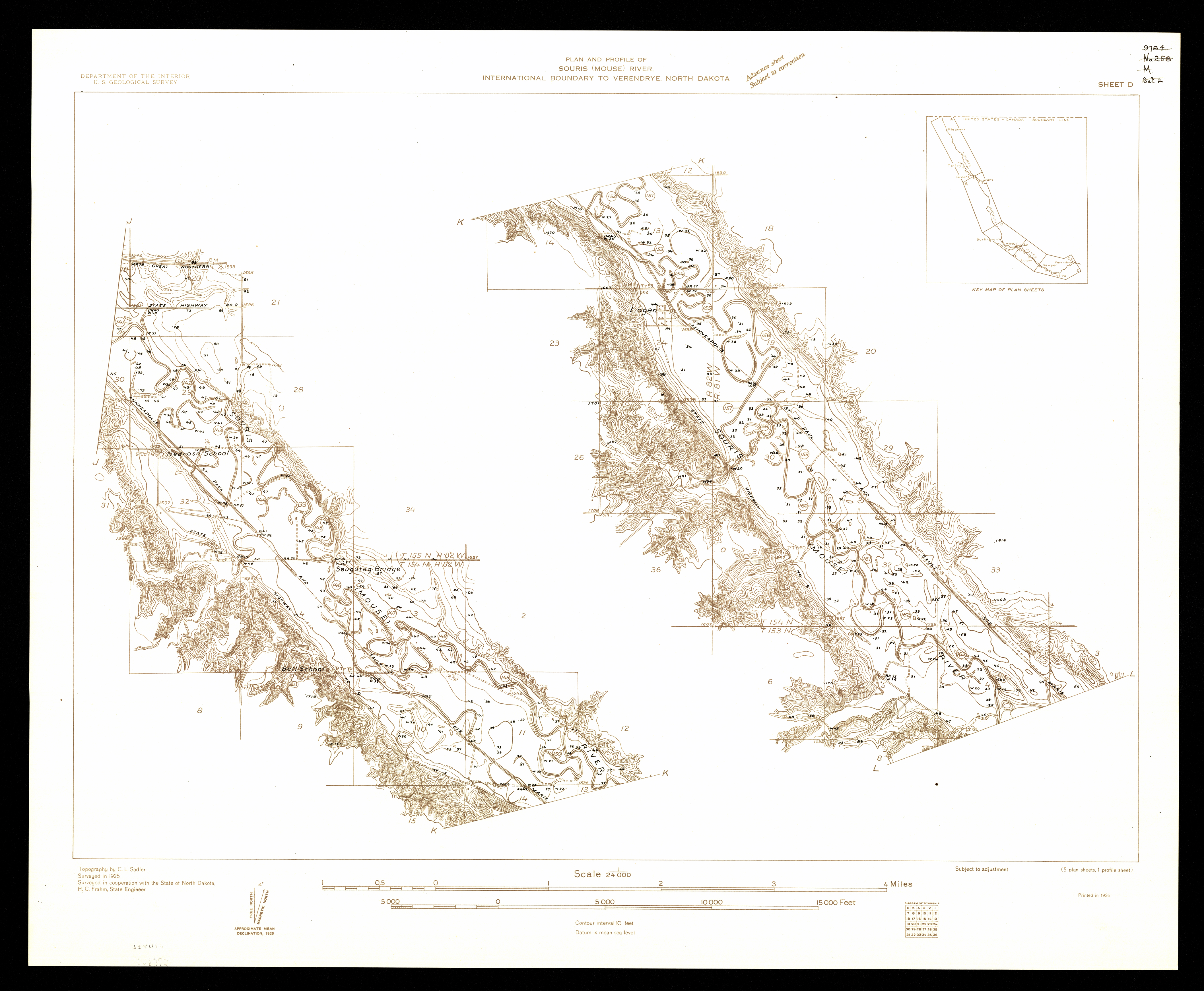
Collection: 978.46 G345p 1926 - Plan and profile of Souris (Mouse) River, international boundary to Verendrye, North Dakota / __ __U.S. Geological Survey, surveyed in cooperation with the state of North Dakota
Folder:
Library
Item:
978.46 G345p 1926
Date:
1926 - 1930
Creator:
Geological Survey (U.S.)
Title:
Plan and profile of Souris (Mouse) River, international boundary to Verendrye, North Dakota / __ __U.S. Geological Survey, surveyed in cooperation with the state of North Dakota
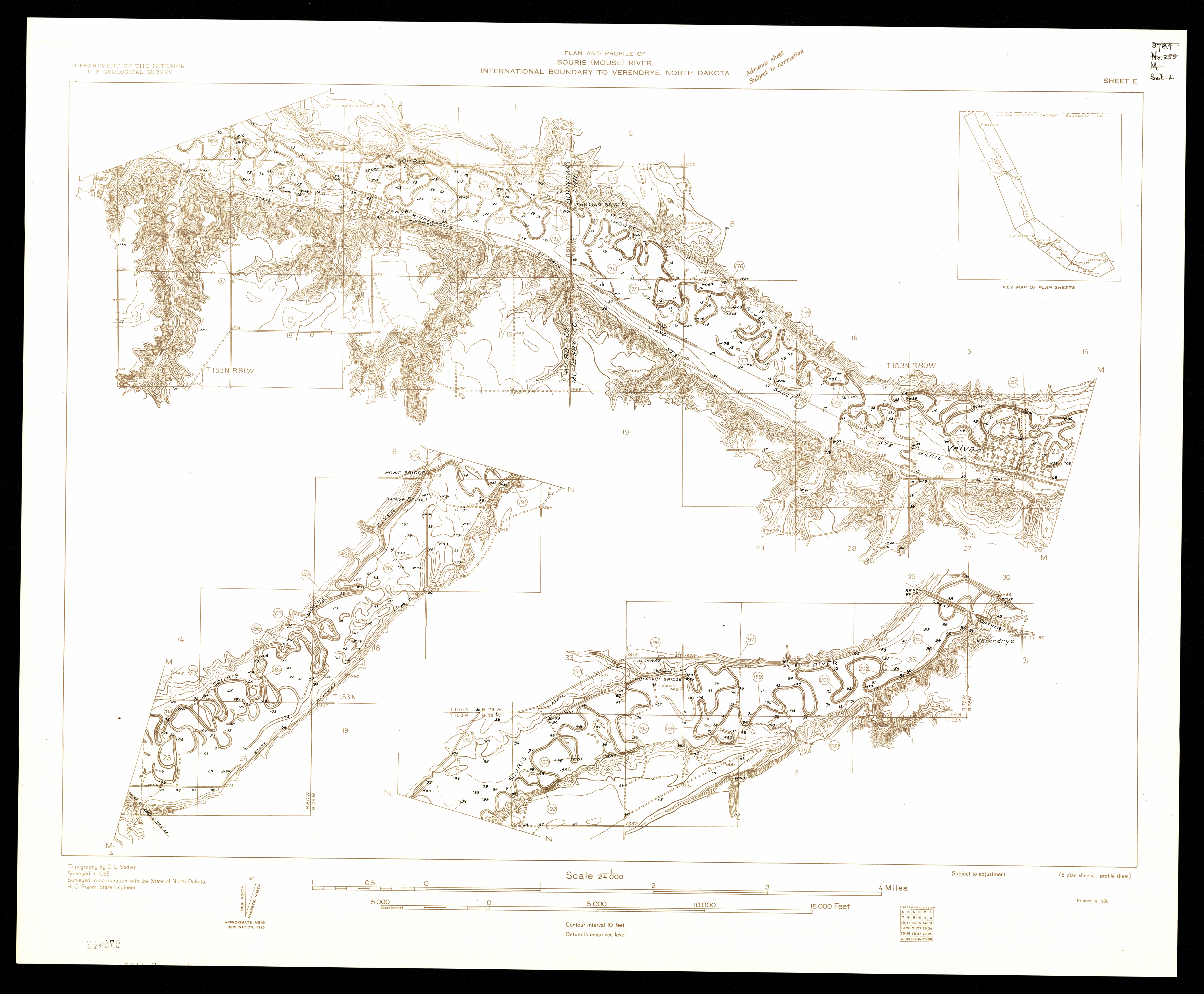
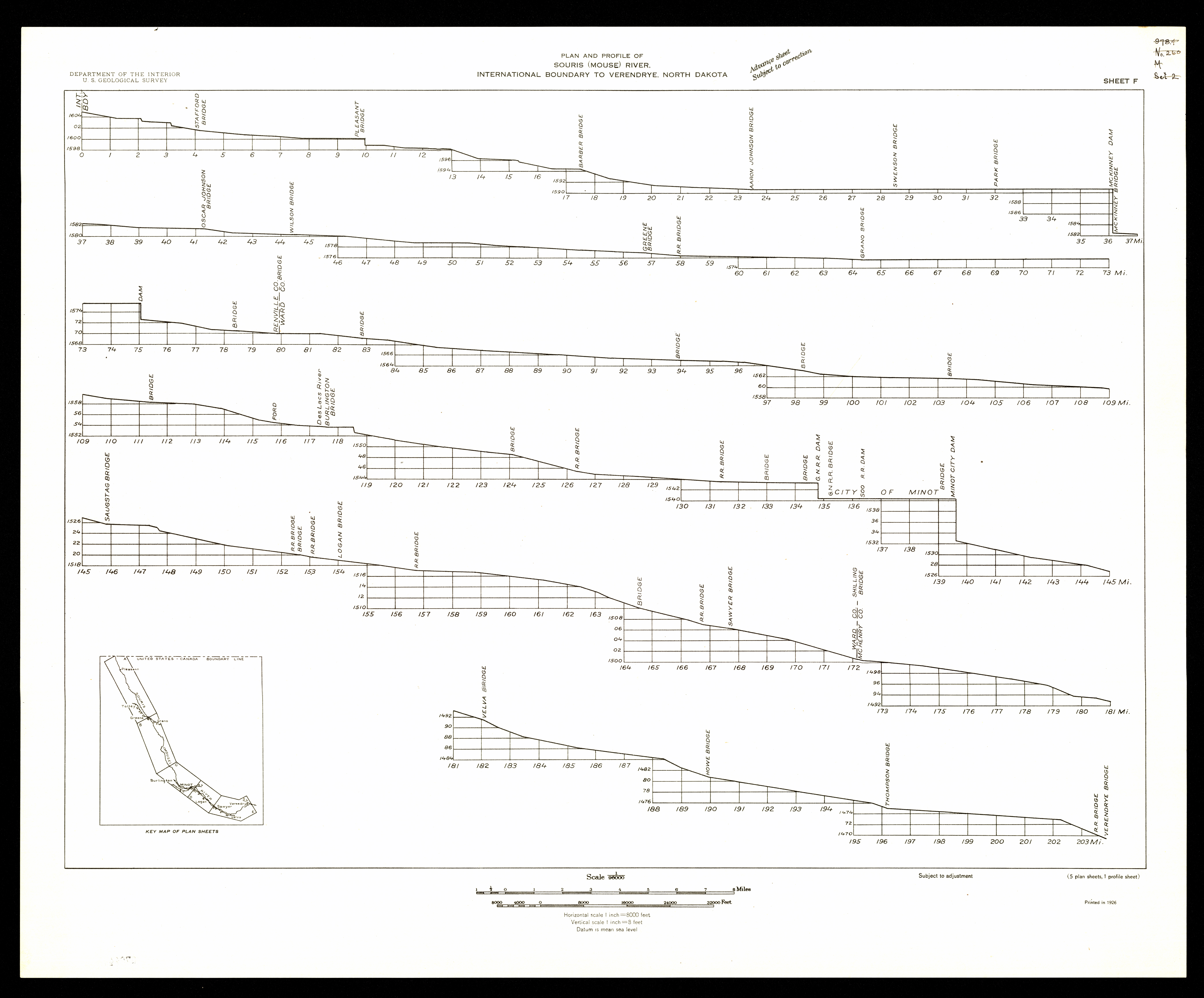
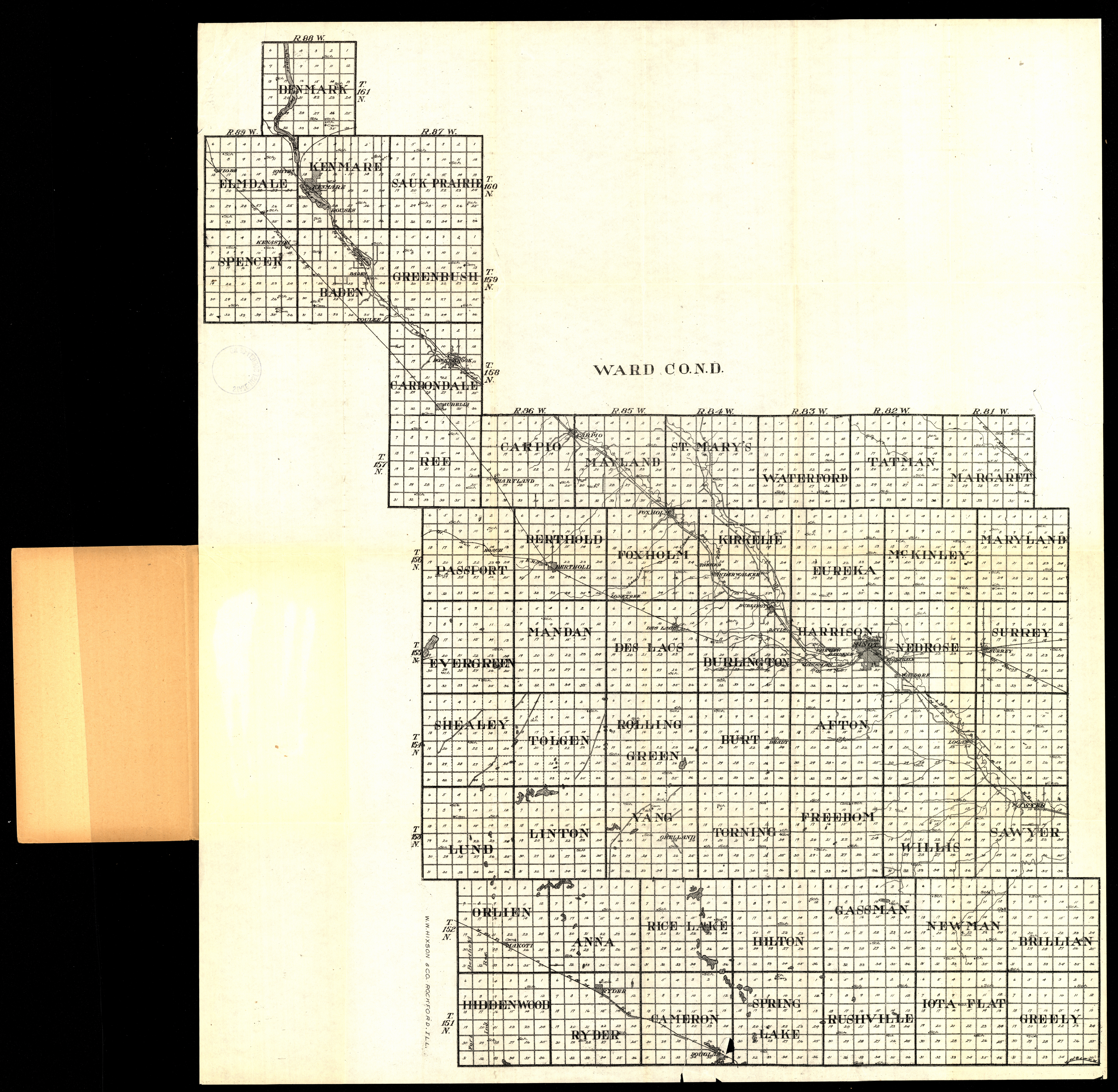
Collection: 978.463 W1117w 1916 - Ward Co., N.D
Folder:
Library
Item:
978.463 W1117w 1916
Date:
1916
Creator:
W.W. Hixson & Co
Title:
Ward Co., N.D
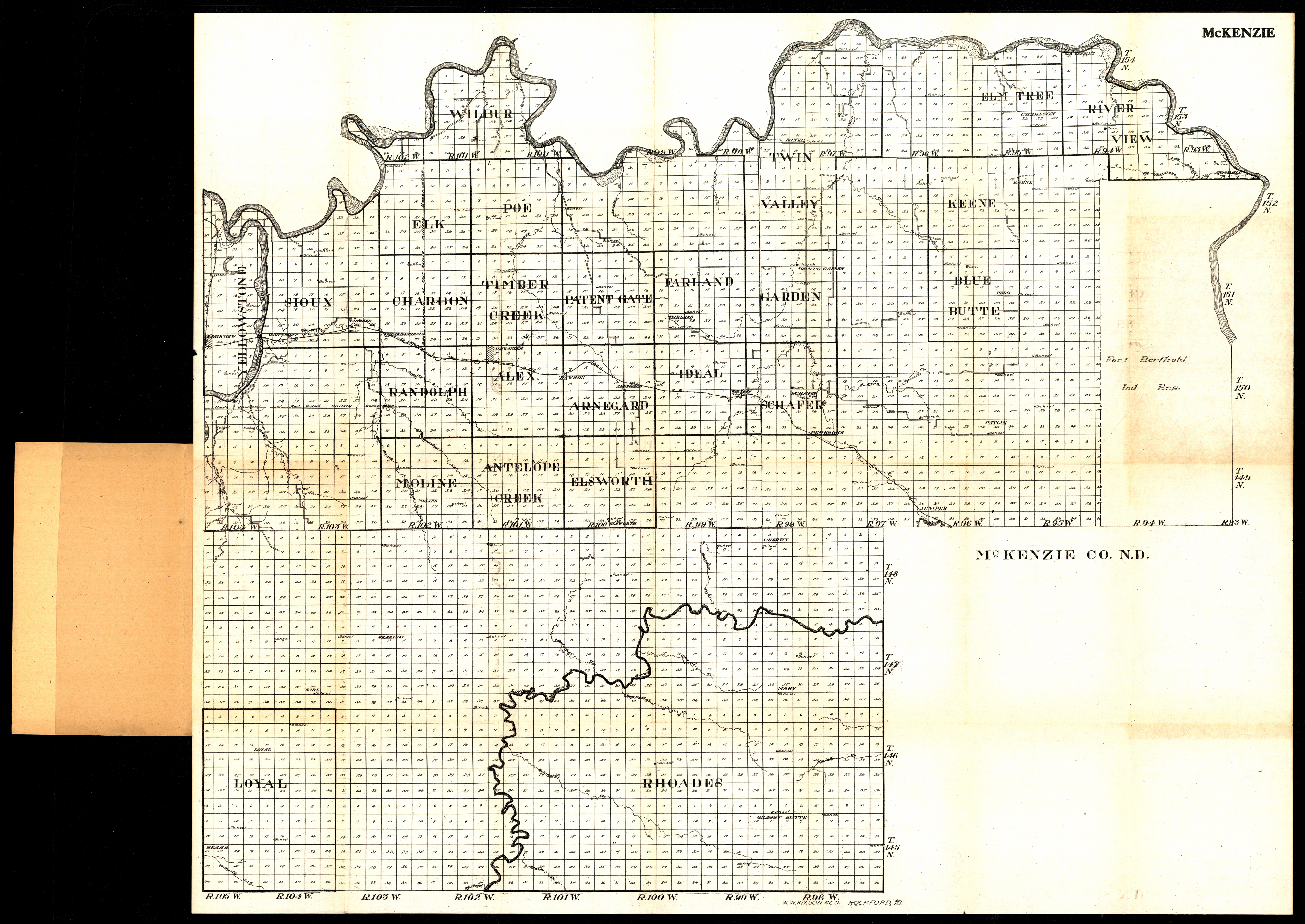
Collection: 978.481 W1117m 1916 - McKenzie Co., N.D
Folder:
Library
Item:
978.481 W1117m 1916
Date:
1916
Creator:
W.W. Hixson & Co
Title:
McKenzie Co., N.D
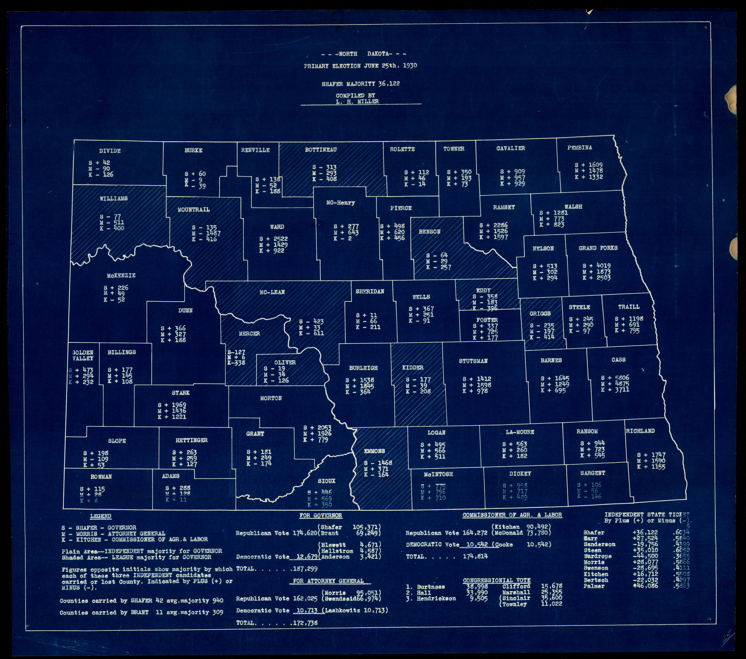
Collection: 324.9784 N864n 1930 - North Dakota primary election, June 25th, 1930 / __ __compiled by L.H. Miller
Folder:
Library
Item:
324.9784 N864n 1930
Date:
1930
Creator:
North Dakota.--Department of State
Title:
North Dakota primary election, June 25th, 1930 / __ __compiled by L.H. Miller
Collection: 978.4031 G3452n 1911 - North Dakota / __ __edited, engraved and published by the Geographical Publishing Co
Folder:
Library
Item:
978.4031 G3452n 1911
Date:
Copyright 1911
Creator:
Geographical Publishing Co
Title:
North Dakota / __ __edited, engraved and published by the Geographical Publishing Co
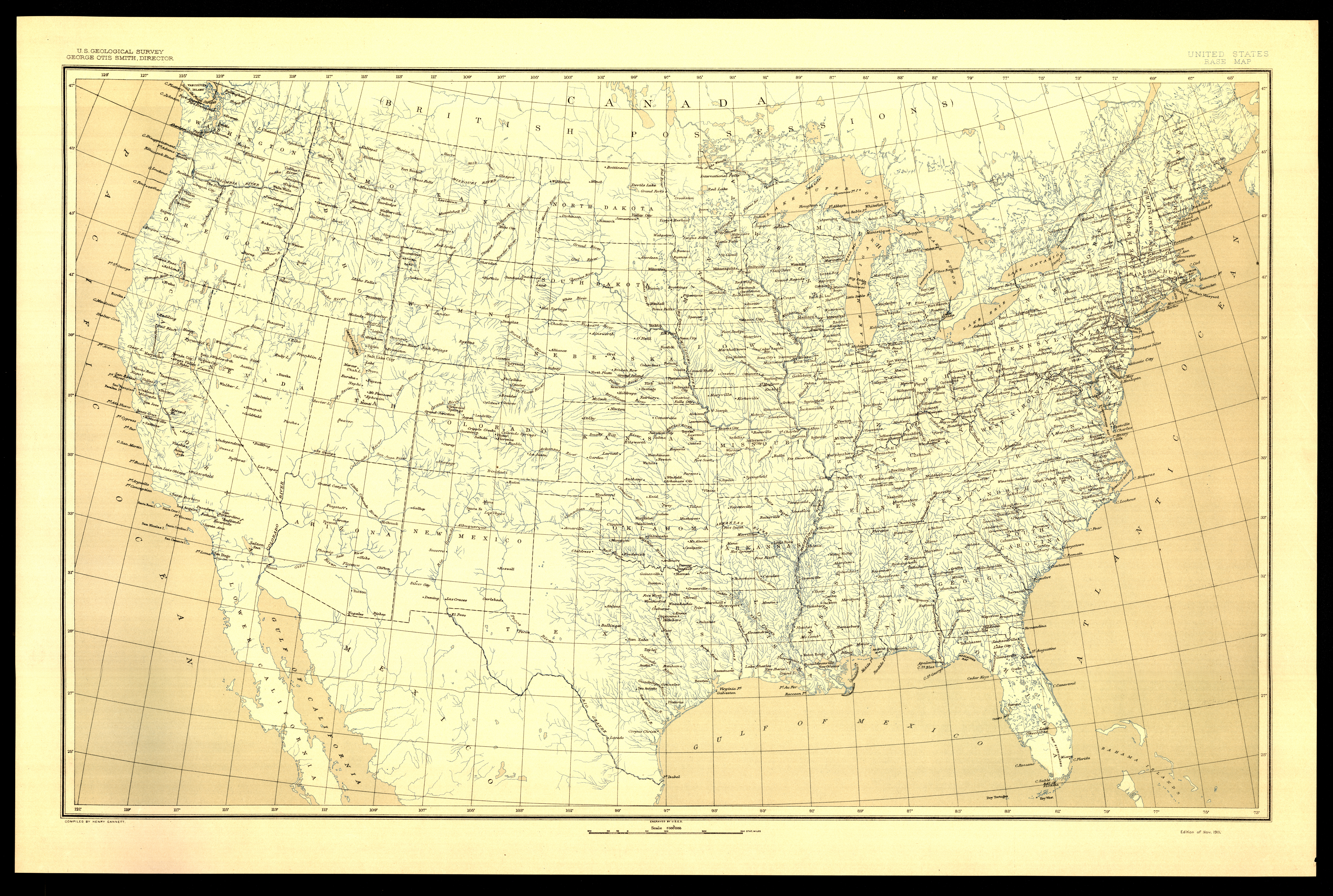
Collection: 551.41 G345ub 1911 - United States base map
Folder:
Library
Item:
551.41 G345ub 1911
Date:
1911
Creator:
Geological Survey (U.S.)
Title:
United States base map
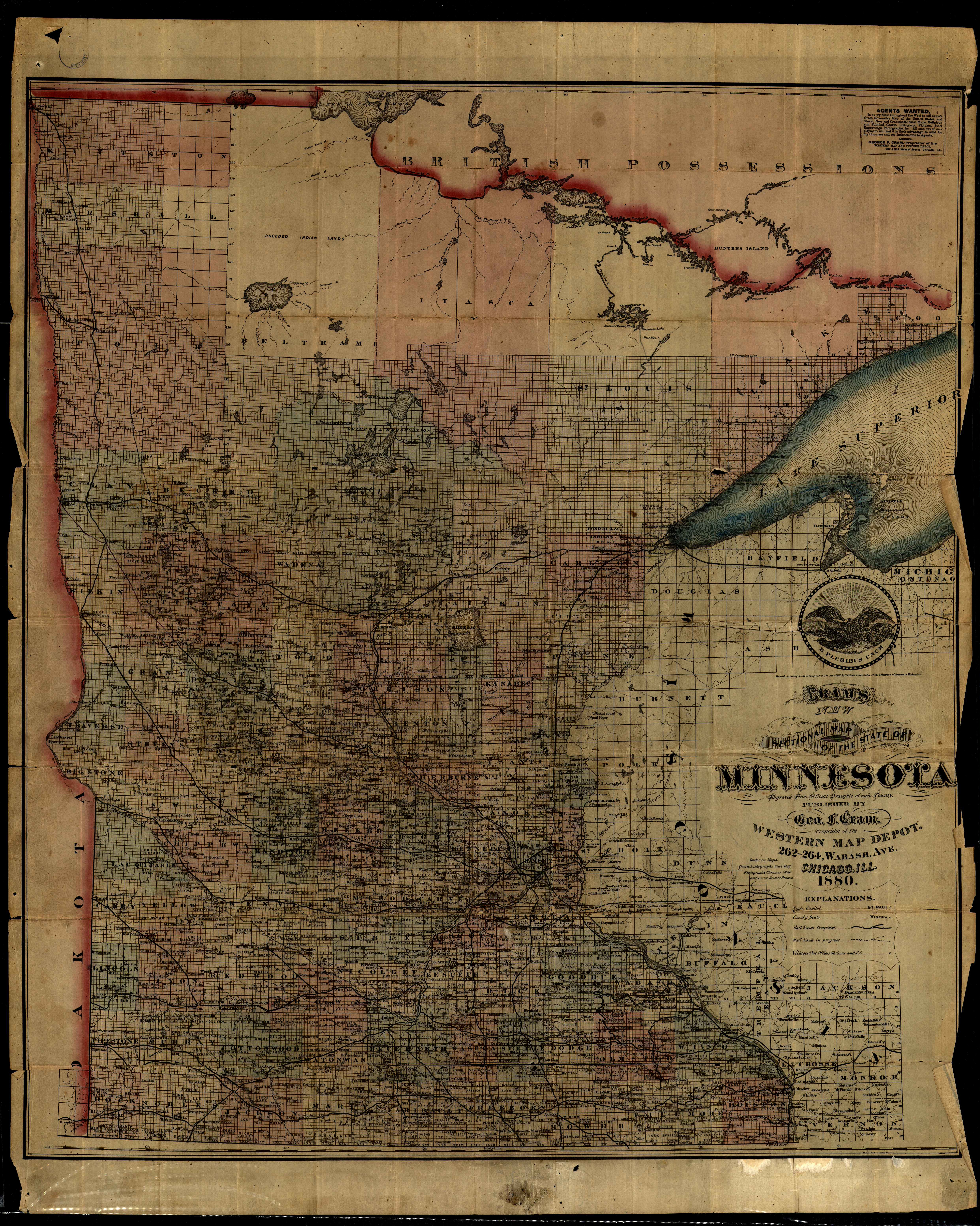
Collection: 977.604 C889c 1880 - Cram's new sectional map of the state of Minnesota : __engraved from official draughts of each county
Folder:
Library
Item:
977.604 C889c 1880
Date:
Copyright 1872 - 1880
Creator:
Cram, George Franklin,--1841-1928
Title:
Cram's new sectional map of the state of Minnesota : __engraved from official draughts of each county
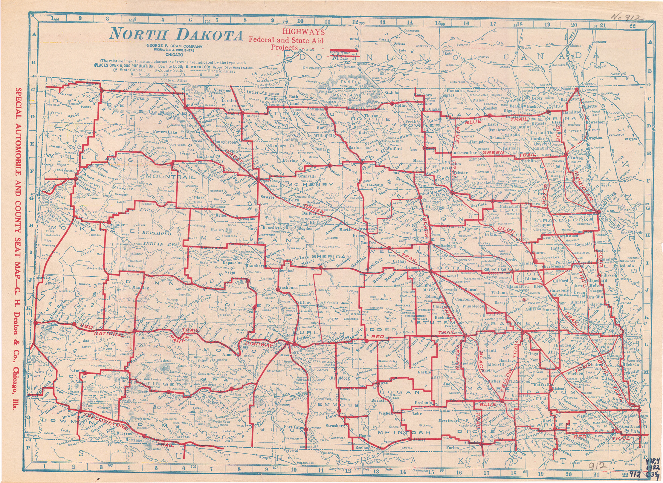
Collection: 978.4032 G347n 1922 - North Dakota / __ __George F. Cram Company
Folder:
Library
Item:
978.4032 G347n 1922
Date:
1922
Creator:
George F. Cram Company
Title:
North Dakota / __ __George F. Cram Company
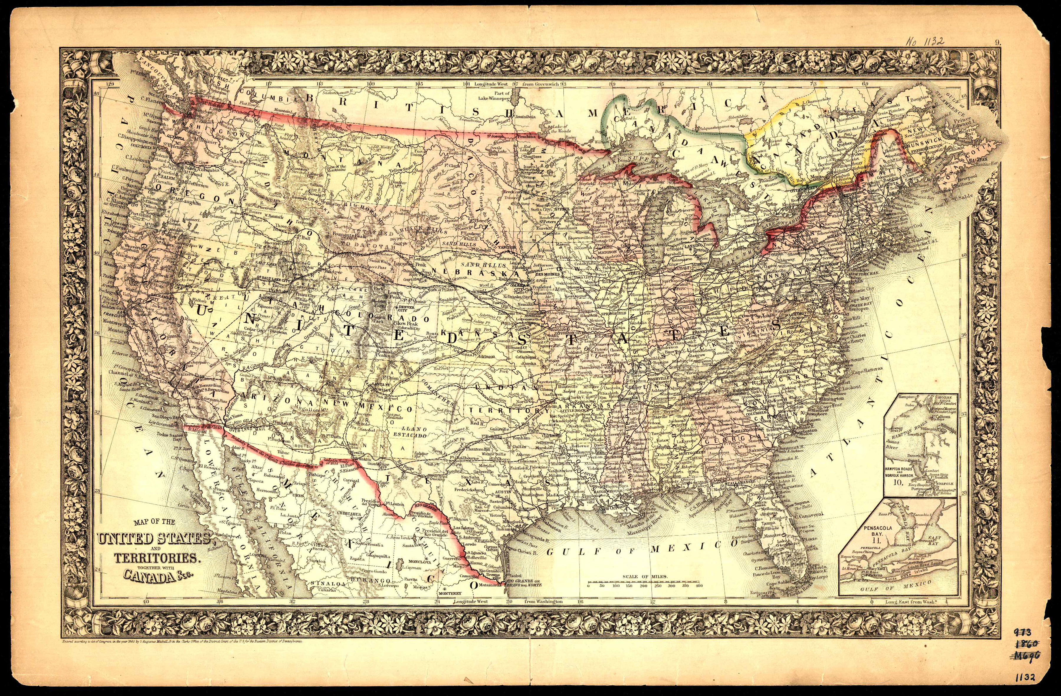
Collection: 973.81 M68m 1865 - Map of the United States and territories : __together with Canada &c
Folder:
Library
Item:
973.81 M68m 1865
Date:
ca. 1865
Creator:
Mitchell, S. Augustus--(Samuel Augustus),--Jr
Title:
Map of the United States and territories : __together with Canada &c
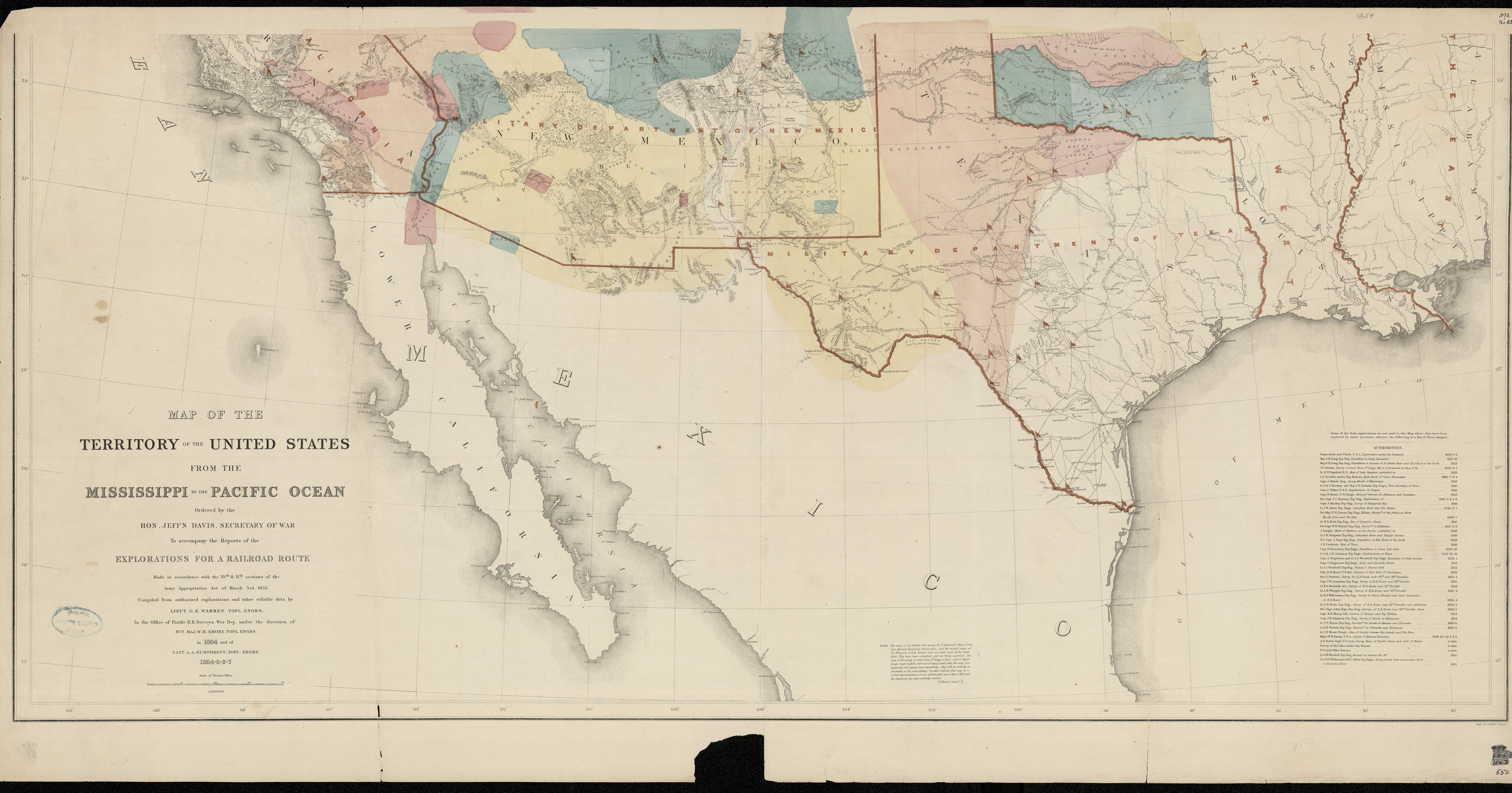
Collection: 917.8 Un3r v.11 map - Map of the territory of the United States from the Mississippi River to the Pacific Ocean : __ordered by Jeff'n Davis, Secretary of War to accompany the reports of the explorations for a railroad route : made in accordance with the 10th & 11th sections of the Army Appropriation Act of March 3rd 1853 / __compiled from authorized explorations and other reliable data by G.K. Warren in the Office of Pacific R.R. Surveys, War Dept. under the direction of W.H. Emory in 1854 and of A.A. Humphreys 1854-5-6-7 ; engr. by Selmar Siebert
Folder:
Library
Item:
917.8 Un3r v.11 map
Date:
ca. 1857
Creator:
Warren, Gouverneur Kemble,--1830-1882
Title:
Map of the territory of the United States from the Mississippi River to the Pacific Ocean : __ordered by Jeff'n Davis, Secretary of War to accompany the reports of the explorations for a railroad route : made in accordance with the 10th & 11th sections of the Army Appropriation Act of March 3rd 1853 / __compiled from authorized explorations and other reliable data by G.K. Warren in the Office of Pacific R.R. Surveys, War Dept. under the direction of W.H. Emory in 1854 and of A.A. Humphreys 1854-5-6-7 ; engr. by Selmar Siebert
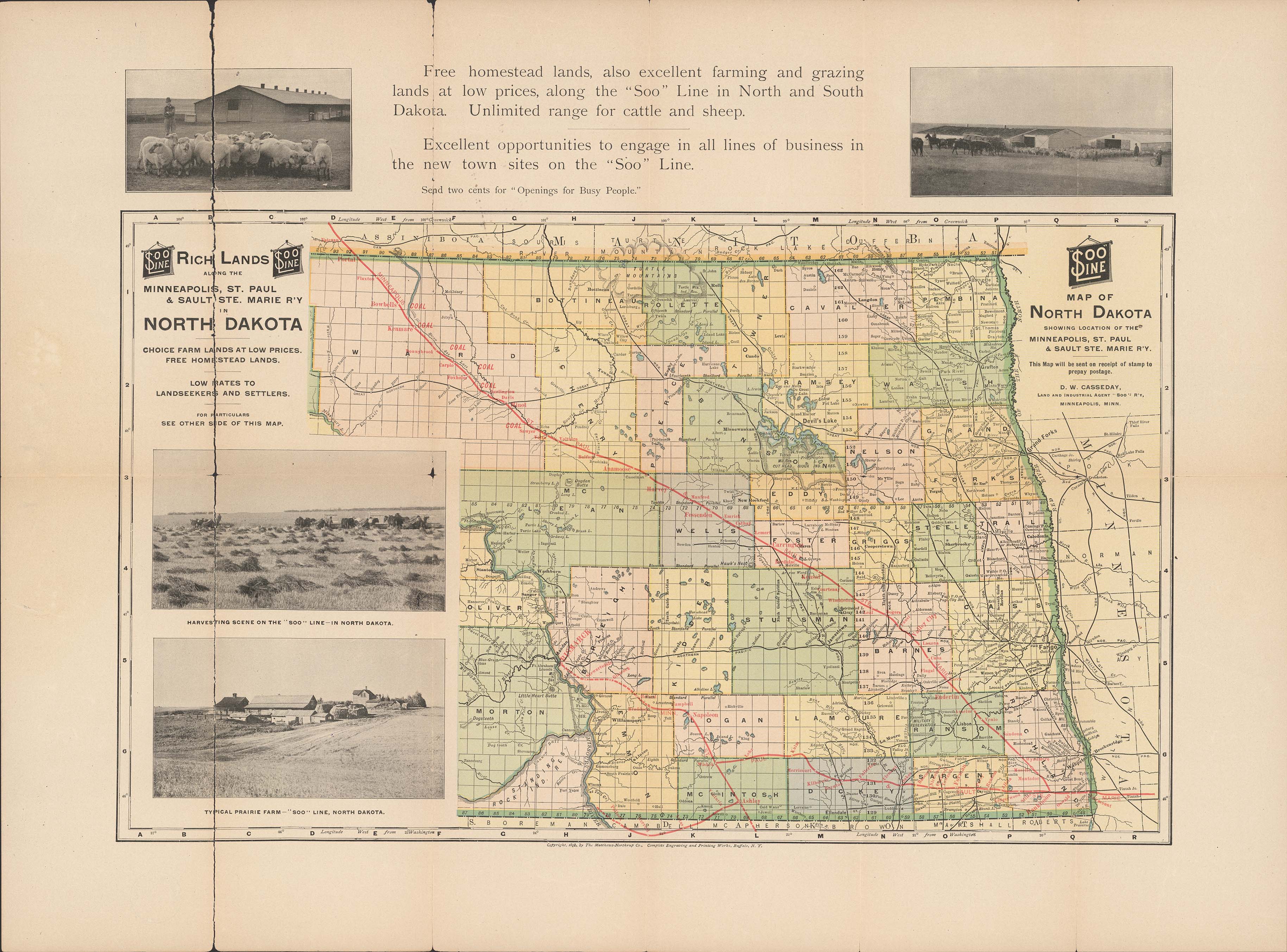
Collection: 385 M44m 1902 - Map of North Dakota : __showing location of the Minneapolis, St. Paul & Sault Ste. Marie Railway
Folder:
Library
Item:
385 M44m 1902
Date:
Copyright 1898 - 1902
Creator:
Matthews-Northrup Company
Title:
Map of North Dakota : __showing location of the Minneapolis, St. Paul & Sault Ste. Marie Railway
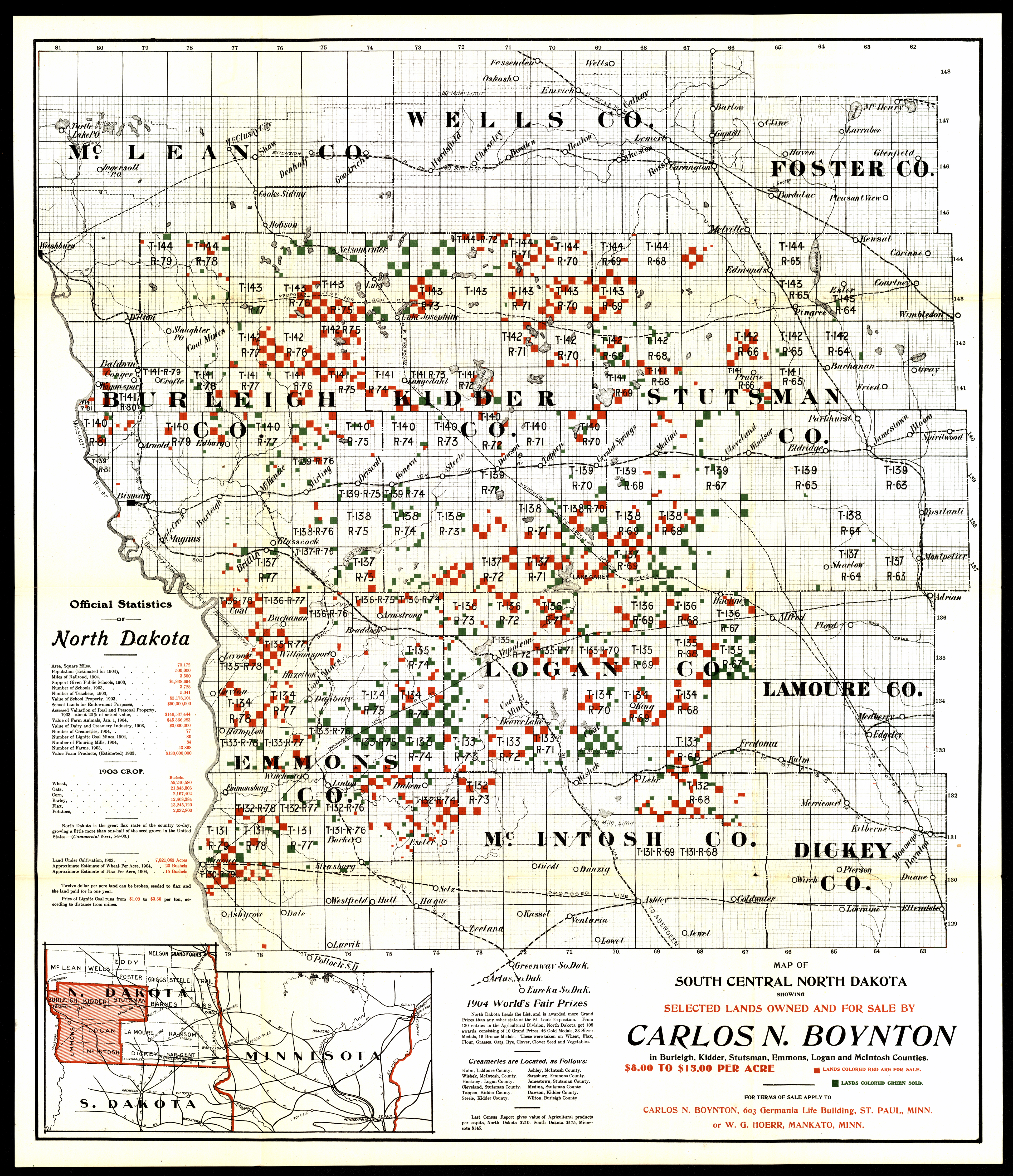
Collection: 978.45 M297sc 1904 - Map of south central North Dakota : __showing selected lands owned and for sale by Carlos N. Boynton : in Burleigh, Kidder, Stutsman, Emmons, Logan and McIntosh Counties
Folder:
Library
Item:
978.45 M297sc 1904
Date:
1904
Creator:
Title:
Map of south central North Dakota : __showing selected lands owned and for sale by Carlos N. Boynton : in Burleigh, Kidder, Stutsman, Emmons, Logan and McIntosh Counties
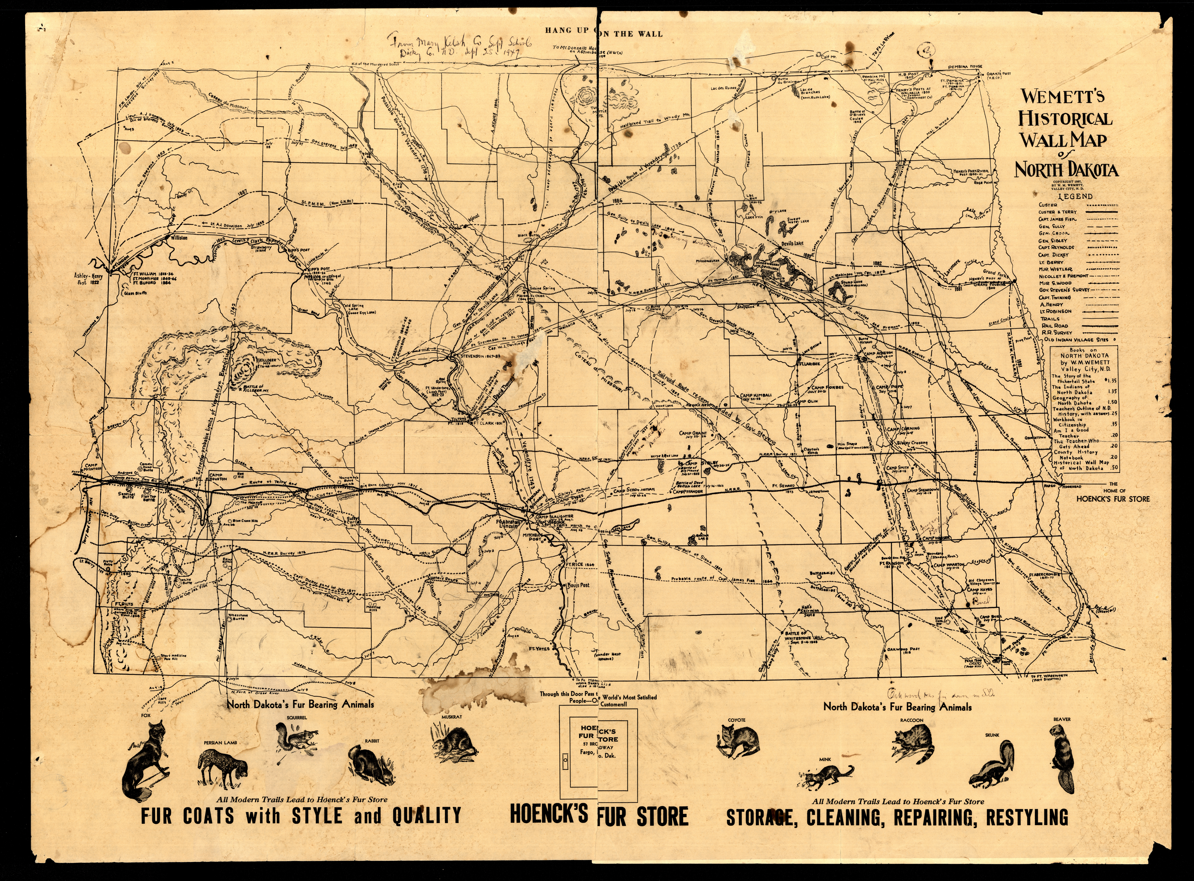
Collection: 978.4 W466wh 1937 - Wemett's historical wall map of North Dakota / __ __by W.M. Wemett
Folder:
Library
Item:
978.4 W466wh 1937
Date:
Copyright 1937
Creator:
Wemett, W. M.--(William Marks),--1884-1965
Title:
Wemett's historical wall map of North Dakota / __ __by W.M. Wemett
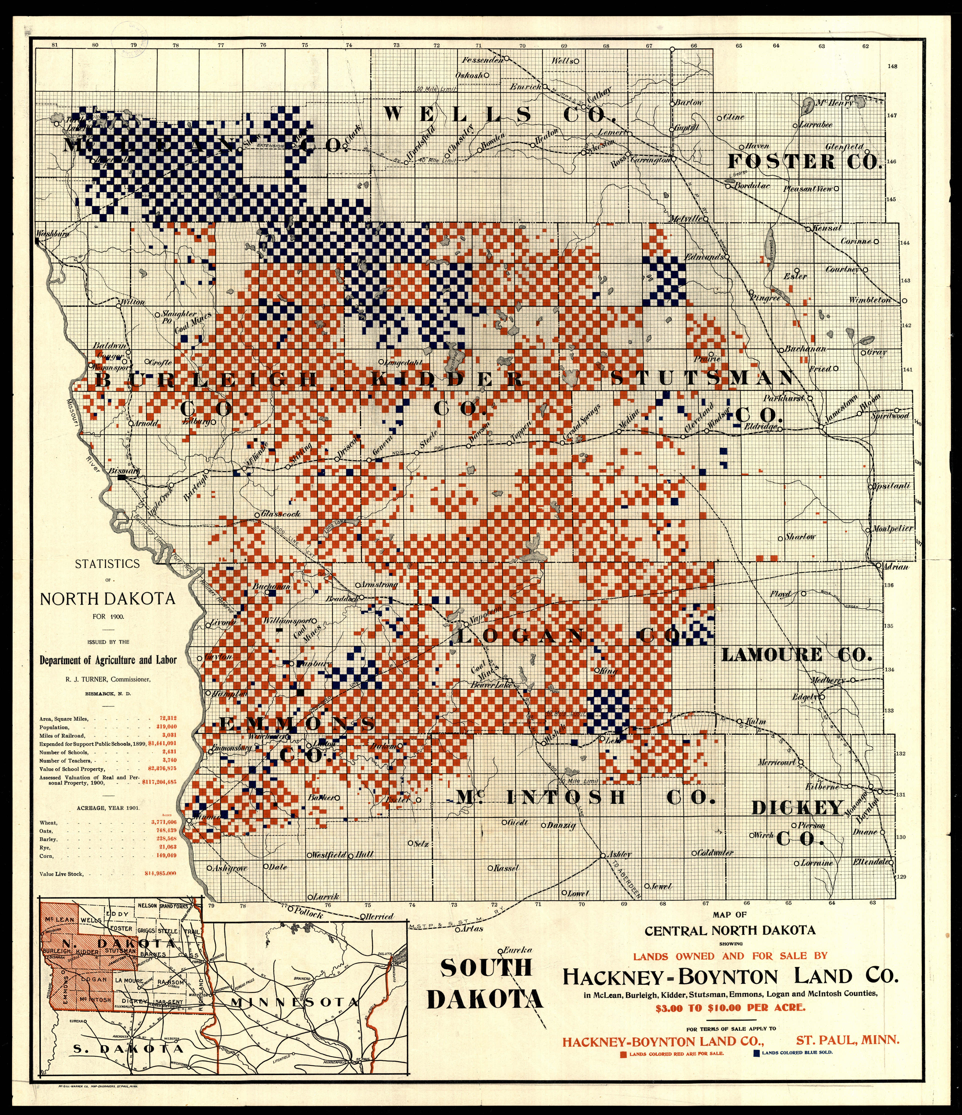
Collection: 978.45 M4788m 1901 - Map of central North Dakota : __showing lands owned and for sale by Hackney-Boynton Land Co. in McLean, Burleigh, Kidder, Stutsman, Emmons, Logan and McIntosh Counties
Folder:
Library
Item:
978.45 M4788m 1901
Date:
1901
Creator:
McGill-Warner Co
Title:
Map of central North Dakota : __showing lands owned and for sale by Hackney-Boynton Land Co. in McLean, Burleigh, Kidder, Stutsman, Emmons, Logan and McIntosh Counties
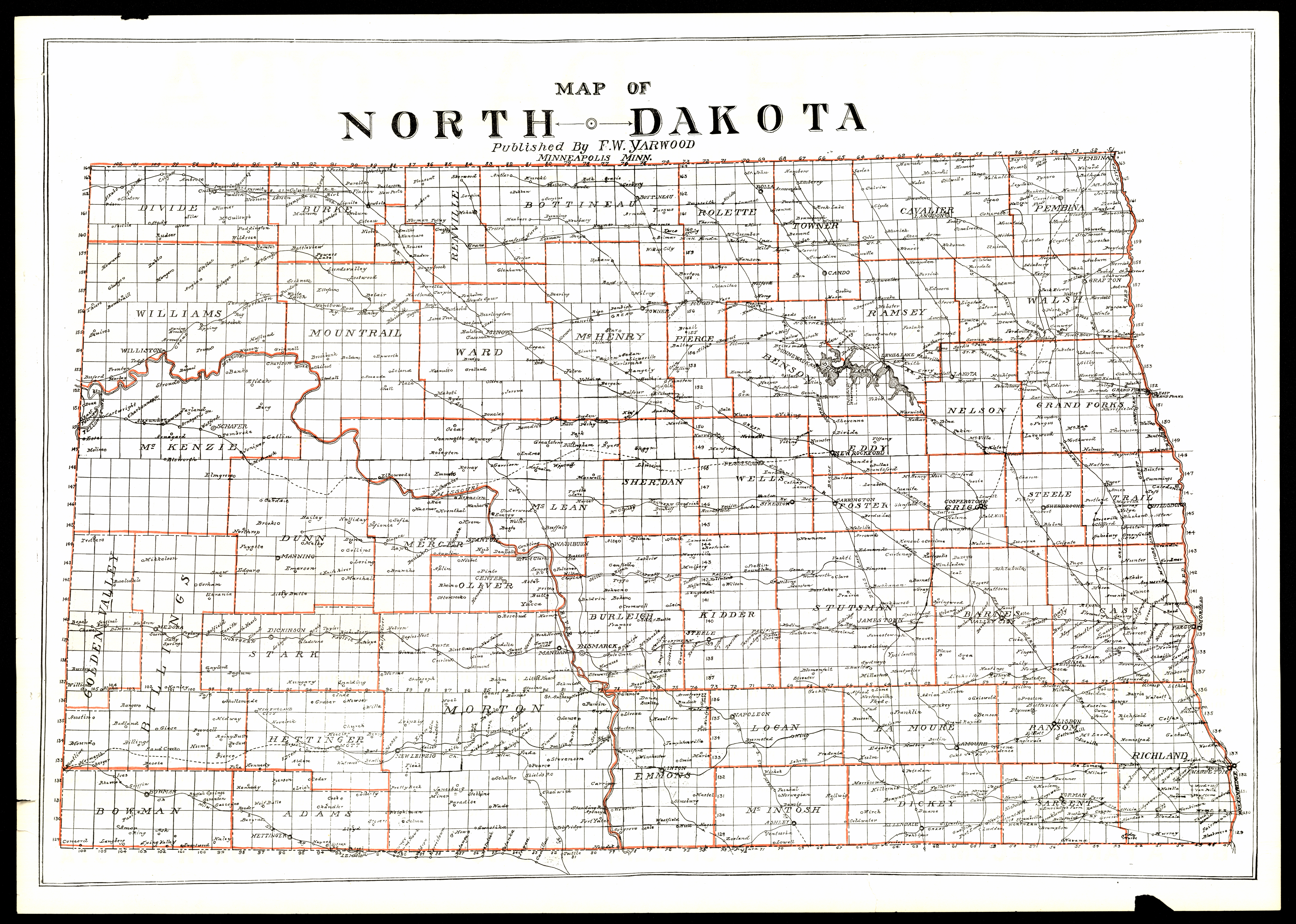
Collection: 978.4031 M297y 1914 - Map of North Dakota
Folder:
Library
Item:
978.4031 M297y 1914
Date:
1914
Creator:
Title:
Map of North Dakota
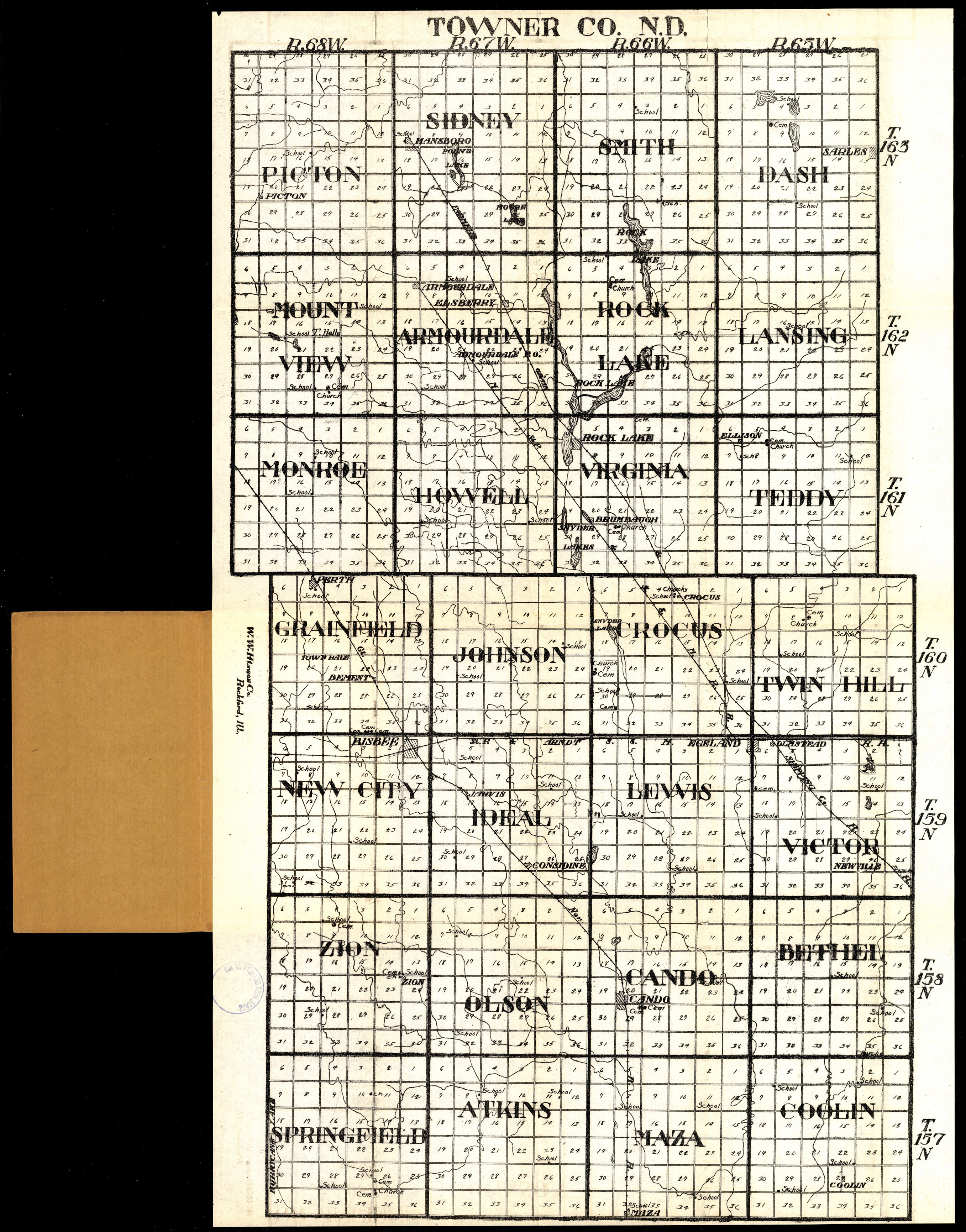
Collection: 978.438 W1117t 1916 - Towner Co., N.D
Folder:
Library
Item:
978.438 W1117t 1916
Date:
1916
Creator:
W.W. Hixson & Co
Title:
Towner Co., N.D
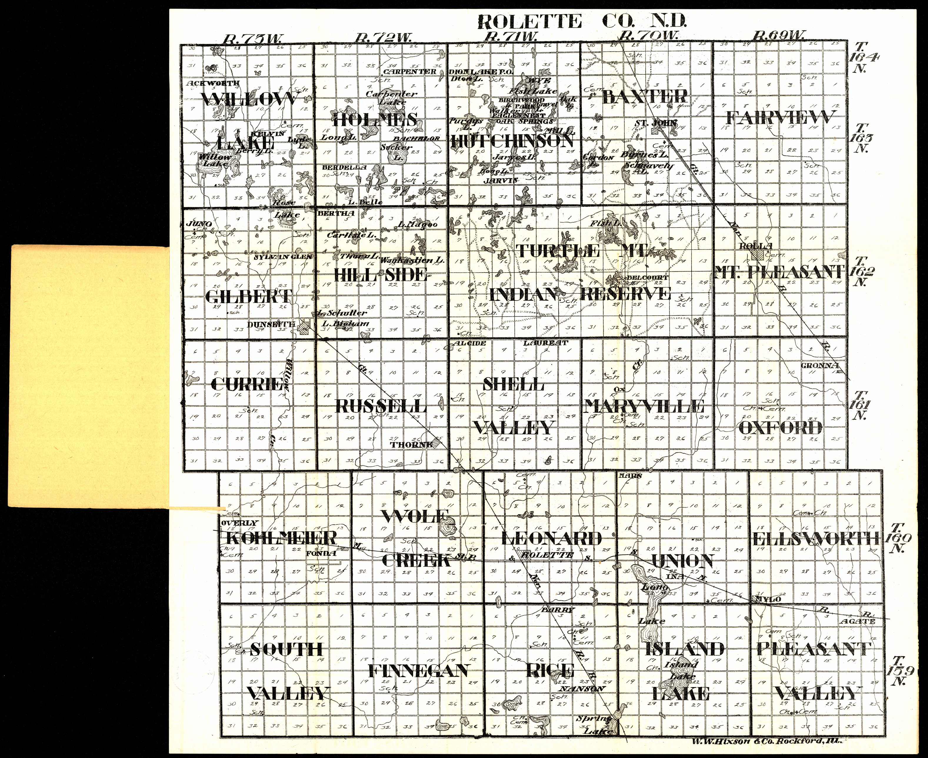
Collection: 978.4592 W1117r 1916 - Rolette Co., N.D
Folder:
Library
Item:
978.4592 W1117r 1916
Date:
1916
Creator:
W.W. Hixson & Co
Title:
Rolette Co., N.D
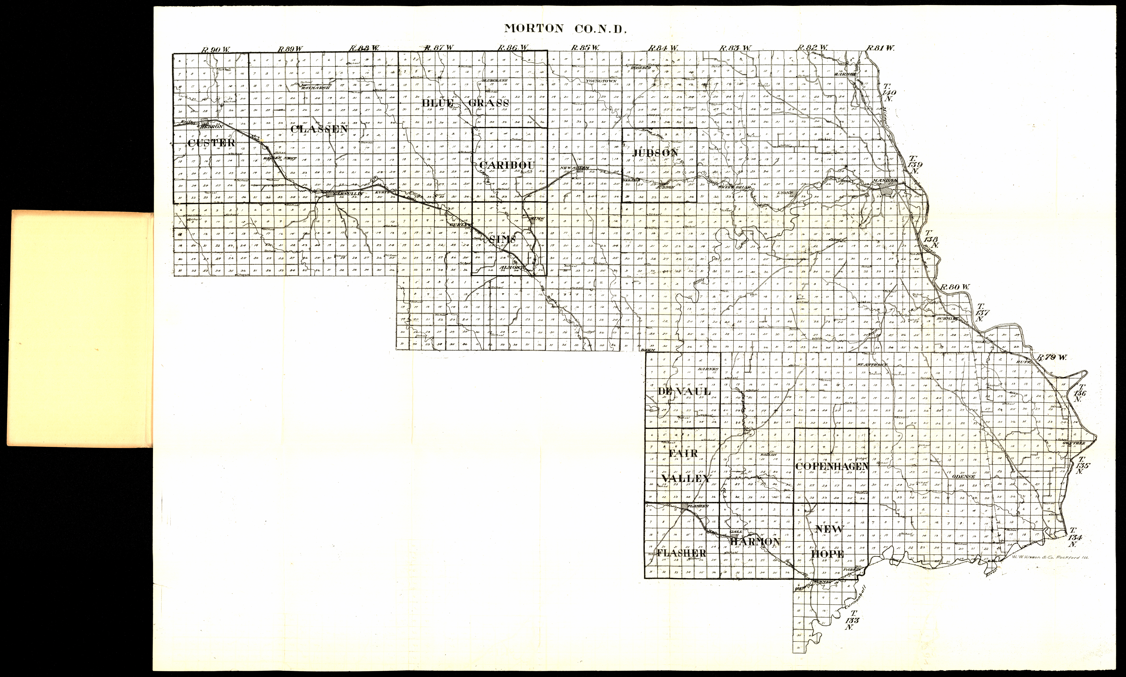
Collection: 978.485 W1117m 1916 - Morton Co., N.D
Folder:
Library
Item:
978.485 W1117m 1916
Date:
1916
Creator:
W.W. Hixson & Co
Title:
Morton Co., N.D
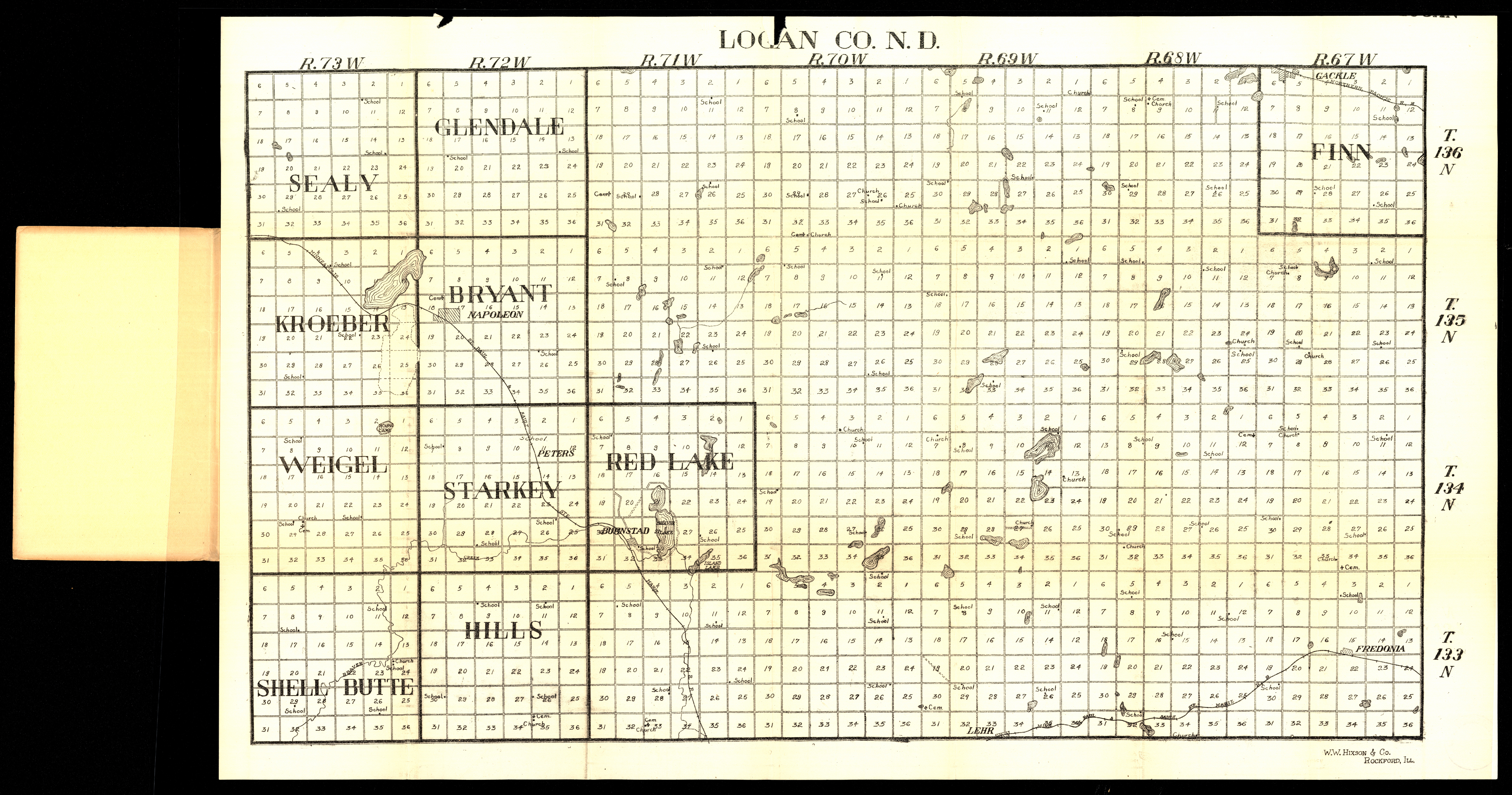
Collection: 978.456 W1117L 1916 - Logan Co., N.D
Folder:
Library
Item:
978.456 W1117L 1916
Date:
1916
Creator:
W.W. Hixson & Co
Title:
Logan Co., N.D