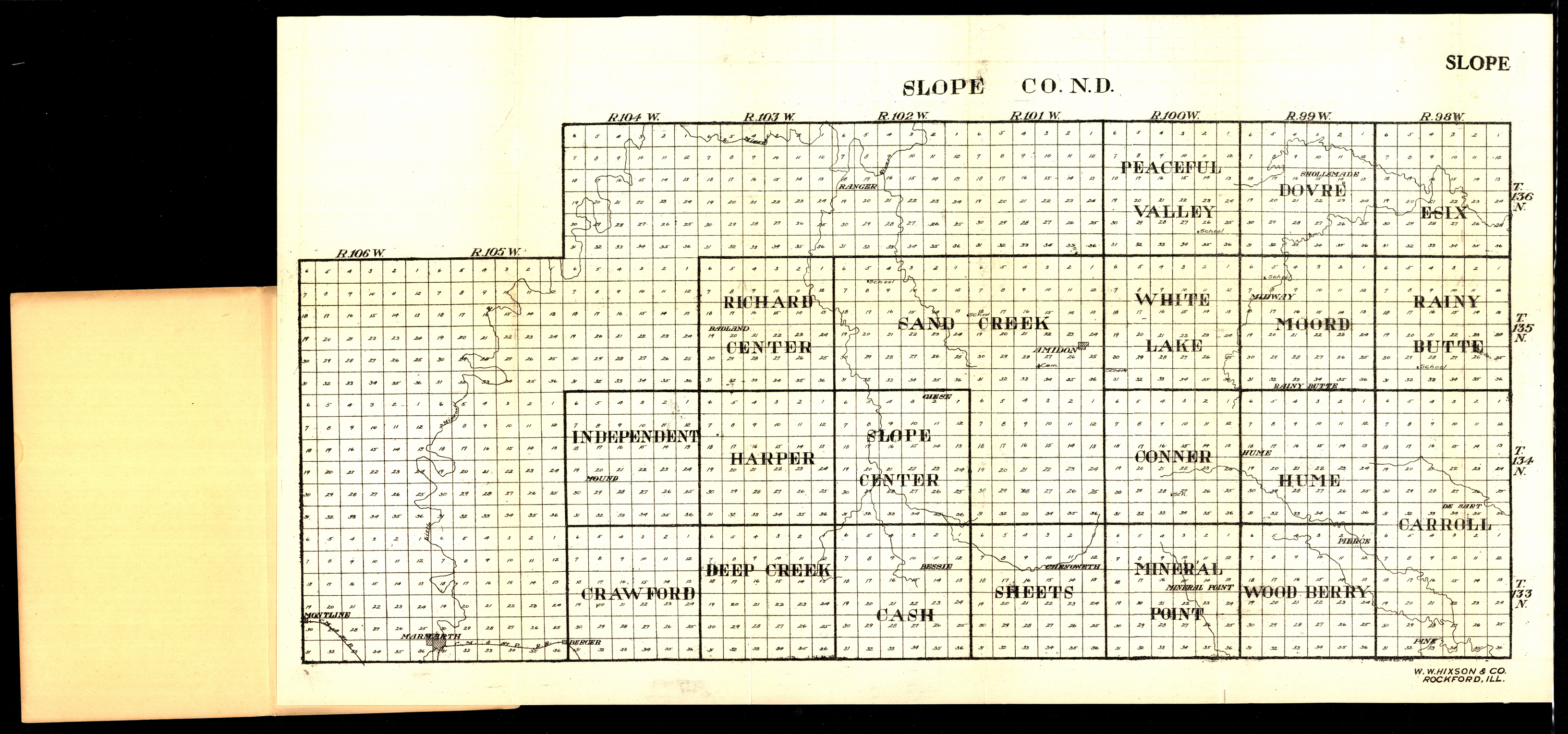
Collection: 978.493 W1117s 1916 - Slope Co., N.D
Folder:
Library
Item:
978.493 W1117s 1916
Date:
1916
Creator:
W.W. Hixson & Co
Title:
Slope Co., N.D
Collection: 978.461 W1117b 1916 - Bottineau Co. N.D
Folder:
Library
Item:
978.461 W1117b 1916
Date:
1916
Creator:
W.W. Hixson & Co
Title:
Bottineau Co. N.D
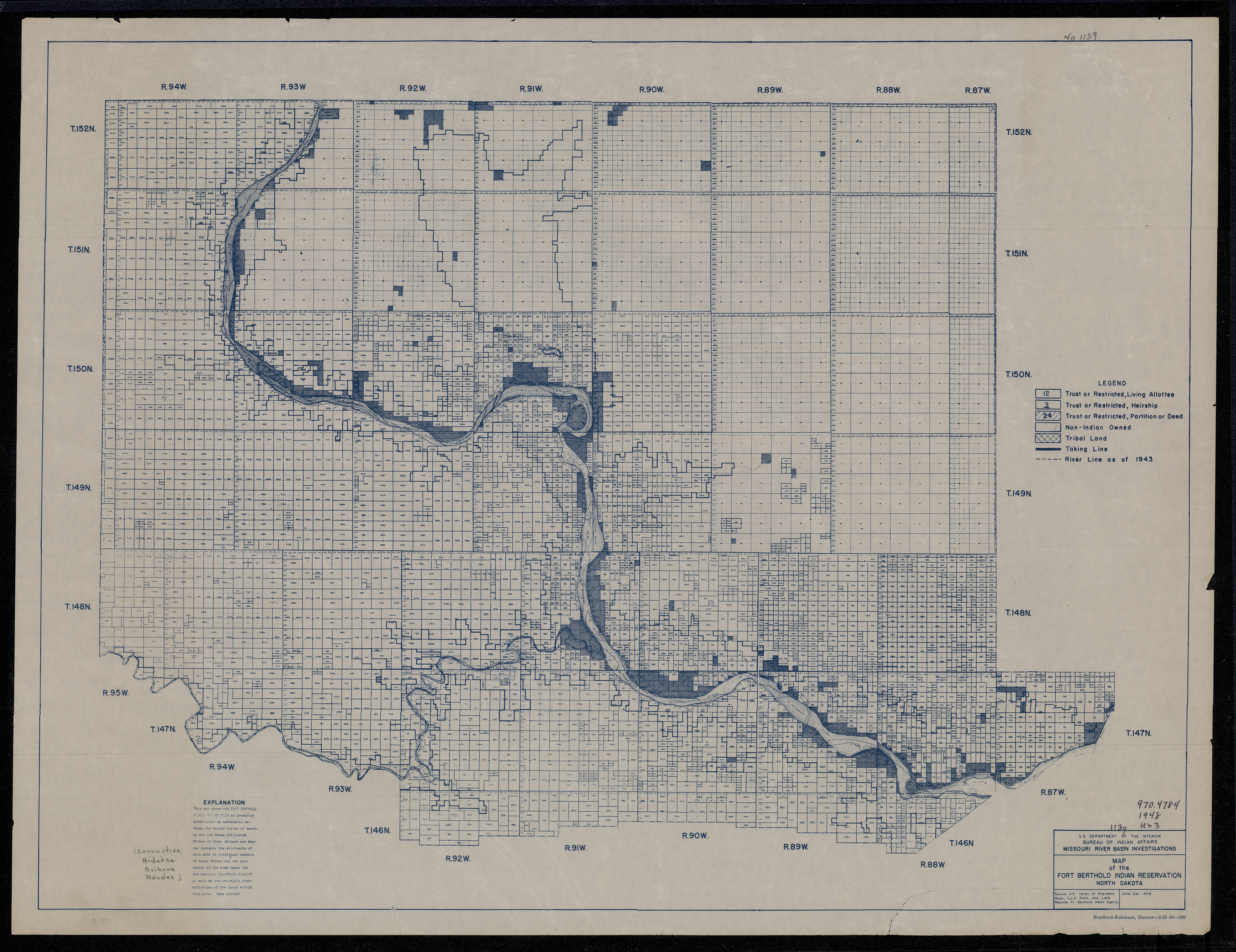
Collection: 978.47 U5813m 1949 - Map of the Fort Berthold Indian Reservation, North Dakota
Folder:
Library
Item:
978.47 U5813m 1949
Date:
1949
Creator:
United States.--Bureau of Indian Affairs
Title:
Map of the Fort Berthold Indian Reservation, North Dakota
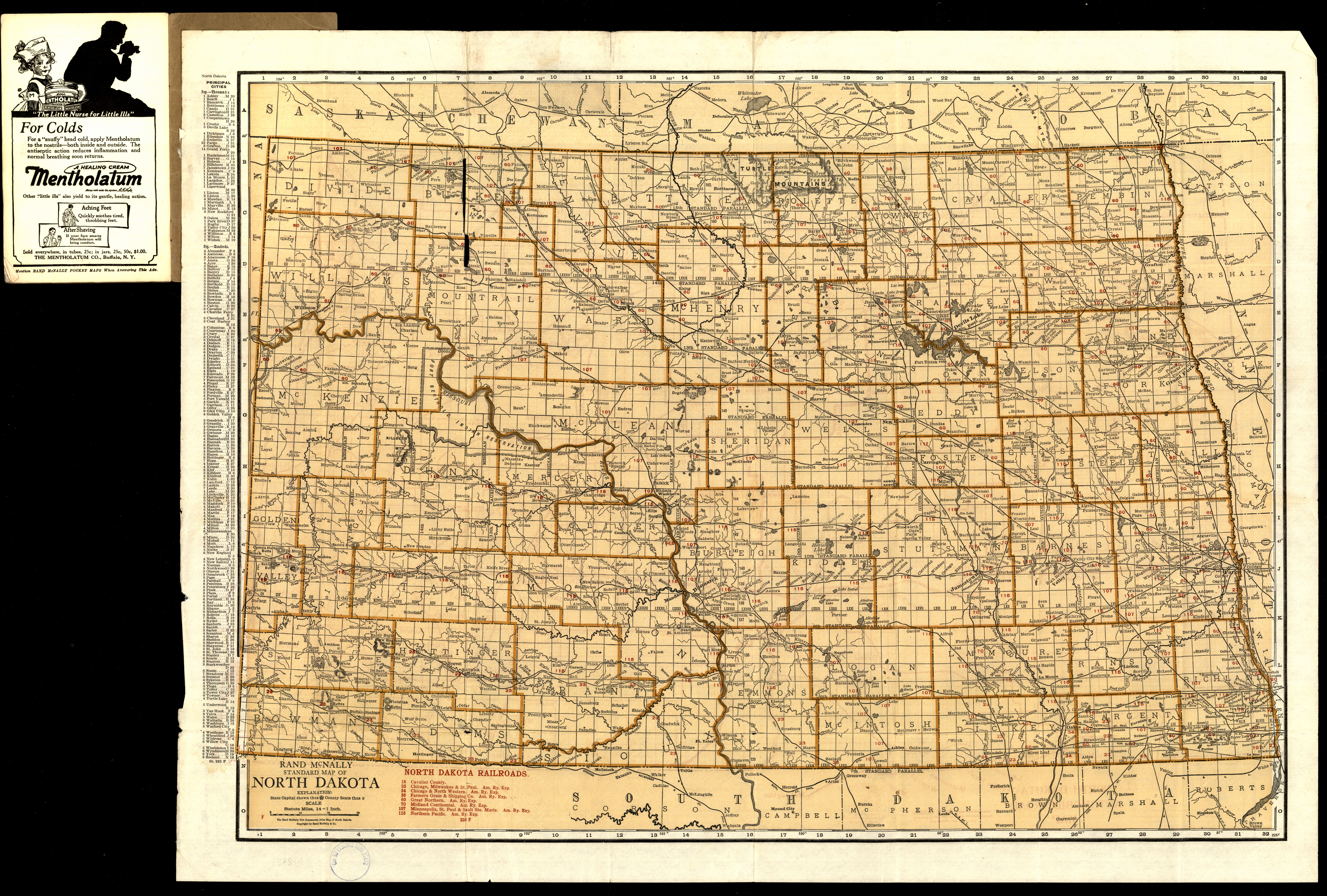
Collection: 978.4032 R186st 1921 - Rand McNally standard map of North Dakota ; __North Dakota automobile road map
Folder:
Library
Item:
978.4032 R186st 1921
Date:
Copyright 1921
Creator:
Rand McNally and Company
Title:
Rand McNally standard map of North Dakota ; __North Dakota automobile road map
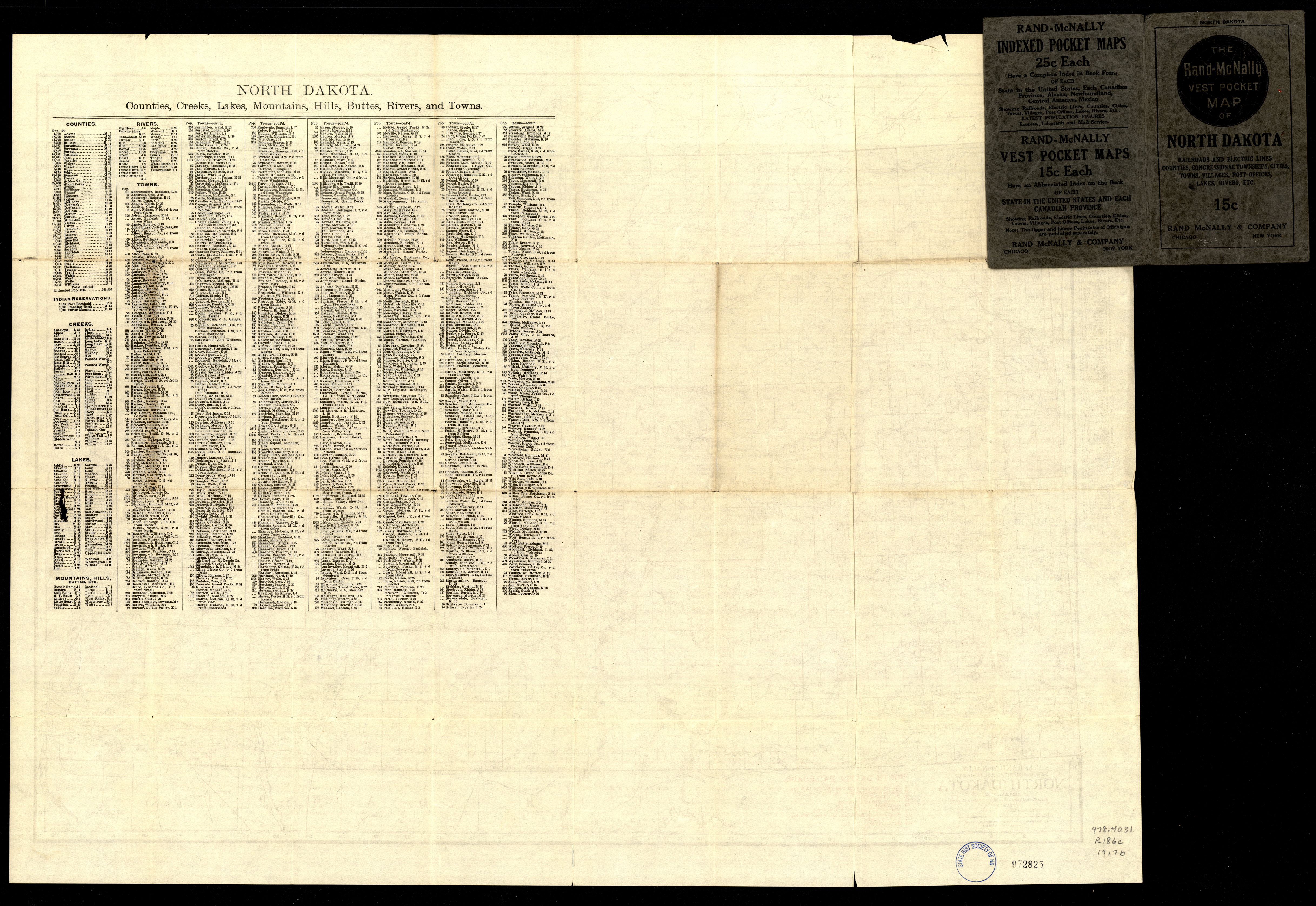
Collection: 978.4031 R186c 1917b - The Rand-McNally new commercial atlas map of North Dakota
Folder:
Library
Item:
978.4031 R186c 1917b
Date:
1917
Creator:
Rand McNally and Company
Title:
The Rand-McNally new commercial atlas map of North Dakota
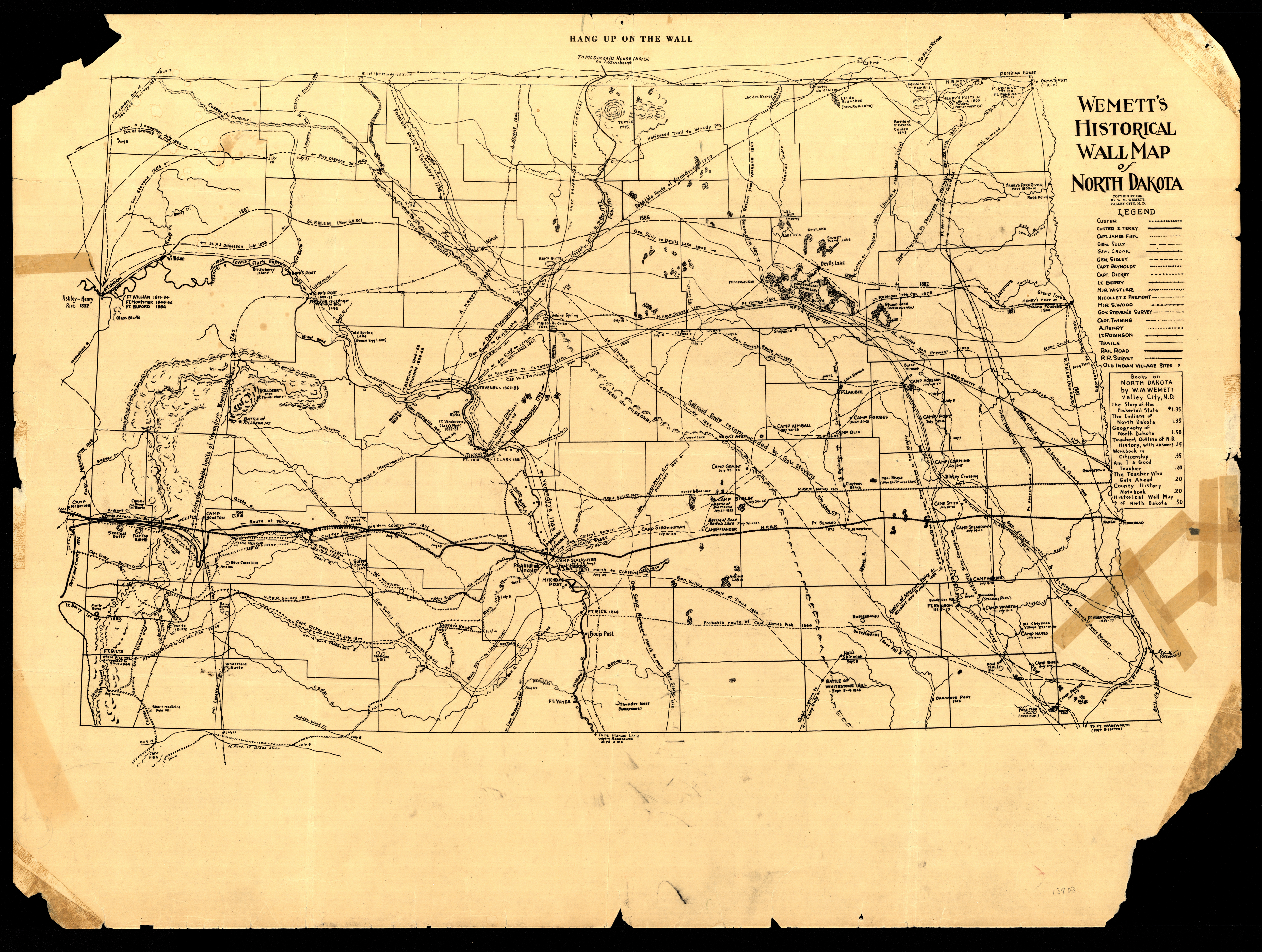
Collection: 978.4 W466w 1937 - Wemett's historical wall map of North Dakota / __ __by W.M. Wemett
Folder:
Library
Item:
978.4 W466w 1937
Date:
Copyright 1937
Creator:
Wemett, W. M.--(William Marks),--1884-1965
Title:
Wemett's historical wall map of North Dakota / __ __by W.M. Wemett
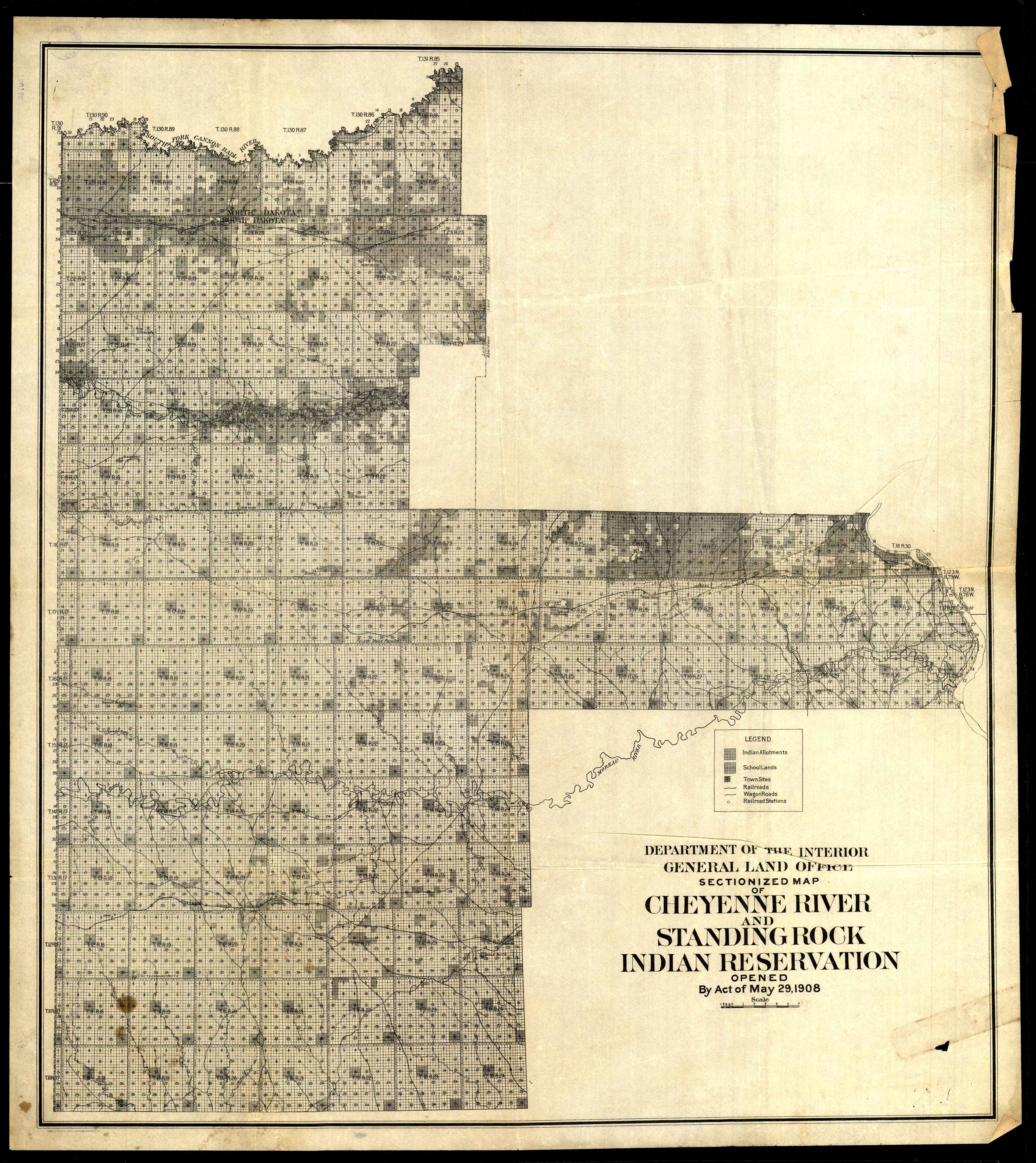
Collection: 978.35 U5813s 1908 - Sectionized map of Cheyenne River and Standing Rock Indian Reservation opened by act of May 29, 1908 / __ __Department of the Interior, General Land Office
Folder:
Library
Item:
978.35 U5813s 1908
Date:
1908
Creator:
United States.--General Land Office
Title:
Sectionized map of Cheyenne River and Standing Rock Indian Reservation opened by act of May 29, 1908 / __ __Department of the Interior, General Land Office
Collection: 973.921 U5813u 1938 - United States, including territories and insular possessions showing the extent of public surveys : __national parks and monuments, Indian, military, bird and game reservations, national forests, railroads, canals and other details, 1938 / __engraved by R.F. Bartle & Co., Washington, D.C. ; United States Department of the Interior, General Land Office
Folder:
Library
Item:
973.921 U5813u 1938
Date:
1938
Creator:
R.F. Bartle & Co
Title:
United States, including territories and insular possessions showing the extent of public surveys : __national parks and monuments, Indian, military, bird and game reservations, national forests, railroads, canals and other details, 1938 / __engraved by R.F. Bartle & Co., Washington, D.C. ; United States Department of the Interior, General Land Office
Collection: 978.4 N814s 1947 map - North Dakota state parks & historic sites under direction of State Parks Committee of State Historical Society of North Dakota
Folder:
Library
Item:
978.4 N814s 1947 map
Date:
1947
Creator:
State Historical Society of North Dakota.--State Park Committee
Title:
North Dakota state parks & historic sites under direction of State Parks Committee of State Historical Society of North Dakota
Collection: 978.4031 N864 1916 - North Dakota / __ __published under direction of R.F. Flint, Department of Agriculture and Labor
Folder:
Library
Item:
978.4031 N864 1916
Date:
1916
Creator:
North Dakota.--Department of Agriculture and Labor
Title:
North Dakota / __ __published under direction of R.F. Flint, Department of Agriculture and Labor
Collection: 978.4031 R186b 1907 - North Dakota / __ __W.B.S. Trimble Co
Folder:
Library
Item:
978.4031 R186b 1907
Date:
Copyright 1907
Creator:
Rand McNally and Company
Title:
North Dakota / __ __W.B.S. Trimble Co
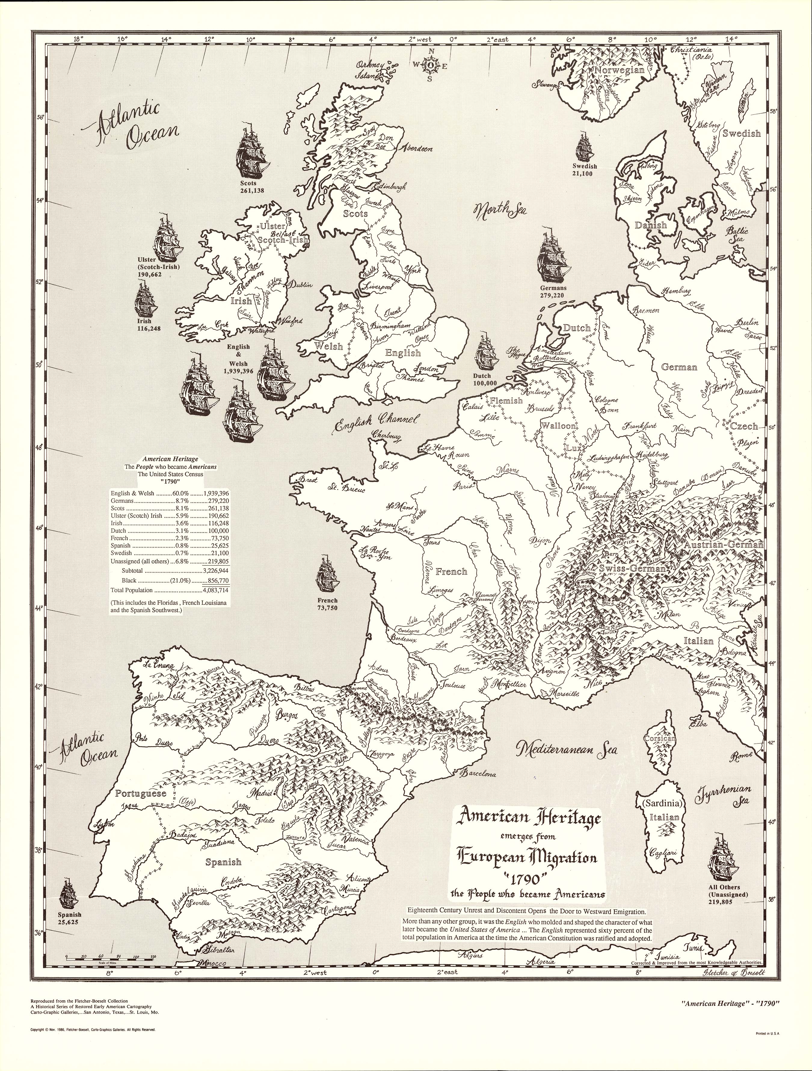
Collection: 325.240973 F612a 1986 - American heritage emerges from European migration "1790" : __the people who became Americans / __[prepared by] Fletcher & Boeselt ; [cartography by Harvey F. Fletcher]
Folder:
Library
Item:
325.240973 F612a 1986
Date:
Copyright 1986
Creator:
Fletcher & Boeselt
Title:
American heritage emerges from European migration "1790" : __the people who became Americans / __[prepared by] Fletcher & Boeselt ; [cartography by Harvey F. Fletcher]
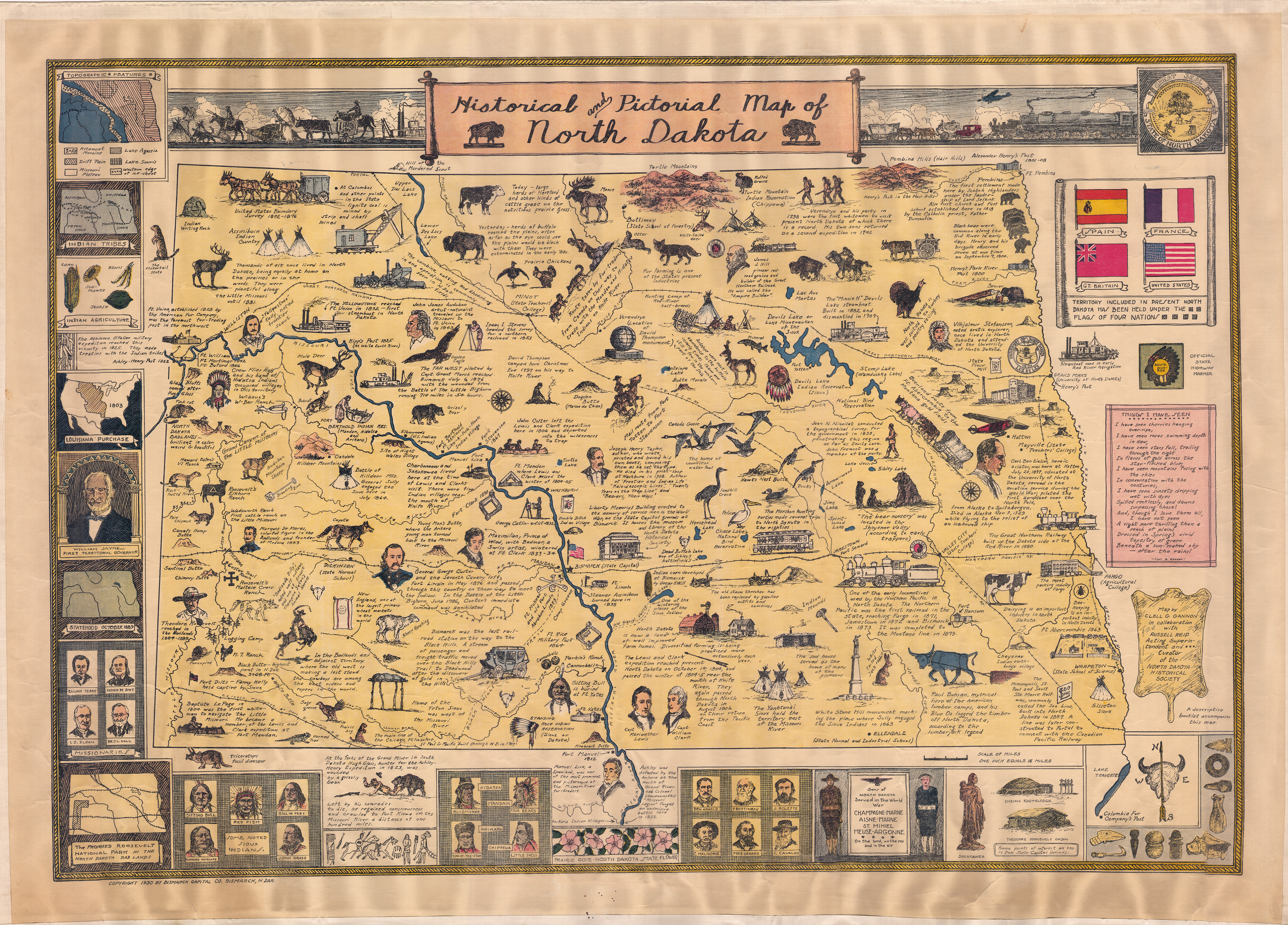
Collection: 978.4032 G198h 1930 - Historical and pictorial map of North Dakota / __ __map by Clell G. Gannon ; in collaboration with Russell Reid
Folder:
Library
Item:
978.4032 G198h 1930
Date:
Copyright 1930
Creator:
Gannon, Clell Goebel,--1900-1962
Title:
Historical and pictorial map of North Dakota / __ __map by Clell G. Gannon ; in collaboration with Russell Reid
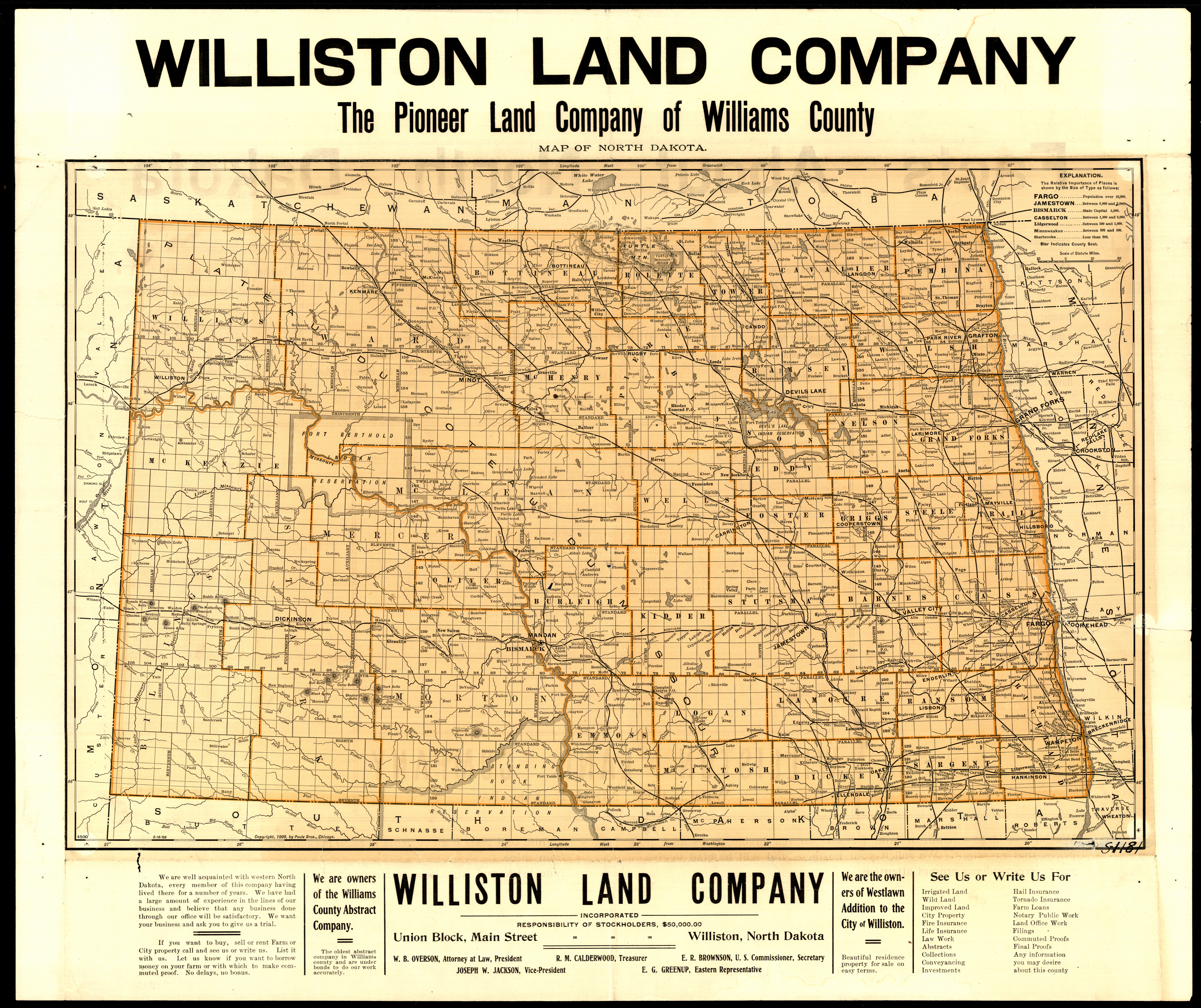
Collection: 978.4031 W736m 1906 - Map of North Dakota / __ __Williston Land Company ; Poole Bros
Folder:
Library
Item:
978.4031 W736m 1906
Date:
Copyright 1906
Creator:
Williston Land Co
Title:
Map of North Dakota / __ __Williston Land Company ; Poole Bros
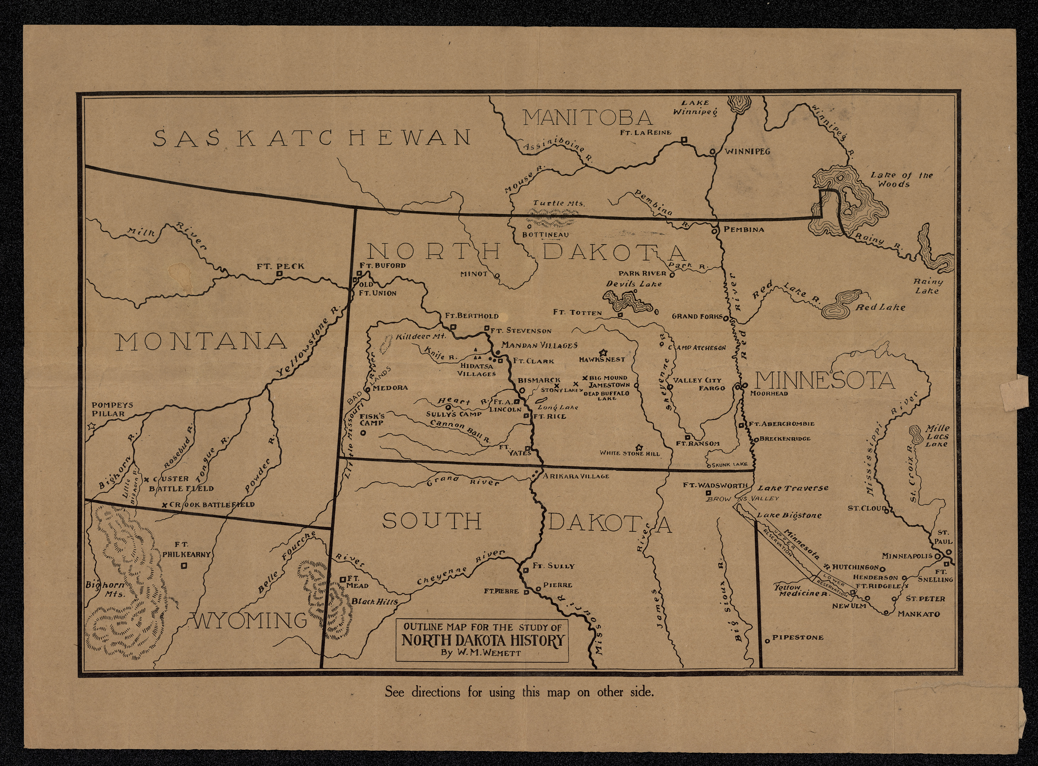
Collection: 978.4 W471 1923 - Outline map for the study of North Dakota history / __ __by W.M. Wemett
Folder:
Library
Item:
978.4 W471 1923
Date:
1923
Creator:
Wemett, W. M.--(William Marks),--1884-1965
Title:
Outline map for the study of North Dakota history / __ __by W.M. Wemett
Collection: 978.402 R186s 1881 - Skandinavens kart over Dakota
Folder:
Library
Item:
978.402 R186s 1881
Date:
1881
Creator:
Rand McNally and Company
Title:
Skandinavens kart over Dakota
Collection: 978.416 K371k 1907 - Kent Realty map of the city of Grand Forks, North Dakota
Folder:
Library
Item:
978.416 K371k 1907
Date:
1907
Creator:
Kent Realty & Investment Corp
Title:
Kent Realty map of the city of Grand Forks, North Dakota
Collection: 978.402 D947d 1881 - Dakota Territory / __ __prepared by order of Brig. Gen'l A.H. Terry, commanding the department ; Brig. Genl. A.A. Humphreys, Chief of Engineers ; revised & corrected under Lieut. Edward Maguire, Corps of Engineers, by Pr'vt. Julius J. Durage, topogl. ass't. ; originally compiled under the direction of Capt. D.P. Heap, Corps of Engrs. by W.H. Wood, 1872
Folder:
Library
Item:
978.402 D947d 1881
Date:
1881
Creator:
Durage, Julius J
Title:
Dakota Territory / __ __prepared by order of Brig. Gen'l A.H. Terry, commanding the department ; Brig. Genl. A.A. Humphreys, Chief of Engineers ; revised & corrected under Lieut. Edward Maguire, Corps of Engineers, by Pr'vt. Julius J. Durage, topogl. ass't. ; originally compiled under the direction of Capt. D.P. Heap, Corps of Engrs. by W.H. Wood, 1872
Collection: 978 K263n 1867 - National map of the territory of the United States from the Mississippi River to the Pacific Ocean : __made by the authority of the Hon. O.H. Browning, Secretary of the Interior in the office of the Indian Bureau chiefly for government purposes under the direction of the Hon. N.G. Taylor Commisr. of Indian Affairs & Hon. Chas. E. Mix Chief Clerk of the Indian Bureau ; compiled from authorized explorations of the Pacific Rail Road routes, public surveys, and other reliable data from the departments of the government at Washington, D.C. / __by W.J. Keeler
Folder:
Library
Item:
978 K263n 1867
Date:
1867
Creator:
Keeler, W. J.--(William J.)
Title:
National map of the territory of the United States from the Mississippi River to the Pacific Ocean : __made by the authority of the Hon. O.H. Browning, Secretary of the Interior in the office of the Indian Bureau chiefly for government purposes under the direction of the Hon. N.G. Taylor Commisr. of Indian Affairs & Hon. Chas. E. Mix Chief Clerk of the Indian Bureau ; compiled from authorized explorations of the Pacific Rail Road routes, public surveys, and other reliable data from the departments of the government at Washington, D.C. / __by W.J. Keeler
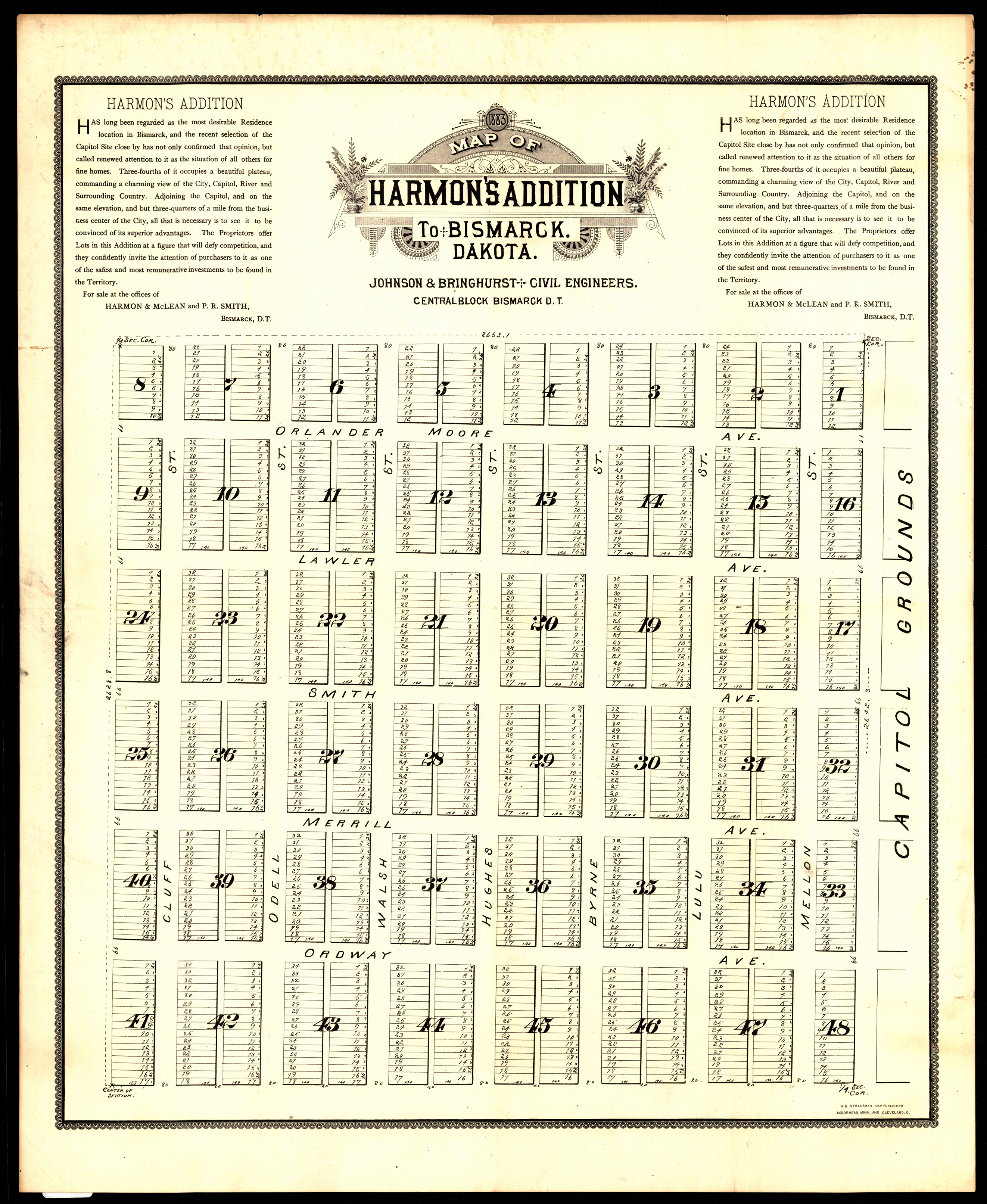
Collection: 978.477 S897m 1883 - Map of Harmon's addition to Bismarck, Dakota
Folder:
Library
Item:
978.477 S897m 1883
Date:
1883
Creator:
H.B. Stranahan & Co
Title:
Map of Harmon's addition to Bismarck, Dakota
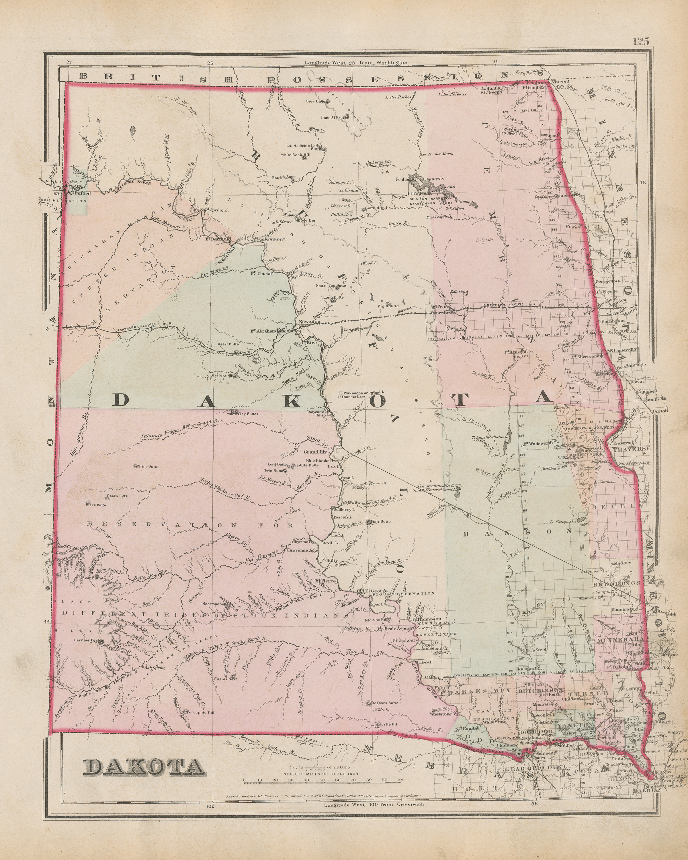
Collection: 978.402 G11c 1873 - Colton's Dakota
Folder:
Library
Item:
978.402 G11c 1873
Date:
1873
Creator:
G.W. & C.B. Colton & Co
Title:
Colton's Dakota
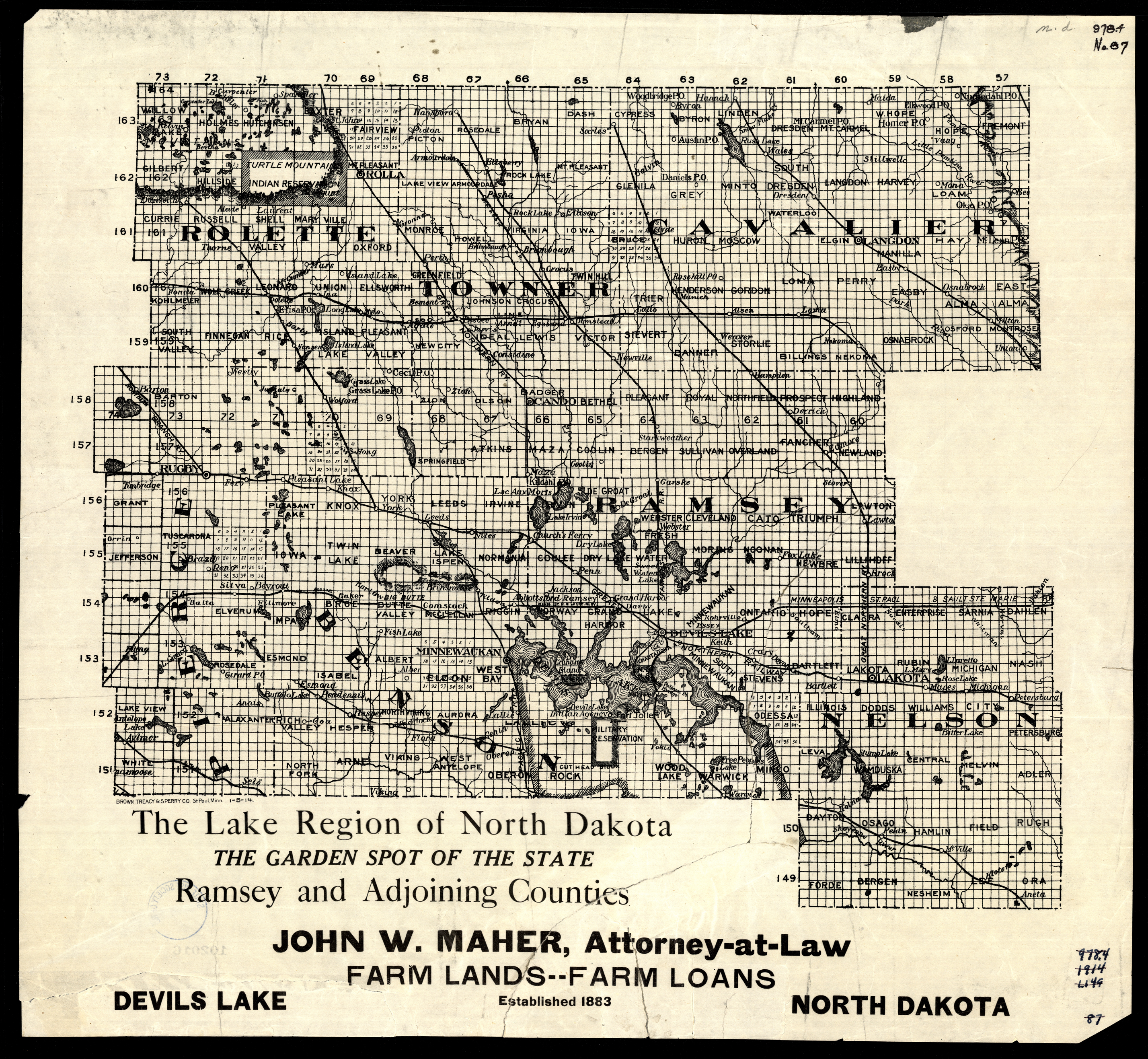
Collection: 978.436 B877L 1914 - The lake region of North Dakota, the garden spot of the state : __Ramsey and adjoining counties
Folder:
Library
Item:
978.436 B877L 1914
Date:
1914
Creator:
Brown, Treacy & Sperry Co. (Saint Paul, Minn.)
Title:
The lake region of North Dakota, the garden spot of the state : __Ramsey and adjoining counties
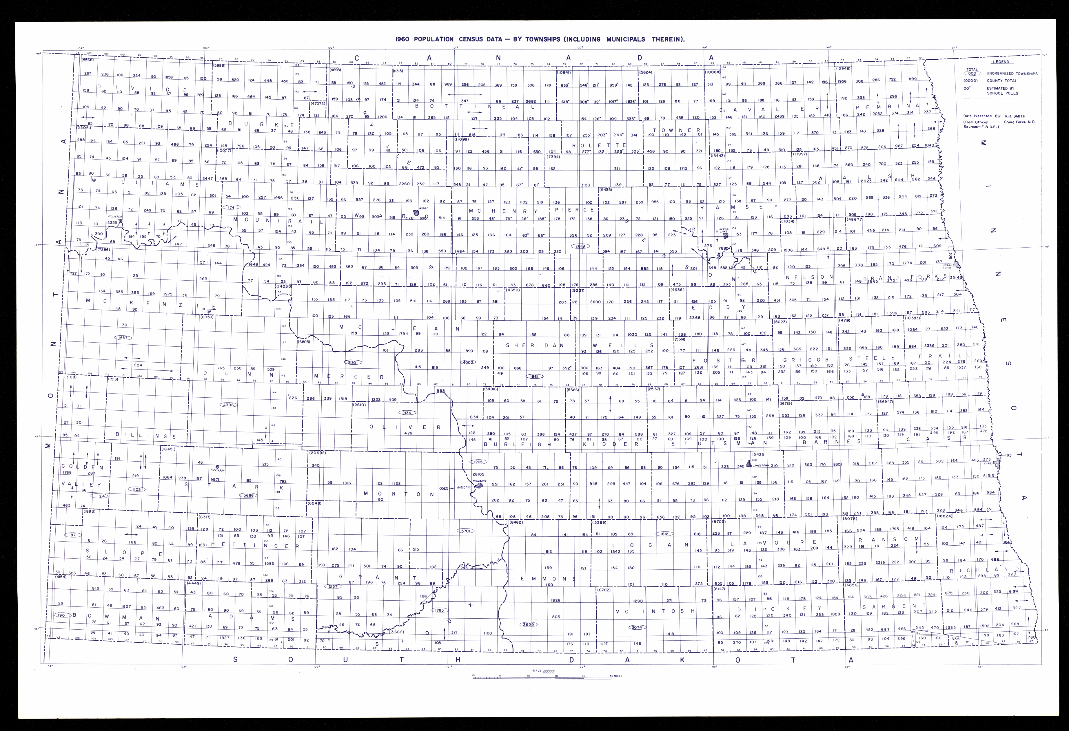
Collection: 304.62 P8315 - 1960 population census data : __by townships (including municipals therein)
Folder:
Library
Item:
304.62 P8315
Date:
ca. 1965
Creator:
Title:
1960 population census data : __by townships (including municipals therein)
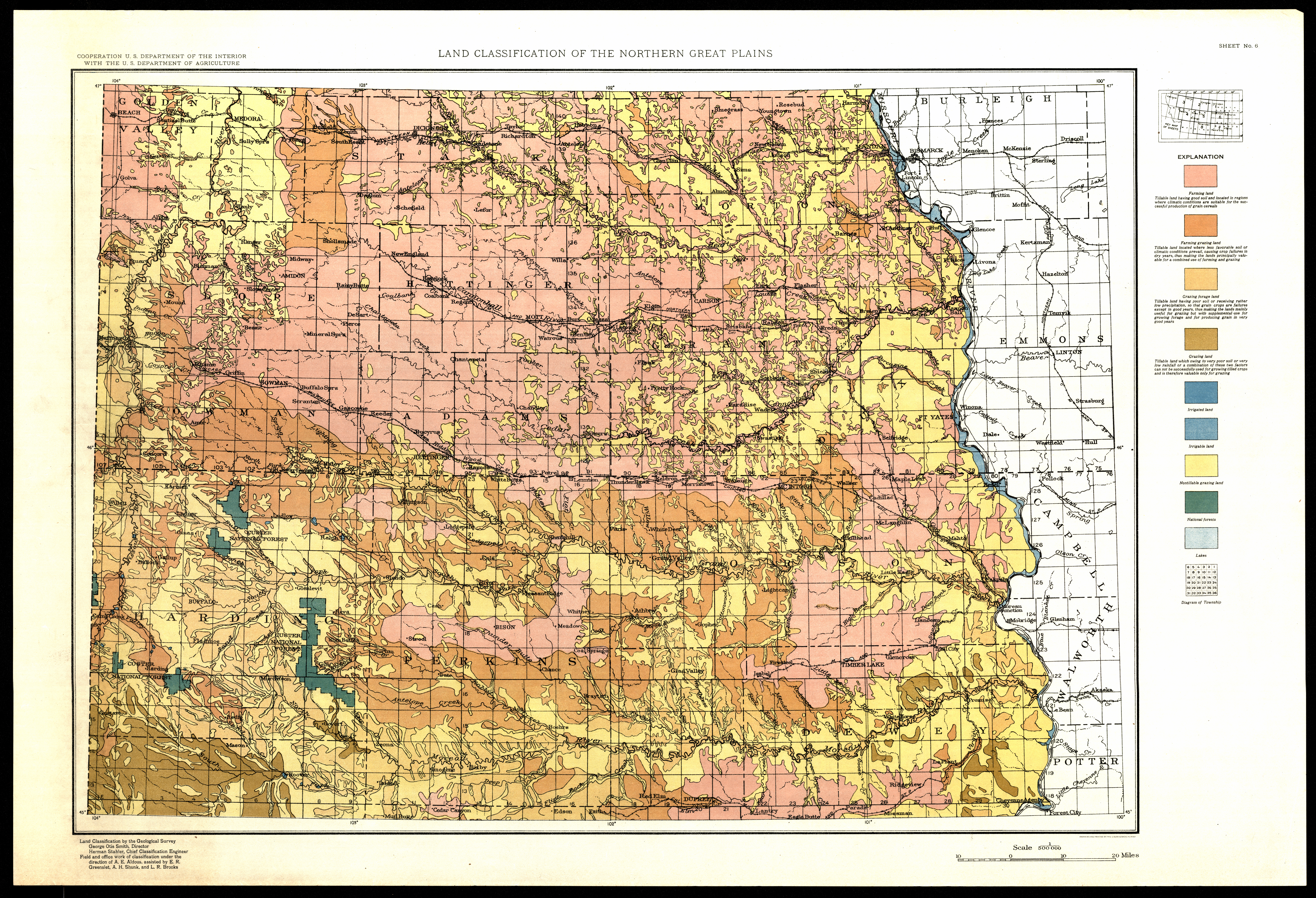
Collection: 338.10978 G3454L 1929 - Land classification of the Northern Great Plains : __Montana, North Dakota, South Dakota, and Wyoming / __land classification by the Geological Survey ; field and office work ... A.E. Aldous, assisted by L.R. Brooks, A.H. Shunk, and R.E. Morgan
Folder:
Library
Item:
338.10978 G3454L 1929
Date:
1929 - 1934
Creator:
Geological Survey (U.S.)
Title:
Land classification of the Northern Great Plains : __Montana, North Dakota, South Dakota, and Wyoming / __land classification by the Geological Survey ; field and office work ... A.E. Aldous, assisted by L.R. Brooks, A.H. Shunk, and R.E. Morgan